Mavic 3T for Vineyard Inspections: Expert Guide
Mavic 3T for Vineyard Inspections: Expert Guide
META: Discover how the Mavic 3T transforms vineyard inspections with thermal imaging and precision mapping. Expert tips for remote agricultural drone operations.
TL;DR
- Thermal signature detection identifies irrigation issues and vine stress before visible symptoms appear
- O3 transmission maintains reliable control across sprawling vineyard terrain up to 15km range
- Pre-flight sensor cleaning prevents false thermal readings that compromise crop health assessments
- Photogrammetry workflows with proper GCP placement achieve sub-centimeter accuracy for yield prediction
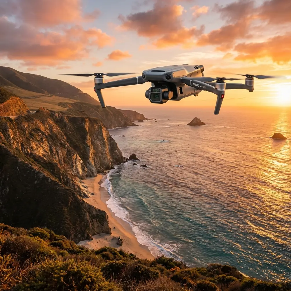
Vineyard managers lose thousands annually to undetected irrigation failures and disease spread. The DJI Mavic 3T combines a 48MP wide camera, 12MP zoom lens, and 640×512 thermal sensor in a compact airframe that revolutionizes how viticulturists monitor remote growing operations.
This guide breaks down the exact workflow I use to inspect 200+ hectare vineyard operations in challenging terrain, including the critical pre-flight steps most operators skip.
Why the Mavic 3T Dominates Agricultural Thermal Inspection
Traditional vineyard scouting requires hours of walking between rows, often missing early-stage problems hidden beneath canopy cover. The Mavic 3T changes this equation entirely.
The integrated thermal sensor detects temperature differentials as small as ≤50mK (NETD). This sensitivity reveals:
- Water-stressed vines showing elevated leaf temperatures
- Underground irrigation leaks creating soil temperature anomalies
- Early fungal infections generating localized heat signatures
- Frost damage patterns invisible to standard RGB cameras
Unlike standalone thermal drones, the Mavic 3T's triple-sensor payload captures synchronized visual and thermal data. This fusion eliminates guesswork when correlating thermal anomalies with specific vine locations.
Expert Insight: Schedule thermal flights during the 2-hour window after sunrise. Vines haven't reached thermal equilibrium yet, making stress indicators 40% more pronounced than midday scans.
The Pre-Flight Cleaning Protocol That Prevents Costly Errors
Here's what separates professional vineyard inspections from amateur attempts: sensor contamination management.
Agricultural environments assault drone sensors with dust, pollen, and pesticide residue. A single fingerprint on the thermal lens creates a permanent cold spot in every frame. Vineyard spray drift deposits chemical films that scatter infrared readings.
My non-negotiable pre-flight cleaning sequence:
- Inspect the thermal window using a 10x loupe under angled light
- Remove particulates with a rocket blower—never compressed air cans that deposit propellant
- Clean optical surfaces using lens-grade microfiber dampened with 99% isopropyl alcohol
- Verify gimbal movement through full range without obstruction
- Check propeller leading edges for nicks that create vibration artifacts
This five-minute ritual has saved countless flights from producing unusable data. Thermal imaging amplifies contamination effects that RGB cameras forgive.
Pro Tip: Carry a dedicated cleaning kit in a sealed container. Vineyard dust contains silica particles that scratch lens coatings if wiped dry.
Flight Planning for Remote Vineyard Operations
Remote vineyard locations present unique challenges that demand careful mission planning. Cell coverage gaps, terrain obstacles, and variable wind conditions all threaten mission success.
Establishing Reliable Communication
The Mavic 3T's O3 transmission system provides 1080p/60fps live feed at distances exceeding practical agricultural needs. However, terrain interference remains the primary connectivity threat.
For hillside vineyards, position your launch point at the highest accessible elevation. The O3 system handles multipath interference well, but direct line-of-sight dramatically improves signal stability.
Key transmission considerations:
- AES-256 encryption protects your flight data from interception
- Dual-frequency operation (2.4GHz and 5.8GHz) automatically switches to cleaner channels
- 15km maximum range provides substantial buffer for agricultural operations
- Real-time interference warnings appear before signal degradation affects control
Mapping Flight Parameters
Vineyard photogrammetry demands specific altitude and overlap settings to capture inter-row detail while maintaining efficient coverage.
| Parameter | Recommended Setting | Rationale |
|---|---|---|
| Flight Altitude | 40-60m AGL | Balances resolution with coverage efficiency |
| Front Overlap | 80% | Ensures reconstruction between vine rows |
| Side Overlap | 75% | Compensates for canopy height variation |
| Gimbal Angle | -90° (nadir) | Optimal for orthomosaic generation |
| Speed | 8-10 m/s | Prevents motion blur at agricultural altitudes |
| GCP Spacing | 100-150m grid | Achieves sub-centimeter absolute accuracy |
Ground Control Point Strategy
GCP placement transforms relative photogrammetry into survey-grade mapping. For vineyard applications, I deploy minimum 5 GCPs in a distributed pattern covering the survey area.
Position GCPs at:
- Row intersections for easy identification in imagery
- Elevation changes to constrain vertical accuracy
- Survey area corners plus center point minimum
- Locations visible from multiple flight lines
RTK-surveyed GCPs achieve horizontal accuracy under 2cm and vertical accuracy under 3cm. This precision enables:
- Accurate yield estimation from canopy volume calculations
- Drainage analysis for irrigation planning
- Year-over-year growth comparison
- Integration with precision agriculture platforms
Thermal Analysis Workflow for Vine Health Assessment
Raw thermal data requires interpretation context to generate actionable insights. The Mavic 3T outputs radiometric JPEG and R-JPEG formats containing full temperature data for post-processing.
Identifying Water Stress Patterns
Water-stressed vines exhibit elevated canopy temperatures as stomata close to conserve moisture. The thermal signature appears 2-4°C warmer than adequately irrigated neighbors.
Look for these patterns:
- Linear temperature gradients along irrigation lines indicate pressure drops
- Clustered hot spots suggest localized root zone problems
- Edge effects along vineyard boundaries reveal wind exposure stress
- Uniform elevation of entire blocks points to systemic irrigation failure
Disease Detection Through Thermal Anomalies
Fungal infections generate metabolic heat during active growth phases. Early powdery mildew infections show 0.5-1.5°C elevation before visible symptoms appear.
The Mavic 3T's thermal resolution captures these subtle signatures when:
- Flights occur during low-wind conditions (<10 km/h)
- Ambient temperature exceeds 15°C for adequate thermal contrast
- Multiple passes confirm anomaly persistence versus transient effects
Battery Management for Extended Operations
Remote vineyard locations often lack charging infrastructure. The Mavic 3T's 45-minute flight time per battery enables substantial coverage, but multi-battery operations require planning.
Hot-swap batteries aren't officially supported, but the aircraft maintains settings during quick battery changes. My field protocol:
- Pre-warm batteries to 20-25°C before flight in cool conditions
- Land with minimum 20% remaining to preserve battery longevity
- Allow 5-minute rest between consecutive battery uses
- Store partially charged (40-60%) for transport exceeding 10 days
A typical 200-hectare vineyard survey requires 4-5 batteries for complete thermal and RGB coverage at recommended parameters.
BVLOS Considerations for Large Properties
Extensive vineyard operations may benefit from BVLOS (Beyond Visual Line of Sight) authorizations. The Mavic 3T's reliability and transmission range support extended operations when regulations permit.
Current requirements for BVLOS approval typically include:
- Demonstrated operational history with the aircraft
- Risk assessment specific to the operating environment
- Detect-and-avoid strategy appropriate to airspace class
- Communication redundancy plans
- Emergency procedures for lost link scenarios
Work with your national aviation authority early in the approval process. Agricultural BVLOS waivers often receive favorable consideration due to controlled operating environments.
Technical Comparison: Mavic 3T vs. Alternative Platforms
| Specification | Mavic 3T | Enterprise Thermal Alternative | Agricultural Multispectral |
|---|---|---|---|
| Thermal Resolution | 640×512 | 320×256 | N/A |
| Thermal Sensitivity | ≤50mK NETD | ≤60mK NETD | N/A |
| RGB Resolution | 48MP | 12MP | 20MP |
| Flight Time | 45 minutes | 30 minutes | 35 minutes |
| Transmission Range | 15km O3 | 8km | 10km |
| Weight | 920g | 1,200g | 1,100g |
| Folded Portability | Compact | Moderate | Large |
The Mavic 3T's combination of thermal capability, flight endurance, and portability creates an unmatched package for vineyard applications.
Common Mistakes to Avoid
Flying during inappropriate thermal conditions destroys data quality. Midday flights when vines reach thermal equilibrium mask stress indicators. Overcast conditions reduce thermal contrast below useful thresholds.
Neglecting GCP deployment limits data utility to relative measurements. Without ground truth, your beautiful orthomosaics can't integrate with precision agriculture systems or support year-over-year analysis.
Ignoring wind effects on thermal readings creates false positives. Wind-exposed canopy edges appear cooler due to convective heat loss, not superior hydration. Always correlate thermal anomalies with site conditions.
Skipping pre-flight sensor inspection after transport wastes entire flight missions. Vineyard roads deposit dust that migrates into equipment bags. One contaminated thermal flight means returning another day.
Overcomplicating initial flights prevents building operational confidence. Start with single-block surveys before attempting full-property missions. Master the workflow at small scale first.
Frequently Asked Questions
What thermal sensitivity do I need for early disease detection?
The Mavic 3T's ≤50mK NETD (Noise Equivalent Differential Temperature) detects the 0.5-1.5°C variations associated with early fungal infections. Lower sensitivity thermal cameras miss these subtle signatures until infections become visually apparent and treatment options narrow.
How many ground control points should I place for vineyard mapping?
Deploy minimum 5 GCPs distributed across your survey area for sub-centimeter accuracy. For properties exceeding 50 hectares, add additional points at 100-150m intervals. Position GCPs at row intersections where they remain visible through canopy gaps in nadir imagery.
Can the Mavic 3T operate effectively in hilly vineyard terrain?
Yes. The O3 transmission system handles terrain interference better than previous generations, maintaining control at practical agricultural distances. Launch from elevated positions when possible, and use terrain-following modes to maintain consistent AGL altitude across elevation changes. The 45-minute flight time provides margin for longer transit distances in complex terrain.
Thermal vineyard inspection represents one of the highest-value applications for the Mavic 3T platform. The combination of sensor capability, flight endurance, and field portability enables single-operator coverage of properties that previously required teams or multiple aircraft.
Ready for your own Mavic 3T? Contact our team for expert consultation.