Mavic 3T for Coastal Vineyards: A Field Tutorial
Mavic 3T for Coastal Vineyards: A Field Tutorial from an Inspection Specialist
META: Practical Mavic 3T tutorial for coastal vineyard inspection, including thermal workflows, antenna positioning, RTK mapping, battery strategy, and image-capture tactics that improve decision-making.
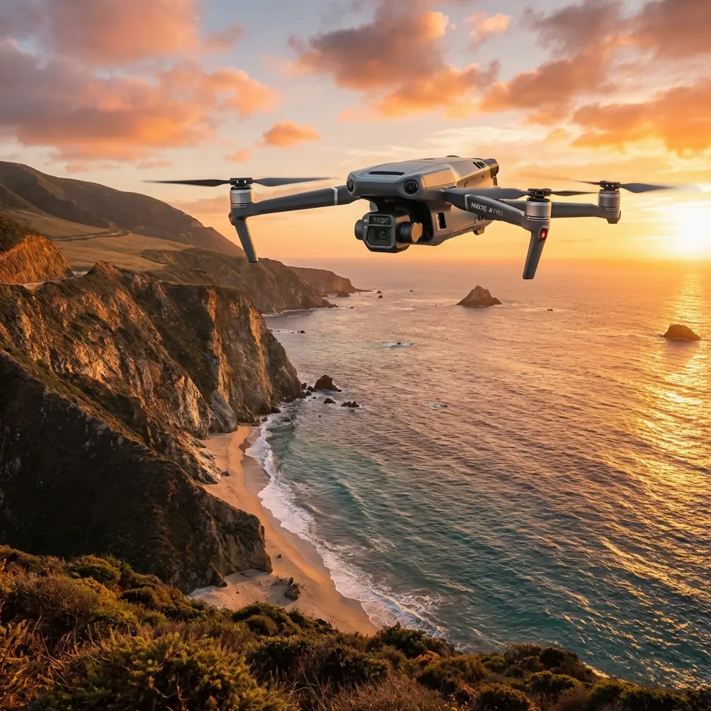
Coastal vineyards ask more of a drone than inland blocks. Wind changes by the minute. Salt haze softens contrast. Rows often run across rolling terrain, and temperature swings between marine fog and direct afternoon sun can distort what less disciplined operators think they are seeing. That is exactly where the Mavic 3T earns its place.
I approach this aircraft less as a flying camera and more as a diagnostic tool. For vineyard managers, agronomists, and field crews inspecting vines near the coast, the Mavic 3T can compress what used to take a full day on foot into a focused mission window. The real value is not simply that it sees more. It helps you separate stress patterns that matter from noise created by weather, canopy density, and terrain.
This tutorial is built for one job: inspecting vineyards in coastal conditions with the Mavic 3T in a way that produces reliable, operationally useful observations.
Why the Mavic 3T fits vineyard inspection so well
The Mavic 3T matters because it combines visible imaging, thermal capability, and a field-friendly airframe that can be deployed quickly between weather gaps. In vineyards, timing is not a nice extra. It changes the usefulness of the data. If a marine layer lifts for 40 minutes and then the wind ramps up, you need to be airborne fast, gather clean information, and land before image quality starts to degrade.
Two Mavic 3T features are especially relevant in coastal viticulture.
First, the thermal sensor gives you a way to read temperature differences across vine rows. That is not the same as diagnosing disease by itself, and experienced operators know better than to make that leap. What it does offer is a map of thermal signature variation. In practice, that helps you flag irrigation irregularities, blocked emitters, drainage issues, missing plants, stressed zones near compacted headlands, and sections where canopy vigor differs enough to justify a closer walk-through.
Second, the aircraft’s O3 transmission system is a major operational advantage in broken terrain. Coastal vineyards often have ridges, treelines, service roads, equipment sheds, and field undulations that interrupt clean line-of-sight if you position yourself poorly. Reliable transmission affects more than pilot comfort. It determines whether you can hold a stable live view while tracing row patterns at low speed and whether your spot thermal findings are captured before signal quality dips.
The Mavic 3T also supports strong data protection with AES-256 encryption. For some operators that sounds like an IT footnote. It is not. Vineyard inspection data can reveal crop stress, irrigation behavior, infrastructure weaknesses, and operational patterns. If you work with estate managers, contract growers, or agricultural consultants, secure handling of those mission records matters.
Start with the right mission objective
The biggest vineyard-drone mistake I see is flying before defining the inspection question.
For coastal vineyard work, your mission usually falls into one of three categories:
Thermal scouting for anomalies
You want to detect unusual hot or cool patches across the block and direct ground crews efficiently.Visible inspection for row-by-row conditions
You need closer visual review of trellis alignment, missing vines, storm impact, road access, or edge effects from salt exposure.Photogrammetry for repeatable comparison
You want stitched map products or terrain-aware visual records that can be compared over time, especially after irrigation changes, drainage work, or replanting.
The Mavic 3T can support all three, but not equally in a single pass. If your priority is thermal interpretation, design for thermal accuracy. If your priority is mapping, design for overlap, geometry, and control.
That sounds obvious, yet many vineyard teams try to do a “one flight does everything” mission and get weak outputs across the board.
Best time to fly a coastal vineyard
Thermal work is highly sensitive to timing. In coastal environments, the ideal flight window often arrives when the fog has thinned enough for safe visual operations but before solar loading flattens the differences you are trying to detect. Early morning is often productive, though not automatically best every day.
Here is the practical principle: fly when the vineyard is expressing meaningful temperature contrast, not when the weather app says “nice.”
After sunrise, stressed rows may warm differently from well-watered rows. Waterlogged areas may also present distinct behavior. But once the day progresses and the canopy heats more uniformly, subtle anomalies can disappear into a broader thermal wash. Wind also matters. Strong coastal airflow can cool surfaces unevenly and create false impressions, especially along exposed edges.
For visible inspections, a later window may be preferable if you need clearer contrast in the RGB image and less interference from fog.
My advice is simple: do not schedule by habit alone. Walk one representative row, feel the wind, look at leaf surface behavior, note residual moisture, then launch.
Antenna positioning advice for maximum range
This is one of the most overlooked details in vineyard operations, especially by crews moving quickly between blocks.
If you want maximum practical range and the most stable O3 link, do not point the tips of the controller antennas at the aircraft. Position the flat faces of the antennas so they are oriented toward the drone’s flight area. Think of the signal as projecting outward from the broad side, not the ends.
That single adjustment becomes even more important in coastal vineyards because terrain and vegetation already work against you. A pilot standing low in a swale, beside a vehicle, or near a corrugated shed can lose signal quality faster than expected. I recommend the following field habits:
- Stand on the highest safe point with an unobstructed view of the rows you plan to inspect.
- Keep your body from shielding the controller, especially when turning to track the aircraft.
- Avoid standing directly beside metal infrastructure or parked machinery.
- Reposition yourself before the aircraft reaches a ridge or drops behind row elevation changes.
- If inspecting long blocks, fly shorter segments from better launch points rather than stretching a weak link.
This is not just about getting farther away. It is about keeping a dependable live feed when you need to interpret a thermal hotspot or inspect a suspicious section without interruption.
Thermal interpretation: what the Mavic 3T can actually tell you
A thermal image is not a diagnosis. It is a pattern detector.
In vineyards, the most useful thermal outputs usually come from comparison. One row against the next. One irrigation zone against another. One slope aspect against a neighboring section. The Mavic 3T helps you find where the vineyard is behaving differently. Your agronomic knowledge determines whether that difference points to water stress, canopy variability, disease pressure, root-zone problems, or a non-problem caused by changing surface conditions.
What should you look for?
- Rows or vine groups consistently warmer than surrounding areas
- Cool patches suggestive of excess moisture or irrigation leaks
- End-of-row patterns linked to compaction, turning traffic, or drainage
- Perimeter effects where coastal wind or salt exposure alters canopy response
- Missing or weak vines that break the thermal continuity of the block
Operationally, this matters because a 20-minute drone mission can reduce hours of aimless scouting. Instead of sending crews to walk every row, you send them to the half-dozen sections where the Mavic 3T found real variance.
That is the point of good UAV inspection. Not pretty imagery. Better decisions with less wasted labor.
When to use photogrammetry, GCPs, and RTK logic
Not every vineyard mission needs a stitched map. But when you are monitoring drainage changes, erosion paths, access roads, missing vine counts, or replant areas, photogrammetry becomes useful.
The Mavic 3T can support mapping workflows, but coastal vineyards introduce geometry problems. Sloping terrain, repeated row textures, and mixed lighting can reduce alignment quality. That is where GCPs become valuable. Ground Control Points give your map a reference framework that improves positional confidence, especially if you need to compare outputs from different dates or align aerial observations with field infrastructure.
If you are building repeatable records rather than just conducting a quick inspection, use visible markers that can be clearly identified in the imagery and distribute them across elevation changes, not only on flat headlands.
The practical rule is this: the more your output needs to support measurement or repeated comparison, the more you should care about control.
Some operators will pair RTK-enabled workflows with GCP verification for higher confidence. That is often justified when the data is feeding engineering, irrigation redesign, or compliance documentation. For simple scouting, it may be unnecessary. Match the workflow to the decision that follows.
Flight pattern recommendations for vineyard blocks
Coastal vineyards reward disciplined planning. Random passes produce fragmented evidence and force you to guess later.
For a standard inspection:
- Fly parallel to rows when the goal is row-specific analysis.
- Fly perpendicular sample passes when you want to compare slope or irrigation-zone behavior across multiple rows at once.
- Maintain consistent altitude over the block section being compared.
- Slow down over suspect areas rather than descending impulsively.
- Break large vineyards into logical sectors based on topography, irrigation zones, or varietal boundaries.
If you are combining thermal and visible review, I usually advise separate mission logic. Use one pass to locate anomalies. Use a second, tighter pass to document them clearly. That creates cleaner records and reduces the temptation to improvise too much in the air.
Battery strategy in real field conditions
Battery planning is not glamorous, but it shapes the quality of the mission.
Coastal vineyard work often means scattered launch locations, vehicle-based operations, and short weather windows. If you are inspecting multiple blocks, efficient battery turnover matters. Hot-swap batteries are not literally instant in every workflow, but fast rotation between charged packs is what keeps mission timing aligned with the best thermal window.
The mistake is waiting until the battery is nearly depleted before deciding whether to finish one more section. In inspection work, the last few minutes of a flight are often where hurried decisions create weak documentation or poor landing choices in gusting wind.
My field rule is conservative:
- land with margin,
- change packs early,
- relaunch with intention.
A battery swap is cheaper than compromised data.
Data handling and chain of custody
This is where specialists separate from casual drone use.
If you are inspecting vineyards for an owner, operator, consultant, insurer, or technical team, your images are not just visual records. They are operational documents. The Mavic 3T’s AES-256 security capability matters because it supports responsible handling of potentially sensitive files.
Develop a habit of naming missions by block, date, and objective. Keep thermal and visible datasets organized separately when needed. Log environmental conditions at launch and landing. If a suspicious thermal pattern is later discussed in relation to irrigation failure or crop stress, you want more than a memory. You want a mission record.
If your team wants help setting up a field-ready inspection workflow, I suggest using this direct coordination channel for mission planning: message our UAV operations desk.
What BVLOS does and does not change
BVLOS is one of those terms that gets used loosely. Operationally, beyond visual line of sight can expand how large agricultural properties are managed, but it is not a casual box to tick. The relevance to the Mavic 3T in vineyards is strategic rather than automatic.
For large estates with separated blocks and long row systems, BVLOS-capable operational planning may eventually reduce repositioning and improve coverage efficiency. But for many current coastal vineyard inspections, the bigger gains still come from smarter launch placement, better antenna orientation, stronger mission segmentation, and better interpretation discipline.
In other words, do not let advanced operational concepts distract from fundamentals that already improve your results right now.
A practical coastal vineyard workflow with the Mavic 3T
If I were arriving at a vineyard tomorrow morning to inspect for stress patterns and infrastructure issues, this is the sequence I would use:
Walk the launch area
Check wind behavior, visibility, and potential signal obstructions.Choose a high, clear pilot position
Set yourself where the controller antennas can face the aircraft with minimal shielding.Define the question before takeoff
Are you finding hot rows, checking a suspect irrigation zone, or documenting storm effects?Fly a broad thermal scouting pass first
Look for anomalies across the block, not detail on a single vine.Tag priority areas
Note row numbers, landmarks, or infrastructure references.Fly a tighter visible follow-up pass
Gather contextual imagery for the flagged areas.If mapping is needed, run a separate photogrammetry mission
Use consistent overlap and include GCPs if the output needs reliable comparison.Swap batteries before quality drops
Keep the mission inside the best environmental window.Log conditions and organize data immediately
Do not wait until the end of the day.
That process is simple enough to repeat, but structured enough to produce inspection records you can trust.
The real advantage of the Mavic 3T in vineyards
The Mavic 3T is not valuable because it makes vineyard inspection look advanced. It is valuable because it shortens the distance between observation and action.
A thermal signature that breaks the pattern of a block can lead a crew directly to a clogged irrigation section. A stable O3 connection, supported by correct antenna positioning, can keep your live feed usable over rolling rows where weaker field habits would lose context. A controlled photogrammetry mission with GCP support can help you compare drainage or replant conditions across time rather than relying on guesswork. AES-256 security keeps that operational record protected.
For coastal vineyards, where conditions are dynamic and small timing errors can ruin a mission, those details are not technical trivia. They are the difference between flying for information and flying for evidence.
Ready for your own Mavic 3T? Contact our team for expert consultation.