Mavic 3T for Wildlife Inspection in Complex Terrain
Mavic 3T for Wildlife Inspection in Complex Terrain: A Field Tutorial That Actually Matches Reality
META: Learn how the DJI Mavic 3T handles wildlife inspection in steep, obstructed terrain with thermal workflows, O3 transmission, RTK-ready mapping practices, and practical field methods.
Wildlife inspection sounds gentle on paper. In the field, it rarely is.
You are often working across broken ridgelines, dense tree cover, wet gullies, rocky escarpments, or coastal bluffs where line of sight comes and goes in seconds. Animals do not wait for ideal light. Heat signatures drift with wind, sun angle, and ground temperature. And if your aircraft cannot switch cleanly between search, confirmation, and documentation, your sortie turns into a compromise.
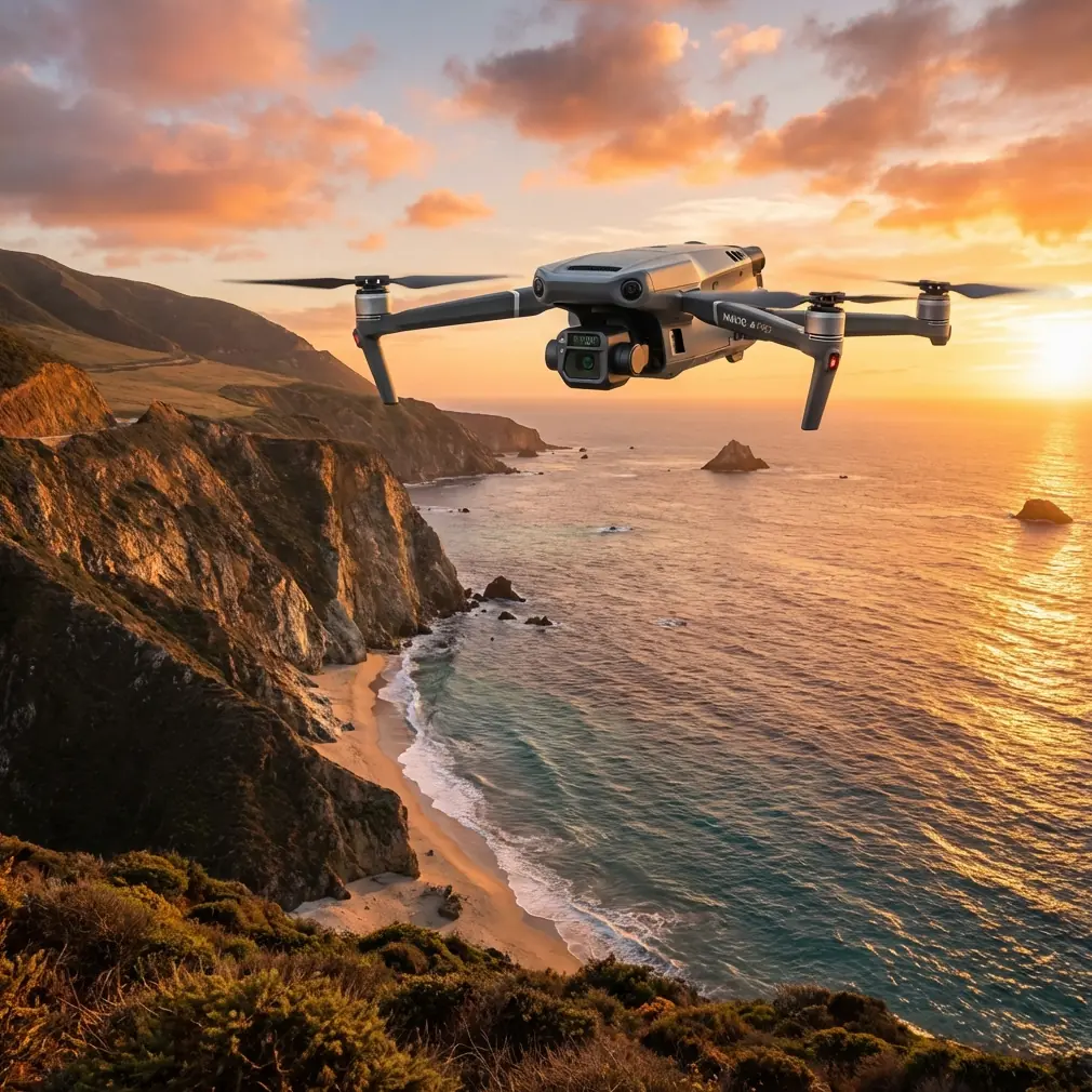
That is where the Mavic 3T earns its place. Not because it is the biggest aircraft in the category, and not because it tries to replace every other drone in a wildlife program. It matters because it compresses several critical tasks into one portable platform: thermal detection, visual verification, route efficiency, and repeatable documentation. For teams inspecting wildlife in complex terrain, that combination changes the workflow more than a single headline spec ever could.
This tutorial is built around that real-world use case.
Why the Mavic 3T fits wildlife inspection better than many alternatives
A lot of competing systems ask you to choose. You either get a compact aircraft with good deployment speed, or you get a heavier platform with stronger sensing and imaging options but more setup burden. In wildlife work, especially across difficult terrain, setup burden is not a small inconvenience. It is lost daylight, missed behavior windows, and more fatigue for crews hiking to launch points.
The Mavic 3T sits in a very useful middle ground. It gives you a thermal camera for finding animals or nests by thermal signature, a wide camera for context, and a tele camera for stand-off observation. That matters operationally because wildlife inspection is almost never a one-camera task.
Thermal helps you detect. Wide helps you orient. Tele helps you verify without pushing the aircraft too close and disturbing the subject.
That three-step sequence is where the aircraft separates itself from many compact competitors. Some smaller thermal drones can find a heat source, but the operator then struggles to confirm exactly what they are seeing. In rough terrain, that delay becomes expensive. You drift, lose angle, or burn battery while trying to interpret a blob of heat against sun-warmed rock. With the Mavic 3T, the handoff from thermal to visible imaging is fast and practical.
Its O3 transmission system also matters more in this environment than spec sheets usually admit. In wildlife inspection, terrain is the enemy of signal consistency. You may not be flying far in absolute distance, but a ridge, tree line, or fold in the land can degrade your link quickly. A strong transmission architecture helps maintain usable video and control confidence during these awkward terrain transitions. It does not remove the need for disciplined route planning, but it gives the pilot more margin when the landscape stops cooperating.
Start with the mission, not the sensor menu
The most common mistake I see is operators launching with a camera-first mindset. They start adjusting palettes, zoom ratios, and exposure settings before they have defined the objective.
For wildlife inspection in complex terrain, your mission usually falls into one of three categories:
- Detection: Find animals, dens, roosts, or nests that are hard to spot visually.
- Verification: Confirm species, count individuals, assess behavior, or identify access constraints.
- Documentation: Capture imagery suitable for reports, habitat records, or repeated monitoring.
The Mavic 3T can serve all three, but not with the same flight pattern.
If your goal is detection, thermal should dominate the sortie design. Fly to maximize contrast, not aesthetics. Early morning and late evening often improve separation between animal body heat and surrounding ground, though the exact thermal performance depends heavily on terrain material and weather. Rock faces that have stored solar heat can mask animals. Moist vegetation can behave differently from dry scrub. The drone is not “seeing animals” in a magical sense. It is helping you interpret thermal differences faster than the naked eye can.
If your goal is verification, the tele camera becomes central. This is one of the strongest reasons to choose the Mavic 3T over more limited compact thermal platforms. Once thermal reveals a possible target, the tele camera lets you inspect from a stand-off distance. That reduces stress on wildlife and lowers the odds of flushing birds from ledges or causing movement in sensitive habitats.
If your goal is documentation, you need consistency. This is where many teams overlook planning basics like route repeatability, altitude discipline, and reference control.
A practical flight workflow for complex terrain
Here is the field method I recommend when using the Mavic 3T for wildlife inspection in uneven ground.
1. Build terrain into your launch decision
Do not launch from the easiest place to stand. Launch from the place that gives you the best signal geometry and safest recovery window.
In steep country, that may mean moving higher to reduce immediate obstruction, even if it adds a short hike. Your aircraft’s transmission link is only as good as the terrain between controller and drone. O3 transmission gives the Mavic 3T a real advantage, but no digital link likes a ridge directly in the path.
Also think about recovery before takeoff. Wind often behaves very differently on cliff edges, in gullies, and above tree canopies. A stable outbound leg does not guarantee an easy return.
2. Use thermal first, but do not over-trust it
Start broad. Scan with thermal over likely habitat edges, sheltered pockets, and movement corridors. In mixed terrain, wildlife often occupies transition zones rather than exposed open ground. Creek lines, rock shadows, scrub margins, and the lee side of slopes are productive areas.
What matters here is not simply spotting heat. It is learning the thermal behavior of the terrain itself. Sun-warmed boulders, livestock, machinery, and even exposed soil can all create misleading signatures.
This is why the Mavic 3T’s sensor combination is so useful. Thermal gets your attention. The visual payload helps you avoid bad assumptions.
3. Switch to tele for confirmation
Once you identify a likely subject, back off slightly and use the tele camera to confirm shape, posture, grouping, and surroundings.
This is where the aircraft outclasses some competing compact thermal units in practical wildlife work. A thermal-only workflow often leaves too much uncertainty. Tele lets you preserve distance while collecting detail. If you are inspecting nesting sites on inaccessible cliffs or observing animals in dense terrain openings, that distance is not just convenient. It is part of good field practice.
4. Capture context with the wide camera
After confirmation, record wide context frames that show the animal’s location in relation to terrain features. This helps later reporting, habitat interpretation, and revisit planning.
A single close-up image is rarely enough for conservation teams, ecologists, or land managers. They need to understand where the subject was found and how accessible or exposed that location is.
5. End with a repeatable route
If the site is likely to be revisited, save the geometry of the mission in a way your team can repeat. Consistency matters more than a one-time perfect shot. Wildlife inspection is often about change over time.
Where photogrammetry and GCPs fit, and where they do not
The Mavic 3T is often discussed as a thermal inspection aircraft first, but in wildlife operations, spatial context matters. If you are monitoring habitat boundaries, nest site surroundings, erosion near breeding zones, or access corridors, you may need map products alongside inspection imagery.
This is where photogrammetry enters the conversation.
Now, the honest point: if your primary objective is high-accuracy mapping, there are aircraft better optimized for pure mapping workloads. But the Mavic 3T can still be valuable when the inspection and mapping tasks must happen within the same field day and from the same portable kit.
If you need repeatable spatial reference, use GCPs where practical. Ground control points improve positional confidence and make comparison across surveys more defensible. In wildlife terrain, that may not always be easy. Steep slopes, fragile habitat, or restricted access can limit how many GCPs you can place safely. But even a modest, well-planned control layout can significantly improve your outputs.
If your unit is paired with RTK capability, that can sharpen the geospatial side of the workflow further. Operationally, that means fewer ambiguities later when a biologist asks whether a burrow cluster shifted downslope, whether vegetation encroached around a nesting area, or whether a trail is drawing activity too close to sensitive habitat.
Use mapping as a support layer, not a distraction. The inspection mission comes first.
Signal security and field data handling matter more than people think
Wildlife inspection is not just about flying and filming. Sensitive location data can carry real conservation risk, especially for protected species or nesting sites. That is one reason secure transmission and careful data handling deserve more attention.
The Mavic 3T platform supports AES-256 data security, which is not a glamorous field feature, but it is relevant. If your team is documenting ecologically sensitive locations, strong encryption contributes to better operational hygiene. It should be paired with disciplined storage practices, limited sharing, and clear file labeling so sensitive habitat information does not spread beyond the people who need it.
This is an area where “consumer-feel” compact drones often get underestimated. Serious wildlife programs should think beyond image quality. They should think about custody of data.
Battery strategy in rough terrain
Battery planning in wildlife work is not the same as battery planning over flat open farmland.
Complex terrain adds hover corrections, route inefficiencies, and occasional repositioning to maintain signal or angle. You may also spend extra time confirming a thermal target that turned out to be a false positive. That means your reserve should be conservative.
Teams accustomed to larger enterprise systems sometimes miss one convenience when stepping down in size: true hot-swap batteries are not really the Mavic 3T’s style of workflow in the same way they are on bigger aircraft. That is not a flaw so much as a planning issue. The answer is simple: structure your field routine around shorter, sharper sorties and immediate battery rotation rather than trying to stretch a single flight into a complete inspection day.
For wildlife crews moving on foot through difficult ground, that compact deployment model is often an advantage anyway. You trade some continuous endurance for speed and mobility.
A note on BVLOS expectations
You will hear operators talk about BVLOS as if it automatically solves terrain problems. It does not.
For wildlife inspection in complex terrain, beyond visual line of sight raises regulatory, safety, and operational considerations that depend entirely on your jurisdiction and approvals. Even where advanced permissions exist, the terrain itself still affects signal, situational awareness, and contingency options. The Mavic 3T is highly capable, but capability is not permission.
In practice, most wildlife teams get better results by improving launch position, route design, observer placement, and timing rather than fantasizing about simply flying farther.
When the Mavic 3T is the wrong tool
An expert view has to include limits.
If your program demands ultra-large area coverage every day, heavier endurance platforms may be more efficient. If your deliverable is survey-grade mapping above all else, dedicated mapping aircraft may fit better. If dense canopy is your dominant obstacle, no amount of thermal enthusiasm will completely solve line-of-sight occlusion from above.
But for mixed missions in difficult terrain, where the team must hike in, deploy fast, detect heat, verify visually, and leave with usable evidence, the Mavic 3T is unusually well balanced.
That balance is why it keeps showing up in serious civilian field programs.
Field checklist for a better first sortie
Before you head out, define these points clearly:
- Primary target species or sign
- Best thermal time window for the landscape
- Launch site with strongest expected signal path
- Recovery site backup
- Search pattern for thermal scan
- Visual confirmation protocol using tele
- Context image requirement
- Mapping need, if any
- GCP plan, if any
- Battery rotation plan
- Data handling rules for sensitive habitat locations
If your team wants help tailoring that workflow to a specific reserve, escarpment, wetland, or hillside site, you can send field details directly through this WhatsApp contact channel.
The real advantage of the Mavic 3T in wildlife terrain
The strongest feature is not a single camera spec or flight number.
It is the way the aircraft reduces hesitation in the field.
You detect with thermal. You verify with tele. You orient with wide. You preserve mobility because the kit stays small. You maintain a stronger link through difficult topography with O3 transmission than many people expect from a folding aircraft. You protect sensitive location data with AES-256. And if your project needs more than observation alone, you can bring photogrammetry and GCP-backed repeatability into the same mission design.
That is what makes the Mavic 3T stand out against many competitors. It does not force wildlife inspectors to choose between portability and serious observation capability nearly as harshly as the market often does.
For complex terrain work, that is not a spec-sheet win. It is a field win.
Ready for your own Mavic 3T? Contact our team for expert consultation.