How I’d Use the Mavic 3T for Coastal Wildlife Inspection Wit
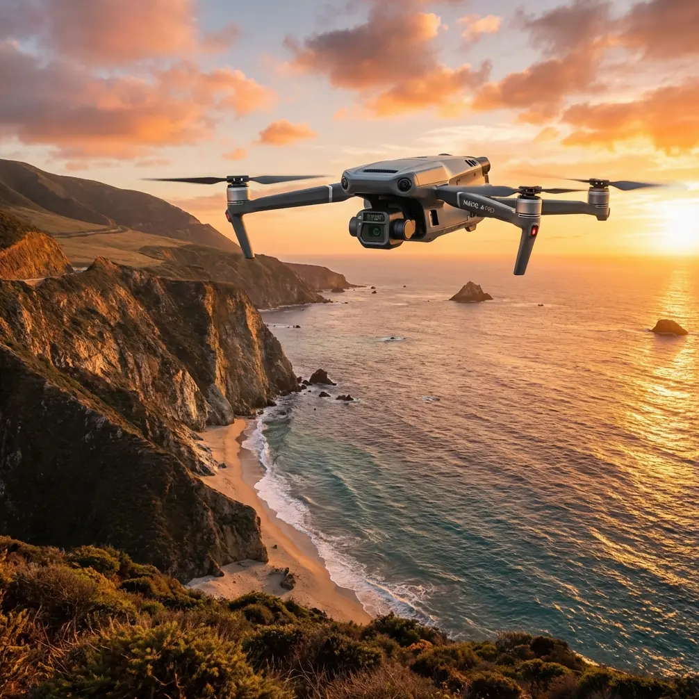
How I’d Use the Mavic 3T for Coastal Wildlife Inspection Without Disturbing the Habitat
META: A specialist field guide to using the Mavic 3T for coastal wildlife inspection, with practical thermal workflows, transmission planning, data integrity considerations, and mission tips grounded in real sensing and control logic.
Coastal wildlife inspection sounds simple until you actually try to do it properly.
Salt spray eats equipment. Wind bends flight plans out of shape. Reflective water confuses the eye. Birds, seals, turtles, and nesting colonies do not wait politely in convenient open areas. And if your aircraft forces you to fly too low, hover too long, or repeat passes because the data is weak, you are no longer just inspecting. You are interfering.
That is where the Mavic 3T earns its place.
I do not say that because it is small, popular, or easy to deploy. I say it because, in coastal inspection work, the best aircraft is the one that lets you make accurate decisions while staying farther away, finishing faster, and preserving stable control even when the environment is trying to degrade both your image quality and your workflow.
For this kind of mission, the Mavic 3T is often stronger than larger, more cumbersome alternatives precisely because it compresses thermal sensing, visible imaging, and operational speed into one aircraft that can be carried to a shoreline, mudflat, estuary, or dune line and launched with very little setup friction.
Start with the real objective: detect, verify, and leave
When I plan a wildlife inspection sortie along the coast, I am not thinking first about camera specs. I am thinking in layers.
First, can I detect an animal or nest site without approaching too close?
Second, can I verify what I am seeing with enough confidence to avoid a second disturbance pass?
Third, can I maintain stable link quality and safe return margins in a place where wind, glare, and sparse landmarks challenge pilot judgment?
The Mavic 3T suits that sequence well because thermal signature detection gives you the first layer, zoom and visual context provide the second, and the aircraft’s transmission and compact deployment profile support the third.
This matters more in coastal environments than many operators realize. A warm-bodied subject against cool dawn sand, shaded rock, or wet vegetation may show up clearly in thermal before it becomes visually obvious. That means you can survey from a more respectful standoff distance. In practical terms, less low-level circling usually means less stress on wildlife and fewer broken behavioral patterns.
Why thermal is not just a sensor choice but a disturbance-control tool
A lot of operators still frame thermal as a specialist add-on. For coastal wildlife work, that misses the point.
Thermal is often your first non-invasive screening method.
If you are checking dune nesting zones, saltmarsh edges, roosting areas, or stranded-animal reports, heat contrast can shorten the search dramatically. Instead of pushing the aircraft visually over every patch of scrub or wrack line, you can run a structured thermal scan and only transition to closer visual confirmation when the scene actually warrants it.
Operationally, this is similar to a principle seen in mature aircraft control systems: measure what matters, compare it against a meaningful reference, and only intervene when the deviation crosses a useful threshold. In one of the provided technical references, an anti-skid system compares wheel speed signals and reduces brake pressure when slip exceeds a set value. The significance is not the aircraft type; it is the logic. Good systems avoid overreaction by continuously reading the real condition and adjusting just enough to restore control.
That same mindset improves drone wildlife inspection. You do not flood the mission with unnecessary low passes. You use thermal contrast as your reference condition, identify anomalies, and then refine the response. The result is better detection with less intrusion.
That is one reason the Mavic 3T often outperforms non-thermal competitors in this exact use case. A standard RGB-only platform may produce beautiful footage and still be the wrong tool at sunrise, in patchy reed beds, or over dark rocks where animal presence is visually ambiguous. When the mission is about locating living subjects efficiently, thermal changes the whole workflow.
Coastal flying punishes weak links
The other hidden challenge is control confidence.
Open shoreline environments can look forgiving because they are wide and uncluttered. In reality, they can be difficult places to maintain orientation and consistent situational awareness. Water surfaces reduce visual texture. Wind shifts near bluffs and sea walls can be abrupt. Light is harsh and angles change quickly. If you are inspecting from a moving launch point or along a long coastal edge, transmission quality matters more than the spec sheet usually suggests.
That is where O3 transmission becomes operationally meaningful. Not because “long range” sounds impressive, but because cleaner live video and more stable command response reduce the temptation to edge the aircraft closer just to feel certain about what you are seeing.
For wildlife work, that is a subtle but real advantage. Better link quality supports better restraint.
I often explain this using another idea embedded in the source material. One reference describes a more modern anti-skid logic that replaces an extra wheel-speed sensor with a reference-speed memory unit, improving reliability while simplifying the sensing burden. Again, the relevance here is conceptual: robust control systems are valuable because they preserve performance when conditions are imperfect. Coastal drone work rewards that same philosophy. The more reliable your transmission and feedback loop, the less you have to compensate with risky proximity or repeated flights.
How I would structure a Mavic 3T coastal wildlife mission
1. Fly at the right time, not just the right place
Coastal thermal work is often best near dawn or during periods when the background has not yet equalized in temperature. Wet rocks after sunrise, sunlit sand, and shallow tidal pools can rapidly flatten contrast. If your target is a resting animal, a nest zone, or a recently stranded subject, a cool-background window can make your thermal signature easier to separate.
With the Mavic 3T, I prefer to use the first pass as a broad thermal reconnaissance line rather than starting with visual zoom. That preserves battery and reduces time spent loitering over sensitive ground.
2. Build the route around habitat sensitivity
The shortest path is not always the least disruptive one. Over open beach, flying parallel to the shoreline may be acceptable. Over bird colonies or seal haul-out zones, lateral standoff and oblique viewing are often better than a direct overhead profile.
The Mavic 3T’s compact form helps here because it can usually be positioned quickly from a less intrusive launch point. You are not forced into the kind of large operational footprint that draws attention and consumes time before takeoff.
3. Use thermal for search, visible for confirmation
This is where many teams waste time. They try to identify everything visually from the start.
Instead, let the thermal camera do triage. Mark candidate heat sources, then verify with the visible camera only as needed. In a mixed coastal scene, driftwood, rocks, seaweed piles, and man-made debris can all create confusing textures in RGB imagery. Thermal helps narrow the field.
If the mission also includes habitat documentation, erosion checks, or shoreline condition mapping, you can capture visual frames for photogrammetry after the wildlife-sensitive portion is done. That sequencing matters. Wildlife detection first. Broader site documentation second.
4. Treat geospatial accuracy honestly
If you are building maps around nests, shoreline erosion, or habitat boundaries, photogrammetry quality depends on workflow discipline, not just aircraft choice. GCP use should be planned around site access restrictions and ecological sensitivity. In some coastal areas, placing markers may be impractical or undesirable. In others, carefully positioned GCPs can improve repeatability for monitoring change over time.
The Mavic 3T is not a dedicated large-format mapping aircraft, but it can still support useful site documentation when expectations are realistic and control methods are sound.
5. Plan battery rhythm around conditions, not brochure numbers
Coastal wind changes the energy budget. So does repeated hovering for confirmation. If your operation relies on hot-swap batteries in the field support kit, stage them so the aircraft can return, relaunch, and continue while your observation window remains useful. That is especially relevant at dawn, when thermal contrast may be strongest for a limited period.
The key point is not just endurance. It is continuity. If the subject moves, tides shift, or light changes fast, downtime matters.
6. Protect the data path
Wildlife inspection data is often more sensitive than outsiders assume. Nesting locations, species concentration zones, restoration plots, and environmental compliance imagery should not be treated casually. AES-256 matters here because secure handling is part of responsible field practice, especially when data may pass through multiple teams or be reviewed off-site.
Security is not only an enterprise checkbox. It is part of stewardship.
Where the Mavic 3T clearly beats many competing platforms
In this specific scenario, the Mavic 3T tends to excel against ordinary visual-only drones for one reason above all: it reduces the number of decisions you must make blindly.
Without thermal, you may be guessing whether a dark patch in dune grass is an animal, shadow, or wet depression. You may need to descend to confirm. You may spend extra minutes tracking movement in visually cluttered habitat. Each one of those uncertainties pushes the aircraft toward the subject.
With thermal on board, the workflow becomes cleaner. Detect first. Validate second. Exit sooner.
Against some larger enterprise systems, the Mavic 3T also holds an advantage in field practicality. Coastal inspection teams often work from rough access paths, small boats, levees, boardwalk edges, or vehicles parked far from the survey point. A platform that launches fast and travels light is not just convenient. It can be the difference between capturing the right tide window and missing it.
Borrowing a lesson from fixed-wing design
The second reference in the source material discusses air intake and exhaust system design, including the fact that even a drop in nozzle efficiency can directly affect thrust and fuel consumption. That detail belongs to crewed aircraft engineering, but the lesson translates well: small efficiency losses in a flight system can have outsized operational consequences.
For drone wildlife inspection, that means every avoidable inefficiency compounds. A weak search method costs battery. Poor route design costs time. Unstable transmission costs confidence. Low-quality detection forces reflight. By the end of the mission, “small” losses become shortened coverage, more disturbance, and weaker data.
The Mavic 3T’s value is that it removes several of those inefficiencies at once.
A field example: scanning a coastal nesting corridor
Imagine a morning inspection of a coastal nesting corridor bordered by dunes on one side and tidal flats on the other.
I would launch from inland if possible, climb to a non-disruptive transit height, and approach the survey block from a tangent rather than directly overhead. The first segment would be thermal-only scanning along preplanned lanes with enough side overlap to avoid blind gaps in vegetation transitions. Any thermal anomalies would be tagged for a brief visible confirmation pass, ideally without altering altitude more than necessary.
If I also needed site-change documentation, I would then run a separate visual capture pattern for orthomosaic generation, using GCPs only where ecological protocols allow placement and retrieval. The data package would separate wildlife detections from general habitat mapping, and all files would be handled under secure storage practices aligned with AES-256-capable workflows.
For teams working across multiple shoreline sites, a simple mission review checklist helps. If you want one built around this kind of coastal inspection workflow, send your use case here: message Dr. Lisa Wang’s team.
What expert operators get right with this aircraft
The best Mavic 3T operators do not obsess over the platform. They obsess over signal quality, thermal timing, standoff distance, and mission discipline.
They know that thermal signature is strongest when the environment cooperates.
They know that O3 transmission is most valuable when a difficult shoreline would otherwise push them into closer, more disruptive flying.
They know that secure data handling matters when species locations are sensitive.
They know that hot-swap battery planning is really about preserving the inspection window, not just extending the day.
And they understand a broader truth echoed by the technical references: good aviation systems are effective because they sense the real condition, compare it against a useful benchmark, and respond with precision instead of brute force.
That is exactly how the Mavic 3T should be used in coastal wildlife inspection.
Not as a flashy camera drone. As a precise, low-disturbance observation tool.
Ready for your own Mavic 3T? Contact our team for expert consultation.