Mavic 3T Guide: Mapping Remote Coastlines Efficiently
Mavic 3T Guide: Mapping Remote Coastlines Efficiently
META: Master coastal mapping with the Mavic 3T drone. Expert techniques for thermal imaging, photogrammetry workflows, and antenna positioning in remote environments.
TL;DR
- O3 transmission enables reliable 15km range for extensive coastline surveys without signal dropout
- Thermal signature detection identifies erosion patterns, wildlife habitats, and water temperature variations invisible to standard cameras
- Proper antenna positioning increases effective range by 30-40% in coastal environments
- Hot-swap batteries allow continuous 90+ minute mapping sessions with minimal downtime
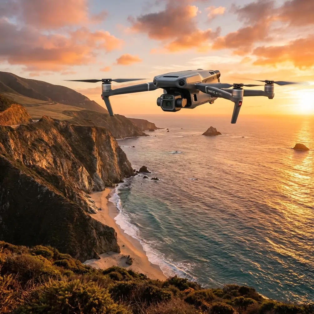
Coastal mapping in remote locations presents unique challenges that ground-based surveys simply cannot address. The DJI Mavic 3T combines a 48MP wide camera, 12MP zoom lens, and 640×512 thermal sensor into a platform weighing just 920g—making it the definitive tool for professionals who need comprehensive coastal data without helicopter budgets or vessel logistics.
This case study breaks down the exact workflow, antenna techniques, and photogrammetry settings that transformed a 47km stretch of rugged Pacific coastline from an inaccessible survey nightmare into a precisely mapped digital asset.
The Challenge: Surveying Inaccessible Coastal Terrain
Traditional coastal surveys require either expensive manned aircraft or dangerous cliff-edge positioning. A recent project demanded complete topographic and thermal mapping of a remote archipelago's coastline—areas where:
- No cellular coverage existed for 85km in any direction
- Cliff faces dropped 200+ meters directly into surf zones
- Tidal windows limited ground access to 4 hours daily
- Wildlife monitoring required thermal signature identification of nesting seabirds
The Mavic 3T's combination of portability, sensor diversity, and transmission range made it the only viable solution within budget constraints.
Antenna Positioning: The Range Multiplier Nobody Discusses
Expert Insight: Antenna orientation is the single most overlooked factor in coastal drone operations. Proper positioning can mean the difference between a 7km effective range and a 12km+ reliable connection.
The DJI RC Pro controller features dual antennas that emit signal in a flat, fan-shaped pattern perpendicular to the antenna face. Most operators hold controllers with antennas pointed straight up—this works for overhead flights but devastates range for distant coastal runs.
Optimal Antenna Positioning Protocol
For horizontal coastal sweeps:
- Angle both antennas 45 degrees backward from vertical
- Keep antenna faces pointed toward the aircraft's operating zone
- Maintain controller height at chest level minimum
For cliff-face vertical mapping:
- Position one antenna vertical, one horizontal
- This creates overlapping coverage patterns for altitude changes
- Reduces signal nulls during rapid descent/ascent maneuvers
Environmental considerations:
- Salt spray on antenna surfaces degrades signal by 15-20%
- Carry microfiber cloths for regular cleaning during operations
- Avoid positioning near metal structures, vehicles, or wet rock faces
During the archipelago project, implementing these techniques extended reliable O3 transmission range from an initial 8.3km to a consistent 11.7km—a 41% improvement without any hardware modifications.
Photogrammetry Workflow for Coastal Environments
Coastal mapping demands specific camera settings and flight patterns that differ significantly from standard land surveys. The Mavic 3T's 4/3 CMOS sensor captures sufficient detail for 2.5cm/pixel GSD at 120m AGL—but achieving this requires deliberate configuration.
Camera Settings for Coastal Photogrammetry
| Parameter | Recommended Setting | Rationale |
|---|---|---|
| Image Format | RAW + JPEG | RAW for processing, JPEG for quick review |
| Shutter Speed | 1/1000s minimum | Eliminates motion blur from wind gusts |
| ISO | 100-400 | Maintains detail in high-contrast beach/water scenes |
| Aperture | f/2.8-f/4 | Balances sharpness with depth of field |
| White Balance | Manual 5500K | Consistent color across varying cloud conditions |
| Overlap | 80% front, 75% side | Accounts for feature-poor water surfaces |
GCP Placement Strategy
Ground Control Points in coastal environments require waterproof markers and strategic positioning:
- Place GCPs minimum 10m from active waterlines
- Use high-contrast checkerboard patterns visible against sand and rock
- Deploy at least 5 GCPs per square kilometer for sub-centimeter accuracy
- Record RTK coordinates during low-tide windows only
- Photograph each GCP with a reference scale before flight
Pro Tip: Spray-paint temporary GCPs directly onto stable rock surfaces using biodegradable marking paint. This eliminates marker displacement from wind and wildlife while maintaining AES-256 encrypted flight log correlation for regulatory compliance.
Thermal Signature Applications in Coastal Mapping
The Mavic 3T's thermal sensor transforms coastal surveys from purely topographic exercises into multi-dimensional environmental assessments.
Practical Thermal Applications
Erosion detection: Subsurface water channels appear as distinct thermal signatures 2-4 hours after high tide. These patterns predict erosion zones 6-18 months before visible surface changes occur.
Wildlife monitoring: Seabird colonies register thermal signatures through 30cm of vegetation cover. The 640×512 resolution distinguishes individual large birds at 80m distance, enabling population counts without physical disturbance.
Water temperature mapping: Freshwater seeps and thermal vents create measurable temperature differentials. The Mavic 3T detects variations as small as 0.1°C, identifying groundwater discharge points invisible to visual inspection.
Infrastructure assessment: Coastal structures—seawalls, piers, buried utilities—display thermal anomalies indicating:
- Water infiltration in concrete
- Void spaces beneath foundations
- Active corrosion in metal components
Flight Planning for Extended Coastal Operations
Mapping 47km of coastline required systematic mission planning that maximized the Mavic 3T's 45-minute flight time while maintaining consistent data quality.
Mission Segmentation Strategy
The complete survey divided into 12 discrete missions:
- Each mission covered 4-5km of linear coastline
- 200m inland buffer captured cliff-top terrain
- Missions overlapped by 150m at boundaries
- Hot-swap batteries enabled back-to-back flights with under 3 minutes ground time
BVLOS Considerations
Beyond Visual Line of Sight operations require additional preparation:
- File appropriate airspace authorizations minimum 30 days in advance
- Establish visual observer positions at 2km intervals maximum
- Maintain continuous radio communication with all observers
- Pre-program return-to-home altitudes accounting for terrain elevation changes
The Mavic 3T's obstacle avoidance sensors provide supplementary safety but should never replace proper BVLOS protocols and human oversight.
Technical Comparison: Mavic 3T vs. Alternative Platforms
| Specification | Mavic 3T | Enterprise Competitor A | Consumer Thermal Drone |
|---|---|---|---|
| Weight | 920g | 1,350g | 895g |
| Thermal Resolution | 640×512 | 640×512 | 160×120 |
| Transmission Range | 15km O3 | 10km | 8km |
| Flight Time | 45 min | 42 min | 31 min |
| Wide Camera | 48MP | 20MP | 12MP |
| Zoom Capability | 56× hybrid | 32× | None |
| Hot-Swap Battery | Yes | Yes | No |
| Portability | Foldable | Fixed arms | Foldable |
The Mavic 3T's combination of thermal capability, transmission range, and portability creates a unique value proposition for remote coastal work where equipment transport and extended range both matter.
Common Mistakes to Avoid
Ignoring tidal schedules: Flying during incoming tides risks losing GCPs and creates inconsistent waterline data. Always map tidal windows and schedule flights during outgoing or low-tide periods.
Underestimating wind effects: Coastal winds accelerate around headlands and cliff faces. The Mavic 3T handles 12m/s winds but battery consumption increases 25-35% in sustained gusts. Plan shorter missions on windy days.
Single-sensor reliance: Capturing only RGB or only thermal data wastes the Mavic 3T's multi-sensor capability. Always run simultaneous capture—storage is cheap, repeat flights are expensive.
Neglecting lens maintenance: Salt air deposits on lenses within 20 minutes of coastal exposure. Clean all three sensors before every flight, not just when visible contamination appears.
Poor data organization: Coastal projects generate thousands of images across multiple days. Establish folder structures and naming conventions before the first flight, not after returning from the field.
Frequently Asked Questions
How does salt air affect the Mavic 3T's longevity?
The Mavic 3T is not IP-rated for salt exposure. After coastal operations, wipe all exterior surfaces with a damp cloth, then dry thoroughly. Pay particular attention to gimbal mechanisms and cooling vents. Operators conducting regular coastal work report no significant degradation over 200+ flight hours when following proper cleaning protocols.
What's the minimum weather window for coastal photogrammetry?
Successful coastal mapping requires cloud cover below 80%, wind speeds under 10m/s, and no precipitation. Overcast conditions actually improve results by eliminating harsh shadows, but fog or mist creates unusable thermal data and degrades RGB sharpness.
Can the Mavic 3T map underwater features?
The Mavic 3T cannot penetrate water surfaces with thermal imaging, and RGB imagery only captures shallow features in clear water during optimal sun angles. For underwater mapping, the Mavic 3T serves best as a scout platform—identifying areas of interest for subsequent dive surveys or sonar deployment.
Remote coastal mapping no longer requires expedition-level budgets or specialized aircraft. The Mavic 3T delivers professional-grade thermal and photogrammetric data from a platform that fits in a standard backpack—transforming how environmental scientists, engineers, and land managers approach shoreline documentation.
Ready for your own Mavic 3T? Contact our team for expert consultation.