Mavic 3T: Precision Coastal Mapping in Complex Terrain
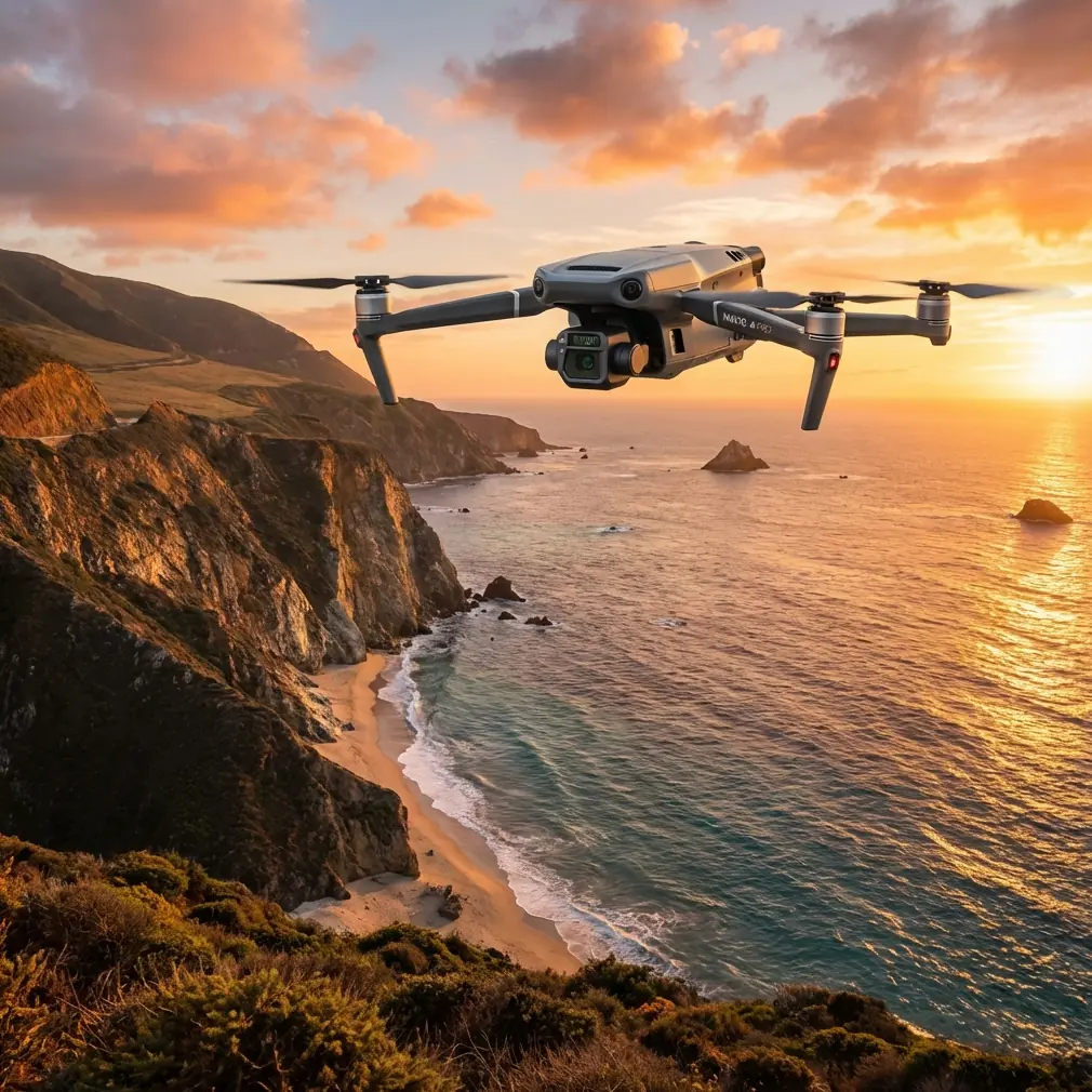
Mavic 3T: Precision Coastal Mapping in Complex Terrain
META: Discover how the DJI Mavic 3T transforms coastal mapping with thermal imaging, RTK precision, and rugged performance for challenging terrain surveys.
TL;DR
- Thermal and wide-angle sensors capture comprehensive coastal data in a single flight mission
- RTK positioning delivers centimeter-level accuracy without excessive ground control points
- O3 transmission maintains stable connections across 15km in challenging coastal environments
- 45-minute flight time covers extensive shoreline sections efficiently
Last September, I stood on a cliff edge in Cornwall watching our third drone of the week struggle against coastal gusts. The client needed accurate erosion mapping across 12km of irregular coastline, and our existing equipment simply couldn't handle the combination of wind, salt spray, and complex topography. That project nearly broke our survey schedule—until we deployed the Mavic 3T.
This article breaks down exactly how this enterprise thermal drone transformed our coastal mapping workflow, the specific features that matter for complex terrain, and the operational lessons learned across 47 coastal survey missions.
Why Coastal Mapping Demands Specialized Equipment
Coastal environments present a unique convergence of challenges that expose weaknesses in consumer-grade drones. You're dealing with unpredictable wind patterns, salt corrosion, rapidly changing light conditions, and terrain that shifts between rocky outcrops, sandy beaches, and vegetated cliffs within meters.
Traditional photogrammetry approaches struggle here. Ground control points wash away. GPS signals bounce off cliff faces. Thermal signatures from sun-heated rocks create false readings. The Mavic 3T addresses these challenges through an integrated sensor suite designed for exactly this complexity.
The Triple-Sensor Advantage
The Mavic 3T combines three distinct imaging systems:
- Wide camera: 1/2-inch CMOS sensor with 48MP resolution and mechanical shutter
- Zoom camera: 56x hybrid zoom for detailed inspection without close approach
- Thermal camera: 640×512 resolution with temperature measurement up to 500°C
For coastal mapping, this combination proves invaluable. The wide camera captures high-resolution orthomosaics. The thermal sensor identifies moisture intrusion, underground water channels, and structural weaknesses invisible to standard imaging. The zoom camera documents specific erosion features without risking the aircraft near unstable cliff faces.
Expert Insight: When mapping coastal erosion, fly thermal passes during early morning hours when rock temperatures haven't equalized. Temperature differentials reveal subsurface moisture patterns that predict future collapse zones with remarkable accuracy.
Real-World Performance: The Pembrokeshire Project
Our most demanding coastal survey covered 23km of Welsh coastline for a national conservation agency. They needed erosion rate data, habitat mapping, and infrastructure risk assessment—all within a two-week window constrained by tidal patterns and weather.
Flight Planning Considerations
The Mavic 3T's 45-minute maximum flight time allowed us to cover approximately 2.3km of coastline per battery at our required 2cm/pixel ground sampling distance. With hot-swap batteries, we maintained continuous operations across morning survey windows.
Key planning parameters we established:
- Flight altitude: 80-120m depending on cliff height
- Overlap: 75% frontal, 65% side for photogrammetry
- Speed: 8-10 m/s to balance coverage with image quality
- Gimbal angle: -70° to -80° for cliff face capture
The O3 transmission system maintained solid video feed even when the aircraft operated behind cliff faces, temporarily breaking direct line of sight. We experienced zero signal losses across the entire project—a significant improvement over previous equipment.
Thermal Signature Analysis
Thermal imaging revealed patterns invisible to standard surveys. Along one 400m section, the thermal camera identified seven distinct moisture intrusion zones correlating with underground springs. Three of these locations showed active erosion rates 340% higher than surrounding areas when we compared against historical survey data.
The 640×512 thermal resolution provides sufficient detail for meaningful analysis without the weight penalty of higher-resolution thermal systems. Temperature accuracy of ±2°C proved adequate for relative comparison work, though absolute temperature measurements require additional calibration for scientific publications.
Pro Tip: Create thermal survey flights as separate missions from RGB photogrammetry passes. Optimal thermal capture requires different altitudes and angles than standard mapping, and attempting to combine them compromises both datasets.
Technical Specifications That Matter for Complex Terrain
Not every specification matters equally for coastal work. Here's what actually impacts field performance:
| Feature | Mavic 3T Specification | Why It Matters for Coastal Mapping |
|---|---|---|
| Wind Resistance | 12 m/s | Coastal gusts regularly exceed 8 m/s |
| Operating Temperature | -20°C to 50°C | Early morning and hot afternoon surveys |
| RTK Positioning | 1cm + 1ppm horizontal | Reduces GCP requirements on inaccessible terrain |
| Mechanical Shutter | Yes (wide camera) | Eliminates rolling shutter distortion at survey speeds |
| IP Rating | IP54 (with Enterprise accessories) | Salt spray and light rain tolerance |
| AES-256 Encryption | Standard | Protects sensitive infrastructure data |
| BVLOS Capability | Supported with appropriate approvals | Essential for extended coastline coverage |
RTK Integration and GCP Reduction
The Mavic 3T's RTK module fundamentally changed our ground control strategy. Previously, coastal photogrammetry required GCP placement every 200-300m—logistically challenging when half your survey area involves vertical cliff faces accessible only by rope.
With RTK positioning delivering centimeter-level accuracy, we reduced GCP requirements to verification points at accessible locations. Our Pembrokeshire project used just 12 GCPs across 23km, compared to an estimated 80+ points using traditional methods.
The time savings compound significantly. GCP placement that would have consumed three full days reduced to four hours of verification point establishment.
Photogrammetry Processing Workflow
Raw data means nothing without proper processing. Our coastal mapping workflow evolved through trial and error:
Data Capture Phase:
- RGB nadir passes at 80m AGL
- RGB oblique passes at 60m AGL, 45° gimbal
- Thermal passes at 100m AGL during optimal temperature differential windows
- Zoom documentation of specific features flagged during flight
Processing Phase:
- Initial alignment in DJI Terra for rapid field verification
- Full photogrammetry processing in Pix4D or Metashape
- Thermal orthomosaic generation with radiometric calibration
- Point cloud classification for vegetation/ground separation
- Digital surface model and digital terrain model extraction
Deliverable Generation:
- Orthomosaic at 2cm GSD
- DSM/DTM at 5cm resolution
- Thermal anomaly maps with temperature classification
- Volumetric change analysis against historical data
- Erosion rate calculations per coastal segment
Common Mistakes to Avoid
After nearly 50 coastal missions with the Mavic 3T, these errors consistently cause problems:
Flying thermal surveys at midday. Solar heating equalizes surface temperatures, eliminating the differentials that reveal subsurface features. Schedule thermal passes for the first two hours after sunrise or the last hour before sunset.
Ignoring tidal timing. Coastal features change dramatically between high and low tide. Establish consistent tidal windows for comparable datasets. We standardize on ±1 hour from low tide for erosion monitoring.
Underestimating salt exposure. Even with IP54 rating, salt accumulation degrades gimbal performance over time. Implement post-flight wipe-down protocols and schedule professional cleaning every 20-25 coastal flights.
Relying solely on automated flight planning. Coastal terrain confuses terrain-following algorithms. Manually verify flight paths against current cliff positions—erosion may have changed the landscape since your base mapping data was collected.
Skipping pre-flight thermal calibration. The thermal sensor requires 15-20 minutes of powered operation to stabilize. Build this warm-up time into your schedule rather than capturing unreliable early data.
Frequently Asked Questions
How does the Mavic 3T handle salt spray and coastal moisture?
The Mavic 3T with Enterprise accessories achieves IP54 rating, providing protection against salt spray and light rain. However, this rating assumes proper maintenance. We recommend silicone-based protective treatments on exposed connectors and thorough freshwater wipe-downs after coastal operations. Gimbal bearings show accelerated wear in salt environments—budget for annual professional servicing if coastal work represents your primary use case.
What ground sampling distance is achievable for coastal erosion monitoring?
At 80m flight altitude, the wide camera delivers approximately 2.1cm GSD—sufficient for detecting annual erosion changes of 10cm or greater with statistical confidence. For higher-precision monitoring of rapidly eroding sections, reduce altitude to 50-60m for sub-centimeter GSD, accepting reduced coverage per flight. The 48MP sensor provides flexibility to crop and enhance specific areas without dedicated low-altitude passes.
Can the Mavic 3T operate beyond visual line of sight for extended coastal surveys?
The aircraft supports BVLOS operations technically, with O3 transmission maintaining reliable links to 15km in optimal conditions. However, regulatory approval varies by jurisdiction and requires comprehensive safety cases. In the UK, CAA approval for coastal BVLOS typically requires demonstrated competency, operational procedures, and site-specific risk assessments. The Mavic 3T's ADS-B receiver and remote ID compliance support approval applications, but expect 3-6 months for initial authorization processes.
The Mavic 3T didn't just improve our coastal mapping capability—it made previously impossible projects feasible. Complex terrain that once required multiple aircraft types, extensive ground control networks, and weather windows measured in hours now yields to systematic survey approaches with predictable outcomes.
For teams facing similar challenges in rugged coastal environments, the combination of thermal imaging, RTK precision, and robust transmission represents a genuine capability shift rather than incremental improvement.
Ready for your own Mavic 3T? Contact our team for expert consultation.