What China’s “Jiutian” Drone Milestone Means for Mavic 3T Op
What China’s “Jiutian” Drone Milestone Means for Mavic 3T Operators Mapping Dusty Coastlines
META: China’s upcoming Jiutian UAV first flight signals a new phase in drone manufacturing, with practical implications for Mavic 3T operators handling dusty coastline mapping, thermal workflows, and mission reliability.
The most useful drone news is not always about the drone you fly.
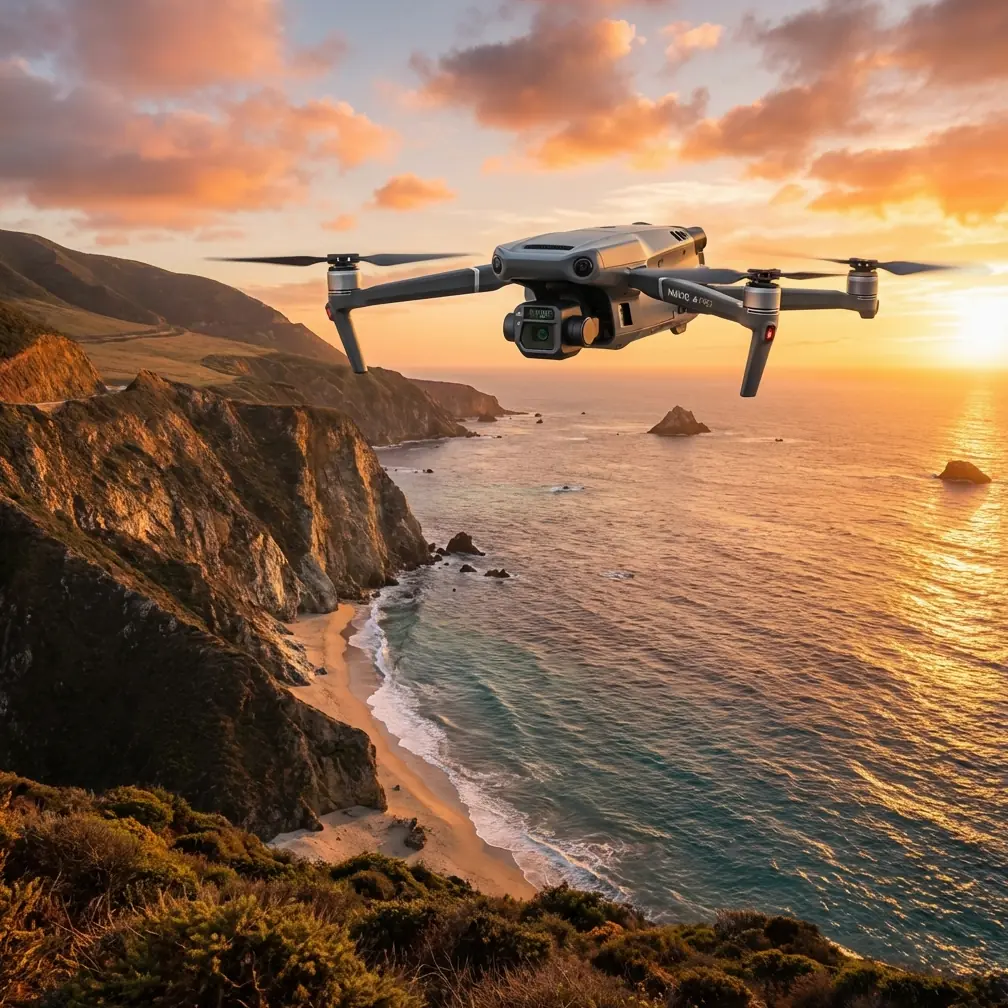
This week’s headline centers on “Jiutian,” a large Chinese unmanned aircraft scheduled for its first flight by the end of June. On paper, it sits in a completely different class from the DJI Mavic 3T. Jiutian is a heavy platform with a 25-meter wingspan and a maximum takeoff weight of 16 tons. The Mavic 3T, by contrast, is the kind of aircraft you can deploy from the back of a field truck, launch in minutes, and use to inspect shoreline erosion, heat leaks, stranded vessels, or infrastructure edges in ugly coastal conditions.
So why should a Mavic 3T operator care?
Because this story is not really about size. It is about manufacturing depth, systems integration, and what happens when a drone ecosystem starts to control more of its own design, materials, production, and final assembly. For professionals working with the Mavic 3T in real environments, especially dusty coastline mapping missions, that shift matters more than many product announcements.
A heavy UAV story with direct implications for smaller platforms
According to the source report, Jiutian is being developed through a coordinated Chinese industrial chain: commissioned by Shaanxi Unmanned Equipment Technology, designed by AVIC First Aircraft Institute, and manufactured by Xi’an Chida Aircraft Parts Manufacturing. The aircraft is expected to complete its first flight in late June. That alone would be notable. But the sharper point is the claim that the project represents a move into “full-chain autonomous manufacturing,” covering everything from process design and raw material supply to complete aircraft debugging and integration.
That phrase deserves attention.
For enterprise drone buyers and working pilots, “full-chain” capability is not abstract policy language. It often shows up later as shorter component lead times, more stable production consistency, better integration between hardware and software, and fewer weak points between design intent and field performance. If you are flying a Mavic 3T to map coastlines in dusty wind, you are betting your deliverables on exactly those quiet, unglamorous parts of the supply chain.
The reference also notes that the Jiutian program’s manufacturing side built an end-to-end system spanning process design, raw materials, and final aircraft commissioning. That kind of systems thinking is a big deal. It suggests that Chinese UAV manufacturing is not only scaling in aircraft size, but also maturing in how design and production talk to each other.
For a pilot using a Mavic 3T, the practical question is simple: does this broader industrial maturity improve trust in the category? In my view, yes.
Why Mavic 3T users should read this as an operations story
The Mavic 3T lives in a tight operational window. It is not a strategic heavy aircraft. It is a compact, highly deployable tool used when you need rapid lift, clean thermal data, stable visual capture, and dependable transmission without building a full runway-and-crew architecture around the mission.
That is exactly why upstream manufacturing news matters.
Coastline mapping in dusty conditions is punishing in ways spec sheets rarely explain well. Fine particulates contaminate landing zones. Salt-heavy air can magnify wear. Uneven light over water stresses camera exposure. Thermal signature interpretation gets messy when sun-warmed rocks, shallow water, marine debris, and man-made surfaces all sit in the same scene. Add wind, and the margin for error narrows quickly.
In those conditions, reliability is not one thing. It is the combined result of airframe precision, gimbal stability, sensor calibration, battery consistency, transmission resilience, and software predictability. News like the Jiutian first-flight program matters because it points to a wider manufacturing culture focused on integration instead of isolated parts.
That is relevant to the Mavic 3T because the aircraft’s strongest advantage against many competing compact enterprise drones is not one headline feature. It is how well the whole package hangs together in the field.
The real edge of the Mavic 3T in coastal work
When people compare compact enterprise UAVs, the conversation often drifts toward single-feature marketing. Thermal resolution. Zoom level. Flight time. Obstacle sensing. Those all matter. None of them wins the mission alone.
The Mavic 3T stands out because it balances thermal imaging, visible capture, transmission stability, and compact deployment better than most rivals in its class. That balance is especially valuable on coastline work where teams need to move fast across multiple launch points, often with difficult surfaces and inconsistent visibility.
A fixed or larger multirotor platform may offer longer endurance or heavier sensor flexibility, but that usually comes with slower deployment, more crew overhead, and more friction around transport and battery logistics. In shoreline operations, friction is expensive. Tide windows close. Light changes. Weather turns. Dust kicks up without warning. A platform that gets airborne fast and returns repeatable data often beats a theoretically stronger aircraft that takes too long to stage.
This is where Mavic 3T operators can draw a line from the Jiutian story to their own work. A manufacturing ecosystem that is getting better at integrated production tends to support aircraft categories where mission speed and consistency are everything.
The significance of digital manufacturing is bigger than the headline
One of the most revealing details in the source text is not the aircraft’s size. It is the mention of substantial investment in digital systems, including PLM, CAXA parts process tools, and DMPP assembly process tools. The source says the company invested in the tens of millions of yuan to build that stack and deepen coordination between R&D and manufacturing.
That detail matters operationally because digital continuity reduces mismatch. It reduces the number of places where engineering intent gets diluted by factory reality. In a drone context, that can affect tolerances, assembly consistency, maintenance logic, and eventually the confidence users place in mission-critical systems.
Now bring that back to the Mavic 3T.
If you are running coastal photogrammetry with thermal overlays, your workflow depends on repeatability. You need image sets that align cleanly across sorties. You need thermal signature capture that is stable enough to compare shoreline anomalies over time. You need confidence that battery behavior, hover stability, and payload response stay consistent from one mission day to the next.
That is why this larger Chinese UAV manufacturing story is not some distant aerospace curiosity. It is part of the same industrial logic that shapes the reliability expectations users now bring to compact enterprise drones.
Mapping coastlines in dust: what actually matters on the job
Let’s get practical.
If your assignment is mapping coastlines in dusty conditions, the Mavic 3T is not a pure photogrammetry specialist in the same mold as some mapping-first aircraft. But it is an exceptionally useful technical review case because many coastal missions are hybrid by nature. They are not just mapping exercises. They involve search, thermal assessment, rapid situational awareness, and visual documentation in one deployment cycle.
That is where the Mavic 3T earns its keep.
Its thermal payload lets you identify heat differentials along shoreline infrastructure, stranded equipment, vessel remnants, or people and animals against mixed terrain. The visual system supports rapid scene documentation. O3 transmission helps maintain a strong control and video link when coastal geography, reflective surfaces, and shifting wind patterns complicate line-of-sight conditions. And AES-256 matters more than many users admit, particularly for infrastructure, environmental, or security-sensitive shoreline work where image and location data should not travel loosely.
Competitors may match one or two of those pieces. Fewer match the compact operational rhythm. That rhythm matters in the field.
A larger mapping platform might produce a more specialized photogrammetry output, especially when paired with rigorous GCP placement and dedicated survey workflow. But if the mission requires one aircraft to handle thermal reconnaissance, visual inspection, fast redeployment, and area documentation before the weather swings, the Mavic 3T often gives teams more usable flexibility per flight case.
Where photogrammetry fits, and where it doesn’t
It is worth being precise here. If your coastline project is a strict survey deliverable, with dense overlap targets, control points, and a photogrammetry-first workflow, you should still treat GCP planning, tide timing, reflective water interference, and wind corridor management as the foundation of the job. The Mavic 3T can contribute to that environment, but its real strength is in mixed-data missions rather than pure survey optimization.
That distinction is useful because the Jiutian news reminds us how important role clarity is in UAV planning. A 16-ton aircraft with a 25-meter wingspan exists because some tasks demand scale, payload room, and strategic endurance. A Mavic 3T exists because many field operations demand the opposite: fast setup, low logistical burden, and enough sensor diversity to solve several problems in one sortie.
For coastline teams working in dust, that tradeoff is often the right one.
What this says about confidence in Chinese UAV platforms
There is another reason this story matters.
The Jiutian report frames the aircraft as a sign that China’s drone sector is entering a new stage of independent, full-process manufacturing. Whether you read that as industrial policy, supply-chain strategy, or aerospace maturity, the message for operators is straightforward: manufacturing confidence is becoming part of the value proposition.
That changes how buyers evaluate aircraft like the Mavic 3T.
The question is no longer just, “Does this platform have thermal?” or “How far does the link reach?” More serious users want to know whether the broader ecosystem behind the aircraft can support continuity, updates, parts availability, and stable production quality over time. A strong all-chain manufacturing base does not automatically solve every field problem. But it improves the odds that the aircraft category evolves with fewer weak links.
For enterprise users, that is a serious advantage.
If your work includes coastal infrastructure, environmental response, shoreline patrol, or pre-BVLOS corridor scouting, you are not merely buying a flying camera. You are choosing an operational system whose value depends on trust. The Jiutian milestone strengthens the case that Chinese UAV manufacturing is pushing deeper into that trust layer.
A simple takeaway for Mavic 3T operators
Do not read the Jiutian first-flight story as unrelated heavyweight aerospace news.
Read it as evidence that the industrial base behind Chinese drones is moving toward tighter integration, stronger internal control over production stages, and better coordination between design and manufacturing. The fact that the aircraft is scheduled for a late-June first flight is newsworthy. The more consequential detail is that the project reportedly spans the full chain from process engineering and raw material supply to complete aircraft debugging. That is the kind of development that influences reliability culture across the sector.
And reliability culture is exactly what matters when a Mavic 3T is lifting off from a dusty shoreline, chasing a narrow weather window, trying to capture clean thermal signature data while maintaining stable transmission and useful visual context.
If you want a compact aircraft that can bridge thermal assessment, inspection, rapid coastal documentation, and hybrid mission planning better than many rivals, the Mavic 3T remains one of the strongest tools in the field. Not because it is the biggest. Because it fits real operations better.
The Jiutian story is a reminder that this advantage does not start at the launch site. It starts much earlier, inside the manufacturing chain.
If you are refining your own coastline workflow and want to compare mission profiles, sensor tradeoffs, or link-security considerations, you can message an operator directly here.
Ready for your own Mavic 3T? Contact our team for expert consultation.