Mavic 3T for Low-Light Coastline Mapping
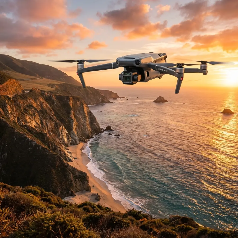
Mavic 3T for Low-Light Coastline Mapping: A Field Method That Actually Works
META: Expert how-to on using the DJI Mavic 3T for coastline mapping in low light, with thermal workflow tips, battery strategy, GCP planning, and transmission considerations.
Coastline mapping in low light sounds simple until you try to produce data that holds up after the flight. Sand, rock, tidal pools, sea walls, wet vegetation, and moving water all behave differently as daylight drops. Add changing wind off the water and the short windows between usable contrast and full darkness, and the mission quickly stops being routine.
This is where the Mavic 3T becomes genuinely interesting. Not because it replaces a dedicated survey platform in every case. It does not. But because it gives field teams a practical combination that is unusually well suited to shoreline work when light is marginal: a stabilized visual payload, a thermal sensor for separation and situational awareness, robust O3 transmission, and a flight package that is fast to deploy when conditions shift. For operators mapping coasts, estuaries, revetments, marsh edges, or erosion zones, those traits matter more than spec-sheet bragging rights.
If your goal is to map coastlines in low light with a Mavic 3T, the right approach is not to simply fly later in the day and hope the camera sorts it out. You need a workflow built around contrast management, overlap discipline, battery timing, and realistic expectations about what thermal data can and cannot do in a photogrammetry job.
Start with the mission objective, not the drone mode
Before takeoff, define what “mapping” means for this job.
There are at least three very different low-light coastline missions that people often lump together:
- Creating a visual map for orthomosaic output
- Identifying wet-dry boundaries, seepage, or thermal anomalies along the shore
- Capturing enough repeatable data for change detection over time
The Mavic 3T can contribute to all three, but not in the same way.
If your deliverable is a photogrammetric map, your primary concern is visual consistency. Low light reduces texture quality and can introduce motion blur or noisy imagery that weakens tie points. In that case, the thermal camera is not the mapping engine. It is a support layer. It helps you detect surf intrusion, stranded debris lines, warm outfalls, recently sun-heated hardscape, and even people or vehicles entering the work area. That operational awareness can save a mission when shoreline conditions change faster than your ground crew can report them.
If your objective is boundary interpretation rather than full survey-grade reconstruction, the thermal signature becomes more central. Wet sand often cools differently than dry upper beach. Rock structures, drainage outlets, and man-made edges can separate more clearly after sunset or before sunrise than they do under flat visible-light conditions. That difference can make your shoreline classification cleaner, even when the visual scene starts losing contrast.
The mistake I see most often is trying to make one flight do everything. Better results come from planning a visual mapping pass and a thermal interpretation pass as related but distinct products.
Why low light can help, not just hurt
Most pilots treat low light as a compromise. Along coastlines, it can also be an advantage.
Midday sun often creates glare on wet sand, specular reflections on tidal flats, and harsh transitions on rocks or concrete defenses. Those conditions can corrupt image consistency across a long shoreline corridor. Low-angle or fading light reduces some of that reflected noise. Features that were washed out earlier in the day can become easier to read.
Thermal can add another layer of separation. On a coastline, materials do not all release heat at the same rate. Riprap, seawalls, standing water, saturated sand, vegetation, and runoff zones can each present a distinct thermal pattern. That does not magically turn the Mavic 3T into a survey miracle. But it does give you another way to understand the site when visible contrast alone is unreliable.
This is especially useful when your team needs to distinguish between a simple waterline shift and a drainage issue, or between uniform beach cooling and a localized heat anomaly near infrastructure. In practical terms, the thermal view helps you decide where to place extra Ground Control Points, where to tighten overlap, and where to send a field technician for verification.
The Mavic 3T advantage on shoreline jobs
The Mavic 3T’s value in this scenario is less about headline performance and more about how the platform behaves during a compressed field window.
First, O3 transmission matters over coastlines more than many inland operators expect. Open shoreline corridors can look deceptively easy, but signal quality can be influenced by terrain breaks, structures, and pilot position relative to bluffs, dunes, harbor walls, or industrial waterfront features. Stable transmission gives the pilot more confidence to maintain a disciplined line and speed profile during low-light work, where small deviations can spoil overlap.
Second, AES-256 encryption matters when your mapping mission involves sensitive infrastructure, environmental monitoring, utility assets, or government work near ports and coastal facilities. This is not just a box-ticking security feature. It can be the difference between a platform that fits a client’s data handling policy and one that gets excluded before the mission even starts.
Third, the aircraft’s thermal capability is not just for emergency response use cases. Along the coast, it helps reveal patterns that are easy to miss visually: freshwater discharges into colder water, residual heat in engineered structures, and temperature differences across saturated ground. Those details can guide a better survey plan, especially when the shoreline is too long to revisit casually.
A practical flight plan for low-light coastline mapping
If I were setting up a Mavic 3T mission for this exact scenario, I would break the work into four phases.
1. Recon pass before the mapping run
Do a short pre-mission recon at safe altitude while there is still enough ambient light to evaluate surface behavior. You are looking for three things:
- reflective zones that may degrade image quality
- moving water boundaries that will not remain stable through the mission
- unexpected heat sources that could affect interpretation later
This pass tells you where photogrammetry is likely to struggle and where the thermal layer might provide useful context.
2. Lock your visual mission parameters early
In low light, consistency beats improvisation. Keep your route simple. Favor clean parallel tracks over creative corridor shapes. Coastlines tempt pilots to hug the edge too tightly, but that often creates uneven perspective and weak reconstruction along transitions between beach, slope, and water.
Set your overlap conservatively. If the site is complex, increase it beyond what you would use in bright daytime conditions. Low-light imagery has less forgiving feature matching. You want redundancy.
And if this is a repeat-monitoring job, do not casually change altitude or angle from the previous survey. Coastline change detection depends on repeatability more than artistic framing.
3. Use thermal as a decision layer, not a crutch
Run thermal to identify areas where the visible map may need support. Examples include:
- seepage through embankments
- recently exposed wet sand bands
- heat-retaining hard structures against cooler natural surfaces
- localized runoff near outfalls or culverts
This is where the Mavic 3T earns its place. The thermal image can help you interpret edge conditions that may appear visually ambiguous at dusk.
4. Validate with GCPs and shoreline notes
If the map needs to stand up beyond internal viewing, use GCPs. On coastline work, Ground Control Points are not optional decoration. They are the difference between a rough visual reference and a dataset you can compare over time with confidence.
Place GCPs where they will remain visible and stable through the mission window. Avoid areas likely to be wetted by incoming tide or softened by reflective sheen. If the beach is dynamic, add field notes on tide stage, recent wave action, and any temporary obstructions. Photogrammetry software can process images; it cannot tell you that a control marker was half-covered by blowing sand ten minutes into the job.
The battery tip that saves missions near the water
Here is the field habit I recommend to every Mavic 3T crew doing shoreline work in low light: rotate batteries by temperature behavior, not just charge percentage.
A battery that looks fine on paper can behave differently after sitting in cool marine air, especially if one pack came straight from a vehicle case and another spent twenty minutes exposed on the tailgate while your team laid out GCPs. Over the coast, that difference shows up when you need consistent power delivery during the return leg and when wind starts stiffening after sunset.
My rule is simple. Label packs by sequence, but before launch also note which one is physically warmest and most recently stabilized at operating temperature. Use that battery first for the longest outbound leg. Save the cooler but fully charged pack for a shorter follow-up run, not the other way around.
This sounds minor until you have flown a long shoreline strip, realized the sea breeze has shifted, and watched a “good” battery sag faster than expected on the trip back. The Mavic 3T does support efficient field turnover, and operators often refer to quick battery swaps as a practical necessity even when they casually call them hot-swap batteries. In reality, disciplined battery rotation is what keeps your workflow smooth. The real lesson is not speed. It is sequencing.
I also avoid mixing battery roles randomly. One set becomes the primary mapping set. Another handles recon or contingency checks. Once you start using the same pack for short scouting hops and then trust it for the longest low-light corridor pass, your energy planning gets muddy fast.
Where thermal helps photogrammetry, and where it does not
This is worth saying clearly because it gets oversold.
Thermal data can improve your understanding of the shoreline. It can help identify target areas, support interpretation, and reveal patterns that guide follow-on work. But thermal does not automatically improve photogrammetry output. In many cases, your orthomosaic quality still lives or dies on the visual data, image sharpness, overlap, and control quality.
What thermal can do is help you decide where to reinforce the visual mission. If the thermal feed shows a complex wet-dry transition or a drainage plume you had not appreciated from the ground, you can add another pass, lower altitude slightly where appropriate, or increase control density in that zone. That is a real operational advantage.
Think of thermal as a reconnaissance and analysis multiplier, not as a shortcut around weak survey discipline.
Transmission, security, and the reality of coastal operations
Low-light coastal missions are often conducted in places where operational risk is not only environmental. You may be near shipping channels, industrial waterfronts, restricted infrastructure, or public access areas with unpredictable foot traffic.
O3 transmission gives the pilot a more reliable live link for route discipline and situational awareness. That is not glamorous, but it matters when visual conditions are degrading and the shoreline geometry makes line maintenance harder than expected.
AES-256 matters for another reason: client trust. If you are capturing imagery around sensitive marine assets, data security is part of the mission design. Teams that understand this tend to win more repeat work because they are not just delivering images. They are delivering a process that fits modern operational requirements.
And if you are planning any coastal workflow that edges toward BVLOS concepts, even in early planning discussions, remember that low-light mapping amplifies the need for strong procedures, local compliance checks, conservative route design, and clear risk controls. The Mavic 3T can support serious operations, but seriousness starts with the operator, not the aircraft.
A clean workflow for repeat shoreline surveys
For teams building a repeatable process, this template works well:
- arrive early enough to place and verify GCPs before light drops
- conduct a short visual and thermal recon pass
- identify unstable shoreline segments and glare-prone surfaces
- run the main visual mapping mission with conservative overlap
- fly targeted thermal passes over anomalies or critical structures
- log tide condition, wind direction, ambient temperature, and battery sequence
- review sample frames on site before leaving
That last step is where experienced crews separate themselves. Do not assume the mission worked because the flight did. Review enough imagery on site to confirm texture, sharpness, and control visibility. A coastline at low light can fool you twice: once in the air, and again at the desk.
If your team is refining this kind of workflow for infrastructure, habitat monitoring, or erosion tracking, you can compare mission planning notes with our field desk here: message our UAV team.
Final take
The Mavic 3T is not the default answer for every mapping problem. But for coastline work in low light, it occupies a very useful space. Its mix of thermal awareness, secure transmission architecture, dependable live link performance, and fast field deployment makes it especially effective when conditions are changing and time on site is tight.
Used well, it helps operators do two things at once: preserve enough visual quality for mapping and gain a second layer of environmental interpretation through thermal signature analysis. Add solid GCP placement, conservative photogrammetry planning, disciplined battery sequencing, and realistic expectations, and the aircraft becomes far more than a general-purpose drone with a thermal badge.
That is the difference between collecting coastal imagery and producing a coastal dataset you can trust next month, next season, and after the shoreline has moved again.
Ready for your own Mavic 3T? Contact our team for expert consultation.