Mavic 3T Mapping Tips for Windy Coastlines
Mavic 3T Mapping Tips for Windy Coastlines: What Actually Matters in the Field
META: A technical review of the DJI Mavic 3T for coastline mapping in windy conditions, covering thermal workflows, photogrammetry limits, RTK alternatives, transmission reliability, and practical mission planning.
I still remember a shoreline survey that should have been routine and wasn’t. The brief looked simple: document erosion along a rocky stretch of coast, identify seepage points near a retaining wall, and produce an updated orthomosaic before the tide turned. On paper, that is a standard drone job. In reality, the wind was unstable, salt haze kept changing the light, and the surf created enough visual noise to confuse weaker positioning and image overlap strategies.
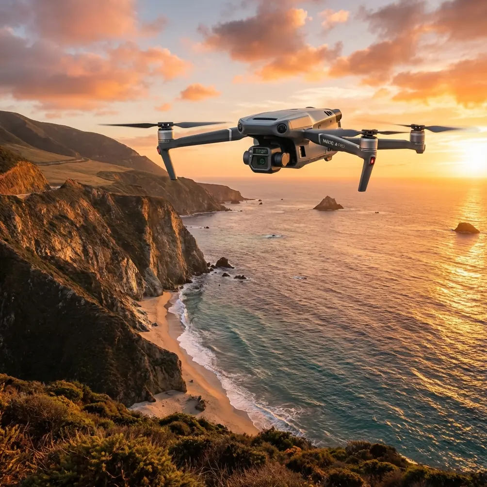
That kind of mission is where the Mavic 3T becomes interesting.
Not because it is a magic answer. It isn’t. The Mavic 3T is a compact thermal enterprise aircraft with a very specific personality: fast to deploy, far more useful than its size suggests, and extremely effective when the survey objective is broader than pure survey-grade photogrammetry. For coastline work in windy conditions, that distinction matters. If you expect it to behave like a dedicated large-sensor mapping platform, you will plan the wrong mission. If you understand where its strengths intersect with shoreline operations, it can save a field day that would otherwise unravel.
Why coastlines expose weak drone workflows
Coastal mapping stresses almost every part of a drone operation at once.
Wind is the obvious issue, but it is not the only one. You also deal with moving water, repetitive textures like sand or shingle, glare, dark rock faces, reflective wet surfaces, and sudden contrast changes when clouds pass over. Add the reality of narrow launch areas and short weather windows, and the mission design becomes less forgiving than inland corridor work.
This is where the Mavic 3T’s portability changes the equation. A larger aircraft may offer stronger raw mapping performance, but a compact foldable platform is often the one that actually gets airborne at the right moment, from the right location, before conditions shift again. For coastal teams working from access roads, sea walls, harbor edges, or remote tracks, deployment speed is not a convenience. It is part of data quality.
The aircraft’s O3 Enterprise transmission is one of the features that has real operational value here. DJI rates the system with strong transmission performance suitable for complex environments, and in shoreline work that matters because the coast is rarely as open as it looks. Cliffs, structures, uneven terrain, and shifting launch positions can all interfere with link stability. Reliable live feed and command response are not just pilot comfort features; they help maintain line integrity on repeat passes and reduce the temptation to cut corners when wind picks up.
The Mavic 3T is not just “a thermal drone”
People reduce the Mavic 3T to its thermal camera too quickly. That misses the point.
The aircraft combines a thermal sensor with a wide camera and tele capability, which makes it far more useful for mixed coastal inspection than a thermal-only workflow. On a shoreline mission, those payloads can complement each other in ways that save time on site.
The thermal signature is valuable for tasks that visual mapping alone often misses. Seepage behind sea defenses, drainage discharge points, moisture anomalies in embankments, and temperature differences around infrastructure can stand out clearly under the right environmental conditions. That does not replace visual mapping. It adds another layer of evidence.
The significance is practical. A standard orthomosaic might tell you where the revetment is cracking. Thermal imagery can help point you toward areas where water movement or material saturation may be contributing to the problem. For asset managers dealing with coastal erosion or infrastructure maintenance, that changes the survey from descriptive to diagnostic.
There is a timing caveat, and experienced users know it. Thermal over coastlines is highly dependent on time of day, sun loading, tidal state, and surface moisture. Midday missions can flatten temperature contrast. Wet stone can behave very differently from dry concrete. If your goal is to locate thermal anomalies rather than simply record them, flight timing matters almost as much as aircraft choice.
Photogrammetry with the Mavic 3T: useful, but know the boundaries
Let’s address the question many buyers really mean to ask: can the Mavic 3T handle photogrammetry for coastline mapping?
Yes, within limits.
The wide camera can support practical photogrammetry outputs for shoreline documentation, site progress records, environmental monitoring, and condition assessment. If the deliverable is a current orthomosaic, a terrain snapshot, or a visual baseline for comparison over time, the Mavic 3T can be very effective.
But windy coastline work exposes the edges of that capability quickly. Photogrammetry depends on image consistency and overlap. Gusts disturb ground track. Surf and wave motion reduce tie-point reliability. Wet reflective surfaces can produce poor matching. Long linear coastlines often tempt operators to fly too high or too fast, which weakens the final model.
That is why GCP strategy becomes more important than many teams expect. If you are using the Mavic 3T for coastal mapping, well-placed ground control points can do a lot of heavy lifting, especially in visually repetitive terrain where software may struggle to anchor the model. On beaches and engineered coastlines alike, GCPs help stabilize results and reduce the drift that can appear across long, narrow datasets.
Operationally, this means the Mavic 3T performs best when treated as part of a disciplined workflow rather than a one-click mapping appliance. Plan for strong sidelap and frontlap. Watch shutter behavior and lighting consistency. Break very long coastline sections into manageable mission blocks. Verify tie points around water-adjacent edges instead of assuming the software solved them cleanly.
If survey-grade absolute accuracy is the priority, you should be honest about the role of the aircraft and the amount of control required to support it.
Wind handling: what helps and what still needs pilot judgment
On windy coasts, aircraft spec sheets only tell part of the story. The rest comes down to how the platform behaves when the environment gets messy.
The Mavic 3T’s compact airframe is both an advantage and a compromise. It is quick to launch, simple to reposition, and practical when operating from awkward ground. That helps enormously on fragmented shoreline sites. At the same time, lighter aircraft are more exposed to lateral drift, abrupt gust loading, and image-angle inconsistency than heavier enterprise rigs.
The trick is to design missions around the wind instead of trying to outfight it.
For coastal transects, I prefer to align legs so the aircraft sees the most predictable wind component possible rather than a constantly shifting crosswind. This improves consistency in overlap and reduces unnecessary yaw corrections. It also lowers the chance that one leg looks clean while the return leg is visibly compromised.
Battery management matters more than inland pilots often realize. Cold sea air, repeated hover checks, and corrective flight in gusts all increase energy use. The Mavic 3T’s field efficiency is excellent, but coastlines punish optimistic planning. Build reserves into every mission, especially when launching from limited access points where recovery options are poor.
The common phrase “hot-swap batteries” gets used casually, but in coastal work the real benefit is continuity. Fast battery changes reduce the risk of missing a narrow tide or light window. When the target area changes character dramatically over an hour, every delay affects comparability between flight segments.
Thermal and visual together: a better coastal inspection workflow
The most effective Mavic 3T coastline missions are rarely single-purpose. The aircraft is strongest when used to stack data types during one deployment.
A practical sequence might look like this: start with a visual pass to establish overall site context, complete a structured image set for photogrammetry over the priority area, then run targeted thermal passes over drainage outlets, wall interfaces, or suspect erosion zones. That workflow gives planners and engineers both geometry and condition clues from the same visit.
This is also where the tele capability earns its place. On unstable cliff edges or protected shoreline sections where close approach is undesirable, zoom observation can reduce unnecessary repositioning and keep the aircraft farther from turbulence generated by structures or terrain.
The result is not just efficiency. It is better interpretation. A thermal hotspot without visual context can be misleading. A visual anomaly without thermal support may be hard to prioritize. Used together, they often point to the next inspection step more clearly.
Security and data handling are not side issues
Coastline projects often involve utilities, ports, critical civil infrastructure, environmental assets, or regulated industrial sites. In those settings, transmission and storage security are not administrative afterthoughts.
The Mavic 3T supports AES-256 encryption, and that is more than a brochure line. For organizations managing sensitive geospatial data, encrypted handling helps reduce exposure when flying around infrastructure or restricted industrial environments. It will not replace a proper data governance policy, but it is part of a defensible workflow.
The same applies to transmission confidence. O3 Enterprise is not just about range in a marketing sense. In operational terms, a stable link helps teams preserve mission discipline instead of rushing flights because signal quality feels uncertain. That matters in wind, where poor decisions compound quickly.
What about BVLOS?
BVLOS is often mentioned around long coastline work because the geography naturally suggests extended corridor operations. The reality is simpler: the Mavic 3T is capable enough to fit into advanced operational frameworks, but the aircraft alone does not make a BVLOS program. Regulatory approval, detect-and-avoid strategy, communications planning, and operator competency still define what is possible.
For most civilian coastal teams today, the better question is not “Can this do BVLOS?” but “Can this reduce the number of repositioning stops and still deliver reliable visual and thermal data under normal regulatory constraints?” In that respect, the Mavic 3T is genuinely useful.
Where this aircraft made my own work easier
The biggest shift for me was not image quality alone. It was decision speed.
Older workflows often forced a choice. Bring a mapping-focused drone and lose thermal context, or bring a thermal platform and accept weaker visual deliverables. On the coast, where access can be limited and weather windows narrow, that split costs time.
The Mavic 3T reduced that friction. I could document shoreline condition, capture actionable thermal signatures, inspect hard-to-reach details, and leave site with enough confidence to brief stakeholders before processing was even complete. That is the sort of improvement that matters in professional operations: fewer return visits, clearer prioritization, and less uncertainty between field capture and office analysis.
If your team is working through mission planning questions for this kind of environment, a quick field-oriented discussion can help more than a generic spec comparison. You can reach someone familiar with practical deployment details through this direct WhatsApp line.
Final assessment for windy coastline mapping
The Mavic 3T is not the perfect coastline mapping drone in every scenario. That is exactly why it deserves a serious look. It succeeds because it combines enough visual utility, enough thermal intelligence, enough transmission reliability, and enough field efficiency to handle the messy middle ground where many real coastal jobs live.
If your mission is pure high-accuracy topographic production across large areas, there are better-specialized tools. If your mission is mixed coastal assessment under changing weather, limited access, and the need to collect more than one type of evidence in a single deployment, the Mavic 3T is one of the most practical aircraft in its class.
Its real advantage is not any one sensor. It is the way the platform shortens the distance between observation and action.
Ready for your own Mavic 3T? Contact our team for expert consultation.