Mavic 3T in Mountain Field Mapping: What Actually Changes
Mavic 3T in Mountain Field Mapping: What Actually Changes When Terrain Stops Cooperating
META: Expert analysis of using the DJI Mavic 3T for mountain field mapping, with practical workflow advice on thermal signature use, photogrammetry limits, transmission reliability, and field efficiency.
I still remember a mountain agriculture job where the map looked clean on paper and chaotic in real life. Terraced plots stepped up the slope in broken layers. Morning fog lingered in the cuts. Tree lines interrupted visibility. Battery planning that would have been routine on flat land turned into a sequence of compromises: where to launch, how many passes to risk before the wind built, whether the signal path would hold once the aircraft dropped behind a ridge.
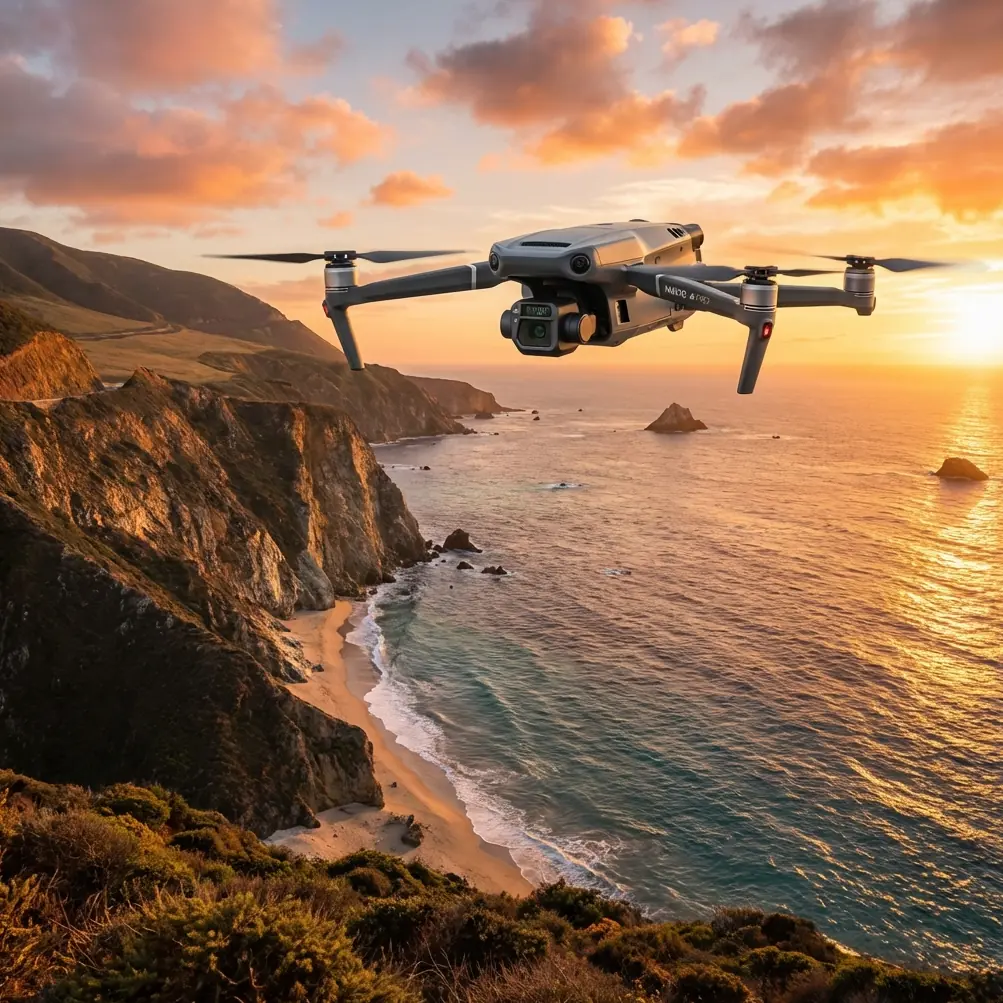
That kind of work is exactly where the Mavic 3T becomes interesting. Not because it is marketed as a specialist mapping aircraft in the same class as a dedicated survey platform, but because for many field teams it solves the real bottlenecks of mountain operations better than spec-sheet comparisons suggest.
The point is not that the Mavic 3T erases terrain complexity. It doesn’t. The point is that it changes what is manageable in a single day.
The mountain mapping problem is rarely just about making an orthomosaic
When people say they need to map fields in mountain terrain, they usually mean several jobs at once.
They need a usable visual record of plot boundaries. They may need photogrammetry outputs for terrain-aware planning. They often need to identify irrigation leaks, drainage issues, crop stress, or access obstructions. And they need to do it from launch points that are rarely ideal.
This is why the Mavic 3T deserves a more careful reading. In steep agricultural zones, the thermal payload is not a novelty. It is operational context. A thermal signature can reveal wet soil lines, blocked irrigation sections, water pooling, animal intrusion paths, or heat-retaining rock bands that affect microclimate across a slope. If you are only collecting RGB imagery, you may leave the mountain with a visually accurate model but still miss the reason one terrace underperformed.
That matters because mountain farming is full of small invisible differences. One row gets morning shade. Another catches runoff. A retaining wall traps moisture. Thermal helps you read those differences quickly, especially in early morning or late afternoon when contrast is more meaningful.
Why the Mavic 3T fits rough field workflows better than many people expect
A lot of mountain jobs are won or lost on field logistics, not raw airborne endurance.
This is where I think many teams underappreciate compact platforms. Large systems can absolutely deliver stronger survey-grade outputs, but they also demand more from the site: better access, more setup room, cleaner launch and recovery conditions, and a higher tolerance for delays when weather shifts. In mountain zones, those assumptions often break down.
The broader UAV industry is already moving toward full-chain, practical deployment. That trend was visible at the 2026 World Drone Congress in Shenzhen, where 1,220 companies and more than ten thousand pieces of equipment were presented across the low-altitude economy ecosystem. That scale matters because it shows where user demand is going: not just toward aircraft performance, but toward systems that fit real operating environments. The event also reflected a market in which China remains the world’s largest drone production base, with 31 provincial-level regions already incorporating the low-altitude economy into their planning. For operators using the Mavic 3T, this bigger industry picture translates into something concrete: mature workflows, stronger accessory ecosystems, and faster standardization around practical mission tools.
Mountain field mapping benefits from exactly that maturity. You don’t need a drone that is theoretically perfect in a laboratory sense. You need one that gets deployed without drama.
The transmission question matters more in the mountains than the camera debate
On flat farmland, a temporary signal interruption can be annoying. In mountain terrain, it can reshape the mission.
That is why O3 transmission is not a minor comfort feature. When you are working around ridgelines, terraces, tree cover, and changing launch elevation, stable video and control link quality become central to safe and efficient data capture. A platform can have excellent imaging performance, but if the link becomes unreliable once the aircraft slips behind a contour, your workflow slows down immediately. You fly more conservatively. You shorten lines. You add visual margin where you would rather add coverage.
The Mavic 3T’s transmission strength gives operators more confidence in awkward topography, especially during utility-style farm assessments where you are not just executing a neat rectangular grid. You may need to inspect a drainage route, then pivot to a retaining wall, then verify an access path above a terrace edge. That kind of mission flexibility is difficult to maintain if link performance is fragile.
And for teams handling farm client data, AES-256 encryption is not a throwaway technical footnote either. Agricultural mapping increasingly touches land records, infrastructure placement, irrigation layouts, and yield-related decisions. Secure transmission and data handling are part of professional practice now, particularly for service providers working across multiple landowners.
Thermal is the feature that saves return visits
If I had to choose the one Mavic 3T capability that most changes mountain field work, it would be thermal.
Not because every job needs a radiometric thermal deliverable. Many do not. But because thermal cuts uncertainty during the flight itself.
A mountainside is full of partial visibility and misleading visual cues. Water movement under vegetation can be missed in RGB. A damaged irrigation line may only create subtle discoloration from above until the sun angle shifts. Bare rock and compacted soil can look similar on a standard image while behaving very differently thermally. With the Mavic 3T, you can quickly cross-check what the eye sees against heat behavior before leaving the site.
That reduces one of the most expensive mistakes in remote field work: realizing back in the office that you captured a technically complete map but missed the actual problem area.
For a farm manager or agronomy consultant, that means fewer “we need to go back tomorrow” conversations. For a service provider, it means stronger first-visit outcomes and better margins.
Photogrammetry with the Mavic 3T: useful, but only if you respect its limits
This is where a lot of articles become too polite. So let’s say it plainly.
The Mavic 3T can support useful photogrammetry workflows for mountain fields, but terrain discipline matters. If your goal is high-confidence measurement across steep grade changes, you cannot fly it like a flat-land mission and expect clean results. You need thoughtful overlap, terrain-aware route planning, and properly placed GCPs where the project requires them.
GCP strategy becomes especially important in mountain agriculture because elevation changes amplify small positioning inconsistencies. A field team that skips control points on broken terrain may still generate a beautiful-looking map while carrying enough distortion to undermine drainage decisions, terrace volume estimates, or access planning.
That is not a flaw unique to the Mavic 3T. It is a truth of hillside mapping.
So where does the aircraft help? It helps by making mixed-purpose capture practical. You can gather RGB imagery for photogrammetry, then immediately validate thermal anomalies in the same deployment window. For many field projects, that combined situational awareness is more valuable than chasing survey outputs beyond what the job truly needs.
If a client needs engineering-grade topographic precision for major earthworks, use the right survey platform. If the job is crop block assessment, drainage evaluation, infrastructure review, and operational planning across rugged fields, the Mavic 3T often lands in the sweet spot.
A past headache the Mavic 3T would have reduced
Years ago, on a terraced orchard site, we spent half a day trying to confirm whether uneven vigor came from irrigation inconsistency or from shallow soil over rock. RGB imagery suggested both. Ground checks took time because vehicle access between terraces was poor. We ended up walking sections we had hoped to diagnose from the air, losing the weather window for the upper blocks.
With a thermal-capable platform like the Mavic 3T, that decision tree becomes much shorter. You can identify temperature patterns that align with water distribution and isolate which terraces deserve boots-on-ground verification first. Instead of checking every suspicion manually, you prioritize the ones the aircraft already highlighted.
That is the real gain: not replacing field expertise, but compressing the time it takes to apply it.
Why field efficiency still decides the outcome
Aviation design manuals have long emphasized something basic but often forgotten: systems become more useful when service access is easy and procedures are simple. In classic aircraft design, maintainers are given clear warnings for pressure changes, components are placed where they can be reached quickly, and access panels are meant to open without unnecessary tools. Those design principles exist because operational friction kills efficiency.
The same thinking applies to drone field work.
Mountain mapping is usually done under time pressure. Weather builds fast. Light shifts quickly. Launch sites are imperfect. Batteries matter. Swapping power, checking the aircraft, changing plans, and getting airborne again should feel almost frictionless. Hot-swap style workflow expectations are now shaping user standards even on compact platforms, because every extra minute on a mountain shoulder is a minute of risk, delay, or fading image consistency.
Another useful principle from traditional aircraft design is tolerance for crosswind ground operation. One handbook section notes that systems should allow unrestricted static engine operation in 20 knots of crosswind or headwind conditions, with restrictions beginning at 21 knots or more. A Mavic 3T is not a crewed aircraft, of course, but the operational lesson carries over: wind limits are not abstract. Ground handling, launch confidence, and mission continuity depend on them. In mountain fields, where ridges channel gusts unpredictably, the disciplined operator plans around terrain-generated wind rather than just the regional forecast.
That’s one reason experienced teams often finish more work with compact, quickly deployable systems than with theoretically stronger platforms that are cumbersome in rough terrain.
What best practice looks like on a mountain field job
A good Mavic 3T workflow in these environments is rarely a single flight plan.
It is usually layered.
Start with a high-level reconnaissance pass to read the terrain, identify signal shadow zones, and spot thermal anomalies worth preserving in the next sortie. Then run the structured image capture for photogrammetry with enough overlap to survive elevation change and slope angle variation. If the site has decision-critical measurement requirements, place GCPs where they anchor the terrain, not just where they are easy to reach. After that, use targeted thermal inspection passes to verify irrigation behavior, moisture retention patterns, road washout, drainage lines, or stress bands across terraces.
That sequence sounds simple. In practice, it saves time because each flight answers a different question.
And if your team is still refining that workflow, it helps to compare mission setups with operators who regularly work in steep agricultural terrain. For practical discussion on route planning, payload use, and field deployment choices, you can message a mountain-mapping drone specialist here.
The Mavic 3T is not the answer to every mapping job. That’s exactly why it works so well for many of them.
The strongest case for the Mavic 3T in mountain field mapping is not perfection. It is balance.
It combines portable deployment, strong transmission, thermal context, and enough imaging flexibility to solve the majority of problems that actually slow down agricultural mapping in rough terrain. It helps teams see what RGB alone misses. It reduces unproductive revisits. It supports photogrammetry when used with discipline. And it keeps the mission practical when access, weather, and topography are all trying to reduce your margin.
That matters more than hype.
If your work involves mountain terraces, hillside orchards, stepped vegetable blocks, or remote farm infrastructure, the question is not whether the Mavic 3T replaces every specialist survey aircraft. It doesn’t. The better question is whether it lets you finish more useful work, with fewer blind spots, in the narrow field windows these sites usually allow.
Very often, the answer is yes.
Ready for your own Mavic 3T? Contact our team for expert consultation.