Mavic 3T in High-Altitude Forest Mapping
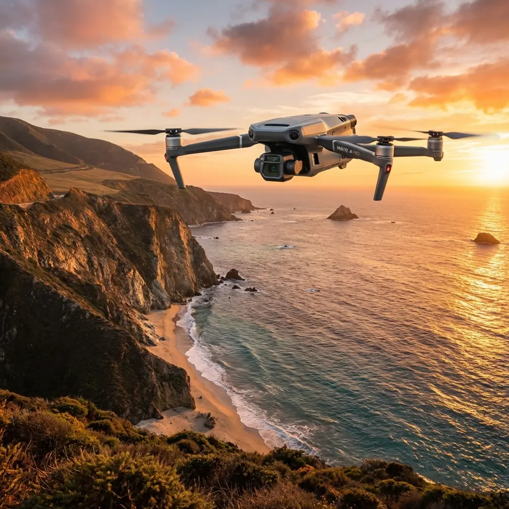
Mavic 3T in High-Altitude Forest Mapping: A Specialist’s Field Report
META: Field-tested analysis of using the DJI Mavic 3T for high-altitude forest mapping, with thermal workflow insights, transmission reliability, GCP strategy, and cold-weather operational lessons.
I’ve spent enough time around mountain forestry projects to know that spec sheets rarely tell the whole story. A drone can look brilliant on paper and still become frustrating once you climb above the tree line, lose easy access to flat launch points, and start dealing with thin air, broken terrain, shifting light, and cold batteries. The Mavic 3T is often discussed as a thermal aircraft first. In actual forest work at altitude, that is only part of the story.
What matters more is how the platform behaves when the mission is not cinematic and not theoretical. You are trying to document canopy condition, detect temperature anomalies, verify access routes, and build usable site intelligence from valleys, ridges, and uneven slopes where repeatability matters. That is where the Mavic 3T becomes interesting.
I’m writing this from the perspective of a mapping specialist, not a hobby reviewer. The project context here is high-altitude forest mapping, where a team needs thermal awareness and visual documentation in the same flight window, often before weather closes in.
Why the Mavic 3T fits mountain forest work better than its reputation suggests
The Mavic 3T is usually introduced through its thermal signature capabilities, and fair enough. In forest environments, thermal imaging helps identify irrigation leaks near nurseries, stressed tree clusters, residual heat from machinery zones, and hidden warm objects under partial canopy openings. Early in the morning, especially at altitude, those thermal contrasts can be much cleaner than what you get later in the day.
But for mapping forests, the real advantage is not just thermal detection. It is the ability to combine thermal reconnaissance with rapid visual capture in one compact aircraft that can be deployed by a small field crew. In remote forestry work, that lowers logistical friction. You can hike with it, redeploy quickly, and still produce data that supports planning.
That said, high-altitude missions expose every weakness in workflow design. Battery discipline matters more. Link stability matters more. Launch zone selection matters more. Even data management matters more because you may only get a narrow operational weather window.
The lesson aviation design teaches us, even for a compact civilian drone
One of the more overlooked ways to think about drone field work is to borrow design logic from manned aviation, especially around survivability and system reliability. The reference material I was given is not about the Mavic 3T directly. It comes from aircraft design manuals discussing crash tolerance and fuel-system reliability. At first glance, that seems distant from a forest drone mission. It isn’t.
One reference describes emergency impact criteria where peak negative acceleration must occur within 0.08s or 0.09s depending on the impact case, and another criterion requires occupant survival space after a crash to remain at no less than 85% of the original volume. We are not carrying people on a Mavic 3T, obviously. But the operational significance is still useful: resilient aircraft systems are engineered around preserving function and margin during abrupt events.
Translate that to drone field operations in steep forests and you get a practical rule: your mission plan should assume sudden interruptions. Gusts spilling over ridgelines. Harder-than-expected landings on uneven ground. Rapid pilot repositioning. Emergency descent because fog moves in faster than forecast. The teams that map efficiently in those conditions are not the ones chasing ideal conditions. They are the ones building margin into every leg.
The second reference is even more directly relevant. It notes that aircraft fuel-system routing should maintain safe clearance from heat sources and electrical components, including a 10 mm spacing standard in one case and 5 mm from surrounding structure in another. It also describes venting arrangements designed to avoid blockage and pressure issues, with U-shaped venting and safety valves to prevent overflow or siphoning. Again, this is from larger aircraft, not a Mavic. But the field lesson is crystal clear: reliability is rarely about one heroic component. It comes from separation, ventilation, and protection against small failure chains.
On a Mavic 3T mission in a cold forest, the equivalent is cable management, battery warming practices, media handling, and payload protection. If you add third-party accessories carelessly, you can create your own failure points.
My high-altitude workflow with the Mavic 3T
For forest mapping, I divide missions into three layers.
1. Thermal reconnaissance pass
The first flight is not usually the mapping flight. It is the decision flight. I use the thermal camera to identify where temperature contrast is strongest, where canopy density will limit visual reconstruction, and where slope aspect creates shadow problems for photogrammetry.
At high altitude, thermal signatures often become more useful in the first hour after sunrise because the mountain surface has not yet equalized. Small stream channels, wet soils, stressed vegetation zones, and human-made disturbances stand out more clearly. If your objective includes habitat support work, drainage verification, or post-disturbance monitoring, this first pass can save hours later.
The mistake I see too often is trying to treat thermal imagery as a map product on its own. In forest operations, thermal usually works best as a prioritization layer. It tells you where to spend your visual mapping effort.
2. Photogrammetry block mission
Once the thermal pass reveals the target zones, I switch to a structured visual mission for photogrammetry. This is where discipline matters. Mountain forests punish loose overlap planning because canopy texture can become repetitive and terrain relief can distort your assumptions quickly.
Ground control points, or GCPs, still matter. People sometimes skip them with compact drones because GNSS performance seems “good enough.” In alpine or subalpine forest mapping, I do not recommend that shortcut when deliverables require confidence. Sloped terrain and canopy interruptions can introduce enough inconsistency that GCP-backed processing becomes the difference between a usable model and an attractive but unreliable one.
For practical placement, I avoid deep shade whenever possible and prioritize ridge-visible clearings, logging access edges, or open rock patches. Fewer well-placed points beat many poorly seen ones. Forest mapping is not won in software. It is won before takeoff.
3. Verification and edge-case capture
The third pass is where the Mavic 3T earns its keep. I use it to close gaps, document steep cut lines, capture orthogonal thermal views where slope heating may have created ambiguity, and verify any area where the model may struggle.
This is also where transmission reliability becomes a non-negotiable issue.
O3 transmission in mountain terrain: what actually matters
In open marketing discussions, O3 transmission is often treated as a range number. In mountain forests, range is not the headline. Obstruction handling is.
A ridge, a dense stand, or even a change in pilot position can affect link quality faster than many operators expect. For mapping, the practical value of O3 is not bragging distance. It is whether the aircraft gives you a stable enough downlink to maintain confidence while contour lines, canopy edges, and uneven terrain constantly interfere with clean line of sight.
That stability affects more than pilot comfort. It affects mission continuity. If your live view degrades at the exact moment you need to assess terrain separation or verify return route clearance, your workload jumps sharply.
I have found that in high-altitude forest work, the best use of O3 is paired with conservative route geometry. Keep your mission blocks aligned with terrain logic, not just software convenience. Avoid route designs that let the aircraft disappear behind a shoulder or dip into a drainage where tree density compounds the obstruction problem.
For teams discussing extended operations or future BVLOS pathways in permitted civilian frameworks, this matters even more. A robust link is part of a larger reliability chain; it is not a substitute for one.
AES-256 and why forestry clients increasingly ask about it
Forest mapping is no longer only about trees. Some projects include concession boundaries, utility corridors, restoration sites, access roads, and environmentally sensitive areas. Data security comes up more often than operators expect.
That is where AES-256 enters the conversation. For many clients, especially commercial forestry groups, infrastructure managers, and land-use consultants, secure handling of imagery is not an optional technical footnote. It is part of trust. The Mavic 3T is often chosen for practical field reasons, but secure transmission and controlled data workflows make it easier to use in mixed-stakeholder projects where not every map should circulate freely.
This is one of those operational details that feels abstract until it isn’t. If your team is mapping remote sites with restricted access roads or valuable timber zones, security becomes part of professional competence.
The third-party accessory that genuinely improved results
The accessory that changed my field results most was not flashy. It was a high-visibility elevated landing pad system with weighted edge support and leg extensions from a third-party supplier. That may sound mundane, but in mountain forestry it solved three recurring problems at once: rotor wash contamination from dust or needles, uneven touchdown surfaces, and thermal sensor contamination risk after damp ground operations.
On one project, we paired that with a weatherproof tablet hood and a low-temperature battery transport case. Those additions did more for mission consistency than many pilots expect. High-altitude operations are often won by accessories that reduce small frictions.
I would be careful, though, with anything that changes airflow, balance, or antenna exposure. This is where the reliability logic from the aircraft design references becomes useful again. Separation and clearance are not academic. If aviation engineers worry about routing lines away from heat, movement, and interference, drone teams should show the same discipline with add-ons. A badly placed mount or oversized sun hood cable loop can create annoying and avoidable failure points.
Cold weather, batteries, and the myth of “just bring extras”
People often mention hot-swap batteries in planning conversations around mountain work. In a strict sense, the Mavic 3T workflow is not about in-air battery replacement. The practical lesson is about rapid battery rotation on the ground while preserving mission tempo.
At altitude, “more batteries” is not the same as “better endurance.” If batteries cool too much during staging, voltage behavior becomes less predictable under load. I keep inactive packs insulated, rotate them methodically, and avoid letting mission urgency push me into launching with a cold pack that has been sitting exposed on snow or rock.
This is also where concise flight segmentation helps. Instead of trying to stretch one long mission over changing terrain and weather, I prefer tightly defined blocks with explicit objectives. You land with cleaner datasets, lower risk, and better pilot awareness.
Where the Mavic 3T still needs careful handling in forest mapping
The Mavic 3T is not a magic forestry mapper. Dense canopy reduces what any optical workflow can reconstruct. Thermal data can mislead if sun angle, moisture, and slope heating are not understood. Wind over ridges can create abrupt handling changes. And compact drones do not forgive sloppy launch and recovery habits in brushy, uneven environments.
If your primary objective is high-precision large-area photogrammetry over very extensive forest estates, there are times when a dedicated mapping platform may still be the stronger tool. But that does not reduce the value of the Mavic 3T. It simply defines its strength more clearly.
Its best role in high-altitude forests is as a fast-deploying intelligence platform that can bridge reconnaissance, thermal anomaly detection, and targeted visual mapping with impressive efficiency when the crew knows what to ask of it.
What I would tell a forestry team before deployment
If you are taking the Mavic 3T into mountain forest work, do three things before you obsess over settings.
First, define whether thermal is your primary output or your targeting layer. That decision changes flight timing and route design.
Second, design your photogrammetry around terrain and GCP visibility, not around a generic mission template.
Third, protect operational margin. The old aircraft design references make that point in a very different context, but it still applies beautifully here. One manual emphasizes survival space retention of 85% after impact. Another highlights reliability through spacing, venting, and pressure protection. Different aircraft class, same philosophy: preserve margin before you need it.
That mindset is what separates successful field mapping from hopeful field mapping.
If you are comparing accessories, workflow options, or deployment planning for a mountain forestry job, you can send your scenario details through this direct field-ops chat. Keep it practical: altitude, forest type, target outputs, and whether GCP deployment is feasible.
The Mavic 3T deserves to be judged in the field, not in a vacuum. In high-altitude forest mapping, it performs best when used as a disciplined survey tool with thermal intelligence built in, not as a one-click answer to every remote-sensing problem.
Ready for your own Mavic 3T? Contact our team for expert consultation.