Mavic 3T Highway Mapping: Remote Terrain Guide
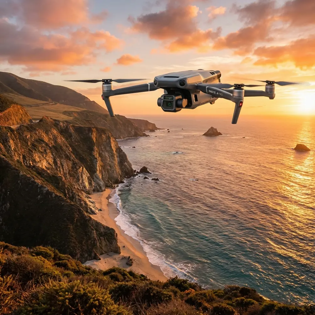
Mavic 3T Highway Mapping: Remote Terrain Guide
META: Master highway mapping in remote terrain with the Mavic 3T. Expert techniques for thermal imaging, photogrammetry workflows, and BVLOS operations explained.
TL;DR
- The Mavic 3T combines 56× hybrid zoom with thermal imaging for comprehensive highway corridor mapping in areas without cellular coverage
- O3 transmission maintains stable connections up to 15km, essential for remote BVLOS operations
- Proper GCP placement reduces positional errors to under 3cm horizontal accuracy
- Hot-swap batteries enable continuous mapping sessions covering 40+ linear kilometers per day
Why Remote Highway Mapping Demands Specialized Equipment
Highway infrastructure assessment in remote terrain presents unique challenges that consumer drones simply cannot address. The Mavic 3T solves three critical problems: maintaining reliable data transmission without cellular networks, capturing both visual and thermal signatures simultaneously, and operating efficiently across vast linear corridors.
Transportation departments and engineering firms increasingly rely on drone-based photogrammetry for pre-construction surveys, pavement condition assessments, and environmental impact documentation. The Mavic 3T's enterprise-grade specifications make it the preferred platform for these demanding applications.
Essential Pre-Flight Planning for Remote Operations
Airspace and Regulatory Compliance
Before deploying in remote areas, secure all necessary authorizations. BVLOS operations require specific waivers in most jurisdictions. Document your flight plans, including:
- Precise corridor boundaries with GPS coordinates
- Maximum altitude above ground level (typically 120m for mapping)
- Emergency landing zones every 2km along the route
- Communication protocols with ground observers
Weather Assessment Protocol
Remote terrain amplifies weather risks. The Mavic 3T operates reliably in winds up to 12 m/s, but thermal imaging quality degrades significantly when ambient temperatures exceed 40°C. Check forecasts for:
- Wind speed and direction at mapping altitude
- Cloud cover affecting shadow consistency
- Temperature differentials for optimal thermal contrast
- Precipitation probability within your operational window
Expert Insight: Schedule thermal surveys during early morning hours when pavement retains overnight cooling. This creates maximum thermal signature contrast between intact surfaces and subsurface moisture intrusion—invisible to standard cameras but critical for identifying future failure points.
Configuring the Mavic 3T for Highway Corridor Mapping
Camera Settings for Photogrammetry
The wide camera's 4/3 CMOS sensor captures 20MP images ideal for orthomosaic generation. Configure these settings for optimal results:
- Shutter speed: 1/1000s minimum to eliminate motion blur
- ISO: 100-400 range for maximum dynamic range
- Aperture: f/2.8 to f/5.6 depending on lighting conditions
- Image format: DNG raw for post-processing flexibility
- Interval: 2-second capture rate at survey speeds
Thermal Imaging Configuration
The integrated thermal camera delivers 640×512 resolution with temperature measurement accuracy of ±2°C. For highway assessment:
- Set emissivity to 0.95 for asphalt surfaces
- Enable high-gain mode for subtle temperature variations
- Configure simultaneous capture with the wide camera
- Use split-screen display for real-time correlation
Flight Path Optimization
Linear infrastructure mapping requires specific flight patterns. Program your mission with:
- 80% frontal overlap for dense point cloud generation
- 70% side overlap when mapping wider corridors
- Consistent altitude maintaining 2.5cm/pixel GSD
- Perpendicular crosshatch passes at major intersections
Ground Control Point Strategy for Centimeter Accuracy
GCP placement transforms good data into survey-grade deliverables. For highway corridors, position markers at:
- 500m intervals along the centerline
- Both shoulders at each GCP station
- Bridge approaches and structural transitions
- Significant elevation changes
Use RTK-enabled GNSS receivers to establish GCP coordinates with sub-centimeter precision. The Mavic 3T's onboard RTK module then references these points during post-processing, achieving final orthomosaic accuracy of 3cm horizontal and 5cm vertical.
Pro Tip: Paint temporary GCP targets directly on pavement using high-contrast survey marking paint. This eliminates target displacement from wind or wildlife—a common problem with traditional fabric markers in remote areas.
Navigating Wildlife Encounters During Remote Operations
During a recent highway mapping project in mountainous terrain, our Mavic 3T's thermal camera detected a large heat signature moving through dense vegetation adjacent to the corridor. The 56× zoom revealed a black bear with cubs crossing toward the survey area.
The O3 transmission system maintained perfect video feed at 8.2km from the launch point, allowing real-time assessment. We paused the automated mission, adjusted the flight path to maintain 200m horizontal separation, and resumed mapping once the animals cleared the area.
This encounter demonstrates why thermal imaging provides essential situational awareness in remote operations. Standard visual cameras would have missed this wildlife activity entirely until a potential collision scenario developed.
Technical Comparison: Mavic 3T vs. Alternative Platforms
| Specification | Mavic 3T | Traditional Survey Drone | Consumer Drone |
|---|---|---|---|
| Thermal Resolution | 640×512 | 320×256 | None |
| Transmission Range | 15km O3 | 7km | 4km |
| Flight Time | 45 minutes | 35 minutes | 31 minutes |
| Zoom Capability | 56× hybrid | 10× digital | 4× digital |
| RTK Support | Integrated | External module | None |
| AES-256 Encryption | Yes | Varies | No |
| Operating Temp | -20°C to 50°C | -10°C to 40°C | 0°C to 40°C |
| Hot-swap Batteries | Supported | Limited | No |
Data Security for Infrastructure Projects
Highway mapping data often contains sensitive infrastructure information. The Mavic 3T implements AES-256 encryption for all transmitted data, preventing interception during remote operations where network security cannot be guaranteed.
Enable local data mode to prevent any cloud synchronization during sensitive projects. Store captured imagery on encrypted microSD cards and transfer using secure protocols upon returning to base.
Post-Processing Workflow for Deliverable Generation
Photogrammetry Processing
Import captured imagery into professional software like Pix4D or Agisoft Metashape. The workflow includes:
- Automatic aerial triangulation using image EXIF data
- GCP integration for georeferencing refinement
- Dense point cloud generation at high quality settings
- Mesh creation and texture mapping
- Orthomosaic export at native resolution
Thermal Data Analysis
Process thermal imagery separately to identify:
- Subsurface moisture indicating drainage failures
- Delamination between pavement layers
- Bridge deck deterioration patterns
- Culvert blockages affecting drainage
Overlay thermal analysis on RGB orthomosaics for comprehensive condition reports that transportation agencies require for maintenance prioritization.
Common Mistakes to Avoid
Insufficient battery reserves: Remote operations eliminate quick recharging options. Carry minimum six fully charged batteries for every 20km of corridor mapping. The hot-swap capability only helps if replacement batteries are available.
Ignoring magnetic interference: Remote areas often contain mineral deposits affecting compass calibration. Perform calibration at each new launch site, not just at the beginning of the day.
Inadequate GCP documentation: Photographing each GCP from ground level with visible surroundings prevents confusion during post-processing. Include a reference scale in every ground photo.
Single-pass coverage: Always capture redundant data. Equipment failures, unexpected wildlife encounters, or changing conditions may invalidate portions of your survey. Overlap adjacent flight missions by 15% minimum.
Neglecting transmission antenna orientation: The O3 system performs best when controller antennas point toward the aircraft. In linear corridor operations, reposition yourself along the route rather than relying solely on maximum transmission range.
Frequently Asked Questions
What ground sample distance should I target for highway condition assessment?
For pavement distress identification, maintain 2-3cm GSD by flying at approximately 100m AGL with the wide camera. This resolution reveals cracking patterns, rutting, and surface deterioration while covering efficient corridor widths per pass.
How do I maintain data link integrity beyond visual line of sight?
The O3 transmission system automatically selects optimal frequencies and adjusts power output based on interference conditions. Position visual observers at 2km intervals with radio communication to the pilot in command. Each observer confirms aircraft position and reports any airspace conflicts.
Can the Mavic 3T thermal camera detect underground utilities?
Thermal imaging cannot directly see underground infrastructure. It detects surface temperature variations caused by buried utilities—particularly active water lines, steam pipes, or electrical conduits generating heat. Survey during temperature transition periods (dawn or dusk) for maximum thermal contrast revealing these signatures.
Ready for your own Mavic 3T? Contact our team for expert consultation.