Mavic 3T Highway Mapping in Mountain Terrain
Mavic 3T Highway Mapping in Mountain Terrain: A Practical Field Method That Actually Holds Up
META: Specialist-led Mavic 3T how-to for mapping highways in mountain terrain, covering pre-flight cleaning, thermal use, photogrammetry workflow, GCP strategy, transmission limits, and safety planning.
Mountain highway mapping exposes every weak assumption in a drone workflow. Wind bends around ridgelines. Road corridors disappear behind outcrops. Temperature swings distort battery behavior. And if your mission plan was built for a flat construction site, the first valley crossing will reveal it fast.
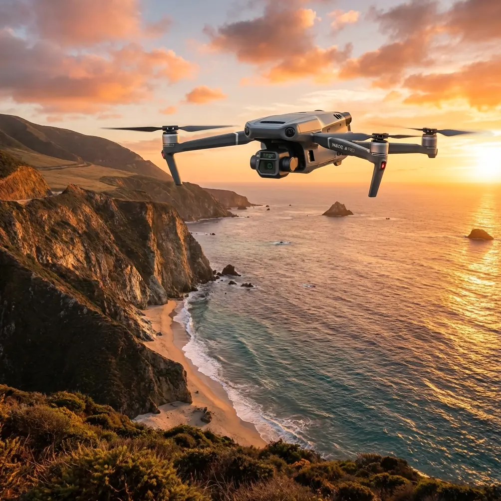
For crews using the Mavic 3T, that matters because this aircraft sits in an unusual place. It is compact enough to deploy from a roadside pullout, yet it carries tools that are genuinely useful for mountain corridor work: a thermal payload for spotting heat anomalies and situational hazards, a visual system capable of supporting inspection and mapping tasks, O3 transmission for maintaining a stronger link in difficult terrain, and enterprise-grade security features such as AES-256 for sensitive infrastructure operations. Those details are not brochure filler. In mountain road surveys, they change how you plan the flight, how you verify risk, and how much rework you avoid later.
I have seen teams treat the Mavic 3T as either a thermal inspection drone or a quick-response public safety platform, then assume highway mapping is simply a matter of drawing a corridor and pressing start. That is where the trouble begins. If the reader scenario is a mountain highway job, the better approach is to think in layers: safety first, terrain model second, image acquisition third, and thermal context only where it adds operational value. When the workflow is built in that order, the Mavic 3T becomes far more capable than many crews expect.
Start with the aircraft, not the map
Before you open your mission planner, clean the drone.
That sounds basic, but on mountain road jobs it is one of the most overlooked safety steps. The Mavic 3T relies on a network of vision and obstacle sensing features that can be compromised by dust, road film, mist residue, or even fingerprints left from hasty battery swaps. If the aircraft was transported in the back of a survey truck after a previous roadside deployment, the sensors and camera surfaces often carry exactly the kind of fine grit that causes inconsistent obstacle detection or degraded image quality.
My preferred sequence is simple and fast:
- Inspect the forward, rear, and downward sensing windows for dust and oily smears.
- Clean the thermal lens and visual lens separately with the correct microfiber and lens-safe method.
- Check the arm hinges and motor vents for roadside particulate.
- Confirm propeller leading edges are free from chips caused by loose gravel during takeoff or landing.
- Wipe battery contacts if the aircraft has been operating through moisture, fog, or cold dawn conditions.
On a mountain highway mission, this cleaning step is not cosmetic. If a downward sensor is obscured, terrain-following confidence drops at exactly the moment the aircraft transitions over uneven embankments or rock cuts. If the visual lens carries residue, your photogrammetry output may suffer from lower image clarity and inconsistent tie points. If the thermal lens is dirty, small temperature differences along drainage structures or retaining walls can be harder to read.
That is the first operational truth: reliable mapping starts before the first waypoint.
Define what “mapping” means for this road
A mountain highway mission can involve several very different deliverables:
- Corridor orthomosaic for planning or documentation
- Slope and shoulder condition review
- Drainage and culvert assessment
- Rockfall or landslide risk observation
- Retaining wall inspection
- Heat anomaly screening on adjacent infrastructure or recently disturbed surfaces
The Mavic 3T can contribute to all of those, but not in the same flight profile.
For pure photogrammetry, consistency beats improvisation. You want repeatable altitude above ground, controlled overlap, stable speed, and a corridor width that respects the terrain rather than forcing the terrain to fit the mission template. For hazard screening, especially early morning or late evening work, the thermal sensor can add a second layer of intelligence by revealing thermal signature differences in moisture pathways, recently active equipment zones, overheated roadside electrical components, or unstable surfaces that are warming and cooling at different rates than their surroundings.
The mistake is trying to do everything in one pass. A mountain road is too dynamic for that. Run mapping flights for geometry. Run thermal flights for interpretation.
Build the route around terrain, not distance
The biggest planning error on mountain corridor work is treating the road centerline as the only geometry that matters. In reality, the terrain beside the road often controls the mission more than the road itself.
A cliff on one side and a deep drop on the other can produce radically different wind behavior across a single segment. Line of sight changes in seconds. Transmission quality may look solid on paper and deteriorate once the aircraft slips behind a ridge shoulder. This is where the Mavic 3T’s O3 transmission system earns its place. In difficult mountain topography, a stronger link is not just about video quality. It affects command reliability, pilot confidence, and your ability to make informed go/no-go decisions as the aircraft moves through terrain-induced blind spots.
Still, no transmission system overrules geography. If your local operation requires visual line of sight, plan around that reality. If the mission concept edges toward BVLOS considerations, do not let the aircraft’s capability tempt you into procedural shortcuts. Mountain highways create seductive corridor layouts that look easy in software and become operationally complex in the field.
A practical method is to break the road into controllable segments based on terrain shadowing:
- Ridge-to-bend sections
- Bridge and culvert sections
- Hairpin and elevation-change sections
- Cut-slope or retaining-wall sections
Each segment should have its own launch or relay logic, emergency return thinking, and battery expectation.
Use GCPs where they solve actual mountain problems
Ground control points are often discussed as if more is always better. In mountain highway mapping, placement matters more than quantity.
The problem is not just absolute accuracy. It is terrain-induced distortion across long, narrow corridors with varying elevation. A well-designed GCP layout helps anchor the photogrammetry model where the road profile changes sharply, where bridges interrupt grade continuity, and where shoulder width or retaining structures can confuse reconstruction.
I advise crews to place GCPs at:
- Vertical transition zones where the road gains or loses elevation abruptly
- Curves that visually compress in oblique mountain terrain
- Bridge approaches and drainage crossings
- Segments bordered by repeating textures such as gravel shoulders, barriers, or vegetation
- Ends of each mission block so separate flights stitch cleanly
If you only place GCPs in easy roadside pull-offs, the map may look fine in the center and drift where the terrain becomes more complex. That matters later when engineers use the output to assess slope movement, drainage geometry, or roadside asset placement.
The Mavic 3T does not replace disciplined control. It rewards it.
Keep photogrammetry and thermal objectives separate, but connected
This is where the Mavic 3T becomes especially useful for mountain road teams. You can collect a mapping-grade visual dataset, then use thermal selectively to answer questions the orthomosaic cannot.
For example, imagine a highway segment with a recurring moisture problem below a retaining slope. A visual map may show staining, vegetation change, or damaged shoulder edge. A thermal scan at the right time of day may reveal a different cooling pattern along the drainage path, helping the team distinguish between general surface discoloration and an active moisture route. That thermal signature does not replace engineering judgment, but it can focus ground inspection.
The same logic applies to roadside electrical cabinets, culvert outlets, temporary work zones, and post-slide monitoring. Thermal is not there to make the mission look sophisticated. It is there to narrow uncertainty.
Operationally, timing matters. Thermal flights in direct midday heat can flatten useful contrast. In mountain environments, early morning often produces cleaner separation between materials and moisture-related anomalies. If you are trying to compare thermal and photogrammetry outputs, note the environmental conditions carefully. Without that context, teams often overinterpret what they see.
Manage batteries like mission-critical survey tools
Hot-swap batteries sound like a convenience feature until you are on a narrow mountain shoulder with unstable wind and a traffic control window that will not wait for indecision.
On corridor jobs, fast and disciplined battery changes reduce downtime and preserve rhythm. That affects data quality more than people admit. When a crew falls behind, overlap settings get rushed, launch spots become compromises, and end-of-day flights happen in worse light and stronger wind.
A good hot-swap routine for the Mavic 3T should include:
- Pre-labeled battery rotation order
- Temperature awareness in cold mountain starts
- Immediate post-flight voltage and condition check
- Clean contact inspection during every swap
- A written trigger for abandoning the next segment if wind or battery trend shifts beyond the plan
Mountain mapping is rarely lost in one dramatic moment. It is usually degraded through a series of small shortcuts. Battery discipline is one place to stop that chain early.
Security is not an abstract concern on infrastructure jobs
Highway mapping often intersects with sensitive infrastructure, restricted works, or government stakeholders. That is why the Mavic 3T’s AES-256 support is worth mentioning in operational planning, not just procurement discussions.
If your imagery, thermal files, and flight records involve transport corridors, construction staging, or critical roadside systems, data protection matters. Not because every road job is classified, but because professional handling standards build trust with clients and agencies. In practice, that means secure device management, controlled file transfer, and clear chain-of-custody procedures for imagery leaving the field team.
The aircraft can support secure operations. The workflow still has to be designed that way.
Field method: a repeatable mountain corridor sequence
For most mountain highway jobs, I recommend this order:
First, perform the cleaning and sensor check before mission planning begins. Do not assume gear that flew yesterday is ready today.
Second, walk or drive the segment and identify terrain shadow zones, emergency landing options, traffic hazards, and places where line of sight degrades unexpectedly.
Third, place GCPs where the corridor geometry changes, not only where parking is easy.
Fourth, run the visual mapping mission in manageable corridor blocks. Keep altitude logic tied to terrain and preserve overlap consistency through curves and grade changes.
Fifth, review sample imagery before committing the next battery set. One minute of checking sharpness and exposure can save an entire remobilization.
Sixth, run targeted thermal passes only where the visual dataset suggests uncertainty or where the mission objective specifically calls for thermal interpretation.
Seventh, secure and catalog data immediately after each block.
If your team is refining this workflow for a live road project, it helps to compare mission design notes with another specialist before mobilization. I often suggest crews use a simple field coordination channel such as sending the route package for a quick review so launch points, terrain constraints, and GCP logic are settled before the first prop spins.
What the Mavic 3T does well here—and where to stay disciplined
The Mavic 3T is strong in mountain highway work because it combines portability with multi-sensor awareness. It can move quickly between roadside launch sites, maintain a resilient link through O3 transmission in challenging topography, and add thermal context when visual data alone leaves questions unanswered. For small teams, that combination is practical, not theoretical.
But discipline still matters.
Do not use thermal imagery as a substitute for proper mapping control. Do not assume a corridor mission is safe simply because the route follows a road. Do not let compact size fool you into treating mountain wind as a minor variable. Do not blur the line between what is possible and what is authorized, especially if BVLOS concepts enter the conversation.
The crews that get the best results from the Mavic 3T are usually the least impressed by novelty. They are methodical. They clean sensors before every deployment. They place GCPs where the terrain demands it. They use thermal signature data to answer specific field questions. They treat transmission quality, battery handling, and data security as operational components of mapping accuracy.
That is the real lesson for mountain highway work. The aircraft is capable, but capability alone does not produce a trustworthy corridor model. Process does.
If you are planning a Mavic 3T mission in steep road terrain, build the day around three priorities: sensor reliability, terrain-aware flight segmentation, and controlled use of thermal data. Get those right, and the platform becomes far more than a compact drone with a thermal camera. It becomes a genuinely efficient field tool for difficult infrastructure environments.
Ready for your own Mavic 3T? Contact our team for expert consultation.