Mavic 3T in Extreme Temperatures: A Highway Mapping Case
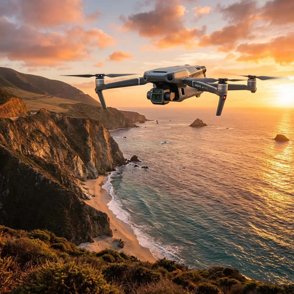
Mavic 3T in Extreme Temperatures: A Highway Mapping Case Study from the Field
META: A field-led case study on using the DJI Mavic 3T for highway mapping in extreme temperatures, with practical insight on thermal signature capture, battery discipline, transmission stability, and data quality.
A highway corridor looks simple on paper. Long, linear, repetitive. In practice, it can be one of the more punishing environments for drone crews, especially when the work happens in temperature extremes.
I learned that the hard way on a transport survey where the brief sounded straightforward: document pavement conditions, drainage features, shoulder deformation, and heat-related anomalies across a long stretch of roadway. The complication was timing. The client needed outputs during a period of intense daytime heat, followed by very early morning follow-up flights for comparison. Those swings matter. Asphalt changes appearance, thermal contrast shifts, batteries behave differently, and crew fatigue starts to shape operational decisions more than anyone likes to admit.
That project is where the Mavic 3T started making real sense to me—not as a generic “all-rounder,” but as a tool that fits a very specific kind of field problem.
Why highway mapping in extreme temperatures is not just “normal mapping in harder weather”
A lot of people think temperature only affects pilot comfort and battery duration. That is too narrow.
Highway work asks the aircraft to do several things at once. It must hold a repeatable flight path over feature-poor surfaces. It has to capture enough visible-spectrum detail for photogrammetry while also making thermal observations that are meaningful rather than decorative. And if the corridor is active, the crew needs confidence in link stability and decision-making speed.
Heat complicates every layer of that.
On a hot road surface, the thermal signature of the corridor can flatten out in some areas and spike in others. Patches, repairs, moisture retention zones, utility cuts, and edge failures begin to present differently depending on time of day. That means the platform is no longer just collecting pretty overhead images. It is helping the team identify where conditions are changing, and whether those changes deserve closer engineering review.
That is where the Mavic 3T becomes more than a compact drone with a thermal payload. It becomes a field triage instrument.
The role of thermal in a highway mapping workflow
For traditional corridor mapping, photogrammetry still carries most of the burden. You need overlap, controlled geometry, disciplined GCP placement where required, and enough image consistency to build reliable deliverables.
But on the project I’m thinking of, thermal changed how we prioritized effort.
Instead of treating the whole highway segment as visually equal, we used thermal passes to identify areas that were behaving differently from adjacent pavement. That matters because “different” can point to trapped moisture, surface degradation, drainage inefficiency, or patch material with a distinct heat response. Not every thermal contrast becomes an engineering issue, of course. Still, it gives the team a fast way to isolate where to spend more analysis time.
This is especially useful in extreme conditions. At sunrise, temperature separation can be subtle but informative. Later in the day, some surfaces become aggressively bright in thermal terms, and weaker anomalies can disappear into the overall heat load. Knowing when to fly is not a side detail. It shapes whether the thermal layer helps or misleads.
Oddly enough, one of the better ways to explain this comes from mobile photography rather than drones. A recent photography piece published on May 4, 2026 described how strong light sources—like sunrise or evening street lamps—often look dramatic to the human eye but collapse into a plain bright spot on a phone image unless the photographer uses the right technique. The lesson carries over neatly to thermal and corridor work: what you see in the field is not automatically what the sensor records. If you do not plan for the sensor’s limitations and behavior, the most visually striking moment can become the least useful dataset.
That is a useful mindset for Mavic 3T crews. Don’t trust the scene alone. Trust the capture strategy.
What changed operationally with the Mavic 3T
The biggest improvement was not headline performance. It was reduced friction in the field.
On highway jobs, repeated launches are normal. You land, shift position, review coverage, adjust the next leg, and launch again. In high heat, every unnecessary delay compounds stress on the crew and the equipment. That is why practical systems matter more than spec-sheet theater.
The Mavic 3T fits this kind of work because it shortens the loop between observation and action. A thermal anomaly seen on one pass can immediately shape the next one. If a culvert outlet, shoulder depression, or resurfaced strip appears thermally inconsistent, the team can pivot from broad corridor collection to tighter visual capture without dragging in a larger aircraft or rebuilding the plan from scratch.
That flexibility matters even more where road access is restricted. Along active highway sections, setup windows are often short and staging areas are awkward. A compact platform with dependable O3 transmission reduces some of the friction that larger systems create. In my experience, transmission confidence is not just about image quality to the controller. It directly affects crew composure. If the link is stable, the pilot can focus on the corridor, traffic context, and positional discipline instead of mentally babysitting the connection.
For infrastructure clients handling sensitive route data, secure transmission also matters. AES-256 is not the sort of phrase a field team throws around casually on the shoulder of a road, but decision-makers care. If you are mapping a transport asset with maintenance implications, they want assurance that data handling was not an afterthought.
Battery discipline becomes a bigger story in extreme temperatures
Most field problems blamed on “bad battery life” are really battery management failures.
This is one area where older DJI battery guidance still teaches the right habits, even if the document itself references a different platform. A DJI battery safety guide notes that if a battery is not used for more than 10 days, it should be stored at roughly 40% to 65% charge to extend service life. It also states that after 10 days of inactivity, self-discharge can begin automatically, with a full battery dropping to 65% in about 2 days, and that some warming during discharge is normal.
Those numbers matter operationally, even for crews focused on the Mavic 3T rather than legacy systems. Why? Because highway mapping campaigns are rarely perfectly continuous. A crew may mobilize for a weather window, then stand down, then return for a second phase. If batteries sit fully charged between those windows, especially in warm environments, performance and lifespan can suffer. That is not theory. It shows up in reduced confidence on site.
The same guidance warns against storing a battery after running it fully flat for a long period, and notes that a severely depleted battery left idle may enter deep sleep and require charging to wake it up. Again, that is directly relevant to real Mavic 3T operations. When you are planning dawn flights after a late finish the previous day, sloppy battery rotation can turn the first hour of the next shift into a recovery exercise.
On our corridor project, battery discipline was one of the hidden success factors. We treated battery state as part of data quality control, not just flight readiness. That sounds excessive until you work in heat and discover how quickly a rushed charging plan starts to affect decisions. Crews begin trimming mission legs, skipping confirmatory passes, or delaying reflights they should have done immediately.
That is where good process beats toughness.
A useful engineering analogy: why stable response matters in the field
One reference that seems unrelated at first glance actually helps explain the operational value of a reliable drone workflow. A helicopter design text discusses maintaining rotor speed through a mix of active and passive control, noting that improving the precision of speed-change sensing and the speed of feedback signal transmission improves engine response and rotational stability.
You do not need to be designing helicopters to appreciate the point. Better sensing plus faster feedback equals more stable behavior under changing load.
That principle maps surprisingly well to drone corridor work in harsh conditions. In the field, the “load changes” are not just aerodynamic. They include temperature stress, variable surface reflectance, shifting light, interrupted staging, and changing mission priorities after each pass. The more quickly the aircraft, payload, and operator can respond to those inputs, the more stable the resulting dataset becomes.
That is one reason the Mavic 3T works so well in this role. It supports a practical feedback loop. Fly, inspect, interpret, adjust, repeat. Not all problems can be predicted before launch. Some have to be managed through response quality. The helicopter text puts it in engineering language; field crews live it more simply: stable systems make better decisions possible.
Data quality: thermal is helpful, but the map still has to stand up
There is a temptation with the Mavic 3T to let thermal steal the entire show. That is a mistake.
For highway mapping, the visible dataset still has to be processed cleanly. If you are building orthomosaics or corridor models for asset review, your photogrammetry plan must remain disciplined. Overlap cannot be an afterthought. GCP strategy, where required by the client or project tolerances, should be decided before the first launch. Extreme heat shimmer, low-angle glare, and repetitive pavement texture can all erode output quality if the crew gets lazy.
The best Mavic 3T jobs I have seen use thermal as a decision layer, not a substitute for rigorous mapping practice.
That is where the aircraft is strongest. It lets one team gather a conventional mapping product and a thermal interpretation layer during the same operational cycle. For road authorities, maintenance contractors, and engineering consultants, that can tighten the gap between observation and action. They do not just receive a map. They receive a map with clues.
Where this platform is especially effective
In my view, the Mavic 3T is particularly well suited to highway work when the brief includes some combination of these needs:
- corridor screening across long linear assets
- thermal review of pavement or drainage behavior
- rapid relocation between launch points
- repeated flights in narrow time windows
- secure handling of infrastructure imagery
- a path toward more advanced workflows, including BVLOS where regulations, approvals, and operator competence allow
That last point deserves restraint. BVLOS should never be treated casually. But for organizations building mature inspection programs, the Mavic 3T can serve as a strong stepping stone in procedural development, crew training, and mixed-sensor mission planning.
What I would do differently now
If I were running that same highway job again, I would lean even harder into timing strategy.
I would schedule one thermal pass closer to sunrise for cleaner contrast in selected areas, then use a later flight to understand how those same spots behave once the road surface is fully heat-loaded. I would also formalize battery rotation more aggressively from the outset and make it visible on the mission board rather than leaving it to verbal coordination.
And I would spend more time educating the client before mobilization. Many still assume that if an anomaly is visible to the eye, it will be obvious in the drone data. That is not always true. Sensors interpret scenes on their own terms. The phone photography article about starburst effects got this exactly right in a different context: dramatic human perception does not guarantee dramatic capture. Skill lives in the translation.
If you are planning a similar corridor project and want to compare mission design ideas, battery routines, or thermal capture timing, you can message our field team directly here.
Final take
The Mavic 3T earns its place in extreme-temperature highway mapping because it reduces operational drag while adding a genuinely useful thermal layer. That combination matters. Plenty of drones can collect images. Fewer help a crew think faster on site.
What stands out to me is not one isolated feature. It is the way the platform supports a stable working rhythm under stress: move quickly, maintain link confidence, protect battery health, gather visible and thermal evidence, then adapt in real time.
That is what highway mapping in extreme temperatures really demands. Not hype. Not oversized workflows. Just a system that keeps producing usable decisions when the environment starts taking options away.
Ready for your own Mavic 3T? Contact our team for expert consultation.