Mapping Dusty Highways With the Mavic 3T
Mapping Dusty Highways With the Mavic 3T: A Field Tutorial From Sensor Setup to Maintainability
META: A practical expert tutorial on using the DJI Mavic 3T for dusty highway mapping, with thermal workflow tips, transmission considerations, maintenance planning, and field lessons that matter.
Highway mapping looks straightforward on paper. Long corridor, repeated passes, clean deliverables. Then you arrive on site and reality starts sanding away the plan: dust columns from passing trucks, heat shimmer above asphalt, patchy signal conditions, and the constant need to keep a small aircraft productive over a long linear asset.
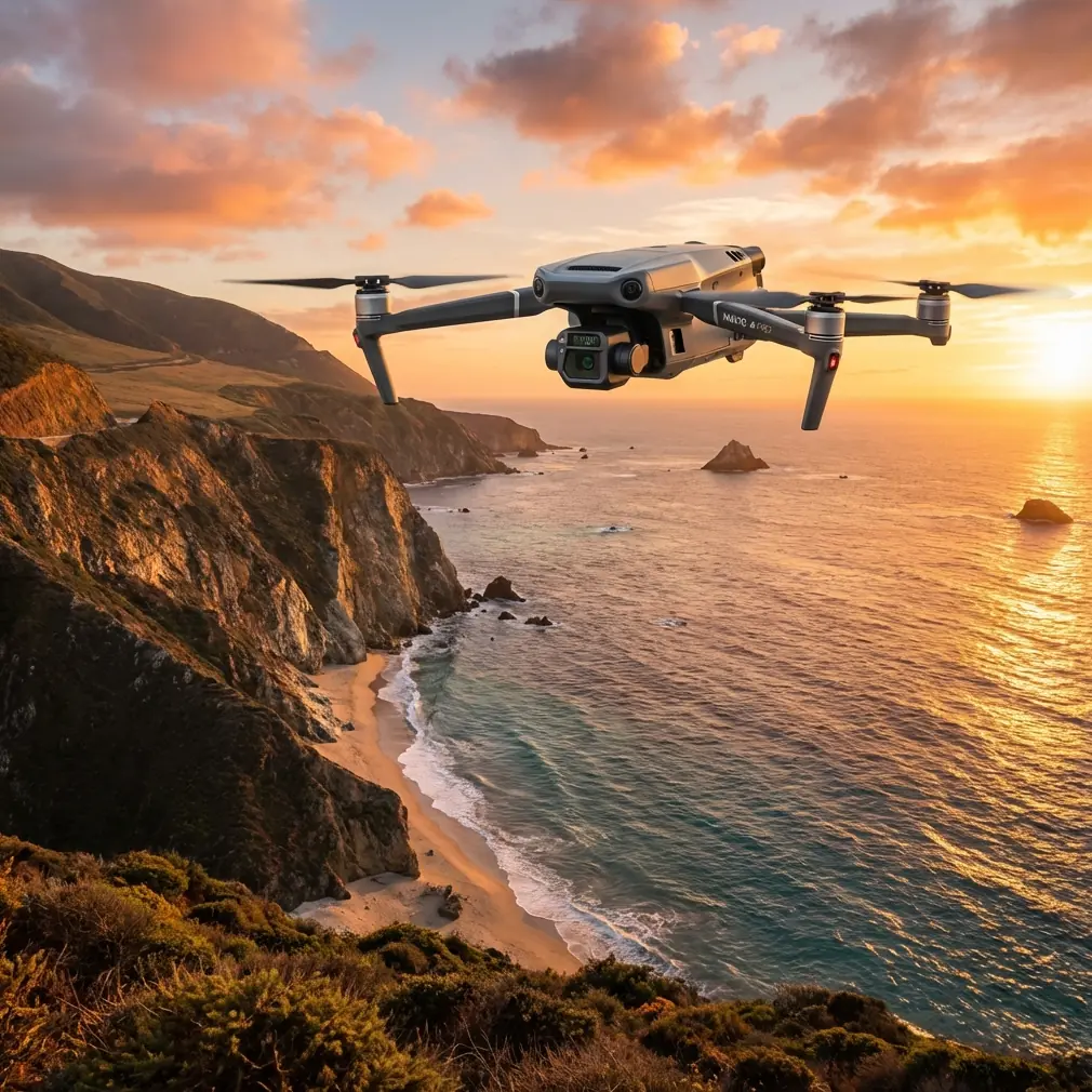
That is exactly where the Mavic 3T becomes interesting.
Most people think of the platform through the thermal lens alone. For highway work, that misses the point. The real strength of the Mavic 3T is how its sensor package, compact deployment profile, and enterprise workflow fit jobs where you need to gather visual context fast, confirm anomalies without walking every meter, and keep operating through punishing field conditions. If you are mapping roads in dusty environments, the aircraft is less about one standout feature and more about how several capabilities reduce wasted site time.
I’ll walk through the way I would approach this mission in the field.
Start with the actual job, not the aircraft brochure
A dusty highway survey can mean several different outputs:
- corridor mapping for progress tracking
- shoulder and embankment condition review
- drainage and culvert checks
- thermal inspection of pavement irregularities or overheated roadside equipment
- pre-construction documentation
- post-maintenance verification
The Mavic 3T is not a replacement for a dedicated large-area photogrammetry platform when your only goal is maximum mapping efficiency over huge distances. But it is extremely useful when the deliverable is mixed: orthomosaic sections, inspection-grade imagery, thermal confirmation, and rapid redeployment from one station to the next.
That mixed workflow is becoming more relevant, not less. One reason is industry scale. At the 2026 World Drone Congress in Shenzhen, the event brought together 1,220 companies and more than ten thousand pieces of equipment, presenting what was described as a full-chain view of the low-altitude economy. That matters because highway operators and survey contractors are no longer buying into a niche toolset. They are working inside a much larger ecosystem where mapping, inspection, data security, and maintainability all have to connect. The Mavic 3T fits that environment well because it bridges several operational needs in one deployable package.
China’s position as the world’s largest drone production base, alongside the fact that 31 provincial-level regions have folded low-altitude economy planning into their broader development roadmaps, points to another practical reality: drone work is moving from experimental use to structured infrastructure operations. For a highway mapping team, that means your aircraft choice should support repeatable SOPs, documentation, and maintenance discipline rather than one-off hero flights.
Why dust changes the mission profile
Dust is not just an annoyance on roads. It affects almost every part of your flight plan:
- visual contrast can drop quickly
- oblique imagery loses fine edge definition
- landing zones become contamination points
- thermal interpretation becomes trickier during peak heat
- maintenance intervals become more important than teams expect
The first planning mistake I see is treating dusty corridor work like a simple area map. It is not. You need a segmented plan.
With the Mavic 3T, I usually break the route into short operational blocks and decide in advance where each sensor will actually add value. RGB data handles most mapping and documentation. Thermal gets used selectively, especially around suspect drainage, pavement patching transitions, utility cabinets, culvert outlets, or shoulders where moisture retention may produce meaningful thermal separation at the right time of day.
That timing issue is critical. If you launch thermal mapping over sun-baked asphalt at the wrong hour, everything becomes one broad hot field and subtle differences get flattened. Early morning or late-day collection generally gives you cleaner thermal signatures for road-adjacent anomalies.
Set up the photogrammetry mission like a corridor specialist
For highway work, corridor consistency matters more than fancy flight aesthetics.
My preferred logic with the Mavic 3T is simple:
- establish ground control where accuracy requirements demand it
- fly manageable route segments rather than one overextended mission
- prioritize overlap stability over theoretical maximum coverage
- collect supplemental obliques at intersections, drainage structures, and grade transitions
- use thermal only where the result will answer a real question
If the output needs to stand up inside engineering or construction documentation, use GCPs. The aircraft can collect the imagery, but the control network is still what turns a decent map into a defensible one. Dusty roads often have long, visually repetitive surfaces, and those are exactly the places where disciplined control and checkpoints save you from quiet alignment drift.
This is also where transmission reliability matters more than many pilots admit. The platform’s O3 transmission capability is useful in highway corridors because it helps maintain situational confidence when the drone is moving away from your launch position along a narrow linear route. I am not saying signal strength replaces proper operational limits. It does not. But a stable link reduces the temptation to improvise, and that alone improves mapping consistency.
If your organization handles sensitive infrastructure data, the mention of AES-256 is not a footnote. On road projects, imagery can include construction staging, utility alignments, traffic patterns, and contractor activity. Secure handling of data and transmission becomes part of the professional standard, not just an IT checkbox.
A real field lesson: wildlife is part of corridor mapping
One of the more memorable highway jobs I’ve worked involved a dry roadside cut with scrub vegetation on both sides. On the RGB feed, the route looked normal. On thermal, a compact heat source appeared just off the shoulder near a drainage depression. It turned out to be a deer sheltering in shade behind a concrete runoff section, almost invisible in the visible-spectrum view because the dust-coated ground and brush flattened the scene.
That changed the flight path immediately.
Instead of pushing the next low-altitude pass through the area, we widened the offset and gained altitude for the segment. The value here was not “seeing wildlife” as a novelty. It was operational awareness. A thermal signature can reveal what the eye misses, and on infrastructure jobs that means safer planning around animals, workers, equipment, or heat-emitting assets that might otherwise be overlooked.
This is one of the underappreciated reasons the Mavic 3T works well on roadside missions. Thermal is not only for inspections after the mapping is done. It can shape the mission as you fly it.
Battery strategy matters more than headline endurance
Dusty highway work punishes teams that build their schedule around ideal battery numbers.
What keeps the Mavic 3T efficient on these jobs is not just airborne time. It is how quickly you can recover, check the aircraft, swap packs, clean contact points if needed, and relaunch without introducing avoidable contamination. If your field kit supports hot-swap batteries or near-continuous rotation workflow at the team level, your output per hour rises because the survey rhythm stays intact.
This has a direct link to maintainability, and that is where the reference material on verification and sampling is surprisingly relevant.
One technical source in the aircraft design literature makes a point that many drone operators learn only through expensive repetition: maintenance evaluation needs explicit metrics, acceptance thresholds, and enough observation data to be meaningful. It notes that with larger sample sets, simple random and proportionally stratified sampling begin to converge, and that at least 30 observations can be considered a practical threshold for larger-sample reasoning in some test conditions. It also gives a clear example of why small samples can mislead: in a total sample of 90, split into 5, 10, 20, 25, and 30 layers, observing only 20 samples can leave the smallest group completely unobserved with a probability of about 0.290.
For a highway drone program, that has real operational significance.
If you only log a handful of dusty flights before declaring your maintenance routine “good enough,” you may miss the exact subset of conditions that causes recurring failures: fine particulate entering hinges, degraded cooling paths, dust on landing surfaces, or contamination introduced during hurried battery changes. A better approach is to stratify your maintenance observations by mission type: dry roadside survey, unsealed shoulder takeoff, midday heat, repeated transport between launch points, and thermal-heavy missions. Don’t just track total flight hours. Track the maintenance burden by environment.
That is the difference between anecdotal reliability and managed reliability.
Build a preflight and postflight routine for dust, not for convenience
With the Mavic 3T on highway work, I recommend a short but non-negotiable discipline.
Before launch
- inspect arms, hinges, landing surfaces, and vents for residual dust
- verify lens surfaces on both visual and thermal payloads
- check battery seating and terminal cleanliness
- review the corridor for heat haze, traffic-generated dust plumes, and likely re-acquisition points
- confirm mission segmentation and emergency landing options
During operation
- avoid launching directly into active dust wash from passing vehicles
- monitor image quality for softening caused by airborne particulate
- use thermal opportunistically instead of continuously if ambient conditions are flattening contrast
- maintain enough spacing from the roadway to prevent turbulence and contamination during low passes
After landing
- inspect gimbal movement before repacking
- clean sensor surfaces carefully
- document any transmission interruptions, image degradation events, or thermal inconsistencies
- note whether environmental conditions, not pilot technique, drove the issue
That last point is where professional teams improve fastest. If a mapping run goes wrong, you need to know whether the cause was route design, atmospheric distortion, dust contamination, or poor overlap management. Otherwise the same errors simply reappear on the next contract.
When to use thermal in a mapping workflow
Thermal on the Mavic 3T should answer a question.
Good examples for a highway corridor include:
- is water collecting where grading suggests it should not?
- is a culvert outlet behaving differently from adjacent structures?
- are there roadside electrical enclosures or assets running abnormally hot?
- does a repaired pavement strip show unusual temperature behavior compared with surrounding material?
- is there an obscured animal or field worker near the planned pass path?
Poor use of thermal is collecting massive quantities of heat data with no interpretation plan. Dust, sunlight angle, and asphalt temperature can generate impressive-looking images that do very little for decision-making if the mission was not framed correctly.
Use it with intent and the Mavic 3T becomes much more than a standard corridor mapper.
The larger industry trend matters to Mavic 3T operators
The reason the Shenzhen event is worth mentioning in an article about one specific aircraft is simple: scale changes expectations.
When an industry gathering can assemble 1,220 exhibitors and over ten thousand devices, and when low-altitude planning has already been written into development frameworks across 31 regions, clients stop viewing drone outputs as experimental extras. They start expecting workflow maturity. They expect secure data handling, repeatable maintenance, documented flight methods, and deliverables that fit broader asset systems.
That expectation benefits operators who know how to use a compact enterprise aircraft intelligently.
The Mavic 3T is well suited to this kind of reality because it can support a field team that needs to move quickly, verify conditions from multiple sensing modes, and maintain control over data and deployment tempo. For dusty highway mapping, that flexibility is often more valuable than raw scale alone.
A practical workflow that holds up in the field
If I were briefing a team for this mission tomorrow, the operating model would be:
- use RGB as the mapping backbone
- place GCPs where contractual accuracy justifies them
- split the highway into short, controlled segments
- use O3 link stability to maintain clean corridor operations, not to stretch good judgment
- collect thermal passes during time windows that preserve contrast
- log maintenance observations systematically across many flights, not casually across a few
- treat dust as a reliability factor, not a cosmetic nuisance
- use secure handling practices where infrastructure imagery is sensitive
If you are building or refining that workflow and want a practical second opinion from someone used to field constraints, you can send your mission profile here: message James directly
The Mavic 3T earns its place on highway projects when you stop asking whether it can “do mapping” and start asking a better question: can it help a crew capture usable corridor intelligence, safely and repeatedly, in dirty real-world conditions?
On the right job, the answer is yes.
Ready for your own Mavic 3T? Contact our team for expert consultation.