Mavic 3T Field Report: Mapping Windy Power Lines Without
Mavic 3T Field Report: Mapping Windy Power Lines Without Losing Data or Margin for Error
META: Expert field report on using the Mavic 3T for windy power line mapping, with practical guidance on thermal capture, photogrammetry, pre-flight cleaning, transmission security, and mission planning.
When crews talk about inspecting power infrastructure with the Mavic 3T, the conversation usually starts with sensors. It should start one step earlier.
On a windy power line job, the first real decision is not camera mode or waypoint spacing. It is whether the aircraft is physically clean enough to trust. That sounds minor until you have watched a thermal mission get compromised by residue on the payload window, or seen obstacle sensing behave inconsistently because a front vision sensor carried dust from the previous site. For the Mavic 3T, a disciplined pre-flight cleaning step is not housekeeping. It is part of the safety system.
I have been asked many times whether the Mavic 3T is actually suitable for mapping power lines when the wind is moving the aircraft, the conductors, and often the vegetation beneath the corridor all at once. The short answer is yes, with caveats. The more useful answer is that it performs well when operators respect what the aircraft is good at and what the mission is asking it to do. Power line work in wind is not one task. It is several tasks layered together: corridor awareness, thermal screening, visual confirmation, positional consistency, transmission reliability, and data security. The Mavic 3T can handle that stack, but only if the workflow is built around field reality rather than brochure logic.
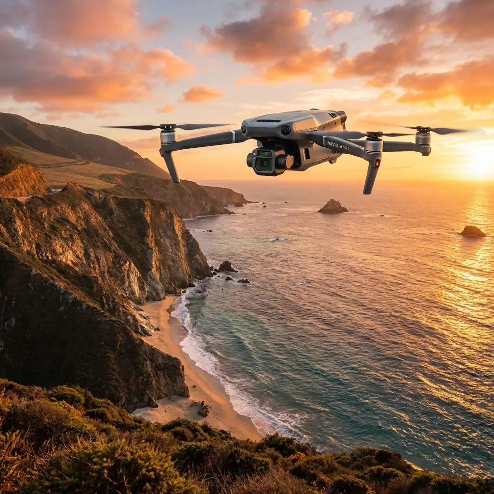
The Mavic 3T earns its place on this type of mission because it combines visible imaging, thermal capability, and a compact airframe that can be deployed quickly near narrow access roads, substations, and right-of-way clearings. That compactness matters more in wind than many teams realize. A larger platform may carry more payload options, but a smaller aircraft can often be staged faster, repositioned faster, and recovered with less exposure when gusts build unexpectedly along the line. In utility work, time on site is not just labor. It is risk exposure.
Still, windy corridor mapping exposes every shortcut in mission planning.
If your goal is true photogrammetry along a power line, you need to decide whether the deliverable is a broad corridor model or asset-specific documentation. The Mavic 3T can support both, but not with the same flight profile. For corridor reconstruction, the temptation is to run a fast linear mission and hope overlap stays acceptable. In wind, that assumption fails quickly. The aircraft may hold the route, but yaw corrections and speed fluctuations change image geometry. If the conductor is the feature you care about, that matters. Thin linear assets are already difficult for reconstruction software. Add variable drift and the model can become visually plausible while being operationally weak.
That is why GCP strategy becomes more than a checkbox. Ground control points are often discussed like a post-processing convenience. On power line jobs, especially in wind, they are a sanity check against the subtle positional wobble that can creep into a corridor dataset. Even a good RTK workflow benefits from independent references when the aircraft is constantly making small attitude corrections. If the mission is intended to support vegetation encroachment analysis, pole position validation, or change detection across repeated surveys, control quality becomes the difference between a useful map and a polished approximation.
Thermal work adds another layer. A thermal signature around connectors, insulators, transformers, or suspect splice points can tell you where to look, but wind changes how you should interpret what you see. Air movement can cool surfaces unevenly and reduce apparent contrast. The result is not that thermal data becomes useless. It becomes contextual. A hot component that still stands out on a windy day deserves attention because it is overcoming an environment that is actively masking heat differences. On the other hand, a weak anomaly may require confirmation from angle, timing, and visual inspection before it is escalated.
This is where the Mavic 3T’s combination of thermal and visual capture is operationally significant. You are not switching platforms or trying to align data from separate sorties flown under slightly different conditions. You can identify a suspicious thermal pattern, immediately verify it visually, and decide whether the issue is likely electrical, structural, or simply a misleading reflection or background effect. For field teams, that shortens the loop between detection and judgment.
Transmission reliability is another place where the Mavic 3T makes practical sense for utility work. The aircraft uses O3 transmission, which matters in a power line environment because these missions often unfold in awkward radio conditions: long straight corridors, changing terrain, intermittent tree cover, and reflective structures. A stable link is not just about pilot comfort. It affects whether the operator can maintain clean framing, make safe route adjustments, and preserve confidence in the live thermal view. When wind is moving the aircraft and the scene itself, lag or instability in the downlink becomes more than annoying. It increases the chance of rushed decisions.
Security rarely gets enough attention in public discussions of inspection drones, but it should. Utility imagery is sensitive. Grid assets, substation layouts, access roads, and fault indicators are not neutral consumer content. The presence of AES-256 for secured data handling and transmission is one of those details that sounds abstract until a utility, contractor, or municipal operator has to answer basic questions about who can access mission data and how it is protected. On real infrastructure projects, that is not an IT footnote. It is part of procurement, compliance, and trust.
The other operational detail that deserves more respect is battery workflow. People often focus on endurance numbers in isolation, but power line mapping rarely fails because the aircraft could not stay aloft long enough in theory. It fails because field tempo breaks down. Vehicles are parked too far from the launch point. Gusts increase on the ridge. The team needs one more pass on a suspect span. Light is changing. In those moments, hot-swap batteries are not a luxury concept; they are how you keep the mission organized. A fast battery exchange keeps the aircraft in rotation, preserves crew focus, and reduces the impulse to “just squeeze in” one more segment on a low pack. That is exactly how avoidable mistakes enter an inspection day.
There is also a growing misconception that every linear infrastructure job should be framed as a BVLOS ambition. Sometimes that is correct. Often it is premature. The Mavic 3T is highly capable, but windy power line environments punish overconfidence. Before teams start talking about extended corridor operations, they need a disciplined VLOS workflow that proves repeatability: stable launch and recovery procedures, reliable handoff between thermal and visual tasks, clear lost-link planning, and evidence that the data remains consistent when the weather is only marginally cooperative. BVLOS is not a shortcut around fieldcraft. It amplifies whatever fieldcraft already exists, good or bad.
Let me return to the cleaning point, because it connects directly to all of this.
A proper pre-flight cleaning routine on the Mavic 3T should include the payload glass, thermal window, obstacle sensing surfaces, and airframe joints where dust or plant residue can accumulate after low-altitude corridor work. Power line rights-of-way are not clean environments. Fine grit, pollen, insect residue, and moisture spots are common, especially when crews are launching from gravel tracks or disturbed soil. A light smear on the visual lens can reduce image sharpness enough to soften conductor edges or hardware detail. A contaminated thermal window can distort contrast and make subtle temperature differences harder to trust. Dirty sensing surfaces can also interfere with the aircraft’s ability to interpret its surroundings correctly during low-speed maneuvers near structures or uneven terrain.
That five-minute cleaning step has a direct operational payoff. It improves data confidence before takeoff rather than forcing doubt into the review stage, when the aircraft is already packed away and the crew is miles from the line segment in question.
Mission design for windy power lines also benefits from a simple mental shift: stop planning around ideal ground speed and start planning around image certainty. If a gusty section forces slower passes, that is not inefficiency. That is the job telling you what quality costs. I would rather see a shorter corridor captured cleanly than a longer route delivered with gaps, inconsistent overlap, and thermal frames that can only support vague conclusions.
One practical approach is to separate the mission into two passes when conditions justify it. First, run a conservative visual mapping pass optimized for overlap and corridor consistency. Then fly a targeted thermal inspection pass on assets or spans that deserve attention. Some teams try to compress everything into one sortie, but in wind that can create conflicting priorities. Mapping wants geometry. Thermal interpretation wants angle discipline and situational patience. The Mavic 3T can do both, but the operator should not pretend those objectives are identical.
Another point that experienced crews learn quickly: conductor motion matters. If wind is causing visible oscillation, the challenge is not only flight stability. It is scene stability. Photogrammetric reconstruction of thin moving objects is inherently limited. In those cases, the deliverable should be framed honestly. Use the mission to map the corridor, poles, towers, surrounding vegetation, access conditions, and fixed hardware. Use thermal and zoomed visual review for component assessment. Do not overpromise conductor-level model fidelity from conditions that physically resist it.
That honesty is what separates a serious UAV workflow from a rushed one.
For teams building or refining this kind of program, the best improvements usually come from small procedural decisions. Clean the aircraft before every sortie. Confirm payload clarity against a bright background. Validate GCP placement before the wind picks up. Keep battery rotation orderly. Set route speed based on image quality, not optimism. Treat thermal anomalies as evidence, not verdicts. Protect transmission and stored data as if the infrastructure owner will audit the chain, because one day they might.
If you want to compare notes on corridor planning or sensor setup for this kind of work, you can reach me through this field support channel.
The Mavic 3T is not magic, and that is exactly why it remains useful. It gives utility teams a compact platform with thermal capability, visual flexibility, O3 transmission, and secure handling features that fit real inspection work. In windy power line mapping, success comes less from raw specification and more from operational discipline. Clean sensors. Thoughtful control. Realistic mission segmentation. Measured interpretation.
That is what turns a capable aircraft into a dependable one.
Ready for your own Mavic 3T? Contact our team for expert consultation.