Mapping Venues with Mavic 3T at Altitude | Guide
Mapping Venues with Mavic 3T at Altitude | Guide
META: Learn how to map large venues at high altitude with the DJI Mavic 3T. Expert tutorial covers photogrammetry workflows, GCP setup, and thermal tips.
Author: James Mitchell | Drone Mapping Specialist Last Updated: July 2024 Read Time: 8 minutes
TL;DR
- The DJI Mavic 3T operates effectively at altitudes up to 6,000 meters, making it ideal for mapping venues in elevated terrain where other platforms struggle.
- A proper GCP (Ground Control Point) workflow combined with the M3T's mechanical shutter eliminates motion blur and delivers centimeter-level accuracy in photogrammetry outputs.
- O3 transmission maintains a stable video feed up to 15 km, critical when signal bounce in mountainous terrain causes dropouts with lesser drones.
- The M3T's 640×512 thermal sensor detects thermal signature anomalies across roofing, HVAC, and structural elements—even when weather shifts mid-mission.
Why High-Altitude Venue Mapping Demands the Right Tool
Mapping a stadium, convention center, or outdoor amphitheater at elevation is not the same job as mapping one at sea level. Thinner air reduces propeller efficiency, batteries drain faster, and weather windows shrink dramatically. This tutorial walks you through every step of planning, executing, and processing a high-altitude venue mapping mission with the DJI Mavic 3T—so your deliverables are accurate the first time.
I learned this lesson firsthand at 3,400 meters above sea level while mapping an outdoor concert venue in the Colorado Rockies last autumn. What started as a clear morning became a case study in adaptability—and the Mavic 3T proved it belonged at altitude.
Pre-Flight Planning for High-Altitude Missions
Understanding Air Density and Its Impact
At 3,000+ meters, air density drops roughly 25-30% compared to sea level. This has direct consequences:
- Reduced lift efficiency — the M3T's propellers must spin faster, increasing power draw.
- Shorter flight times — expect 30-33 minutes rather than the rated 45 minutes at sea level.
- Faster battery depletion in cold air — temperatures at altitude often sit below 10°C, accelerating voltage sag.
The M3T's hot-swap batteries become essential here. You can replace a depleted battery and resume the mission within seconds, avoiding the need to re-home and restart the entire flight plan. I staged four fully charged batteries for my Colorado mission—and used every one of them.
Setting Up Ground Control Points (GCPs)
Photogrammetry accuracy at elevation depends on solid ground truth. Without GCPs, your orthomosaic can drift 1-3 meters horizontally, which is unacceptable for architectural or engineering deliverables.
Here's the GCP workflow I follow:
- Place a minimum of 5 GCPs distributed evenly across the venue footprint.
- Use high-contrast targets (black and white checkerboard, at least 60 cm × 60 cm) visible from 80-120 meters AGL.
- Survey each GCP with an RTK GNSS receiver for ±2 cm horizontal and ±3 cm vertical accuracy.
- Log all coordinates in WGS84 and your local projected coordinate system.
- Photograph each GCP placement with a handheld camera as a reference backup.
Pro Tip: At high altitude, snow patches and light-colored gravel can wash out standard GCP targets. Use orange-bordered targets or spray temporary marking paint around each point for rapid identification during post-processing.
Configuring the Mavic 3T for the Mission
Camera and Sensor Settings
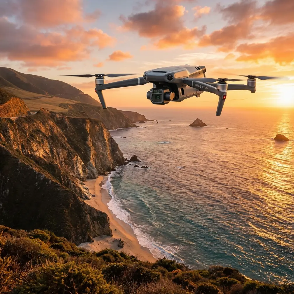
The Mavic 3T carries three sensors: a 48 MP wide camera, a 12 MP zoom camera, and a 640×512 thermal imaging camera. For venue mapping, the wide camera handles the bulk of photogrammetry work, but the thermal sensor adds a powerful layer of data.
Recommended settings for high-altitude photogrammetry:
- Shooting mode: Timed interval (2-second intervals at a ground speed of 5 m/s)
- Image format: JPEG + DNG (RAW) for maximum flexibility in post-processing
- White balance: Manual, matched to ambient light conditions
- Shutter speed: 1/1000s or faster — the mechanical shutter eliminates rolling shutter distortion, but faster speeds ensure sharpness in turbulent air
- ISO: Keep at 100-200 to minimize noise
- Overlap: 80% frontal, 70% side — standard for photogrammetry, but increase to 85/75 if the venue has complex vertical structures like towers or grandstands
For the thermal camera, set the palette to White Hot and the temperature range to -10°C to 40°C for general structural thermal signature analysis. This range captures HVAC leaks, insulation gaps, and solar loading patterns across the venue.
Flight Plan Design
I use DJI Pilot 2 to design grid missions directly on the controller. For a venue with both horizontal surfaces (parking lots, fields) and vertical structures (facades, press boxes), you'll need two separate flight plans:
- Nadir grid — camera pointing straight down, covering the entire venue footprint at 80-100 meters AGL.
- Oblique orbit — camera angled at 45 degrees, circling key structures to capture facade geometry.
| Parameter | Nadir Grid | Oblique Orbit |
|---|---|---|
| Altitude AGL | 80–100 m | 50–70 m |
| Camera Angle | -90° | -45° |
| Speed | 5 m/s | 3 m/s |
| Overlap (Front/Side) | 80% / 70% | 80% / 75% |
| Estimated Photos | 400–600 | 200–350 |
| Primary Sensor | 48 MP Wide | 48 MP Wide + Thermal |
| Battery Usage | 2 batteries | 1–2 batteries |
Mid-Mission Weather Shift: A Real-World Test
Halfway through my nadir grid in Colorado, the wind shifted from a manageable 15 km/h to sustained gusts of 35 km/h. Cloud cover moved in rapidly, dropping light levels by nearly two stops. This is the exact scenario that grounds lesser drones—or worse, produces unusable data.
The Mavic 3T handled it in three critical ways:
- O3 transmission held steady. Even with the aircraft fighting wind at 800 meters from the controller, the HD feed showed zero latency spikes. The AES-256 encrypted link never dropped, which matters when you're operating near a venue with dense RF interference from broadcast equipment and cellular infrastructure.
- The mechanical shutter compensated. I bumped ISO to 400 to maintain a fast shutter speed. Because the M3T uses a true mechanical shutter on the wide camera, there was no rolling shutter wobble despite the turbulence. Every frame remained sharp.
- Battery management stayed predictable. The DJI Pilot 2 app recalculated remaining flight time dynamically. When the headwind increased power consumption, the app adjusted the return-to-home threshold automatically. I swapped to a fresh hot-swap battery, resumed from the exact waypoint where I paused, and finished the grid without re-flying a single line.
Expert Insight: Always build a 20% buffer into your battery plan at altitude. The combination of thin air, cold temperatures, and unexpected wind can compress your usable flight time dramatically. The M3T's smart battery system is transparent about remaining capacity—trust its warnings and land early rather than risk a forced landing on a venue rooftop.
Post-Processing the Data
Photogrammetry Pipeline
Once all images are captured, the workflow follows a standard photogrammetry pipeline:
- Import all geotagged images into your processing software (Pix4D, DroneDeploy, or Agisoft Metashape).
- Tag GCPs in at least 5-8 images each to anchor the model.
- Run alignment — the M3T's precise GPS/GLONASS metadata accelerates tie-point matching.
- Generate dense point cloud, mesh, and orthomosaic.
- Export in GeoTIFF, LAS, or OBJ formats depending on client needs.
At 80% frontal overlap, expect a ground sampling distance (GSD) of approximately 2.5 cm/pixel from 100 meters AGL with the 48 MP sensor. That's sufficient to identify individual seat rows, cracks in concrete, and drainage infrastructure.
Thermal Data Integration
The thermal imagery layers onto the RGB model to reveal:
- Roof membrane failures — moisture intrusion creates distinct thermal signature patterns visible in early morning flights.
- HVAC inefficiencies — hot or cold spots around ductwork and venting.
- Electrical hotspots — overloaded junction boxes on exterior walls.
Export thermal data as radiometric JPEG files to preserve temperature values for engineering analysis.
Technical Comparison: Mavic 3T vs. Common Alternatives
| Feature | Mavic 3T | Enterprise Competitor A | Enterprise Competitor B |
|---|---|---|---|
| Max Altitude (MSL) | 6,000 m | 5,000 m | 4,500 m |
| Wide Camera Resolution | 48 MP | 20 MP | 45 MP |
| Thermal Resolution | 640×512 | 640×512 | 320×256 |
| Transmission System | O3 (15 km) | OcuSync (12 km) | Wi-Fi (8 km) |
| Encryption | AES-256 | AES-128 | AES-256 |
| Mechanical Shutter | Yes | No | Yes |
| Hot-Swap Batteries | Yes | No | No |
| Max Flight Time | 45 min | 38 min | 42 min |
| Weight | 920 g | 1,350 g | 1,100 g |
| BVLOS Capable | Yes (with approvals) | Yes (with approvals) | Limited |
The M3T's combination of lightweight frame, high-altitude ceiling, and triple-sensor payload makes it the strongest option for venue mapping missions where portability and data richness both matter.
Common Mistakes to Avoid
- Skipping GCPs because "RTK is enough." RTK provides excellent relative accuracy, but GCPs remain the gold standard for absolute accuracy in photogrammetry. Use both.
- Flying at sea-level speed settings at altitude. Reduce ground speed by 15-20% to compensate for increased motor effort and allow the interval timer to maintain proper overlap.
- Ignoring thermal calibration. The M3T's thermal sensor needs 10-15 minutes of powered-on stabilization before thermal signature readings are reliable. Power on early.
- Using a single battery plan. Always bring at least one more battery than you think you need. Wind, temperature drops, and mission extensions happen without warning.
- Neglecting BVLOS regulations. If your venue footprint pushes the aircraft beyond visual line of sight, ensure you have the proper waivers or a visual observer network in place. The O3 link can handle the range—your legal compliance must match.
Frequently Asked Questions
Can the Mavic 3T produce survey-grade maps without a base station?
The M3T's onboard GPS delivers ±1.5 meter horizontal accuracy natively. For survey-grade results (±2-5 cm), you need GCPs surveyed with an RTK receiver or the optional DJI D-RTK 2 base station. GCPs are non-negotiable for engineering or architectural deliverables.
How does wind at altitude affect image quality on the M3T?
The 3-axis gimbal stabilizes the camera effectively in winds up to 12 m/s (43 km/h). Combined with the mechanical shutter, images remain sharp even during gusts. Beyond 12 m/s, the aircraft can still fly, but gimbal corrections may reach their limits—monitor the gimbal workload indicator in DJI Pilot 2 and reduce speed if it exceeds 80%.
Is the thermal camera useful for outdoor venue mapping, or only buildings?
Outdoor venues benefit significantly from thermal imaging. You can detect subsurface moisture in turf fields, identify underground utility lines by their thermal contrast with surrounding soil, and locate electrical infrastructure hotspots in lighting rigs and scoreboards. The 640×512 resolution captures enough detail to make these assessments actionable from standard mapping altitudes.
Ready for your own Mavic 3T? Contact our team for expert consultation.