Mapping Remote Venues with the Mavic 3T: A Field Report
Mapping Remote Venues with the Mavic 3T: A Field Report on Signal Discipline, Thermal Context, and Survey Accuracy
META: Expert field report on using the DJI Mavic 3T for remote venue mapping, covering photogrammetry, thermal workflows, O3 transmission, AES-256 security, GCP strategy, EMI handling, and battery planning.
By Dr. Lisa Wang, Specialist
Remote venue mapping sounds simple until the site starts pushing back.
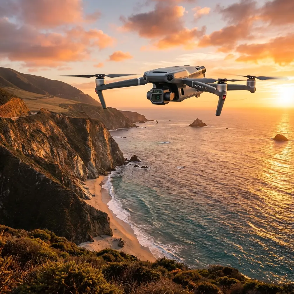
On paper, the Mavic 3T looks like a compact aircraft with a thermal payload and a familiar folding airframe. In the field, especially far from urban support and stable infrastructure, it becomes something else: a practical bridge between inspection-grade awareness and fast site documentation. That matters for temporary event grounds, remote utility compounds, hillside facilities, eco-tourism builds, mining camp perimeters, and hard-to-reach construction venues where the job is not just “make a map,” but “make a map that still holds up when the terrain, signal environment, and timeline all get messy.”
I’ve used the Mavic 3T in exactly that kind of setting, where the assignment began as a straightforward venue map and quickly turned into a lesson in electromagnetic interference, battery discipline, and the value of combining photogrammetry with thermal context. This is a field report, not a brochure. The point is to explain where the aircraft actually helps, where crews need to think harder, and why a few technical details—like O3 transmission, AES-256 data security, and careful GCP placement—change the quality of the final result.
Why the Mavic 3T fits remote venue work
The Mavic 3T is often discussed through the thermal lens first, and that is understandable. Thermal signature analysis is one of its defining strengths. But for remote venue mapping, its value is broader than that. The aircraft sits at a useful intersection: portable enough to deploy without a heavy support chain, sophisticated enough to collect layered site intelligence, and stable enough for repeatable work if the operator respects survey fundamentals.
That mix is especially useful when a “venue” is not a polished urban site but a remote location with irregular access roads, partial utility infrastructure, mixed ground materials, and uncertain communications conditions. In those cases, you are rarely collecting one clean dataset for one clean purpose. You are usually building a base map, verifying access routes, checking drainage behavior, looking for heat anomalies around electrical or mechanical assets, and documenting constraints for teams who may not visit the site for days or weeks.
A standard RGB-only workflow can produce a solid orthomosaic. The Mavic 3T lets you add a second layer of operational meaning. A thermal pass can reveal active equipment areas, recently used service corridors, roof heat variation, generator zones, or stressed electrical points that are invisible in visual imagery alone. For remote venue planning, that extra layer is not decoration. It helps teams understand where activity is concentrated, where temporary infrastructure is affecting the site, and where follow-up inspection should start.
The signal problem nobody should treat casually
The most useful lesson from recent Mavic 3T fieldwork was not about the camera. It was about signal behavior.
Remote sites are often described as “clean RF environments,” but that phrase can be dangerously misleading. A site may be remote and still produce nasty interference. Portable generators, improvised communications gear, metal structures, relay units, temporary towers, high-voltage runs, and even the terrain itself can degrade link quality in ways that surprise crews expecting a perfect line-of-sight day.
This is where the Mavic 3T’s O3 transmission system becomes operationally meaningful, not just spec-sheet filler. O3 gives the aircraft a robust transmission backbone for maintaining image and control link quality over distance, but no transmission system exempts the pilot from good antenna practice. During one remote venue mapping session, we saw intermittent signal instability while flying a planned grid near a temporary utility cluster. The first assumption was obstruction. It wasn’t. The real issue was local electromagnetic interference, amplified by poor controller antenna orientation after a position change.
The fix was simple, but only because we recognized the pattern early: stop forcing the mission, reposition the pilot station slightly, and adjust the controller antennas to maintain a cleaner relationship with the aircraft path. Once the antenna angle was corrected and the operator stepped away from the interference-heavy equipment area, link stability improved immediately.
That sounds minor. It isn’t. A shaky link during mapping can create inconsistent mission execution, delayed image capture timing, and unnecessary pilot intervention. All of that increases the chance of gaps, duplicate coverage, or unusable data. In remote work, every extra sortie has a cost in time, fatigue, and battery resources. Antenna discipline is not a small skill. It is part of data quality control.
Photogrammetry still depends on ground truth
A compact drone with smart automation can tempt crews into believing that software will rescue weak field practice. It won’t.
If the brief is venue mapping rather than casual aerial documentation, photogrammetry must be treated with survey rigor. That starts with flight planning but does not end there. Ground control points, or GCPs, remain one of the most reliable ways to improve spatial accuracy and confidence in the final model, especially when the venue has uneven elevation, repetitive surface texture, or limited permanent reference features.
The Mavic 3T is well suited to collecting the imagery needed for mapping deliverables, but the operational significance of GCPs is straightforward: they reduce doubt. On remote sites, that reduction in doubt matters more than in urban jobs because there are fewer reference layers to cross-check against later. If a project manager is planning temporary structures, routing vehicles, or assessing clearances based on your map, “close enough” is not a professional standard.
A practical approach is to place GCPs across the site envelope rather than clustering them near easy access points. Corners alone are not enough for difficult terrain. Mid-field control improves confidence in how the model behaves across the full venue. This is particularly useful if the site includes sloped ground, mixed vegetation, and hardscape transitions. The result is not just a prettier orthomosaic. It is a dataset that aligns better with the decisions people will make from it.
Why thermal context changes venue planning
There is a tendency to treat thermal as a separate mission type: inspections on one side, mapping on the other. That division leaves value on the table.
For remote venues, thermal data can sharpen interpretation of a map in ways that pure RGB output cannot. Consider a site hosting temporary power, refrigeration, shelters, portable lighting, pumping equipment, or remote communications cabinets. On a visual map, these may appear as ordinary infrastructure objects. In thermal imagery, they become active systems with a pattern of use.
That pattern matters. A thermal signature can help identify heavily loaded equipment zones, recently trafficked operational lanes, drainage effects after partial drying, or heat-retaining surfaces that may affect worker staging and temporary material placement. It can also help distinguish occupied service areas from dormant ones when site logistics are fluid.
The Mavic 3T’s strength here is not that it replaces a dedicated survey platform or a specialized high-end thermal workflow. Its strength is that it lets a field team document geometry and thermal behavior within the same deployment cycle. On remote assignments, collapsing tasks into fewer mobilizations reduces exposure to weather changes, access delays, and battery turnover pressure.
Data security is not an afterthought in remote operations
Remote mapping creates a strange paradox. Teams often feel isolated, yet the data they gather may be highly sensitive from a commercial standpoint. Venue layouts, utility positions, temporary infrastructure design, asset locations, and construction progress records all have operational value. If they move through the wrong channels, the project risk is obvious.
That is why AES-256 deserves mention in a practical discussion of the Mavic 3T. Encryption language often gets ignored because it sounds abstract. In reality, AES-256 matters because remote field operations tend to involve improvised workflows: laptops in vehicles, temporary Wi-Fi links, portable drives, and handoffs across multiple teams. If the platform supports strong data protection practices, that contributes to a healthier chain of custody around project files.
For commercial operators, security should be built into the field routine, not bolted on after the flight. Secure storage, controlled transfer procedures, and documented handling rules are part of professional drone operations now. The aircraft’s security features help, but the crew has to complete the system through procedure.
Battery planning is where smooth missions are won
Battery management rarely gets celebrated, but poor battery planning wrecks more mapping days than most technical faults.
On remote venue jobs, battery turnover is not just about total flight time. It shapes the rhythm of the mission. If you are capturing a large site with RGB mapping passes and targeted thermal follow-up, you need to sequence tasks so that the highest-priority coverage happens while the crew is freshest, the weather is most stable, and the light is most predictable.
This is where hot-swap batteries become a workflow advantage in real terms. Fast battery changes reduce dead time between sorties and help preserve mission continuity. That continuity is valuable when you are trying to maintain consistent overlap, stable lighting windows, or repeatable thermal conditions. The less idle delay between flights, the easier it is to keep datasets coherent.
A smart field routine usually looks like this: first, fly the core photogrammetry mission while visual conditions are best; second, review coverage immediately rather than trusting the plan blindly; third, conduct focused thermal passes over infrastructure, access points, drainage features, or equipment clusters; fourth, log any EMI anomalies, wind changes, or pilot station moves that may affect interpretation later. A battery is not just stored energy. It is scheduling authority.
BVLOS talk should stay grounded in reality
BVLOS gets mentioned often in discussions around remote work because distance and access challenges make it attractive. The concept is understandable. But for venue mapping, the operational conversation should remain disciplined and compliant. The real takeaway is not “fly farther.” It is “design the mission around communication reliability, visual understanding of the site, and the regulatory framework you actually operate under.”
Even when a mission is planned within standard line-of-sight practices, the habits that support more advanced operations still improve outcomes: stronger pre-flight risk assessment, better pilot-observer coordination, clearer lost-link planning, and stricter launch-point selection. The Mavic 3T benefits from this level of structure because it is often used on jobs where the site itself is changing quickly.
A practical workflow that holds up under field pressure
For teams mapping remote venues with the Mavic 3T, I recommend a workflow that treats the aircraft as a site intelligence tool rather than just a camera in the sky.
Start with a walk-through. Identify likely RF trouble spots, metal clutter, elevated infrastructure, and thermal points of interest before launch. Choose a pilot station with a stable line of sight and enough room to adjust if interference appears. Then place GCPs with the final deliverable in mind, not just operator convenience.
Fly the photogrammetry mission first. Keep altitude, overlap, and speed consistent. Watch the link, not just the map. If signal quality degrades, do not “push through” because the aircraft still responds. Pause, evaluate the interference source, and adjust antenna orientation deliberately. Small changes in operator position can matter.
After the core map is secured, use thermal selectively. Look at utility nodes, temporary structures, access corridors, roof surfaces, and drainage patterns. Thermal is most useful when tied to a question. “What is active here?” “What is retaining heat?” “Where is equipment under load?” Those are mapping questions too, if the venue is operational.
If your team wants to compare workflows for a similar site, I’ve found quick field coordination through direct project messaging much more efficient than trying to decode isolated flight logs after the fact.
Finally, validate before leaving. In remote environments, the cheapest time to discover a hole in coverage is still on site.
What the Mavic 3T does well—and where expertise still matters
The Mavic 3T earns its place in remote venue mapping because it compresses several useful capabilities into a deployable package. O3 transmission supports stable field operations when handled correctly. Thermal imaging adds operational context to mapping outputs. AES-256 aligns with professional data protection expectations. Efficient battery change routines help maintain mission flow. And with proper GCP use, photogrammetry outputs become more trustworthy for planning and coordination.
But the aircraft does not remove the need for judgment. It rewards it.
The best maps from the Mavic 3T come from crews who understand that remote work is a systems problem. Signal behavior, antenna orientation, control placement, ground reference strategy, thermal timing, and data handling are all linked. Ignore one, and the others become less useful. Respect all of them, and the aircraft delivers something much more valuable than imagery: a site record people can actually rely on.
That is the real story of the Mavic 3T in remote venue mapping. Not hype. Not abstraction. A compact platform that performs well when the operator treats field discipline as part of the payload.
Ready for your own Mavic 3T? Contact our team for expert consultation.