Mapping Dusty Venues with the Mavic 3T: What Actually
Mapping Dusty Venues with the Mavic 3T: What Actually Matters in the Field
META: Practical Mavic 3T workflow for mapping dusty venues, with expert insight on sensor access, flight stability, thermal use, O3 transmission, GCP strategy, and safer data capture.
Dust changes everything.
On paper, venue mapping looks straightforward: define the boundary, set overlap, launch, collect imagery, process the model. In a dusty environment, that clean sequence breaks down fast. Fine particles reduce contrast, hide surface texture, interfere with visual checks, and punish every shortcut in your preflight routine. If you are mapping an equestrian arena, a quarry event ground, a temporary festival site on dry soil, or an outdoor training venue in arid conditions, the Mavic 3T can do excellent work—but only if you treat the aircraft as a measurement system, not just a camera in the air.
I’ve seen this firsthand. During one survey of a dry venue perimeter near scrubland, a small deer moved out from the edge of the site just as the aircraft was preparing for a low-altitude pass. The visible feed gave only a weak outline against the pale ground. The thermal signature, though, separated the animal immediately from the background, and the pilot adjusted the line before continuing the mission. That moment had nothing to do with dramatic flying. It was about sensing, interpretation, and preserving both survey quality and site safety.
For dusty venue mapping with the Mavic 3T, that mindset matters more than any spec sheet.
The real problem with dust is not only visibility
Most operators think dust mainly affects the image. It does, but that is only the beginning.
Dusty venues often produce low-texture surfaces, especially when the ground is uniform and sun-bleached. Photogrammetry needs identifiable points from frame to frame. If your scene is dominated by beige soil, repeated tire marks, and glare, your model can become noisy, warped, or simply inefficient to reconstruct. This is where GCP planning becomes more than a box to tick. In these environments, well-placed ground control points are often what separates a useful deliverable from a decorative one.
The second issue is operational confidence. Fine dust makes it harder to verify the aircraft visually on the ground before launch and after landing. That sounds basic, but it connects directly to a principle that conventional aircraft designers have understood for decades: access matters. One of the reference materials here, from 飞机设计手册 第5册 民用飞机总体设计, spends surprising attention on inspection openings, service panels, and internal access covers. On pages 254-255, it describes dedicated access points for checking structural, electrical, and control-related components, including cargo ceiling panels used to inspect and install related fuselage structure, electrical systems, control cables, and associated components.
That may sound worlds away from a compact UAV. It isn’t.
The operational significance is simple: reliable flying depends on being able to inspect what you cannot afford to guess about. In manned aircraft, that means access panels for systems and structure. In a dusty Mavic 3T workflow, it means disciplined inspection of sensor windows, gimbal movement, arm joints, propeller roots, vent areas, landing surfaces, and battery interfaces before every sortie. Dust encourages false confidence because the aircraft may still arm and hover normally while image quality, cooling efficiency, or mechanical smoothness quietly degrade.
Why mapping venues with the Mavic 3T is different from generic photogrammetry
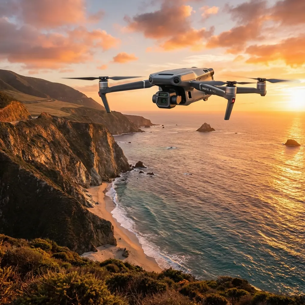
The Mavic 3T is often discussed through its thermal capability, and rightly so. But in dusty venue mapping, the more useful question is how its sensor package changes your decision-making before and during a mission.
Thermal is not there to replace photogrammetry. It is there to reveal what the RGB mission might miss: warm machinery parked near the route, personnel moving into a restricted area, recently operated vehicles, livestock at the edge of a rural venue, or heat-retaining features that help distinguish zones when visible texture is poor. That is why thermal signature awareness belongs in pre-mapping reconnaissance, not only in incident response or inspection work.
Once you accept that, the Mavic 3T becomes a two-layer site intelligence tool. The visible camera supports mapping outputs. The thermal view helps you understand whether the mapping environment is stable enough to capture safely and consistently.
Dust also influences transmission discipline. O3 transmission gives the operator a robust live link, but a stable link should not be mistaken for stable survey conditions. In dusty air, you may still have a clear feed while the scene itself loses useful detail. The right response is not to keep pushing because the signal looks good. The right response is to reassess altitude, sun angle, route direction, and whether the venue should be flown in smaller blocks.
For teams handling sensitive site layouts, AES-256 matters as well. Not because it changes flight physics, but because many dusty venues are temporary infrastructure spaces: event grounds, industrial staging yards, utility laydown areas, training compounds, or logistics zones. The mapping data often includes access paths, service positions, and temporary asset locations. Secure transmission and controlled handling of that data are part of professional practice, not an afterthought.
Stability is not just a pilot skill issue
The second reference, from 飞机设计手册 第6册 气动设计 on pages 562-563, examines how propulsion changes pitching moment and longitudinal stability. It discusses how thrust effects alter the aircraft’s pitching moment coefficient and even separates the influence of thrust-line offset from center of gravity, with formulas such as equation (14-77) for the stability increment caused by thrust axis deviation. It also notes how induced flow can change tail lift and therefore pitching moment.
Again, that comes from conventional aircraft aerodynamics. Why bring it into a Mavic 3T article?
Because it highlights a field truth many drone operators only learn after a few difficult jobs: aircraft attitude under power is not neutral. When the propulsion system changes thrust, the aircraft does not merely move faster or slower; the balance of forces changes. For dusty venue mapping, this becomes operationally significant in three ways.
First, every abrupt power change can alter camera geometry at the wrong moment. If you are trying to maintain consistent overlap and image angle in a low-level mapping pass, sloppy throttle transitions or aggressive braking can reduce reconstruction consistency. That hurts photogrammetry, especially over feature-poor surfaces.
Second, in gusty, thermally active, dusty venues, the aircraft may constantly work to preserve position and track. The live feed can still look acceptable, but the platform may be making subtle attitude corrections that affect image sharpness and repeatability.
Third, payload interpretation depends on stable motion. Thermal imagery is particularly vulnerable to being over-trusted during unstable passes. A warm object glimpsed at an angle through dusty air is not always enough to classify a feature correctly. Controlled passes matter.
The lesson is practical: fly smoother than you think you need to. Venue mapping is not the place to prove the agility of the aircraft.
A field workflow that holds up in dust
If I were planning a Mavic 3T venue mission in a dusty environment, I would structure it as a problem-solution sequence rather than a one-shot automated flight.
1. Start with a thermal reconnaissance lap
Before photogrammetry, do a higher-altitude perimeter scan. Look for moving people, animals, recently used vehicles, hot equipment, and dust plumes driven by wind or site traffic. That early deer encounter I mentioned is exactly why this matters. In mixed terrain, thermal can reveal living subjects or active equipment before they become a conflict with your route.
This first lap also helps identify sections where visible texture is too weak. You may decide those blocks need lower altitude, additional oblique coverage, or extra GCP support.
2. Build the GCP plan around texture weakness, not convenience
On dusty grounds, evenly spacing GCPs by habit is often not enough. Place them where the model is most likely to drift: broad uniform surfaces, edges between compacted soil and loose dust, and transition zones near temporary structures or fencing. If the site includes open pads with little visual character, those areas deserve more control, not less.
Good GCP use also reduces the temptation to fly unnecessarily low. Lower altitude can improve detail, but it can also increase the impact of dust haze, moving vehicles, and abrupt perspective changes around site clutter.
3. Break the venue into mission blocks
Large dusty venues are easier to map accurately in sections. This is where battery strategy matters. Hot-swap batteries support continuity, but continuity should serve quality, not speed. Use each battery cycle to complete a coherent block with consistent light and wind conditions. That gives you cleaner processing than one long mission that spans changing conditions.
4. Respect the direction of dust movement
Do not plan your routes as if the site is static. Wind-driven dust often sits differently at one end of the venue than the other. Fly the cleaner side first if you expect conditions to worsen. If vehicle movement is generating airborne particles, coordinate timing with site managers and create temporary pauses in ground traffic where possible.
5. Use O3 transmission for verification, not complacency
A strong link is useful for checking framing, route integrity, and safety. It does not guarantee the images are optimal for reconstruction. Zoom in on ground texture periodically. If the surface is washing out into a flat, low-detail field, change something while you still can.
What the aircraft-design references quietly teach drone operators
At first glance, the source material appears disconnected from a compact enterprise drone. One section catalogs access panels, service points, and inspection covers. Another analyzes how propulsion affects pitch and static stability.
Put together, they point to the same operating philosophy: performance is only meaningful when the aircraft can be inspected properly and when force changes are understood rather than ignored.
The access-panel material from pages 254-255 is a reminder that maintainability is part of airworthiness. In practical Mavic 3T terms, dusty mapping work demands a stricter inspection culture than green-field demo flights. Clean sensor windows. Check gimbal freedom. Look for dust buildup around hinges and joints. Confirm battery seating with no contamination at the interface. Review props for fine edge wear. Dust does not always fail a mission dramatically. Often it erodes your output quietly.
The aerodynamic material from pages 562-563 is a reminder that power and stability are linked. Smooth route execution is not cosmetic. It protects image consistency, improves reconstruction reliability, and reduces misreads in thermal observation.
That is exactly the sort of connection professionals make instinctively, and it is where many venue-mapping teams level up.
Where BVLOS fits—and where it doesn’t
BVLOS is often discussed as a pathway to covering larger sites efficiently. In dusty venue work, though, range is not the main bottleneck. Site complexity is. If a BVLOS framework exists in your operating environment, it should be used to improve mission design and continuity, not to excuse poor situational awareness.
The limiting factor on dusty grounds is often data quality under variable visibility and texture conditions, plus the need to maintain safe separation from people, vehicles, and wildlife. Thermal reconnaissance, strong comms discipline, and reliable control procedures matter more than simply extending the radius of the mission.
A better way to think about the Mavic 3T for dusty sites
The Mavic 3T is at its best in venue mapping when you stop treating it as a single-purpose mapping drone. It is a site-reading instrument.
Its visible camera supports photogrammetry. Its thermal sensor helps identify live hazards, operational heat sources, and hidden movement. O3 transmission supports confident oversight. AES-256 supports responsible handling of sensitive site data. Hot-swap battery planning keeps block-based capture efficient. GCP discipline compensates for the visual weakness of dusty terrain.
And underneath all that is something more old-fashioned: inspection discipline and flight smoothness. The two references supplied here, despite being drawn from traditional aircraft design texts, land on exactly those fundamentals. One emphasizes physical access for checking systems. The other explains that propulsion changes aircraft moments and stability in measurable ways, with formulas and section references rather than vague advice. Different airframes, same professional lesson.
If your venue mapping results have felt inconsistent in dry environments, the problem may not be the software or even the drone. It may be that the site was flown like a generic mission when it needed an aircraft-thinking approach.
If you want to compare workflows for dusty venue mapping or discuss how to structure a safer Mavic 3T survey plan, you can message Dr. Lisa Wang directly.
Ready for your own Mavic 3T? Contact our team for expert consultation.