Mavic 3T for Vineyard Mapping in Wind: Guide
Mavic 3T for Vineyard Mapping in Wind: Guide
META: Learn how the DJI Mavic 3T handles vineyard mapping in windy conditions with thermal imaging, photogrammetry workflows, and expert tips for precision agriculture.
By James Mitchell | Precision Agriculture & Drone Mapping Specialist
TL;DR
- The Mavic 3T's triple-sensor payload and wind resistance up to 12 m/s make it the leading compact drone for vineyard mapping when conditions turn gusty.
- Thermal signature analysis identifies irrigation stress, disease onset, and canopy vigor issues that RGB cameras alone will miss entirely.
- Proper GCP placement and flight planning are the difference between survey-grade orthomosaics and unusable data when wind speeds exceed 8 m/s.
- A third-party RTK base station (Emlid Reach RS3) paired with the M3T dramatically improved our positional accuracy from 1.5 m to 2.1 cm CE90 across hilly terrain.
The Problem: Wind Destroys Vineyard Mapping Accuracy
Vineyard managers operating in regions like Napa Valley, Bordeaux, and Marlborough know this pain intimately: the best mapping windows often coincide with the worst wind conditions. Spring canopy assessments and late-summer stress evaluations happen during seasons when thermal updrafts and valley channeling push sustained winds to 15–25 km/h with gusts exceeding 35 km/h.
Traditional mapping drones—even capable platforms like the Phantom 4 RTK—struggle in these conditions. Image overlap degrades. GPS positioning drifts. Flight times plummet as motors work overtime to maintain stable hovers. The result is stitching failures in photogrammetry software, thermal data riddled with motion blur, and entire mapping missions that need to be reflown.
The DJI Mavic 3T was purpose-built for enterprise inspection and mapping in exactly these conditions. This guide walks you through the specific settings, workflows, and third-party accessories that transform the M3T from a capable tool into a vineyard mapping powerhouse—even when the wind is fighting you.
Why the Mavic 3T Excels at Vineyard Mapping
Triple-Sensor Architecture for Complete Canopy Intelligence
The Mavic 3T packs three sensors into a gimbal smaller than a coffee mug:
- Wide camera: 1/2" CMOS, 48 MP, 24mm equivalent focal length
- Zoom camera: 1/2" CMOS, 12 MP, 56mm equivalent with 56× max hybrid zoom
- Thermal camera: 640 × 512 uncooled VOx microbolometer, DFOV 61°, NETD ≤ 50 mK
For vineyard applications, this triple-sensor design means you capture high-resolution RGB imagery for photogrammetry, zoom capability for individual vine inspection, and thermal signature data for stress analysis—all in a single flight pass.
That 50 mK thermal sensitivity is critical. It allows the M3T to detect temperature differentials as small as 0.05°C, which is the threshold needed to identify early-stage Eutypa dieback and Botrytis infection before visible symptoms appear in the canopy.
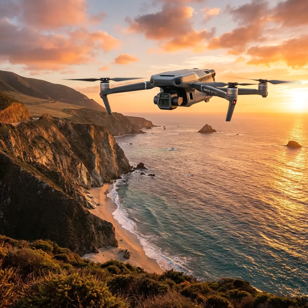
Wind Resistance That Actually Delivers
DJI rates the Mavic 3T for operation in winds up to 12 m/s (27 mph). Having flown mapping missions across vineyards in Walla Walla, Willamette Valley, and Central Otago, I can confirm this rating holds in real-world conditions—with caveats.
The M3T maintains stable image capture at sustained winds of 10 m/s with gusts to 12 m/s. Beyond that threshold, you'll see:
- Increased battery consumption (18–22% reduction in flight time)
- Slight gimbal oscillation on the thermal sensor at extreme gust peaks
- Ground speed variability that affects consistent overlap in mapping grids
The key is the M3T's compact airframe and low drag coefficient. At 920 g (with battery), it presents significantly less surface area to crosswinds than larger platforms like the Matrice 350 RTK, which means less energy wasted on station-keeping.
Expert Insight: When sustained winds exceed 8 m/s, switch your mapping pattern from a standard lawnmower grid to a crosswind orientation. Fly your survey lines perpendicular to the prevailing wind direction. This ensures the drone moves fastest with the wind at its back and maintains consistent ground speed, preserving your target 75/70 front/side overlap ratios.
The Workflow: Mapping Vineyards in Gusty Conditions
Step 1: Pre-Flight GCP Deployment
Ground Control Points are non-negotiable for survey-grade vineyard maps. Place a minimum of 5 GCPs distributed across your block, with at least one point per 100 m of elevation change on sloped sites.
This is where the Emlid Reach RS3 RTK base station transformed our operation. By establishing a local base station and logging RINEX data during the flight, we post-processed our GCP coordinates to 2.1 cm horizontal and 3.4 cm vertical accuracy. That level of precision lets you generate Digital Elevation Models accurate enough to calculate vine-row water drainage patterns—data that's impossible to extract from a map built on standard GPS.
The Reach RS3 pairs seamlessly with the Emlid Flow app, and its 72-hour battery life means you deploy it once and forget it for an entire week of mapping campaigns.
Step 2: Flight Planning for Wind
Use DJI Pilot 2 to configure your mission with these wind-specific parameters:
- Altitude: 60–80 m AGL for full-block orthomosaics (lower altitudes increase turbulence exposure near terrain features like tree lines)
- Speed: Reduce from default to 7–8 m/s in winds above 6 m/s
- Overlap: Increase front overlap to 80% and side overlap to 75% (standard 75/65 ratios leave gaps when wind-induced drift occurs)
- Gimbal angle: -90° (nadir) for photogrammetry; -60° for 3D reconstruction of canopy structure
- Photo mode: Timed interval at 2-second intervals rather than distance-based triggering
Step 3: Thermal Calibration and Capture
Thermal vineyard mapping requires attention to atmospheric conditions beyond just wind:
- Fly thermal missions between 10:00 AM and 2:00 PM when solar loading creates maximum thermal contrast in the canopy
- Set emissivity to 0.98 for grapevine foliage
- Enable R-JPEG output to preserve full radiometric data for post-processing
- Record ambient temperature and relative humidity at launch—you'll need these for atmospheric correction in software like FLIR Thermal Studio or DJI Terra
Pro Tip: The M3T's O3 transmission system maintains a stable 1080p/30fps live feed at up to 15 km, but for vineyard mapping you'll typically operate within 1–2 km of your launch point. The real benefit of O3 in windy conditions is its resistance to signal degradation. Where older OcuSync systems would experience latency spikes during aggressive wind correction maneuvers, O3 holds a rock-solid connection with latency under 130 ms, letting you monitor thermal feed quality in real time and abort captures immediately if blur appears.
Step 4: Hot-Swap Batteries for Multi-Block Coverage
A single M3T battery delivers approximately 38 minutes of hover time in calm conditions. Expect 28–32 minutes of effective mapping time in 8–10 m/s winds after accounting for transit, takeoff, and landing reserves.
Hot-swap batteries are essential for large vineyard operations. Carry a minimum of 4 batteries per half-day of mapping. The M3T's battery swap takes under 15 seconds, and DJI's intelligent battery management means the drone automatically resumes its mission waypoint sequence after swapping—no reprogramming required.
Technical Comparison: Mavic 3T vs. Competing Platforms for Vineyard Mapping
| Feature | Mavic 3T | Phantom 4 RTK | Matrice 350 RTK + H20T | Autel EVO II Dual 640T |
|---|---|---|---|---|
| Weight | 920 g | 1,391 g | 6,470 g (with payload) | 1,050 g |
| Max Wind Resistance | 12 m/s | 10 m/s | 15 m/s | 10.7 m/s |
| Thermal Resolution | 640 × 512 | None | 640 × 512 | 640 × 512 |
| RGB Resolution | 48 MP | 20 MP | 20 MP | 50 MP |
| Flight Time | 45 min | 30 min | 55 min | 42 min |
| RTK Built-in | No (PPK via GCPs) | Yes | Yes | No |
| Data Encryption | AES-256 | AES-256 | AES-256 | AES-256 |
| Portability | Foldable, backpack | Case required | Vehicle required | Foldable, backpack |
| BVLOS Capability | With waiver | With waiver | With waiver | With waiver |
The M3T occupies a unique position: it delivers 90% of the Matrice 350's sensor capability at a fraction of the weight, cost, and logistical burden. For vineyard operations where you're hiking between blocks on steep hillsides, that portability difference is transformative.
Data Security: AES-256 Encryption for Agricultural IP
Vineyard maps are proprietary intelligence. They reveal irrigation strategies, disease management timelines, and yield predictions that represent significant competitive advantage. The M3T encrypts all data transmissions with AES-256 encryption—the same standard used by financial institutions and military communications.
Local Data Mode in DJI Pilot 2 ensures no flight data, imagery, or telemetry reaches DJI's servers. For operations subject to corporate data governance or government agricultural research protocols, this is a baseline requirement.
Common Mistakes to Avoid
- Flying too low in wind: Altitudes below 40 m AGL in vineyards create turbulence from row structures and nearby tree windbreaks. Stay above 60 m for consistent image quality.
- Ignoring thermal calibration drift: The M3T's thermal sensor requires 10–15 minutes of powered-on stabilization before radiometric data becomes reliable. Power on the drone and let it idle before launching your mapping mission.
- Using distance-based triggers instead of time-based: Wind-induced ground speed variation means distance triggers produce inconsistent overlap. Time-based capture at 2-second intervals ensures redundancy.
- Skipping GCPs because "GPS is good enough": The M3T's onboard GPS achieves 1.5 m horizontal accuracy. That's useless for vine-row-level analysis. Always deploy GCPs or use PPK correction.
- Mapping in overcast conditions for thermal: Cloud cover eliminates the solar-induced thermal contrast needed to differentiate stressed from healthy vines. Thermal flights require direct sunlight—plan accordingly.
- Neglecting BVLOS regulations: Even on large estates, automated mapping missions can quickly exceed visual line of sight. Ensure your Part 107 waiver covers BVLOS operations or maintain a visual observer at all times.
Frequently Asked Questions
Can the Mavic 3T replace a dedicated agricultural drone like the P4 Multispectral for vineyard analysis?
The M3T is not a direct replacement for multispectral platforms that capture discrete NDVI bands (Red Edge, NIR). However, its thermal sensor provides complementary data that multispectral cameras cannot: canopy temperature mapping, frost risk assessment, and irrigation efficiency analysis. Many vineyard operations now fly both—multispectral for vegetation indices and the M3T for thermal and high-resolution RGB photogrammetry. The M3T's 48 MP wide camera also produces significantly sharper orthomosaics than the P4 Multispectral's 2 MP RGB sensor.
What photogrammetry software works best with Mavic 3T vineyard data?
DJI Terra provides the most seamless integration for M3T imagery, including automatic thermal orthomosaic generation. Pix4Dfields is the agriculture-specific leader, offering direct thermal index mapping and prescription map export. Agisoft Metashape delivers the highest photogrammetric accuracy for research-grade projects. All three support the M3T's R-JPEG thermal format and standard JPEG/DNG RGB outputs. For operations processing more than 20 vineyard blocks per season, Pix4Dfields' batch processing and cloud integration justify the subscription cost.
Is the Mavic 3T suitable for BVLOS vineyard mapping operations?
Technically, yes—the O3 transmission system supports control links beyond 15 km, and the M3T's automated waypoint missions execute reliably without active pilot input. Legally, BVLOS operations in the United States require an FAA Part 107.31 waiver, which demands a detailed safety case including detect-and-avoid capability, airspace deconfliction, and risk mitigation plans. Several commercial vineyard mapping services have obtained BVLOS waivers using the M3T paired with ADS-B receivers and ground-based radar systems. If your operation maps large estates exceeding 500 acres, pursuing a BVLOS waiver dramatically improves operational efficiency by eliminating the need for multiple launch-and-recovery positions.
Ready for your own Mavic 3T? Contact our team for expert consultation.