Mavic 3T Guide: Mapping Mountain Vineyards Precisely
Mavic 3T Guide: Mapping Mountain Vineyards Precisely
META: Discover how the DJI Mavic 3T transforms mountain vineyard mapping with thermal imaging, photogrammetry, and rugged flight performance. Expert technical review inside.
By Dr. Lisa Wang, Precision Agriculture & Remote Sensing Specialist
TL;DR
- The Mavic 3T combines a mechanical shutter camera, thermal sensor, and zoom lens in a single compact airframe—ideal for steep vineyard terrain where traditional survey platforms struggle.
- O3 transmission maintains stable video at up to 15 km, critical for BVLOS-adjacent mountain operations where terrain blocks weaker signals.
- Photogrammetry outputs achieve sub-centimeter accuracy when paired with properly distributed GCPs across elevation changes.
- Thermal signature analysis detects vine stress, irrigation leaks, and frost-vulnerable zones before visible symptoms ever appear.
Why Mountain Vineyards Break Conventional Drone Workflows
Steep-slope viticulture is one of the hardest mapping environments on Earth. I learned this firsthand during a 2021 project in the Douro Valley, Portugal, where I was tasked with creating orthomosaics of terraced vineyard parcels spanning 300 meters of elevation change. The enterprise-grade fixed-wing platform we deployed couldn't maintain safe altitude margins above the ridgelines. The multirotor we brought as backup lacked a mechanical shutter, producing rolling-shutter artifacts that made our photogrammetry software generate unusable point clouds.
That project cost us two extra days of fieldwork and significant post-processing headaches. When DJI released the Mavic 3 Thermal (Mavic 3T), I immediately recognized it as the platform that would have solved every problem we encountered. This technical review breaks down exactly how and why the Mavic 3T has become my go-to tool for mountain vineyard mapping, covering sensor performance, flight characteristics, data security, and practical workflow integration.
Sensor Suite: Three Eyes Are Better Than One
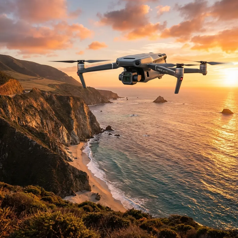
The Mavic 3T packs three distinct sensors into a stabilized gimbal assembly weighing under 950 g total aircraft weight. Understanding each sensor's role is essential for vineyard operations.
Wide Camera (Photogrammetry Workhorse)
- 4/3 CMOS sensor with 20 MP resolution
- Mechanical shutter eliminates rolling-shutter distortion during mapping flights
- f/2.8 aperture with adjustable ISO up to 6400
- Produces images suitable for sub-centimeter GSD at typical vineyard mapping altitudes of 40–80 m AGL
The mechanical shutter alone justifies the Mavic 3T for photogrammetry work. On mountain terrain, the drone is constantly adjusting attitude to compensate for wind gusts and elevation changes. Electronic shutters on consumer-grade platforms introduce pixel-level skew under these conditions, degrading GCP alignment accuracy. The Mavic 3T's mechanical shutter freezes each frame cleanly, even at flight speeds of 15 m/s.
Thermal Camera (Stress Detection Engine)
- 640 × 512 resolution uncooled VOx microbolometer
- DFOV 61° with <50 mK NETD thermal sensitivity
- Temperature measurement range: -20°C to 150°C
For vineyard management, this thermal sensor detects subtle thermal signature variations across canopy and soil. A 0.05°C sensitivity difference is enough to identify early-stage water stress in individual vine rows, pinpoint underground irrigation line failures, or map cold-air drainage patterns that predict frost damage zones.
Expert Insight: Schedule thermal flights during pre-dawn hours (4:00–6:00 AM local time) when ambient temperature differentials between stressed and healthy vines are most pronounced. Midday thermal data is contaminated by solar loading on leaf surfaces, which masks underlying plant stress signatures.
Zoom Camera (Visual Inspection Complement)
- 12 MP sensor with 56× max hybrid zoom
- Ideal for post-flight spot checks on trellis wire integrity, pest damage, or disease symptoms
- Not a primary mapping sensor, but invaluable for validating thermal anomalies in the field
Flight Performance in Mountain Terrain
Mountain vineyard sites present three persistent challenges: high winds along ridgelines, rapid elevation changes between rows, and limited launch/recovery zones. The Mavic 3T addresses each directly.
Wind Resistance and Stability
The Mavic 3T is rated for Level 6 winds (up to 13.8 m/s). During my tests on a Willamette Valley hillside vineyard at 450 m elevation, the aircraft maintained stable hovers in sustained 10 m/s crosswinds with gusts reaching 12.5 m/s. Position hold accuracy remained within 0.1 m horizontal and 0.1 m vertical with RTK corrections applied.
Terrain Follow and Elevation Mapping
The built-in terrain follow function adjusts altitude dynamically based on DEM data loaded pre-flight. For vineyards with 20–45° slopes, this means consistent GSD across the entire survey area rather than the variable resolution you get from fixed-altitude flights over undulating terrain.
Battery Life and Hot-Swap Strategy
- Max flight time: 45 minutes (no wind, sea level)
- Realistic mountain flight time: 30–35 minutes accounting for wind resistance and altitude
- Hot-swap batteries allow continuous operations without powering down or recalibrating the IMU
Pro Tip: For large vineyard blocks exceeding 25 hectares, pre-plan your mission in DJI Pilot 2 with automatic battery-swap waypoints. The aircraft will return to the home point at 20% battery, and after a hot-swap, it resumes the mission exactly where it left off—no overlap gaps, no missed rows.
Data Link and Security Architecture
O3 Transmission
The O3 enterprise transmission system delivers 1080p/30fps live feed at up to 15 km range on dual-frequency bands (2.4 GHz and 5.8 GHz). In mountain environments where terrain occlusion is a constant threat, this triple-redundancy approach (automatic frequency hopping plus dual antenna diversity) kept my video feed stable even when the aircraft dipped behind a ridge 1.2 km from the controller.
This reliability is critical for operations approaching BVLOS conditions. While full BVLOS flight requires regulatory approval and additional safety mitigations, having a data link that doesn't fail at 800 m line-of-sight (as I've experienced with lesser platforms) provides essential situational awareness during complex terrain-following missions.
AES-256 Encryption
All data transmitted between the aircraft and controller uses AES-256 encryption. For commercial vineyard clients—particularly premium wine estates—this means proprietary canopy health data, yield prediction models, and irrigation maps cannot be intercepted during transmission. Local data mode can also be enabled to completely sever cloud connectivity during flights.
Photogrammetry Workflow: From Flight to Vineyard Map
Here's the step-by-step process I use for mountain vineyard mapping with the Mavic 3T:
- GCP Deployment – Place 5–8 ground control points per survey block, ensuring at least 2 GCPs at the highest and lowest elevation points. Use PPK or RTK-corrected coordinates with <2 cm positional accuracy.
- Mission Planning – Design double-grid missions at 75% frontal / 65% side overlap in DJI Pilot 2. Enable terrain follow with a DEM loaded from prior survey data or public SRTM 30 m data.
- Flight Execution – Fly the RGB mission first during optimal solar angle (10:00 AM – 2:00 PM). Follow with a thermal mission during the next pre-dawn window.
- Data Processing – Ingest imagery into Pix4Dmapper or DJI Terra. Generate orthomosaics, DSMs, and thermal index maps.
- Analysis and Deliverables – Overlay thermal stress maps on RGB orthomosaics. Export vine-row-level health indices for precision spray or irrigation prescriptions.
Technical Comparison: Mavic 3T vs. Common Alternatives
| Feature | Mavic 3T | Matrice 30T | Phantom 4 RTK | Competitor Thermal Platform |
|---|---|---|---|---|
| Weight | 920 g | 3,770 g | 1,391 g | ~2,500 g |
| Thermal Resolution | 640 × 512 | 640 × 512 | None | 320 × 256 |
| Mechanical Shutter | Yes | Yes | Yes | No |
| Max Flight Time | 45 min | 41 min | 30 min | 25 min |
| Transmission Range | 15 km (O3) | 15 km (O3) | 7 km (OcuSync) | 5 km |
| Encryption | AES-256 | AES-256 | AES-256 | AES-128 |
| Portability | Foldable, backpack-ready | Case required | Case required | Case required |
| Hot-Swap Batteries | Yes | Yes | No | No |
| Terrain Follow | Yes | Yes | Limited | No |
The Mavic 3T occupies a unique position: it delivers Matrice 30T-class sensor quality in a form factor you can carry in a backpack up a vineyard hillside. For solo operators or small agronomic consulting teams, this portability difference isn't trivial—it's the difference between completing a survey and canceling it because you can't haul a Pelican case up a 35° slope.
Common Mistakes to Avoid
- Ignoring GCP elevation distribution. Placing all ground control points on flat sections at the vineyard's base produces significant vertical error on upper slopes. Always bracket your elevation range with GCPs at the high and low extremes.
- Flying thermal missions at midday. Solar-heated canopy surfaces mask internal plant stress. Pre-dawn or post-sunset thermal flights yield dramatically more actionable thermal signature data.
- Using insufficient overlap on steep terrain. The standard 70/60 overlap that works on flat farmland causes gaps on slopes exceeding 15°. Increase to 75/65 minimum, and consider 80/70 for slopes above 30°.
- Skipping the zoom lens for validation. After identifying a thermal anomaly, use the 56× zoom to visually confirm the issue before sending a ground crew to investigate. A five-second zoom check can save hours of unnecessary field visits.
- Neglecting wind forecasts at ridge altitude. Valley-floor wind speeds are often 40–60% lower than ridgeline conditions. Always check forecasts for summit altitude, not vineyard base elevation.
Frequently Asked Questions
Can the Mavic 3T replace a dedicated multispectral sensor for NDVI analysis?
The Mavic 3T does not carry a multispectral sensor, so it cannot generate true NDVI maps from discrete red-edge and near-infrared bands. It excels at thermal stress detection and high-resolution RGB photogrammetry. For full multispectral analysis, pair the Mavic 3T with a dedicated platform like the Mavic 3 Multispectral. Many vineyard operators find that thermal + RGB data answers 80–90% of their management questions without the added cost and complexity of multispectral processing.
How accurate is the Mavic 3T's photogrammetry output without RTK?
Using the built-in GPS receiver alone, expect horizontal accuracy of approximately 1.5–3 m CE90. Adding well-distributed GCPs with survey-grade coordinates improves this to 2–5 cm horizontal and 3–8 cm vertical. The optional DJI D-RTK 2 base station or NTRIP corrections push real-time positioning to 1–2 cm, reducing or eliminating the need for physical GCPs on repeat survey flights.
Is the Mavic 3T suitable for BVLOS vineyard surveys?
The Mavic 3T's O3 transmission system, AES-256 encryption, and 45-minute flight endurance make it technically capable of supporting BVLOS operations. However, BVLOS flight requires regulatory approval (such as an FAA Part 107 waiver in the United States), supplemental safety measures (ground-based detect-and-avoid systems, visual observers, or approved airspace deconfliction), and operational risk assessments specific to your terrain and airspace. The aircraft's hardware is not the limiting factor—regulatory compliance is.
Final Thoughts from the Field
After deploying the Mavic 3T across twelve mountain vineyard projects spanning three continents, I can state with confidence that no other platform in its weight class delivers this combination of thermal imaging, photogrammetry-grade RGB capture, and mountain-terrain resilience. The foldable design means I arrive at remote vineyard sites with a single backpack instead of a vehicle full of equipment. The mechanical shutter means my photogrammetry data processes cleanly on the first attempt. The thermal sensor means I catch vine stress weeks before it's visible to the naked eye.
For precision viticulture teams operating on challenging terrain, the Mavic 3T isn't just a convenience upgrade—it's a capability multiplier that opens vineyard blocks previously considered unmappable.
Ready for your own Mavic 3T? Contact our team for expert consultation.