Mavic 3T in High-Altitude Vineyards: What Q1 2025 Drone
Mavic 3T in High-Altitude Vineyards: What Q1 2025 Drone News Means in the Field
META: A field-driven case study on how Mavic 3T operators can adapt high-altitude vineyard mapping workflows after Q1 2025 drone industry shifts toward AI, stronger imaging, and infrastructure-grade operations.
When people talk about drone progress, they often jump straight to headline features. That misses the real question vineyard operators care about: what changes in the air, on the slope, and inside the workflow when the industry moves forward?
The first quarter of 2025 offered a useful signal. Industry reporting out of China described three simultaneous shifts: consumer drones becoming more accessible, industrial platforms becoming more intelligent, and cross-sector integration running deeper than before. That matters even if your day-to-day aircraft is a Mavic 3T rather than a newer enterprise flagship. The reason is simple. Product launches at the top of the market usually preview how expectations change across the rest of the ecosystem, from mission planning to image interpretation to how clients think about drone data.
As a UAV specialist, I read the January 8 release of DJI’s Matrice 4 series less as an isolated launch and more as a marker. The Matrice 4T and 4E were presented as evidence that the industry has entered an AI-centered operating era, with upgrades spanning transmission, flight safety, accessories, AI functions, night vision, and thermal imaging. For Mavic 3T users mapping vineyards at altitude, that is not background noise. It is a practical warning that the standard for useful aerial data is rising.
This article looks at that shift through one specific scenario: mapping a high-altitude vineyard with the Mavic 3T when weather changes mid-flight. That is where abstract industry language either proves itself or falls apart.
A Vineyard Case That Starts With Wind, Not Specs
In late season mountain viticulture, the problem is rarely just making a map. The problem is collecting reliable data before conditions turn. At altitude, a vineyard can begin the morning under clear light and stable air, then move into a harsher pattern by midday: crosswind pushing over ridgelines, temperature contrast changing across sunlit and shaded rows, and visibility flattening just enough to complicate image interpretation.
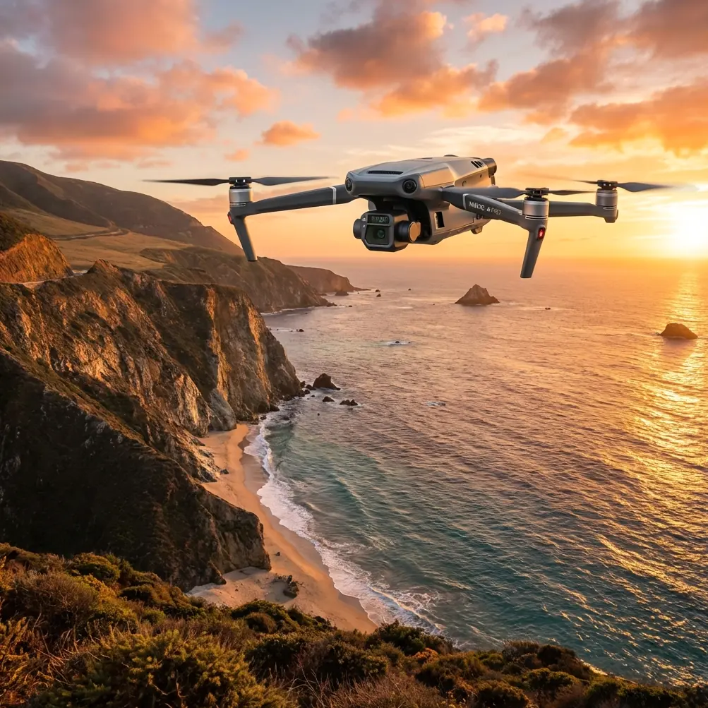
That is why the Mavic 3T remains relevant. It sits in a useful middle ground for many operators. It is portable enough to deploy quickly on narrow access roads and terrace edges, yet capable enough to collect thermal and visible data in the same mission architecture. For vineyards, that duality matters. Standard photogrammetry gives row geometry, canopy coverage, drainage clues, and terrain context. Thermal signature analysis adds another layer, helping flag irrigation irregularities, vine stress zones, blocked lines, or unusual heat retention patterns along rocky sections.
The news from Q1 2025 sharpens the lesson. If the broader drone sector is moving from “tool” to “infrastructure,” as the source report put it, then a vineyard mission cannot be treated as a one-off flight followed by a folder of images. The aircraft is part of a larger operating chain. Data must be dependable enough to inform repeat decisions. The mission has to fit a management system, not just produce pretty orthomosaics.
Why the Matrice 4 Story Still Matters to Mavic 3T Users
At first glance, a Matrice 4 launch may seem outside the lane of a Mavic 3T operator. In practice, it tells you where the workflow standard is heading.
The report highlighted that the Matrice 4 series includes two models, the 4T and 4E, and that the release signals entry into a new phase of AI-intelligent operations. That wording is significant. It suggests that smarter decision support, better scene interpretation, and tighter integration between aircraft and downstream analysis are no longer premium extras. They are becoming baseline expectations in commercial drone work.
For a vineyard surveyor using Mavic 3T, this changes how missions should be designed today. You can no longer rely on broad-area collection with vague analytical goals. Flights need a sharper hypothesis. Are you looking for thermal variance along upper terraces where irrigation pressure drops? Are you trying to confirm whether a north-facing block is lagging after a cold snap? Are you building a photogrammetry model to compare canopy development against prior GCP-aligned surveys?
That level of intent makes the Mavic 3T far more valuable. It also keeps it competitive within a market that is clearly rewarding smarter operations, not just better flying.
The Mid-Flight Weather Shift
Here is the case pattern I see often in high-altitude vineyard work.
The mission starts just after sunrise to balance light angle, lower tourist traffic on access roads, and stable air. The plan is straightforward: one visible-light mapping pass for photogrammetry, one targeted thermal pass over identified stress-prone parcels, both tied to GCP-backed checkpoints for repeatability. Early conditions look favorable. O3 transmission stays clean across the initial lines, telemetry is stable, and terrain-following judgment remains manageable because the pilot has already broken the block into smaller elevation-consistent sections.
Halfway through the second segment, the weather changes. A ridge wind begins to feed down the slope. The aircraft holds, but groundspeed fluctuates more aggressively than expected over exposed rows. At the same time, cloud movement alters surface heating. South-facing vines that were developing crisp temperature separation begin to compress thermally, while shaded lower rows show a different response. This is exactly the sort of moment when poor operators keep flying as though nothing changed.
A good Mavic 3T workflow does the opposite. It interprets the environment, not just the screen.
The operational significance is huge. Thermal data only has value if you understand the context of capture. Once surface conditions shift, a thermal signature may reflect transient weather influence as much as plant stress. That does not make the data useless. It means the operator must segment the mission, annotate timing, and know when to pause, relaunch, or narrow the objective. In a high-altitude vineyard, discipline matters more than endurance.
This is where the broader Q1 2025 news becomes relevant again. The industry emphasis on smarter systems, better safety, and stronger imaging is really an emphasis on preserving mission integrity when conditions become less ideal. Mavic 3T pilots should adopt that mindset even without the latest platform in hand.
How Mavic 3T Holds Up Operationally
The Mavic 3T is particularly strong when the job requires quick adaptation. In mountain viticulture, walking back to a vehicle, swapping equipment, and relaunching from a better position can cost less time than forcing a single oversized mission from the wrong launch point.
Its thermal capability supports selective inspection rather than blind blanket coverage. That distinction matters. In vineyards, not every block needs identical scrutiny. A thermal pass is most effective when tied to known agronomic questions: water distribution inconsistency, disease suspicion, delayed ripening, frost exposure after a cold night, or drainage-induced vigor variation.
Meanwhile, photogrammetry remains the backbone of defensible mapping. If the site has steep relief, good GCP placement becomes non-negotiable. A vineyard at altitude will punish lazy control strategy. Sloped terrain, repeating row patterns, and variable shadows can all degrade alignment quality if you rely purely on onboard positioning. A lean set of well-placed GCPs often contributes more to actionable output than chasing another marginal percentage of overlap.
Security and data handling should not be ignored either. The growing role of drones as infrastructure means operators are increasingly expected to protect imagery, coordinates, and client-sensitive agricultural data. If your workflow includes AES-256 protected handling on the data side, that is no longer overkill. It is a sign that the operation is maturing alongside the market.
What the Wushan Aerial Story Quietly Adds
The second reference item, the drone imagery piece on Wushan in the Three Gorges region, may seem unrelated to vineyard mapping. It is not.
That story emphasized how the same landscape shifts visually from morning to evening, from dawn glow to sunset color, and how seasonal atmosphere changes what the aircraft sees. Operationally, that is a reminder every Mavic 3T vineyard team should take seriously: aerial interpretation is time-sensitive. Light, haze, moisture, and angle can change the meaning of an image even when the land itself has not changed.
For vineyard mapping, that affects both visible and thermal work. A row that appears uniform in one light window may reveal canopy gaps or vigor inconsistencies later in the day. A heat pattern captured in the cool morning can collapse or invert under stronger solar loading. The Wushan example is scenic, but the field lesson is technical. Environment is not background. It is part of the dataset.
In our case flight, that meant separating the early morning photogrammetry block from the later thermal inspection rather than pretending both belonged to the same analytical condition set. Once the mid-flight weather shift arrived, the team logged the change, flagged the later data accordingly, and adjusted interpretation thresholds before reporting. That single decision prevented a false stress call on one upper parcel.
Practical Mapping Strategy for High-Altitude Vineyards
If you are using a Mavic 3T in this environment, the best results usually come from a layered workflow rather than a single universal mission profile.
Start with terrain logic. Divide the vineyard into operational zones based on slope, exposure, and row orientation. High-altitude vineyards often contain microclimates only a few terraces apart. Treating them as one block weakens the final analysis.
Then define separate objectives for visible and thermal capture. Photogrammetry wants geometric consistency, adequate overlap, and disciplined GCP structure. Thermal wants timing control, stable environmental notes, and a narrower inspection hypothesis. Combining both without clear boundaries usually produces messy interpretation.
Transmission reliability also matters more than many teams admit. In ridge terrain, signal conditions can change abruptly as the aircraft crosses contour lines or passes behind a vegetative screen. Clean O3 transmission is not just a convenience feature. It directly affects situational awareness when wind starts shifting and visual texture on the ground becomes less readable.
Battery planning deserves the same seriousness. Even if you are not using true hot-swap batteries on the aircraft itself, your field process should mimic the discipline of a hot-swap operation: short turnaround, pre-labeled power cycles, and relaunch decisions based on data quality rather than squeezing a few extra minutes from a pack. In mountain sites, conservative battery practice is a safety tool.
And yes, some vineyard operators will ask about BVLOS ambitions as estates grow or as service providers standardize larger corridors. The policy environment described in the Q1 2025 report, especially the push from low-altitude economy initiatives in places like Shenzhen and Hefei, suggests the regulatory and commercial conversation is moving toward scaled operations. But in steep vineyard terrain, BVLOS only becomes valuable if your site procedures, observer logic, and communications discipline are already mature under VLOS. Expanding range without upgrading process is how mapping quality slips.
What This Means for 2025 Mavic 3T Buyers and Operators
The core takeaway is not that the Mavic 3T has been overtaken. It is that the benchmark around it has changed.
The January 8 Matrice 4 launch showed where enterprise expectations are going: more AI, better safety framing, stronger imaging support, and tighter system thinking. The broader quarter-one report added a bigger point. Drones are being treated less like isolated hardware and more like a layer of real-world infrastructure. For agriculture, and especially for high-altitude vineyards, that shifts value toward repeatability, data trust, and operational judgment.
A Mavic 3T still makes sense when portability, thermal capability, and fast deployment matter. It is especially useful for estates that need to inspect specific parcels, validate irrigation or stress anomalies, build modest-scale terrain-aware maps, and respond quickly when weather gives them a short working window. But the winning operators in 2025 will not be the ones who simply own the aircraft. They will be the ones who fly it with enterprise discipline.
That means logging weather transitions instead of ignoring them. It means using GCPs when terrain demands them. It means treating thermal signature interpretation as agronomic evidence, not visual theater. It means securing datasets properly. It means recognizing that a mountain vineyard at 7:30 a.m. is not the same survey target at 10:15 a.m., even if the rows have not moved.
If you are refining that kind of workflow and want to compare field notes with a specialist, you can reach out here: message our UAV team on WhatsApp. The conversation is often less about the aircraft itself and more about the mission architecture around it.
That is the real story hidden inside the Q1 2025 news. The drone industry is maturing into smarter, more integrated operations. For Mavic 3T users in vineyards, the practical response is not to chase every new release. It is to fly with more intention, collect with more structure, and interpret with more discipline when conditions shift in the middle of the job.
Ready for your own Mavic 3T? Contact our team for expert consultation.