Mavic 3T Mapping Tips for Dusty Vineyards
Mavic 3T Mapping Tips for Dusty Vineyards: A Field Method That Actually Holds Up
META: Practical Mavic 3T vineyard mapping tips for dusty conditions, covering thermal workflows, photogrammetry limits, battery planning, O3 transmission, GCP use, and field-ready operating methods.
I still remember a vineyard survey where the dust was the real pilot in command.
By mid-morning, every vehicle was coated. Boots sank into powder at the row ends. Ground targets disappeared under a fine brown film before the second battery cycle. The mission itself was simple on paper: document vine stress patterns, verify irrigation uniformity, and capture enough visual detail to support block-level planning. The problem was that field conditions kept eroding data quality one small compromise at a time.
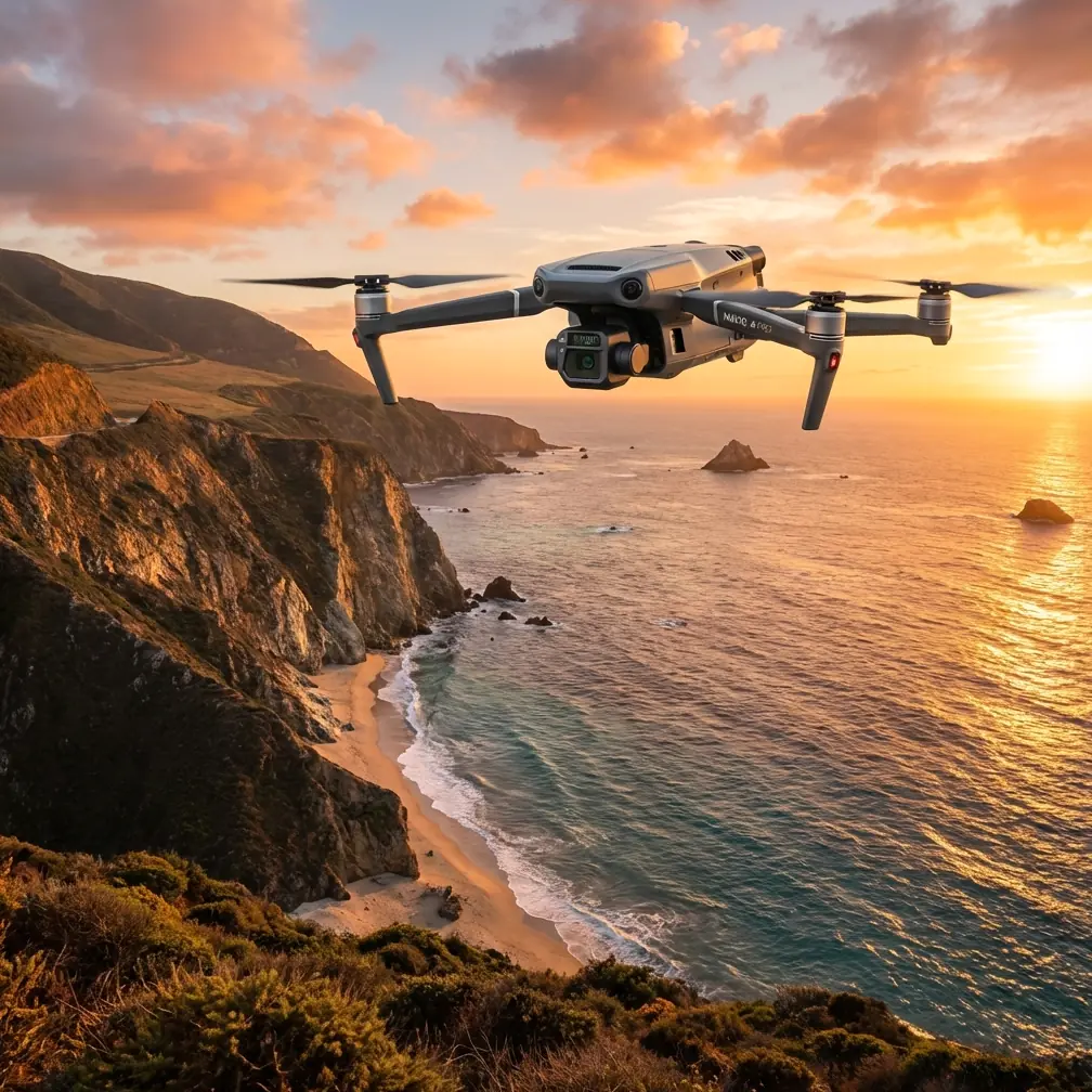
That is exactly where the Mavic 3T earns its place.
Not because it does everything. It does not. And if your sole objective is large-area, survey-grade photogrammetry at the highest possible geometric fidelity, there are platforms better suited to that job. But for dusty vineyard operations where you need to move fast, confirm thermal anomalies, maintain situational awareness, and still come home with useful mapping layers, the Mavic 3T can be a very efficient tool when the workflow is set up correctly.
This article is built around that reality: not a brochure version of vineyard mapping, but the practical method that makes the Mavic 3T useful in the field.
Start with the right question: are you mapping geometry, temperature, or decisions?
Many teams approach a vineyard mission as if “mapping” is one thing. It is not.
In a dusty vineyard, you may actually be trying to answer three different questions:
What is where?
Row geometry, missing vines, access routes, drainage features, infrastructure.What is changing?
Canopy temperature variation, irrigation issues, stressed zones, blocked emitters, uneven vigor patterns.What needs attention first?
Which blocks deserve a walk-through today, and which can wait.
The Mavic 3T is strongest when those three needs overlap. Its value is not limited to a single sensor. It comes from combining visible imagery with a thermal signature layer so the operator can flag anomalies early, then direct follow-up where it matters.
That distinction matters operationally. If you try to force the Mavic 3T into a pure, high-precision photogrammetry role without acknowledging its strengths and limits, your workflow becomes inefficient. If you use it as a decision tool that also supports mapping, it becomes much more compelling.
Why the Mavic 3T fits vineyard work better than many people expect
Vineyards are awkward from the air. Rows create repetitive visual patterns. Dust softens contrast. Terrain undulates. Field roads can be narrow, and launch points are rarely ideal. You also often need to shift from broad overview to close inspection without unpacking a second aircraft.
The Mavic 3T is well suited to that mixed mission profile.
Its compact airframe helps when you are moving between blocks instead of staging from one perfect launch site. The O3 transmission system is also a meaningful advantage in agricultural terrain where line-of-sight can be interrupted by elevation changes, tree lines, utility structures, or the simple fact that a vineyard rarely gives you a clean operating corridor. Stable transmission is not just a convenience; it reduces mission interruptions and allows you to maintain confidence in framing and aircraft status when dust haze and distance start to work against you.
The security side often gets ignored in agriculture, but it should not. If you are collecting imagery over high-value crops, irrigation layouts, facility roads, and operational infrastructure, encrypted transmission matters. AES-256 support is not a flashy talking point in the field, yet it is operationally relevant for growers, consultants, and enterprise teams that need a better chain of custody for imagery and mission data.
The first mistake: treating thermal like a pretty overlay
In vineyards, thermal data can be incredibly useful and deeply misleading at the same time.
Useful, because canopy temperature variation can reveal zones that deserve ground verification. Misleading, because temperature differences are affected by time of day, sun angle, canopy density, wind, recent irrigation, soil exposure, and even the dust itself. A thermal image is not a verdict. It is a directional clue.
That is why I advise using the Mavic 3T thermal view as a triage layer first.
A practical workflow looks like this:
- Fly an initial block-level pass to identify hot or cool anomalies.
- Compare those anomalies with visible imagery in the same mission.
- Mark suspect zones for a lower-altitude revisit or ground inspection.
- Use your agronomy context before making management decisions.
This is where the Mavic 3T becomes more than a pilot’s convenience tool. It helps compress the time between observation and action. A stressed strip caused by irrigation inconsistency may not be obvious from standard imagery alone, especially under dusty conditions where visible contrast can flatten. Thermal can give that zone a visual priority.
The operational significance is simple: you stop wasting hours walking every row equally.
Photogrammetry with the Mavic 3T: useful, but be disciplined
Let’s be blunt. If your goal is textbook survey output, the Mavic 3T should be handled with realistic expectations.
You can still produce useful orthomosaics and block documentation, especially for vineyard management, infrastructure review, and change tracking. But dusty conditions make discipline non-negotiable. Photogrammetry depends on clean image overlap, stable lighting, and enough visual texture for matching points. Vine rows can already challenge feature matching. Add haze and dust, and your software has less to work with.
So the fix is not magical settings. It is field method.
1. Fly lower than you think you need
In vineyards, repetitive geometry benefits from stronger image detail. Lower altitude improves ground sampling and gives the reconstruction engine more image information to work with. If you try to cover too much acreage in one pass at a higher altitude, dusty atmosphere and repetitive rows can degrade alignment quality.
2. Increase overlap beyond your minimum habit
Standard overlap habits can fall apart in vineyards. Give the software margin. More frontlap and sidelap help when portions of the block have weak texture or when airborne dust reduces image crispness.
3. Use GCPs when location confidence matters
If the map will influence irrigation planning, replanting decisions, or repeatable season-to-season comparisons, use GCPs. In dusty sites, GCP visibility becomes its own challenge, so place them where they remain distinct from bare soil and row shadows. Clean them if needed between flights. It sounds trivial until you discover your beautifully planned targets have turned the same color as the road.
The operational significance of GCPs is not academic. They tighten positional reliability and make your outputs more useful when comparing one block survey to the next.
4. Don’t let thermal and mapping goals conflict
A flight optimized for thermal interpretation is not always the same as a flight optimized for photogrammetry. Thermal work may favor a certain time window for canopy contrast. Visual mapping may favor steadier light and image consistency. If the block is important, separate the objectives into dedicated missions rather than trying to squeeze both into one compromised flight.
Dust changes battery planning more than most operators admit
People often talk about endurance as if battery life is just a number on a spec sheet. In vineyards, endurance is a logistics problem.
Dust slows everything down. You spend more time checking the aircraft, cleaning contact points, confirming lens clarity, and selecting safer launch and recovery spots. The field team may also need to reposition vehicles more often than planned. All of that eats into productive windows.
This is why a hot-swap battery mindset matters even if your exact platform workflow does not technically involve a true uninterrupted power swap in the industrial sense. In practice, what matters is having a battery rotation system that keeps aircraft downtime low and mission rhythm steady. In a large vineyard, losing ten extra minutes per cycle to poor battery handling can mean missing the thermal window you planned around.
Build your rotation around these realities:
- Pre-stage batteries in dust-protected cases.
- Keep charging and cooling areas separate.
- Log each battery against block coverage, not just flight count.
- Inspect contacts and airframe surfaces between sorties.
The Mavic 3T is especially effective when the operator treats battery management as part of data quality control, not just flight duration planning.
O3 transmission matters more in row-crop terrain than office teams expect
On a spec sheet, O3 transmission can look like a generic connectivity feature. In the field, it affects confidence and continuity.
Vineyards are rarely neat, open test ranges. Rolling terrain, trellis lines, farm buildings, shelterbelts, and service roads all influence the mission envelope. Dust in the air can also reduce visual certainty, even when the link itself remains stable. O3 helps preserve situational awareness during these less-than-perfect operations.
That does not mean you should stretch the aircraft to the edge of your control comfort. It means the aircraft is better able to support a professional workflow in agricultural topography where interruptions cost time and can force reflights.
Some operators also ask whether the Mavic 3T is suitable for BVLOS planning discussions. For civilian enterprise teams, the aircraft may sit inside larger conversations about scalable agricultural monitoring, but any BVLOS operation depends on local regulations, approvals, risk controls, and organizational capability. The practical takeaway for vineyard managers is simpler: even in standard visual operations, robust transmission architecture improves mission reliability.
A field-ready vineyard workflow for the Mavic 3T
Here is the method I now recommend after seeing too many teams collect “good enough” data that was not actually actionable.
Step 1: Divide the vineyard by management question
Do not map the whole property the same way. Separate blocks by purpose:
- irrigation concern
- heat stress screening
- infrastructure check
- canopy consistency review
- seasonal documentation
That lets you match altitude, overlap, and timing to the job.
Step 2: Fly a quick reconnaissance pass first
Use the Mavic 3T’s strength as a fast assessment platform. Identify dust plumes, equipment movement, reflective surfaces, and zones with unusual thermal patterns before committing to a full mapping mission.
Step 3: Run thermal in a meaningful window
Thermal signature interpretation depends heavily on environmental timing. Plan around a repeatable time of day if you want comparisons over time. Consistency is more valuable than chasing a single dramatic image.
Step 4: Run a separate visual mapping mission if needed
If you want cleaner photogrammetry, treat it as its own task. Use consistent speed, high overlap, and visible GCPs. Keep the lens clean. Dust on optics quietly ruins deliverables.
Step 5: Ground-truth a small number of anomalies
This is the part that saves the operation from becoming a dashboard exercise. Walk the rows that the thermal and visual data flagged. Validate whether the pattern is irrigation, disease pressure, canopy variation, soil exposure, or simply timing noise.
Step 6: Build outputs for decisions, not just archives
A vineyard manager does not need another folder full of stitched images. They need a map that shows which block edge is running hotter, where rows are lagging, and which areas deserve labor tomorrow morning.
The past challenge this aircraft solved for me
The old problem was fragmentation.
One aircraft for visual mapping. Another device for thermal checks. Extra time moving between systems. More opportunities for dust contamination. More coordination friction in fields where conditions change by the hour.
The Mavic 3T made that simpler.
Not perfect. Simpler.
It reduced the gap between “something looks off in that western block” and “we have enough evidence to send the vineyard manager to the right rows.” In dusty environments, that reduction in friction is not a luxury. It is the difference between acting the same day and postponing until the signal is gone.
For teams trying to refine this kind of workflow in active vineyards, it often helps to compare mission design notes with someone who has already wrestled with mixed thermal and mapping objectives in the field. If that would be useful, you can message a Mavic 3T vineyard workflow specialist here.
Where the Mavic 3T should sit in your vineyard program
The smartest way to use the Mavic 3T is not as a universal answer. It is as a responsive field aircraft that can bridge inspection, anomaly detection, and practical mapping.
Use it when:
- you need fast block assessment
- thermal context matters
- dust and mobility make larger systems cumbersome
- the goal is operational prioritization, not just polished imagery
- your team values one aircraft that can support multiple field questions in one outing
Be cautious when:
- your project demands high-order survey precision as the primary output
- your acreage is so large that endurance and throughput become the main constraint
- your organization has not built a proper ground-truth process for thermal interpretation
For dusty vineyard work, those distinctions are healthy. They help the aircraft succeed instead of being judged against the wrong mission.
The Mavic 3T is at its best when used by operators who understand that maps are only useful if they survive field conditions and lead to better decisions. In vineyards, that usually means combining thermal clues, disciplined visual capture, reliable transmission, thoughtful battery rotation, and just enough GCP control to trust what you are seeing.
That is not glamorous. It is effective.
And in real agriculture, effective wins.
Ready for your own Mavic 3T? Contact our team for expert consultation.