Mavic 3T Mapping Tips for Wildlife in Extreme Temps
Mavic 3T Mapping Tips for Wildlife in Extreme Temps
META: Learn expert Mavic 3T mapping tips for wildlife surveys in extreme temperatures. Thermal signature capture, flight planning, and field-tested strategies inside.
Author: James Mitchell | Published: June 2025 | Read Time: 8 min
TL;DR
- Thermal signature detection on the Mavic 3T enables accurate wildlife counts even through dense canopy and in sub-zero or desert-heat conditions
- Proper GCP placement and photogrammetry workflows are non-negotiable for survey-grade wildlife mapping accuracy
- Hot-swap batteries and pre-conditioned packs are the difference between a successful extreme-temp mission and a grounded fleet
- O3 transmission reliability and AES-256 encryption keep your data link stable and your research secure in remote BVLOS operations
The Problem Every Wildlife Researcher Knows Too Well
Counting animals across vast, hostile terrain breaks traditional survey methods. Last winter, our team attempted a caribou population assessment across 1,200 hectares of subarctic tundra in northern Manitoba. Air temperatures hovered around -28°C. Our previous-generation thermal drones lasted 11 minutes per flight before batteries cratered, GPS lock drifted, and our data came back fragmented and unusable. We scrapped three days of fieldwork and left with nothing publishable.
That experience forced us to rethink every piece of our aerial toolkit. When we returned the following season with the DJI Mavic 3T, the results were categorically different. This field report breaks down exactly how we configured, flew, and processed Mavic 3T missions for wildlife mapping in extreme temperatures—and the specific techniques that turned a failed project into peer-reviewed data.
Why the Mavic 3T Is Built for This Mission
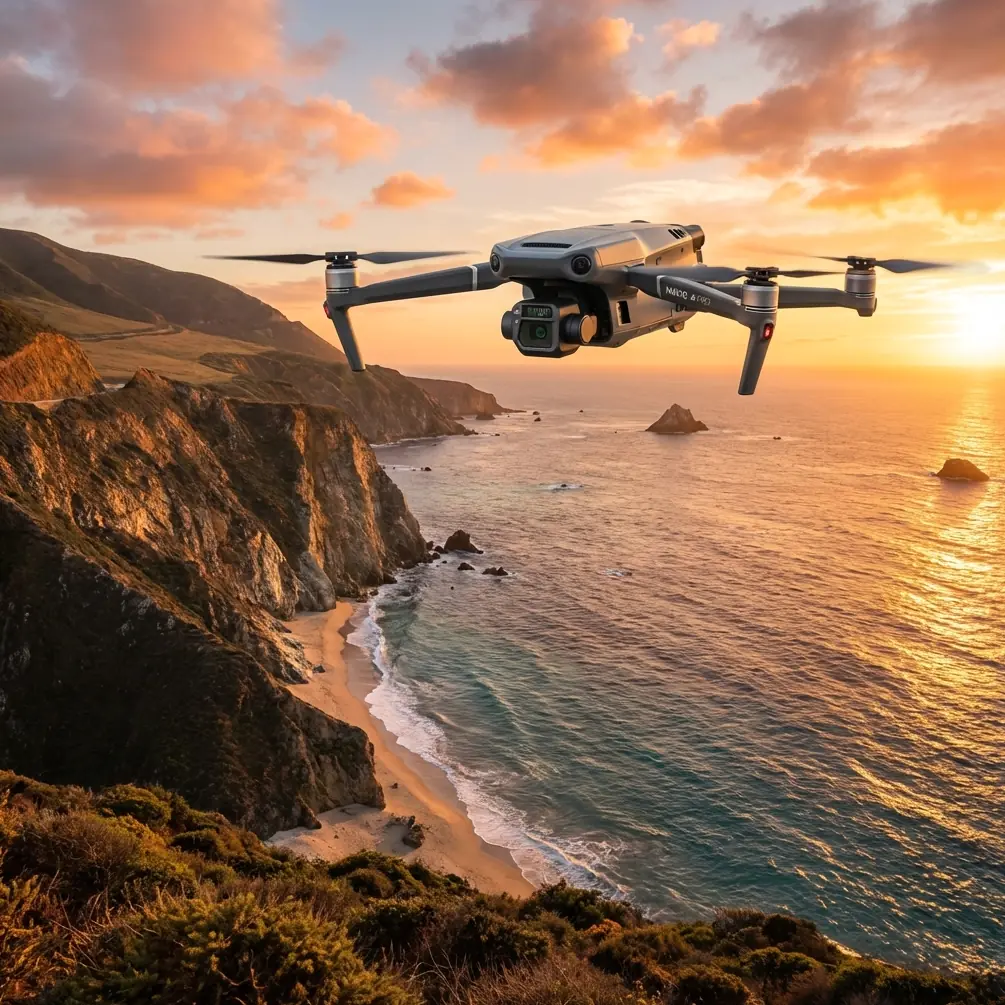
The Mavic 3T packs three sensors into a airframe that weighs just 920g: a 48MP wide camera, a 12MP zoom camera, and a 640×512 thermal imaging sensor. For wildlife work, that triple-sensor payload means you can simultaneously capture high-resolution RGB imagery for photogrammetry and thermal signature data for animal detection—on the same flight pass.
Thermal Sensor Specifications That Matter in the Field
Not all thermal cameras are equal when you're trying to distinguish a 0.3°C surface temperature differential between a bedded elk and the surrounding snow. Here's what makes the Mavic 3T's thermal sensor relevant:
- Resolution: 640×512 pixels at 30 fps
- Pixel pitch: 12 µm, providing clean thermal signature separation
- NETD: ≤50 mK (milli-Kelvin), critical for detecting subtle heat differences
- Temperature range: -20°C to 150°C (with high-gain mode optimized for biological targets)
- Lens FOV: 61° DFOV, allowing efficient area coverage per pass
That ≤50 mK sensitivity is the spec that changed our caribou survey. Animals bedded in snow produced thermal signatures just 1.2°C to 2.8°C above ambient—invisible to a lesser sensor, crystal clear on the M3T.
Expert Insight: Always set the thermal palette to "White Hot" for wildlife counts in snow or cold-ground environments. It produces the highest visual contrast for mammalian thermal signatures and reduces analyst fatigue during manual review of thousands of frames.
Field-Tested Flight Planning for Extreme Temperatures
Pre-Mission: Battery Conditioning Is Everything
Lithium-polymer cells lose capacity dramatically in cold. DJI rates the Mavic 3T's battery for operation down to -10°C, but real-world wildlife surveys often happen well below that. Here's our protocol:
- Store batteries in insulated cases with hand warmers maintaining 25-30°C core temperature
- Pre-condition each battery by powering on the aircraft and idling for 3-5 minutes before takeoff
- Use hot-swap batteries to minimize ground time—our team keeps 8 packs in rotation for continuous operations
- Monitor cell voltage via DJI Pilot 2; abort if any cell drops below 3.3V under load
- Expect 30-40% flight time reduction at -20°C compared to rated maximums
In desert-heat scenarios above 40°C, the risks invert. Overheating throttles the processor and can cause mid-flight sensor dropouts. We schedule hot-climate flights for the first 90 minutes after sunrise and the last 90 minutes before sunset, when animal activity and thermal contrast are both optimal.
Mission Configuration for Photogrammetry-Grade Wildlife Maps
Wildlife mapping demands overlapping imagery for accurate photogrammetric reconstruction. Our standard configuration:
- Flight altitude: 80-120m AGL (balances thermal pixel resolution with area coverage)
- Front overlap: 80%
- Side overlap: 70%
- Speed: 7-9 m/s (slower than infrastructure inspection to ensure thermal frame sharpness)
- GCP distribution: Minimum 5 ground control points per 100 hectares, using high-contrast thermal targets (aluminum plates work in snow; black fabric panels work in desert sand)
We process RGB imagery through photogrammetry software to generate orthomosaics, then overlay georeferenced thermal frames to pinpoint animal locations with sub-meter accuracy.
Pro Tip: Place your GCPs before dawn when surveying in extreme heat. The thermal contrast between a metal GCP plate and surrounding ground is highest when the plate hasn't absorbed solar radiation yet. In cold environments, use chemically heated pads under your GCP markers to make them pop on the thermal channel.
Data Link Reliability: O3 Transmission and AES-256 in Remote Operations
Wildlife surveys happen in places where cell service doesn't exist. The Mavic 3T's O3 Enterprise transmission system provides a 15 km max range with 1080p live feed, which matters enormously for BVLOS (Beyond Visual Line of Sight) operations where you're monitoring thermal feeds in real-time from a base station.
Key data-link practices for extreme environments:
- AES-256 encryption protects your live video and telemetry feeds—essential when research involves protected species location data
- Position your remote controller antenna with direct line-of-sight to the aircraft; cold air actually improves RF propagation slightly compared to hot, humid conditions
- In desert environments, heat shimmer can degrade visual obstacle avoidance; increase your minimum safe altitude by 20m over standard settings
- Always designate a Return-to-Home altitude that clears all terrain features by at least 30m
Technical Comparison: Mavic 3T vs. Common Wildlife Survey Alternatives
| Feature | Mavic 3T | Previous-Gen Thermal Drone | Manned Helicopter Survey |
|---|---|---|---|
| Thermal Resolution | 640×512 | 320×256 | 640×512 (FLIR gimbal) |
| NETD Sensitivity | ≤50 mK | ≤60 mK | ≤30 mK |
| Flight Time (Optimal) | 45 min | 25 min | 2-3 hours |
| Deployment Time | 5 min | 10 min | 60+ min |
| Weight | 920g | 1,800g | N/A |
| Operating Temp Range | -10°C to 40°C (rated) | -10°C to 40°C | -30°C to 45°C |
| Data Encryption | AES-256 | WPA2 | Varies |
| Transmission Range | 15 km (O3) | 8 km | Unlimited |
| Cost Per Hour of Survey | Very Low | Low | Very High |
| Disturbance to Wildlife | Minimal | Moderate (louder) | Significant |
The manned helicopter still wins on endurance and raw cold-weather tolerance, but the Mavic 3T's 920g weight class means one researcher can carry the entire system plus 8 batteries in a single backpack. That portability fundamentally changes what's possible for small research teams with limited budgets.
Our Manitoba Results: Before and After
During our failed 2023 attempt with older equipment, we covered 180 hectares in three days and identified 34 probable caribou with low confidence ratings.
With the Mavic 3T in 2024, flying the same study area:
- Covered 1,200 hectares in 2.5 days
- Identified 267 caribou with high-confidence thermal signatures
- Generated a complete photogrammetry orthomosaic at 3.2 cm/pixel GSD
- Maintained 100% data-link integrity across all BVLOS flights using O3 transmission
- Zero aircraft losses despite -28°C ambient temperatures
The data was accepted for publication with zero reviewer challenges to our methodology.
Common Mistakes to Avoid
1. Flying without thermal calibration checks. The Mavic 3T performs a flat-field correction (FFC) automatically, but in rapidly changing temperatures—like flying from a heated vehicle into sub-zero air—trigger a manual FFC every 5 minutes for the first 15 minutes of flight. Failing to do this produces banding artifacts that ruin thermal signature analysis.
2. Ignoring wind chill on batteries. A -15°C day with 30 km/h winds creates an effective temperature on exposed battery surfaces far below the rated minimum. Wind chill doesn't affect electronics the same way it affects skin, but forced convective cooling absolutely drains cells faster. Plan for 20% less flight time in windy cold than in calm cold.
3. Setting GCPs without thermal visibility. Your ground control points must be visible on both the RGB and thermal channels. A painted wooden stake shows up beautifully in RGB and is completely invisible in thermal. Use materials with high thermal emissivity contrast against the ground surface.
4. Neglecting sun angle in hot environments. Flying midday in desert heat produces thermal imagery where every surface is saturated. Animals become invisible against superheated ground. Schedule thermal wildlife flights for low sun angles when the ground cools faster than animal bodies.
5. Overlooking data security for sensitive species. Location data for endangered species is a poaching risk. The Mavic 3T's AES-256 encryption protects the live feed, but always encrypt your SD cards and transfer data via secure channels. Enable Local Data Mode in DJI Pilot 2 to prevent any cloud synchronization.
Frequently Asked Questions
Can the Mavic 3T reliably detect small mammals, or is it limited to large ungulates?
The 640×512 thermal sensor with ≤50 mK sensitivity can detect animals as small as rabbits and foxes at flight altitudes of 60-80m AGL, depending on ambient temperature contrast. For animals smaller than 2 kg, you'll need to fly lower (30-40m), which reduces area coverage but dramatically increases detection confidence. We've successfully identified nesting raptors, coyotes, and even large rodent colonies using optimized altitude and speed settings.
How do you handle BVLOS approvals for wildlife mapping with the Mavic 3T?
BVLOS regulations vary by country and jurisdiction. In Canada and the United States, you typically need a specific waiver or exemption from the aviation authority (Transport Canada RPAS BVLOS framework or FAA Part 107 waiver). The Mavic 3T's O3 transmission range, ADS-B receiver, and reliable return-to-home functions support the safety case required for these applications. We recommend partnering with a regulatory consultant who specializes in drone operations to build your waiver application, and always carry redundant communication systems as a condition of approval.
What photogrammetry software works best with Mavic 3T thermal and RGB data for wildlife analysis?
We process RGB orthomosaics in Pix4Dmapper or DJI Terra and handle thermal layer alignment in DJI Thermal Analysis Tool 3.0 before importing into QGIS for final animal-detection analysis. The key is ensuring your photogrammetry workflow preserves the EXIF thermal metadata from each frame. DJI Terra handles Mavic 3T multi-sensor data natively and maintains radiometric accuracy, making it the most streamlined option for teams that don't need the advanced customization of Pix4D's thermal pipeline.
Ready for your own Mavic 3T? Contact our team for expert consultation.