Mavic 3T for Wildlife Mapping in Extreme Temperatures
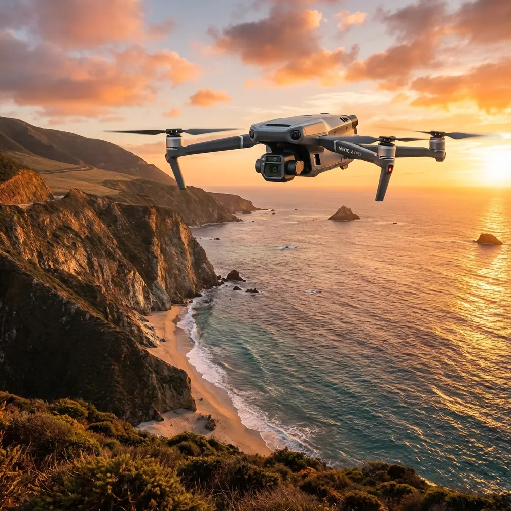
Mavic 3T for Wildlife Mapping in Extreme Temperatures: A Technical Review from the Field
META: Expert review of using the Mavic 3T for wildlife mapping in extreme temperatures, with practical insight on thermal signature capture, flight safety logic, O3 transmission, AES-256, and mission planning under changing weather.
By James Mitchell
Wildlife mapping sounds clean on paper. Draw a polygon, set altitude, launch, collect data. In the field, it rarely behaves that way.
The harder jobs happen at temperature extremes: frozen marsh edges before sunrise, heat-soaked grasslands after noon, high-contrast terrain where thermal signatures shift by the minute. Those are the conditions where a platform like the Mavic 3T stops being a spec-sheet exercise and starts proving whether it can maintain useful data quality when the environment turns unstable.
That is the lens I want to use here. Not a generic overview of the aircraft, but a practical technical review centered on one specific problem: mapping wildlife in severe temperature conditions when weather changes during the mission.
Why the Mavic 3T fits this kind of work
For wildlife teams, the Mavic 3T sits in an interesting position. It is compact enough to deploy fast, yet capable enough to support thermal reconnaissance, visible-light documentation, route repetition, and secure data handling in one aircraft. That matters because wildlife mapping often involves a split objective.
First, you need thermal awareness: locating animals, nests, or heat anomalies hidden by vegetation or low light. Second, you need spatial reliability: producing imagery that can be tied back to maps, habitat boundaries, and repeat surveys. That means thermal signature alone is not enough. You also need disciplined mission geometry, repeatable passes, and clean image sets for photogrammetry or habitat-change comparison.
The Mavic 3T is strong here because it bridges those two workflows without requiring a large field team or a complex launch footprint. For conservation contractors, ecological consultants, and reserve managers, that translates into less setup friction and more usable survey time during those narrow windows when animal movement and thermal contrast align.
The real challenge is not flight. It is confidence in the system.
When people discuss drone performance in wildlife operations, they usually focus on camera output. That is only half the story. In extreme temperatures, confidence comes from knowing how the aircraft behaves as a system.
A useful way to think about this comes from classical civil aircraft safety analysis. One of the source engineering references behind this discussion describes building a full functional relationship map, then analyzing failure paths from a selected top event downward into basic causes using fault tree logic. It also notes that quantitative analysis often relies on Boolean algebra and Monte Carlo simulation.
That sounds far removed from a compact commercial UAV. It is not.
For wildlife mapping, the “top event” is not abstract. It might be loss of mission continuity during a thermal census. Or incomplete overlap in a photogrammetry block. Or degraded situational awareness when the aircraft transitions from cold stable air into wind and precipitation. If you take a systems view, you stop asking only, “Can the drone fly?” and start asking better questions:
- What happens to image consistency if wind shifts halfway through the grid?
- What happens to decision quality if temperature, vibration, moisture, or electromagnetic interference begin stacking together?
- What part of the mission is truly redundant, and what merely feels redundant?
That same reference also highlights regional safety analysis: evaluating the actual installation and maintenance environment, the interaction between systems, and external influences such as temperature, pressure, vibration, shock, acceleration, lightning, fire, foreign object intrusion, corrosive liquids, and electrical faults. For Mavic 3T wildlife work, the operational significance is immediate. Extreme-temperature surveying is not only a camera task. It is an exposure-management task.
If the aircraft is working from a frozen vehicle tailgate at dawn, then later lands on dusty, sun-baked ground in gusting wind, you are already dealing with changing environmental loads that affect handling, sensor confidence, operator judgment, and maintenance risk between sorties.
Mid-flight weather change: where the Mavic 3T earns its place
One of my own benchmark scenarios for this aircraft involves a wildlife habitat edge survey that began in cold morning air and turned ugly faster than expected. We launched before sunrise to capture stronger thermal separation between animals and the surrounding terrain. The first leg was calm. Thermal signatures were crisp, and the visible feed was stable enough to support later correlation with habitat features.
Then the weather moved.
The air mass warmed quickly. Surface contrast started flattening. A crosswind built along a low ridge, and patchy moisture began pushing in. This is the kind of moment when a mission can become messy for two reasons. First, thermal interpretation gets less obvious as the background catches up. Second, once conditions become less stable, the aircraft’s data value depends heavily on link integrity and pilot confidence.
That is where O3 transmission matters in a very practical sense. In wildlife work, especially near tree lines, broken terrain, or broad wetlands, a robust transmission link reduces the temptation to make bad decisions based on incomplete visual feedback. Stable situational awareness means you can decide whether to continue the line, change the angle, adjust altitude, or abort without guessing. The aircraft is not “better” because a brochure says so. It is better because the operator still has enough clean information to preserve mission quality when conditions begin degrading.
The same applies to AES-256. People often file encryption under compliance checkboxes, but wildlife mapping can involve sensitive ecological locations, breeding areas, proprietary environmental assessments, and infrastructure adjacency. Secure transmission and data handling are not decorative features when you are working with protected site intelligence.
Thermal signature capture in extreme temperatures
Thermal users learn quickly that heat does not equal clarity. Good wildlife thermal work depends on contrast management.
In cold conditions, mammals and birds often separate more distinctly from the background, but that can create false confidence. Frost, wet vegetation, rocks holding residual warmth, and sheltered ground pockets can all complicate interpretation. In hot environments, the challenge changes. The terrain itself becomes noisy. The target does not disappear, but the thermal signature can blend faster than many teams expect.
This is where disciplined mission timing matters more than raw flight time. The Mavic 3T is at its best when used to exploit those brief windows where thermal separation is meaningful, then paired with visible imagery for spatial interpretation. If your end product includes habitat documentation, route comparison, or count verification, visible data and thermal data should be planned together from the start.
For teams doing repeat surveys, I strongly recommend treating thermal collection as an environmental measurement problem rather than a simple detection exercise. Note launch temperature, surface conditions, time since sunrise, wind shift, and moisture trend. Those observations explain the dataset later when someone asks why one pass showed stronger signatures than another.
What photogrammetry professionals should understand
The Mavic 3T is often discussed through the thermal lens, but wildlife mapping projects do not end there. Many programs also need orthomosaic context, terrain comparison, buffer planning, and habitat-change records. That pushes the conversation toward photogrammetry.
If the visible imagery is going into a formal mapping workflow, GCP use still matters whenever absolute positional confidence is critical. A thermal find is valuable; a thermal find tied accurately to a management zone, nest buffer, fence line, or restoration polygon is far more useful.
Extreme temperatures also influence photogrammetry in a less obvious way: they change your tolerance for sloppy mission execution. Wind gusts, changing light, and mid-mission thermal currents can reduce image consistency and overlap quality. If weather shifts halfway through a block, it may be smarter to divide the job into smaller validated sections rather than forcing one uninterrupted mission and discovering later that edge areas degraded.
This is exactly where system-level thinking, similar to the fault-tree approach described in the aircraft design reference, becomes practical. Instead of seeing a flawed output as one failure, break it into causes:
- overlap loss,
- variable ground speed,
- changing illumination,
- thermal turbulence,
- pilot repositioning,
- battery swap timing,
- and terrain masking of the control link.
Once you think like that, your mission planning improves.
A useful engineering lesson from an unlikely source
One of the reference documents deals with intake boundary layer control in aircraft propulsion systems, including how suction placement and suction ratio affect stability and loss. It mentions that the best suction effect occurs around roughly 3% to 4% under certain conditions, and that different slot designs can produce very different stable operating ranges—about 10% in one case versus 18% in another.
At first glance, that has nothing to do with the Mavic 3T. But the operational lesson is surprisingly relevant: small design or configuration choices can produce disproportionately large changes in stability margin.
That is exactly how wildlife drone missions behave in difficult weather.
A minor route adjustment. A small altitude change. A different battery-change cadence. A launch point moved to reduce terrain shielding. A decision to capture one shorter thermal pass before the sun angle shifts. These are the UAV equivalents of preserving margin in a narrow operating envelope. The point is not to imitate manned-aircraft intake design. The point is to respect the engineering principle behind it: performance near the edge depends on where and how you control the disturbance.
With the Mavic 3T, the disturbance is usually environmental rather than aerodynamic in the classical sense. But the mission logic is the same. Build margin early, and the aircraft will look “easy.” Ignore margin, and the same platform suddenly feels unreliable.
Batteries, turnaround, and the cold-weather reality
Hot-swap batteries are one of those practical workflow topics that experienced field crews care about more than casual readers. In wildlife operations, especially in cold conditions, battery handling is not just a convenience issue. It affects sortie pacing, data continuity, and whether the team can capitalize on a short thermal window.
If the site is remote and temperatures are low, you want battery rotation planned well before launch. Keep packs conditioned, maintain a consistent change procedure, and avoid letting the aircraft sit exposed while your team debates the next leg. Thermal windows close quickly. So do weather windows.
This is also where regional safety thinking becomes useful again. The aircraft design reference emphasizes analyzing installation and maintenance conditions in the real environment, not just in theory. For Mavic 3T crews, that translates into field discipline:
- inspect around ports and moving surfaces after dusty or wet landings,
- manage condensation risk when transitioning between heated vehicles and outdoor cold,
- watch for vibration-related issues after rough pack-outs,
- and treat each battery swap as part of mission assurance, not a pit stop.
BVLOS discussion, carefully framed
For large wildlife corridors, wetlands, forest edges, or coastal habitats, operators naturally think about BVLOS because the geography encourages longer corridors and repeat observation lines. The Mavic 3T’s transmission and sensor package make it attractive for such concepts, but this only makes sense within lawful civilian frameworks, approved procedures, and risk-managed operations.
What matters here is not the buzz around BVLOS. It is whether your survey architecture actually supports safe, traceable, repeatable data collection. In many cases, a well-designed segmented mission flown within the applicable rules produces better ecological data than an overly ambitious long run.
Practical field takeaway
The Mavic 3T is not valuable for wildlife mapping simply because it carries thermal. It is valuable because it supports a disciplined workflow when the environment becomes unstable. That includes:
- using thermal and visible imagery as one integrated survey method,
- preserving link confidence with O3 transmission,
- protecting sensitive project data with AES-256,
- planning battery turnover around thermal windows,
- and thinking about safety and failure pathways at the system level rather than as isolated incidents.
If you want to discuss field setup, mission design, or sensor workflow for your own habitat mapping program, you can message a Mavic 3T specialist here.
The strongest lesson from the reference material is not about equations or intake slots by themselves. It is that reliability comes from understanding interactions. In one source, that meant using Boolean logic and Monte Carlo simulation to analyze how events combine. In another, it meant recognizing that a narrow change in suction behavior could alter the stable operating range from about 10% to 18%. For Mavic 3T wildlife teams, the translation is simple: good outcomes are built upstream, in planning, margin, and environment-aware execution.
When weather changes mid-flight, that truth becomes visible very quickly.
Ready for your own Mavic 3T? Contact our team for expert consultation.