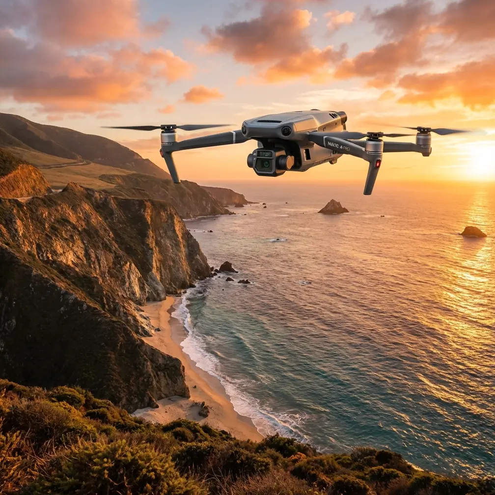
How to Monitor Urban Coastlines with Mavic 3T
How to Monitor Urban Coastlines with Mavic 3T
META: Learn how the DJI Mavic 3T transforms urban coastline monitoring with thermal imaging, photogrammetry, and extended range for comprehensive surveillance operations.
TL;DR
- Mavic 3T's thermal signature detection identifies erosion hotspots, pollution sources, and infrastructure stress invisible to standard cameras
- O3 transmission system maintains stable video feeds up to 15km, enabling BVLOS operations along extensive coastlines
- Photogrammetry capabilities generate centimeter-accurate 3D models for tracking shoreline changes over time
- Hot-swap batteries enable continuous monitoring sessions exceeding 90 minutes with proper planning
Urban coastline monitoring presents unique challenges that traditional surveillance methods simply cannot address. Erosion threatens waterfront infrastructure, illegal dumping contaminates beaches, and storm damage requires rapid assessment across miles of shoreline. The DJI Mavic 3T combines thermal imaging, mechanical zoom, and enterprise-grade transmission to solve these problems—outperforming competitors like the Autel EVO II Dual 640T in range, image clarity, and operational flexibility.
This guide breaks down exactly how to deploy the Mavic 3T for urban coastal surveillance, from mission planning to data processing.
Why Urban Coastlines Demand Advanced Drone Technology
Urban coastlines represent some of the most complex monitoring environments. You're dealing with salt spray corrosion, electromagnetic interference from nearby buildings, restricted airspace near ports, and rapidly changing conditions.
Traditional monitoring methods fall short:
- Ground surveys miss submerged erosion patterns
- Satellite imagery lacks the resolution for infrastructure assessment
- Manned aircraft cost prohibitive for routine patrols
- Consumer drones lack thermal capabilities and transmission range
The Mavic 3T addresses each limitation with purpose-built enterprise features.
The Thermal Advantage for Coastal Work
Thermal signature detection transforms how operators identify coastal threats. Water temperature differentials reveal:
- Illegal discharge pipes releasing industrial waste
- Stormwater outfall locations during dry weather (indicating illicit connections)
- Subsurface erosion channels where groundwater undermines structures
- Wildlife congregation areas for environmental impact studies
The Mavic 3T's 640×512 thermal sensor with 40mK sensitivity detects temperature variations as small as 0.04°C. Competitors like the Parrot Anafi USA offer only 320×256 resolution—literally half the thermal detail.
Expert Insight: Schedule thermal coastal surveys during early morning hours when ambient temperature differentials are greatest. The contrast between retained heat in structures and cooler water makes anomaly detection significantly easier.
Mission Planning for Coastal BVLOS Operations
Beyond Visual Line of Sight operations along coastlines require meticulous planning. The Mavic 3T's capabilities enable extended missions, but regulatory compliance and safety protocols remain paramount.
Pre-Flight Checklist for Coastal Environments
Before launching any coastal mission, address these critical factors:
- Airspace authorization: Verify LAANC approval or Part 107 waiver status for your specific corridor
- Weather windows: Wind speeds below 12 m/s for stable photogrammetry results
- Salt exposure mitigation: Apply corrosion-resistant coating to exposed components
- GCP placement: Establish Ground Control Points every 500 meters along your survey corridor
- AES-256 encryption: Confirm data security protocols for sensitive infrastructure imagery
Optimal Flight Parameters
The Mavic 3T performs best along coastlines with these settings:
| Parameter | Recommended Setting | Rationale |
|---|---|---|
| Altitude | 80-120 meters | Balances coverage width with detail resolution |
| Speed | 8-10 m/s | Ensures adequate overlap for photogrammetry |
| Overlap | 75% front, 65% side | Accounts for water surface reflection issues |
| Gimbal Angle | -80° to -90° | Minimizes horizon glare in thermal imagery |
| White Balance | Manual/Cloudy | Compensates for high reflectivity environments |
Pro Tip: When monitoring seawalls and breakwaters, fly parallel to the structure at 45-degree offset angles on alternating passes. This captures both the vertical face and horizontal cap in your 3D reconstruction.
Leveraging the Triple-Sensor Payload
The Mavic 3T's three-camera system provides unprecedented flexibility for coastal monitoring. Understanding when to deploy each sensor maximizes mission value.
Wide Camera Applications
The 12MP wide camera with 1/2-inch CMOS sensor excels at:
- Rapid area assessment after storm events
- General shoreline documentation
- Public beach condition monitoring
- Vegetation encroachment tracking
Zoom Camera Precision Work
The 48MP mechanical zoom camera reaches 56× hybrid zoom, enabling:
- Remote identification of structural cracks in piers
- License plate capture on unauthorized vehicles
- Wildlife species identification without disturbance
- Signage and marker condition assessment
Thermal Sensor Strategic Deployment
Deploy thermal imaging for:
- Pollution source identification
- Search and rescue support
- Infrastructure thermal stress analysis
- Nighttime security patrols
Technical Comparison: Mavic 3T vs. Coastal Monitoring Alternatives
| Feature | Mavic 3T | Autel EVO II Dual 640T | Parrot Anafi USA |
|---|---|---|---|
| Thermal Resolution | 640×512 | 640×512 | 320×256 |
| Transmission Range | 15km (O3) | 9km | 4km |
| Max Flight Time | 45 minutes | 42 minutes | 32 minutes |
| Zoom Capability | 56× hybrid | 32× hybrid | 32× digital |
| IP Rating | IP54 | IP43 | IP53 |
| Weight | 920g | 1191g | 500g |
| RTK Compatibility | Yes | Yes | No |
The Mavic 3T's combination of extended range and superior zoom makes it the clear choice for comprehensive coastal corridor monitoring. The O3 transmission system maintains 1080p/30fps video quality at distances where competitors experience significant degradation.
Data Processing and Photogrammetry Workflows
Raw imagery requires proper processing to generate actionable intelligence. The Mavic 3T's output integrates seamlessly with industry-standard platforms.
Recommended Software Pipeline
- DJI Terra for initial orthomosaic and 3D model generation
- Pix4D or Agisoft Metashape for advanced photogrammetry
- QGIS for GIS integration and change detection analysis
- Global Mapper for volumetric calculations on erosion sites
GCP Integration for Survey-Grade Accuracy
Proper Ground Control Point placement transforms Mavic 3T imagery from relative to absolute accuracy:
- Position GCPs on stable surfaces above high tide lines
- Use RTK-corrected coordinates for each point
- Distribute points evenly across your survey area
- Include at least 5 GCPs per square kilometer
With proper GCP integration, the Mavic 3T achieves horizontal accuracy of 2-3cm and vertical accuracy of 3-5cm—sufficient for engineering-grade coastal surveys.
Common Mistakes to Avoid
Flying during peak solar reflection: Midday sun creates intense glare off water surfaces, degrading both visual and thermal imagery quality. Schedule missions for early morning or late afternoon.
Ignoring salt accumulation: Coastal environments accelerate corrosion dramatically. Wipe down the aircraft with fresh water after every coastal mission and inspect motor bearings monthly.
Insufficient overlap over water: Water surfaces lack distinct features for photogrammetry software to match. Increase overlap to 80% or higher when significant water appears in your survey area.
Neglecting hot-swap battery protocols: Rushing battery changes introduces moisture and debris. Establish a clean, sheltered battery swap station and allow 30 seconds for proper connection verification.
Underestimating electromagnetic interference: Urban coastal areas concentrate radio interference from ports, industrial facilities, and communications infrastructure. Conduct compass calibration at your actual launch site, not nearby parking areas.
Frequently Asked Questions
Can the Mavic 3T operate effectively in foggy coastal conditions?
The thermal sensor performs well in light fog, detecting heat signatures through moisture that blocks visible light. However, dense fog attenuates thermal radiation and reduces effective detection range. The O3 transmission system maintains connectivity in conditions that would ground visual-only operations, but always prioritize safety and regulatory compliance regarding visibility minimums.
How does the Mavic 3T handle salt spray exposure during coastal flights?
The IP54 rating provides protection against splashing water and dust, but salt spray presents unique corrosion challenges. Apply conformal coating to exposed electronics, rinse the aircraft with distilled water after coastal missions, and store with silica gel packets. Operators in heavy salt environments report 40% longer component lifespan with these precautions.
What transmission range can I realistically expect along urban coastlines?
While the O3 system rates for 15km, urban coastal environments typically achieve 8-12km reliable range due to electromagnetic interference from buildings and infrastructure. Maintain direct line of sight when possible, position your controller elevated above obstructions, and use the high-power transmission mode for extended operations.
Urban coastline monitoring demands equipment that matches the complexity of the environment. The Mavic 3T delivers the thermal sensitivity, transmission range, and imaging flexibility that coastal professionals require. From detecting illegal discharge to tracking erosion patterns, this platform transforms how organizations protect and manage their shoreline assets.
Ready for your own Mavic 3T? Contact our team for expert consultation.