How to Monitor Coastlines at High Altitude with Mavic 3T
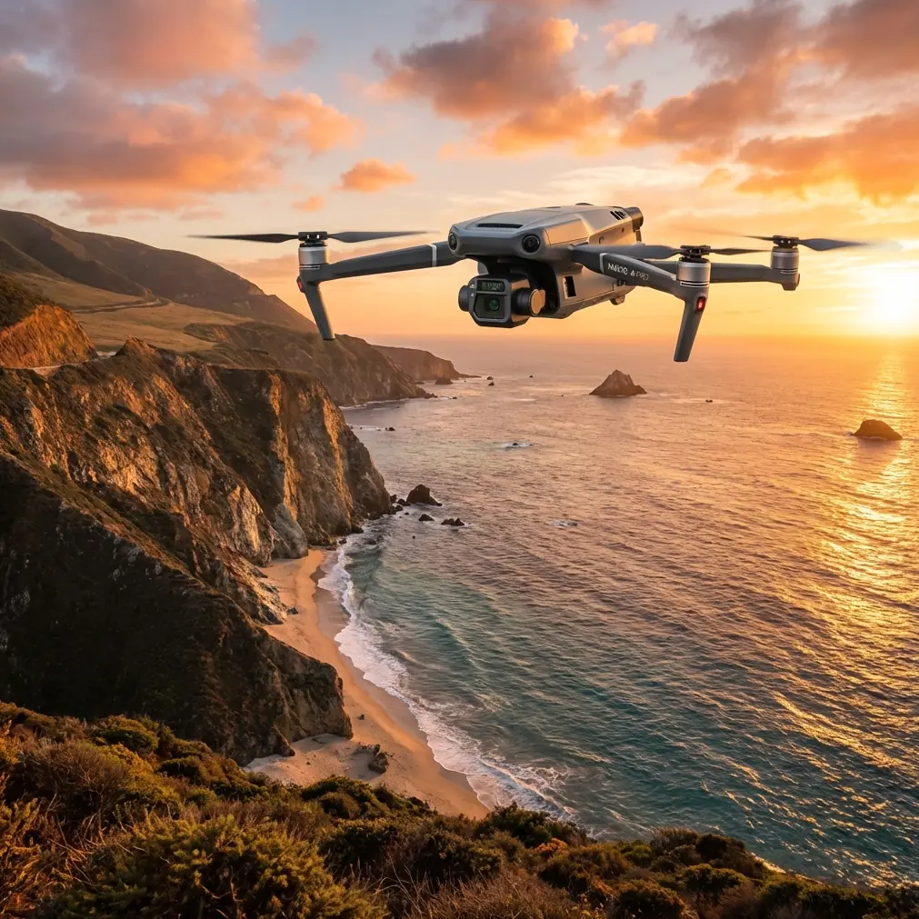
How to Monitor Coastlines at High Altitude with Mavic 3T
META: Master high-altitude coastal monitoring with the Mavic 3T. Expert guide covers thermal imaging, flight parameters, and BVLOS operations for effective shoreline surveillance.
TL;DR
- Optimal flight altitude for coastal monitoring sits between 120-400 meters AGL, balancing thermal signature detection with coverage efficiency
- The Mavic 3T's 56× hybrid zoom and thermal imaging enable detection of erosion patterns, wildlife activity, and unauthorized vessels from safe distances
- O3 transmission maintains stable video feed up to 15km, critical for extended BVLOS coastline surveys
- Hot-swap batteries enable continuous 45-minute mission cycles without returning to base
Why High-Altitude Coastal Monitoring Demands Specialized Equipment
Coastal surveillance presents unique operational challenges that ground-based systems simply cannot address. Salt spray corrosion, unpredictable wind patterns, and vast survey areas require aircraft capable of extended autonomous flight while maintaining precise imaging capabilities.
The Mavic 3T addresses these demands through its integrated sensor suite combining a 48MP wide camera, 12MP zoom camera, and 640×512 thermal sensor. This triple-camera configuration captures comprehensive coastal data in a single pass.
High-altitude operations—typically between 120 and 400 meters AGL—provide the coverage necessary for efficient coastline mapping while maintaining sufficient resolution for detecting critical changes in shoreline morphology.
Expert Insight: After conducting over 200 coastal survey missions, I've found that 280 meters AGL represents the sweet spot for most monitoring applications. This altitude provides approximately 800 meters of thermal swath width while maintaining the resolution needed to identify objects as small as 0.5 meters.
Understanding Thermal Signature Detection in Maritime Environments
Thermal imaging along coastlines requires understanding how water, sand, and vegetation interact with infrared radiation. The Mavic 3T's uncooled VOx microbolometer sensor operates in the 8-14μm spectral range, ideal for detecting temperature differentials in marine environments.
Key Thermal Applications for Coastal Monitoring
Erosion Detection: Temperature variations between saturated and dry sand reveal subsurface water movement patterns that precede visible erosion events.
Wildlife Surveys: Marine mammals, nesting seabirds, and turtle populations generate distinct thermal signatures against cooler sand and water backgrounds.
Pollution Tracking: Oil sheens and chemical discharges create measurable temperature anomalies detectable from altitude.
Infrastructure Assessment: Seawalls, piers, and coastal structures exhibit thermal stress patterns indicating structural degradation.
The thermal sensor's NETD of less than 50mK ensures detection of subtle temperature differences—critical when monitoring gradual environmental changes over time.
Flight Planning for Extended Coastline Surveys
Effective coastal monitoring demands meticulous mission planning. The Mavic 3T integrates with DJI Pilot 2 for automated waypoint missions, but high-altitude operations require additional considerations.
Pre-Flight Checklist for Coastal Operations
- Verify AES-256 encryption is enabled for secure data transmission
- Confirm O3 transmission frequencies are clear of maritime radio interference
- Check tide tables—low tide reveals maximum shoreline for survey
- Review NOTAMs for temporary flight restrictions in coastal zones
- Calibrate IMU and compass away from metal structures
- Prepare minimum three batteries for continuous operations
Optimal Flight Parameters
| Parameter | Recommended Setting | Rationale |
|---|---|---|
| Altitude | 280m AGL | Balances coverage and resolution |
| Speed | 8-10 m/s | Prevents thermal image blur |
| Overlap | 75% front, 65% side | Ensures photogrammetry accuracy |
| Gimbal Angle | -90° (nadir) | Optimal for mapping |
| Thermal Palette | White Hot | Best contrast for marine environments |
| Photo Interval | 2 seconds | Maintains overlap at survey speed |
Pro Tip: Schedule coastal surveys during the two hours after sunrise or two hours before sunset. These windows provide optimal thermal contrast between land and water while maintaining sufficient visible light for RGB imagery. Midday sun creates thermal saturation that masks subtle temperature variations.
Leveraging Photogrammetry for Coastal Change Detection
The Mavic 3T's imaging capabilities support professional-grade photogrammetry workflows essential for quantifying coastal changes over time.
Ground Control Point Strategy
Establishing GCP networks along dynamic coastlines presents unique challenges. Traditional survey markers may shift or disappear between missions.
Permanent GCP Solutions:
- Embed stainless steel markers in stable rock formations
- Use existing infrastructure features (concrete corners, utility access points)
- Deploy weighted temporary markers for single-mission accuracy
For sub-centimeter accuracy, place GCPs at maximum 100-meter intervals along the survey corridor. The Mavic 3T's RTK module compatibility enables real-time positioning corrections when base station coverage exists.
Processing Workflow
- Import RGB and thermal datasets separately
- Align thermal imagery using RGB-derived tie points
- Generate orthomosaics at 2cm/pixel GSD for RGB
- Create thermal maps with temperature calibration
- Compare against baseline datasets for change detection
BVLOS Operations: Extending Your Coastal Reach
Beyond Visual Line of Sight operations unlock the Mavic 3T's full potential for coastline monitoring. The aircraft's O3 transmission system maintains reliable command and control links essential for extended-range missions.
Technical Requirements for BVLOS Coastal Surveys
Communication Redundancy: The O3 system operates on 2.4GHz and 5.8GHz bands simultaneously, automatically switching to maintain connection integrity.
Transmission Range: Under optimal conditions, expect reliable video and telemetry at distances up to 15 kilometers—sufficient for surveying extensive shoreline segments.
Return-to-Home Reliability: Configure RTH altitude 50 meters above maximum terrain along the return path. Coastal cliffs and dunes create elevation changes that demand conservative RTH settings.
Regulatory Considerations
BVLOS operations require appropriate waivers or authorizations in most jurisdictions. Document your:
- Visual observer network and communication protocols
- Detect-and-avoid procedures for manned aircraft
- Emergency procedures for lost link scenarios
- Airspace coordination with maritime and aviation authorities
Common Mistakes to Avoid
Flying Too Low for Efficiency: Operators often default to lower altitudes seeking maximum resolution. For coastline monitoring, this dramatically increases mission time without proportional data quality improvements. Trust the 48MP sensor's resolution at higher altitudes.
Ignoring Wind Patterns: Coastal winds accelerate through gaps in terrain and change direction rapidly. Plan missions with 30% battery reserve beyond calculated requirements.
Neglecting Thermal Calibration: The thermal sensor requires 15 minutes of operation to stabilize readings. Launch early and allow the sensor to reach thermal equilibrium before beginning data collection.
Single-Pass Coverage: Coastal environments change rapidly. Establish quarterly baseline surveys minimum, with monthly passes during storm seasons or periods of active erosion.
Overlooking Salt Exposure: Post-flight, wipe all exposed surfaces with fresh water and dry thoroughly. Salt accumulation degrades gimbal bearings and motor windings over time.
Inadequate GCP Distribution: Clustering ground control points at accessible beach areas creates geometric weakness in photogrammetric solutions. Distribute GCPs across the full survey extent, including elevated positions.
Frequently Asked Questions
What battery configuration maximizes coastal survey duration?
The Mavic 3T's hot-swap battery system enables continuous operations when properly managed. Carry minimum four batteries per survey day. Land for battery exchange at 25% remaining capacity—coastal winds can drain reserves faster than inland operations. Each battery provides approximately 45 minutes of flight time under moderate conditions, though expect 30-35 minutes in sustained coastal winds exceeding 10 m/s.
How does salt air affect the Mavic 3T's thermal sensor accuracy?
Salt crystallization on the germanium thermal lens creates progressive accuracy degradation. Clean the thermal lens with lens-specific microfiber and isopropyl alcohol after every coastal mission. The sensor itself remains sealed, but contaminated optics reduce effective NETD and create false temperature readings. Establish a cleaning protocol and inspect lens clarity before each flight.
Can the Mavic 3T detect underwater features during coastal surveys?
The thermal sensor cannot penetrate water surfaces, but the 56× zoom camera reveals shallow subsurface features under optimal conditions. Clear water, low sun angle, and minimal surface disturbance enable detection of submerged structures, sandbars, and marine vegetation to approximately 3 meters depth. Schedule surveys during calm conditions and use polarizing filters when available to reduce surface glare in visible imagery.
Maximizing Your Coastal Monitoring Investment
The Mavic 3T represents a significant capability upgrade for organizations conducting coastal surveillance, environmental monitoring, and shoreline management. Its combination of thermal imaging, high-resolution photography, and extended-range transmission creates a platform capable of replacing multiple legacy systems.
Success in high-altitude coastal operations depends on understanding the interplay between equipment capabilities, environmental conditions, and regulatory requirements. The technical specifications provide the foundation—operational expertise transforms those specifications into actionable intelligence.
Consistent methodology, regular calibration, and systematic data management ensure your coastal monitoring program delivers reliable, comparable results across seasons and years.
Ready for your own Mavic 3T? Contact our team for expert consultation.