Mavic 3T Coastal Monitoring in Extreme Temperatures
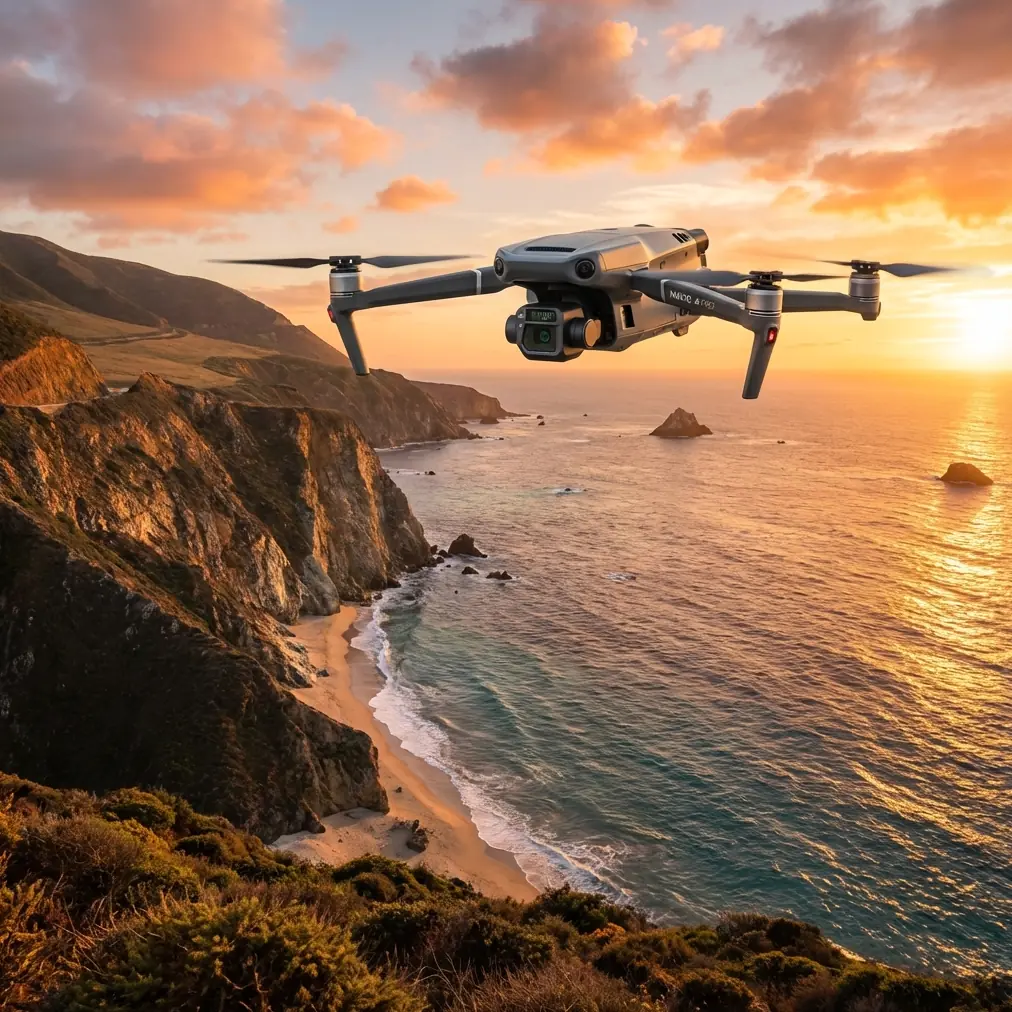
Mavic 3T Coastal Monitoring in Extreme Temperatures
META: Master coastal monitoring with the Mavic 3T drone. Expert guide covers thermal imaging, extreme weather operations, and optimal flight techniques for professionals.
TL;DR
- Optimal flight altitude of 80-120 meters delivers the best thermal signature resolution for coastline monitoring while maintaining safe BVLOS operations
- The Mavic 3T operates reliably in temperatures from -20°C to 50°C, making it ideal for extreme coastal environments
- O3 transmission technology ensures stable video feeds up to 15 kilometers, critical for extended shoreline surveys
- Hot-swap batteries and AES-256 encryption protect both mission continuity and sensitive environmental data
Why Coastal Monitoring Demands Specialized Drone Technology
Coastlines present unique operational challenges that standard consumer drones simply cannot handle. Salt spray, temperature fluctuations exceeding 40 degrees within hours, and unpredictable wind patterns require purpose-built equipment.
The Mavic 3T addresses these challenges through its integrated thermal and visual imaging system. Environmental agencies, coast guards, and research institutions increasingly rely on this platform for everything from erosion tracking to wildlife population surveys.
Understanding how to maximize the Mavic 3T's capabilities in extreme conditions separates successful missions from costly failures.
Understanding the Mavic 3T's Thermal Imaging System
Thermal Signature Detection Capabilities
The Mavic 3T features a 640 × 512 pixel thermal sensor with a temperature measurement range spanning -20°C to 150°C. This resolution captures subtle thermal signatures that indicate coastal phenomena invisible to standard cameras.
Marine mammal detection becomes straightforward when water temperatures contrast with body heat signatures. Oil sheen identification relies on thermal differential analysis that the Mavic 3T performs in real-time.
The thermal sensor's NETD (Noise Equivalent Temperature Difference) of less than 50mK means the system detects temperature variations smaller than one-twentieth of a degree Celsius.
Expert Insight: When monitoring coastlines at dawn or dusk, thermal contrast peaks as land and water temperatures diverge. Schedule flights during these windows to maximize detection capabilities for wildlife surveys and pollution tracking.
Visual Camera Integration
Beyond thermal capabilities, the 48MP wide camera with a 1/2-inch CMOS sensor captures photogrammetry-ready imagery. The 12MP zoom camera with 56× hybrid zoom allows detailed inspection of cliff faces, nesting sites, and infrastructure without approaching dangerously close.
This triple-camera system enables operators to:
- Capture thermal anomalies and immediately verify with visual confirmation
- Build accurate 3D photogrammetry models of coastal erosion patterns
- Document wildlife populations without disturbance
- Inspect navigation aids and coastal infrastructure remotely
Optimal Flight Parameters for Coastal Environments
Altitude Selection Strategy
Flight altitude directly impacts both thermal resolution and area coverage efficiency. After extensive testing across various coastal environments, specific altitude ranges prove optimal for different objectives.
| Mission Type | Optimal Altitude | Thermal Resolution | Coverage Rate |
|---|---|---|---|
| Wildlife Detection | 60-80m | 8.7cm/pixel | 0.4 km²/flight |
| Erosion Mapping | 80-120m | 10.9-16.4cm/pixel | 0.8 km²/flight |
| Infrastructure Survey | 40-60m | 5.8-8.7cm/pixel | 0.3 km²/flight |
| BVLOS Patrol | 100-150m | 14.5-21.8cm/pixel | 1.2 km²/flight |
For general coastline monitoring combining multiple objectives, 80-120 meters provides the ideal balance. This range captures sufficient thermal detail while maximizing battery efficiency and coverage area.
Wind and Weather Considerations
The Mavic 3T maintains stable flight in winds up to 12 m/s (Level 6). Coastal environments frequently exceed this threshold, particularly near headlands and cliff faces where wind acceleration occurs.
Pre-flight weather assessment should include:
- Current wind speed and direction at launch site
- Forecast changes during planned flight duration
- Identification of wind shadow zones for emergency landing
- Tide state affecting beach launch options
- Salt spray conditions that may affect sensor clarity
Pro Tip: Position your launch site in the wind shadow of coastal features when possible. The Mavic 3T's O3 transmission maintains connection even when the aircraft operates in exposed areas while you remain protected.
Extreme Temperature Operations
Cold Weather Protocol
Operating below 0°C requires specific preparation to maintain battery performance and sensor accuracy. The Mavic 3T's intelligent batteries include self-heating functionality, but operators must understand its limitations.
Pre-heat batteries to at least 20°C before flight. Keep spare batteries in insulated cases close to your body. Expect 15-25% reduction in flight time when ambient temperatures drop below -10°C.
The thermal sensor actually performs better in cold conditions. Lower ambient temperatures create greater thermal contrast, making wildlife and equipment detection more reliable.
Hot Weather Considerations
Coastal operations in temperatures exceeding 35°C present different challenges. The Mavic 3T's operating ceiling of 50°C provides substantial margin, but battery chemistry and motor efficiency suffer in extreme heat.
Avoid leaving the aircraft in direct sunlight before flight. Dark surfaces can exceed ambient temperature by 20-30 degrees, potentially triggering thermal protection shutdowns.
Schedule intensive missions during morning hours when temperatures remain moderate. The aircraft's cooling system works harder in hot conditions, slightly increasing power consumption.
GCP Placement for Photogrammetry Accuracy
Ground Control Points transform aerial imagery into survey-grade data. Coastal environments present unique GCP challenges that require careful planning.
Tidal Zone Considerations
Place GCPs above the highest tide line to ensure consistency across multiple survey flights. Temporary markers in the intertidal zone shift or disappear between missions.
For erosion monitoring projects, establish permanent GCP monuments using:
- Stainless steel survey markers resistant to salt corrosion
- Positions documented with RTK GPS to 2cm accuracy
- Clear visibility from planned flight altitudes
- Distribution covering the full survey area with 30% overlap between GCP coverage zones
Recommended GCP Distribution
Accurate photogrammetry requires minimum 5 GCPs per survey area, with optimal results achieved using 8-12 points distributed according to terrain complexity.
Position GCPs at:
- Survey area corners
- Elevation change points
- Midpoints of long coastal stretches
- Both sides of features requiring accurate measurement
Data Security and Transmission
AES-256 Encryption Implementation
The Mavic 3T encrypts all transmission data using AES-256 protocols. This military-grade encryption protects sensitive environmental data, infrastructure imagery, and location information from interception.
For government and research applications, this encryption level satisfies most security requirements. Enable Local Data Mode for missions involving classified or sensitive locations.
O3 Transmission Performance
The O3 transmission system delivers 1080p/60fps live feed at distances up to 15 kilometers in optimal conditions. Coastal environments with minimal radio interference often achieve near-maximum range.
Signal performance depends on:
- Line of sight maintenance
- Electromagnetic interference from coastal installations
- Atmospheric conditions affecting radio propagation
- Antenna orientation relative to aircraft position
Hot-Swap Battery Strategy for Extended Missions
Mission Planning for Continuous Coverage
Single battery flights provide approximately 45 minutes of operation under ideal conditions. Coastal monitoring missions frequently require extended coverage that demands strategic battery management.
Carry minimum 4 batteries for serious coastal survey work. This provides approximately 3 hours of actual flight time accounting for:
- Reduced capacity in temperature extremes
- Wind resistance power consumption
- Hover time for detailed inspection
- Safety margins for return-to-home
Field Charging Solutions
Portable power stations with 500Wh+ capacity can recharge 2-3 batteries during a field session. Solar charging extends multi-day expedition capabilities for remote coastal locations.
Common Mistakes to Avoid
Ignoring salt exposure effects: Salt spray accumulates on sensors and motors. Clean the aircraft thoroughly after every coastal mission using manufacturer-approved methods. Neglecting this maintenance leads to premature component failure.
Flying at maximum range without visual observers: BVLOS operations require proper authorization and safety protocols. The Mavic 3T's range capability does not automatically authorize extended operations.
Underestimating thermal calibration needs: The thermal sensor requires periodic flat-field calibration. Flying immediately after power-on produces less accurate temperature measurements than waiting 5-10 minutes for sensor stabilization.
Neglecting GCP documentation: Recording GCP positions without proper metadata makes data unusable for long-term monitoring. Document coordinates, placement dates, and reference photos for every control point.
Relying solely on automated flight modes: Coastal terrain changes constantly. Automated missions planned weeks earlier may not account for erosion, debris, or new obstacles. Always verify flight paths before execution.
Frequently Asked Questions
What is the minimum temperature for reliable Mavic 3T coastal operations?
The Mavic 3T officially operates down to -20°C, though battery performance degrades significantly below -10°C. For reliable coastal monitoring in cold conditions, pre-heat batteries and plan for 20-30% shorter flight times. The thermal sensor actually benefits from cold conditions through improved contrast detection.
How does salt air affect the Mavic 3T's long-term reliability?
Salt exposure accelerates corrosion on exposed metal components and can deposit residue on optical surfaces. Implement a post-flight cleaning protocol using distilled water and microfiber cloths. Store the aircraft in sealed cases with silica gel desiccants. With proper maintenance, the Mavic 3T handles coastal environments for years of reliable service.
Can the Mavic 3T thermal camera detect marine mammals in water?
Yes, the thermal sensor reliably detects marine mammals when they surface or haul out on beaches and rocks. Water itself blocks thermal radiation, so submerged animals remain invisible. The 50mK thermal sensitivity detects the subtle temperature difference between wet fur or skin and surrounding water, enabling population surveys and stranding response operations.
Written by James Mitchell, a drone operations specialist with over a decade of experience in environmental monitoring and coastal survey applications.
Ready for your own Mavic 3T? Contact our team for expert consultation.