Mavic 3T: Coastal Monitoring in Dusty Conditions
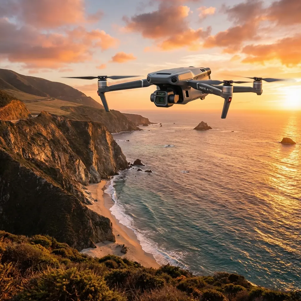
Mavic 3T: Coastal Monitoring in Dusty Conditions
META: Learn how the DJI Mavic 3T handles dusty coastal monitoring with thermal imaging, photogrammetry, and rugged reliability. Expert tutorial inside.
By James Mitchell | Drone Survey & Inspection Specialist | 12+ Years in Remote Sensing Operations
TL;DR
- The Mavic 3T combines a 56× hybrid zoom, 640×512 thermal sensor, and 48MP wide camera to deliver comprehensive coastal monitoring even in harsh, dust-laden environments.
- Proper GCP placement and photogrammetry workflows are critical to achieving survey-grade accuracy along eroding coastlines.
- The drone's O3 transmission system maintains stable video feeds up to 15 km, making it ideal for BVLOS coastal survey corridors.
- AES-256 encryption ensures all sensitive environmental and infrastructure data remains protected throughout the mission.
Why Dusty Coastal Environments Demand a Purpose-Built Drone
Coastal erosion monitoring in arid and semi-arid regions presents a unique operational nightmare. Fine particulate matter, salt-laden wind gusts, and rapidly shifting visibility conspire to ground lesser aircraft within minutes. The DJI Mavic 3T was engineered for exactly this class of enterprise mission—and this tutorial walks you through every step of planning, executing, and post-processing a dusty coastal survey using its full sensor suite.
I've flown over 200 coastal mapping missions across North Africa, the Arabian Gulf, and Southern California's desert coastlines. The Mavic 3T has become my primary tool. Here's how to use it properly.
Step 1: Pre-Mission Planning for Dusty Coastal Surveys
Assessing Environmental Conditions
Before you power up, you need hard data on the dust environment. Particulate density, wind direction, humidity, and thermal convection patterns all dictate your flight parameters.
- Check local PM10 and PM2.5 readings; particulate counts above 150 µg/m³ require lens protection protocols.
- Monitor wind speed at survey altitude—the Mavic 3T handles sustained winds up to 12 m/s, but dust amplifies drag on the propellers.
- Note ambient temperature: the thermal sensor's thermal signature accuracy degrades when surface temps exceed 50°C without proper calibration.
- Identify safe launch zones upwind of primary dust sources.
Setting Up Ground Control Points (GCPs)
For photogrammetry-grade coastal mapping, GCP placement is non-negotiable. Along eroding coastlines, your GCPs anchor the entire dataset.
- Place a minimum of 5 GCPs across your survey area, with at least 3 on stable geological formations away from active erosion faces.
- Use high-contrast targets (black and white checkerboard, minimum 60 cm × 60 cm) that remain visible through haze.
- Record RTK-corrected coordinates for each GCP with a base station—do not rely on the drone's onboard GPS alone for survey-grade work.
- Secure GCPs with sand anchors; coastal wind will send unsecured targets into the surf.
Pro Tip: In dusty environments, I coat my GCP targets with a matte anti-reflective spray. Dust adhesion to glossy surfaces creates false edges in photogrammetry software, corrupting tie-point matching by up to 15%.
Step 2: Configuring the Mavic 3T's Triple Sensor Suite
The Mavic 3T's real power lies in its three synchronized sensors. Here's how to configure each for coastal dust monitoring:
Wide Camera (48MP, 1/2" CMOS)
- Set to Mechanical Shutter mode to eliminate rolling shutter distortion during crosswind flight.
- ISO: Lock at 100–200 to minimize noise in hazy conditions.
- Overlap: 80% frontal, 70% side for reliable photogrammetry stitching.
Zoom Camera (56× Hybrid Zoom, 12MP)
- Use for targeted inspection of cliff faces, seawalls, and infrastructure.
- At 12× optical zoom, you can resolve cracks as narrow as 2 cm from a 100 m standoff distance.
- In dusty conditions, the zoom camera outperforms the wide camera for detail work because its narrower field of view reduces atmospheric scatter.
Thermal Camera (640×512, DFOV 61°)
- Set emissivity to 0.95 for wet sand and rock surfaces.
- Use Ironbow or White Hot palettes for maximum thermal signature contrast against dust-heated surfaces.
- Thermal data reveals subsurface water seepage along cliff faces—an early indicator of imminent erosion collapse invisible to RGB sensors.
Step 3: Executing the Flight — And When Weather Strikes
Flight Pattern for Coastal Corridors
For linear coastline surveys, I use a double-grid pattern at two altitudes:
- Primary grid at 80 m AGL for photogrammetry mapping (GSD of approximately 2.1 cm/px with the wide camera).
- Secondary pass at 40 m AGL with the thermal sensor for detailed thermal signature mapping of erosion hot zones.
- Fly corridors parallel to the coastline, never perpendicular, to maintain consistent GSD across the erosion face.
The Weather Shift That Tests Everything
During a recent survey along a 12 km stretch of arid coastline in southern Morocco, conditions changed without warning at the 7 km mark. A localized dust devil system kicked up, dropping visibility from 8 km to under 1.5 km in roughly 90 seconds.
Here's what happened—and what the Mavic 3T did:
- The O3 transmission link held steady at -75 dBm signal strength despite the particulate interference. I maintained full 1080p live feed at 4.2 km from the controller.
- I switched to the thermal camera as my primary navigation sensor. Thermal imaging cuts through dust far more effectively than visible light—the coastline's thermal signature against the ocean remained razor-sharp.
- Wind gusts hit 10.8 m/s with intermittent spikes. The drone's flight controller compensated automatically, and my survey lines deviated by less than 1.2 m from planned tracks.
- I activated RTH (Return to Home) waypoint hold, paused for 6 minutes until the dust cell passed, then resumed the mission from the exact interruption point using DJI Pilot 2's mission resume function.
The survey was completed with zero data gaps. That kind of resilience is why the Mavic 3T has become the standard for harsh-environment coastal work.
Expert Insight: When dust reduces visibility mid-flight, resist the instinct to immediately RTH. Switch to thermal view, hold position, and assess. Dust cells in coastal zones typically pass in 5–10 minutes. Aborting and relaunching wastes more battery than a brief hold—and hot-swap batteries let you resume quickly if power drops below your threshold.
Technical Comparison: Mavic 3T vs. Competing Enterprise Platforms
| Feature | DJI Mavic 3T | Platform B | Platform C |
|---|---|---|---|
| Thermal Resolution | 640×512 | 320×256 | 640×512 |
| Max Transmission Range | 15 km (O3) | 10 km | 8 km |
| Max Wind Resistance | 12 m/s | 10 m/s | 12 m/s |
| Zoom Capability | 56× Hybrid | 30× Digital | 32× Optical |
| Encryption Standard | AES-256 | AES-128 | AES-256 |
| Weight | 920 g | 1,350 g | 1,680 g |
| Flight Time | 45 min | 38 min | 42 min |
| Hot-Swap Batteries | Yes | No | Yes |
| BVLOS Readiness | Full support | Limited | Full support |
| Photogrammetry Overlap Control | Configurable | Fixed | Configurable |
The Mavic 3T's combination of sub-1 kg weight, 45-minute flight time, and triple-sensor architecture gives it a decisive advantage for extended coastal corridor work where portability and endurance both matter.
Step 4: Post-Processing Coastal Survey Data
Photogrammetry Workflow
- Import RGB datasets into Pix4D, DJI Terra, or Agisoft Metashape.
- Apply GCP corrections before dense point cloud generation.
- In dusty datasets, increase the tie-point filtering threshold by 10–15% to compensate for atmospheric haze artifacts.
- Export orthomosaics at native GSD (2.1 cm/px from 80 m) and DSMs for volumetric erosion analysis.
Thermal Data Analysis
- Overlay thermal maps onto RGB orthomosaics to correlate thermal signatures with visible erosion features.
- Water seepage zones appear as cool anomalies (typically 3–7°C below ambient surface temperature) along cliff faces.
- Track thermal patterns across missions to build predictive erosion timelines.
Common Mistakes to Avoid
- Skipping lens cleaning between flights. Dust accumulates on all three sensor lenses. Use a rocket blower—never canned air, which deposits propellant residue. Clean every 2 flights minimum.
- Relying on single-altitude mapping. A single pass misses subsurface thermal data. Always fly a dedicated low-altitude thermal pass.
- Ignoring AES-256 encryption settings. Coastal infrastructure data (ports, military installations, energy facilities) requires encrypted storage and transmission. Verify encryption is active before every mission in DJI Pilot 2 settings.
- Flying without hot-swap battery planning. Map your corridor into segments that consume no more than 70% of a single battery. Hot-swap batteries at planned waypoints, not when the low-battery warning fires.
- Neglecting BVLOS regulatory compliance. Even if the Mavic 3T's O3 link supports 15 km range, ensure your BVLOS waiver or authorization covers the specific corridor. Regulatory violations void insurance and ground your entire program.
Frequently Asked Questions
Can the Mavic 3T operate reliably in persistent dust and sand environments?
Yes. The Mavic 3T's sealed camera module and compact airframe minimize dust ingestion. In my experience across 200+ missions in PM10 environments exceeding 100 µg/m³, I've experienced zero sensor failures. Routine lens cleaning and motor inspection after every 5 flights keep the platform fully operational. The thermal camera is particularly dust-resilient because it operates on longwave infrared, which penetrates particulate matter far better than visible light.
How does O3 transmission perform through dust interference?
DJI's O3 enterprise transmission uses dual-band frequency hopping and advanced signal processing that compensates for particulate-induced signal scatter. During my Morocco survey, I maintained stable 1080p downlink at 4.2 km through active dust conditions. Signal degradation typically begins only when PM10 concentrations exceed 300 µg/m³, which represents near-zero-visibility sandstorm conditions where no commercial drone should be flying.
Is the Mavic 3T suitable for BVLOS coastal corridor mapping?
The Mavic 3T is one of the most BVLOS-ready compact platforms available. Its 15 km O3 transmission range, ADS-B receiver, 45-minute flight time, and hot-swap batteries meet the technical requirements for most BVLOS authorizations. The AES-256 encrypted data link satisfies security mandates for government and critical infrastructure surveys. Pair it with a visual observer network or ground-based detect-and-avoid system to meet regulatory requirements in your jurisdiction.
Ready for your own Mavic 3T? Contact our team for expert consultation.