Mavic 3T on Windy Coastlines: A Field-Tested Case Study
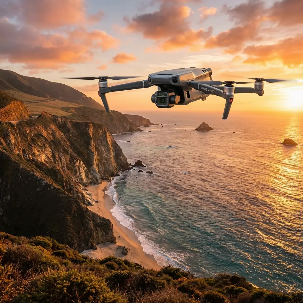
Mavic 3T on Windy Coastlines: A Field-Tested Case Study for Reliable Thermal and Visual Monitoring
META: Expert case study on using the DJI Mavic 3T for windy coastline monitoring, covering thermal signatures, O3 transmission, battery strategy, mapping workflow, and field reliability.
Coastline work exposes every weakness in a drone program.
Salt haze softens contrast. Wind stacks up over cliffs and sea walls. Sand gets into everything. Sun angle changes fast, and what looks obvious to the naked eye can disappear in glare the moment the aircraft turns seaward. That is exactly why the Mavic 3T keeps showing up in coastal monitoring conversations. Not because it is a general-purpose aircraft with a thermal camera bolted on, but because its sensor mix, flight endurance, and deployment speed line up unusually well with shoreline inspection, erosion checks, habitat observation, and infrastructure review.
I have seen this firsthand in windy coastal operations where teams needed to monitor revetments, breakwaters, drainage outlets, rockfall zones, and vegetation stress across a long stretch of shoreline without dragging a heavy airframe through shifting weather windows. The Mavic 3T is not the answer to every coastal job. It is, however, one of the most practical tools for the many coastal jobs that demand fast setup, repeatable imaging, and a clean handoff between visible and thermal data.
This is the story that matters for real operators: not a feature parade, but how the aircraft behaves when the sea breeze starts pushing harder than the morning forecast suggested.
Why the Mavic 3T fits coastline monitoring so well
The core strength of the Mavic 3T is that it compresses multiple survey and inspection tasks into one deployable platform. You can move from a visual condition check to thermal anomaly detection without changing aircraft. For shoreline teams, that matters more than most spec sheets admit.
On a typical coastal mission, the visible camera gives you the broad situational layer. You use it to document surface condition, shoreline movement, debris accumulation, wave overtopping marks, access routes, and structural context. The thermal camera does something different. It reveals temperature separation that can indicate seepage, moisture concentration, blocked drainage behavior, subsurface water pathways, or stressed materials that are not obvious in RGB imagery alone.
That dual view becomes especially useful around low light, overcast, and partial glare conditions. Coastal environments are full of false negatives in standard imagery. Wet surfaces reflect. Foam patterns distract. Uniform sand tones hide detail. A thermal signature can cut through that visual noise when used correctly.
The operational significance is straightforward: one aircraft can tell you both what the coastline looks like and how it is behaving.
The coastal wind problem is not just about flying
People often frame windy shoreline missions as a pure stability issue. Can the aircraft hold position? Can it return safely? Those are basic questions, but they miss the deeper operational challenge. Wind changes the quality of your data.
A gusty crosswind affects image overlap, motion consistency, and the pilot’s ability to maintain a predictable survey line. Over water, the visual environment can become deceptively flat. Near cliffs or embankments, air can tumble and shift in ways that make a neat mission plan look messy in practice. On the Mavic 3T, this is where workflow discipline matters as much as aircraft capability.
For coastline monitoring, I prefer to split the mission into two layers rather than force one flight to do everything. First, capture the broad site awareness pass. Second, run targeted thermal and zoom-based inspection lines on suspect areas. That sounds simple, but in wind it preserves battery, protects image quality, and reduces the temptation to overstay in degrading conditions.
The Mavic 3T helps here because it is fast to launch and does not demand a large support footprint. When the weather window opens, speed matters.
O3 transmission matters more along the shore than inland crews expect
One detail that deserves more attention in coastal operations is O3 transmission. In an inland industrial site, signal planning is usually about structures, steel interference, and line-of-sight interruptions from terrain. Along a coastline, the challenge shifts. You may be flying parallel to bluffs, around protruding formations, or near infrastructure that creates awkward angles between pilot position and aircraft route.
A robust transmission link is not just a convenience in that setting. It directly affects mission continuity and pilot workload. O3 transmission gives operators a more dependable live view and command link during shoreline runs, especially when they need to hold clean visual framing while tracking irregular coastal assets. That means fewer unnecessary pauses, less repositioning of the ground crew, and better confidence in completing a repeatable corridor flight before conditions change.
For teams building long-term monitoring records, repeatability is the currency that matters. If your signal quality keeps forcing ad hoc path changes, your comparison data gets weaker. The Mavic 3T’s transmission system helps stabilize that piece of the puzzle.
Thermal signatures on the coast: what actually works
Thermal work at the coast rewards discipline and punishes assumptions.
You cannot simply launch at noon on a clear day and expect thermal imagery to tell the truth. Shoreline materials absorb and release heat at different rates. Rock armor, wet sand, concrete steps, vegetation, tidal pools, and drainage outfalls all behave differently. If you do not understand the timing, you risk reading environmental heat noise as a meaningful anomaly.
The Mavic 3T becomes valuable when operators treat thermal as a comparative layer, not a magic detector. On one erosion-monitoring assignment, the useful result did not come from spotting a dramatic hot zone. It came from identifying a subtle temperature contrast along a drainage path behind a retaining section. In visible imagery, the surface looked unremarkable. In thermal, the pattern suggested persistent moisture movement. That prompted a closer ground check and changed the maintenance priority.
This is where the phrase thermal signature earns its keep. You are not chasing pretty heat maps. You are interpreting patterns tied to materials, moisture, and timing.
For coastal crews, early morning and late afternoon often produce more honest thermal separation than the bright middle of the day. Conditions vary, but the principle holds: plan for thermal readability, not just flight convenience.
A battery management habit that saves missions
Here is the field tip I wish more teams adopted.
Do not think of Mavic 3T batteries as a simple percentage number in windy coastal work. Think in “return confidence bands.” On paper, you might feel comfortable pressing further down a shoreline segment. In reality, a headwind on the return leg can turn a healthy outbound profile into a nervous recovery.
My own rule on exposed coastlines is to assign one battery for one core objective, not one battery for one maximum-duration flight. If Flight 1 is for the western breakwater thermal pass, that battery belongs to that task. Once the objective is complete, bring the aircraft back, review the data, swap packs, and relaunch only if the next objective still makes sense. This sounds conservative. It is actually efficient, because it avoids the classic mistake of trying to “add just one more section” and coming home with compromised imagery and a battery curve you do not trust.
The Mavic 3 series ecosystem is well suited to disciplined battery cycling, and teams that organize their charging routine around fast turnarounds can keep the aircraft productive without creating pressure to stretch flights. The practical lesson is simple: in wind, battery management is mission design.
A related habit matters too. Keep batteries sheltered from direct coastal exposure before installation. Salt air and blowing sand create subtle handling problems on a busy shoreline staging point. Clean process beats rushed process every time.
Mapping, photogrammetry, and where the Mavic 3T fits
The Mavic 3T is often discussed as an inspection platform first, but there is real value in how it contributes to mapping-driven coastline projects. It is not just about taking pictures of a sea wall. It is about building evidence over time.
When teams use photogrammetry to document shoreline movement, erosion progression, drainage changes, or structural settlement, consistency becomes the deciding factor. If your capture geometry shifts wildly between missions, your comparison model loses authority. That is why GCP deployment still matters even with an aircraft that makes acquisition easier. Ground control points help anchor the model to real-world coordinates and reduce ambiguity when you are trying to quantify change instead of merely illustrate it.
This is operationally significant for coastal engineering, environmental monitoring, and asset management. A visual inspection can tell you something looks different. A controlled photogrammetry workflow, reinforced with GCPs, can help show how different and where.
The Mavic 3T’s advantage is that the same field team can collect mapping-support imagery and then transition into targeted thermal checks on the same visit. That shrinks the gap between “we mapped it” and “we investigated the anomaly.”
Data security is not a side issue
Coastal monitoring projects often involve more than scenery. They may include ports, utilities, public infrastructure, private industrial assets, or environmentally sensitive zones. That makes data handling part of the mission, not an afterthought.
AES-256 support matters because many organizations need stronger confidence in how flight data and transmitted information are protected. If you are working under client governance requirements or internal compliance rules, secure handling is part of whether the aircraft is operationally acceptable at all. In plain terms, the drone can only be useful if the data pipeline is usable inside the client’s real-world risk framework.
That point gets overlooked too often in field discussions. The best drone for a coastline contract is not merely the one that flies well. It is the one that fits the technical, environmental, and data-control realities of the work.
What the Mavic 3T is not
It is worth drawing a clean line here. The Mavic 3T is not a substitute for every long-corridor coastal workflow. If your mission genuinely requires extensive BVLOS operations over very large linear assets, you are in a different planning category involving airspace, approvals, detect-and-avoid strategy, and platform selection that may extend beyond what a compact system is meant to handle. The Mavic 3T excels when the job benefits from agile deployment, targeted repeat missions, and rich short-to-medium range data collection.
That distinction matters because good operators choose platforms based on the job architecture, not brand enthusiasm.
A practical shoreline workflow
For teams building a repeatable coastline program around the Mavic 3T, this sequence works well:
Start with a short site read before launch. Watch flag movement, wave direction, and cliff-edge gust behavior for a few minutes rather than trusting the app alone.
Run the first flight as a visual reconnaissance pass. Confirm access points, note reflected glare zones, and identify sectors where thermal might be distorted by sun exposure.
Land, review, then launch the second flight for thermal targets only. Do not dilute that mission with broad scenic coverage.
If the site also needs mapping outputs, plan those lines separately and support them with GCPs where accuracy matters.
Log wind behavior by sector, not just by day. One cove may fly clean while the next section gets hammered by crossflow.
That last point sounds minor. It is not. Shorelines create micro-environments, and those patterns are often more valuable on the second visit than the first.
If your team is refining a real coastal workflow and wants to compare mission planning notes with an operator who has seen these conditions up close, this direct field contact can help: message an M3T specialist here.
The bigger takeaway
The Mavic 3T earns its place on windy coastline jobs because it reduces friction where field operations usually break down. It carries visual and thermal capability in one small airframe. It gives pilots a dependable O3 link for awkward shoreline geometry. It supports secure data handling with AES-256. It can contribute to photogrammetry workflows when paired with disciplined planning and GCP control. Most of all, it lets teams move fast when the weather grants a narrow opening.
That is what makes it useful.
Not hype. Not brochure logic. Just a platform that aligns with the tempo and unpredictability of real coastal monitoring. When erosion, drainage behavior, structural wear, and environmental change need to be documented before conditions turn again, the Mavic 3T is often exactly the right amount of aircraft.
Ready for your own Mavic 3T? Contact our team for expert consultation.