Mavic 3T Guide for Urban Coastline Monitoring
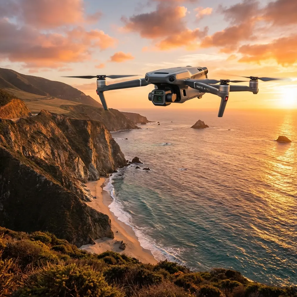
Mavic 3T Guide for Urban Coastline Monitoring: What Actually Matters in the Field
META: A practical Mavic 3T tutorial for urban coastline monitoring, covering thermal workflows, O3 transmission, photogrammetry limits, AES-256 security, battery strategy, and why stable control matters near complex waterfront environments.
Urban coastlines look simple on a map. In practice, they are messy systems. You are dealing with seawalls, marinas, ferry wakes, drainage outlets, rooftops, heat-retaining concrete, reflective water, gusts rolling between towers, and public infrastructure that cannot be inspected casually. That is exactly why the Mavic 3T has become such a useful aircraft for this kind of work.
Not because it does everything.
Because it solves a very specific problem set better than many competing compact platforms: it lets one team collect visible and thermal evidence quickly, safely, and with enough stability to make decisions before site conditions change.
This guide is built around urban coastline monitoring, not generic drone theory. If your work involves shoreline asset checks, outfall monitoring, roof-to-water interface inspections, construction edge documentation, vegetation stress near seawalls, or rapid thermal anomaly detection around waterfront utilities, the Mavic 3T fits a very particular operational niche.
Why the Mavic 3T suits coastal city work
Urban waterfront operations punish weak aircraft behavior. The problem is not only wind. It is disturbance.
A drone moving along a mixed shoreline is constantly exposed to small changes in airflow, surface temperature, signal environment, and visual contrast. Water absorbs detail. Glass throws glare. Concrete stores heat. Piers create geometric clutter. A mission that looks straightforward from the office can become unstable if the aircraft or sensor workflow is not disciplined.
This is where the Mavic 3T stands out against many smaller thermal drones. It combines a thermal payload with a strong flight stack, long enough endurance for practical sector-based inspections, and a transmission system that remains usable in difficult urban RF conditions. The O3 transmission link matters more on coastlines than many operators admit. Along waterfront districts, the pilot is often wedged between buildings, roads, cranes, and vessel traffic. A clean, resilient feed is not a luxury. It is how you maintain inspection quality while keeping the mission controlled.
Competitor platforms can offer thermal views too, but they often force a compromise somewhere else: weaker endurance, less confidence in transmission continuity, or more limited integration between thermal observation and routine site documentation. The Mavic 3T is compelling because it compresses several roles into one deployment package.
The first mistake: treating coastline monitoring as just a camera job
A lot of teams start with imagery and only later realize the real issue is control quality.
That sounds abstract until you think about what older aircraft design literature spent so much effort modeling. In one reference set, the helicopter design handbook breaks stability into linearized small-disturbance equations, with separate treatment for roll moment, yaw moment, and coupled lateral-directional behavior. The source explicitly isolates roll moment equations and yaw moment equations, then extends into small-disturbance linearization for flight behavior. Those equations are not there for academic decoration. They exist because slight disturbances compound quickly if the aircraft does not respond predictably.
That principle carries directly into Mavic 3T coastal work.
When you are flying parallel to a seawall or tracing the edge of a marina, your data quality depends on how calmly the aircraft handles constant micro-corrections. Any drift in yaw changes the angle of observation. Any roll instability affects framing against vertical surfaces. Any uneven correction in hover near a reflective waterline changes thermal interpretation and visible overlap. In photogrammetry terms, that can reduce consistency. In thermal terms, it can make comparison between adjacent structures less trustworthy.
The operational significance is simple: stable control is not just about flight feel. It is about whether one thermal frame can be reliably compared to the next one as you move along the shoreline.
On the Mavic 3T, that stability advantage is one reason it performs so well in urban infrastructure work. It is not a helicopter, obviously, but the same engineering truth applies: when the aircraft is repeatedly disturbed by environmental inputs, control quality determines whether your sensor data remains decision-grade.
Thermal work near water: what the Mavic 3T does well
The thermal camera is the headline feature, but coastlines are one of the hardest places to use thermal well.
Water surfaces can flatten useful contrast. Wet concrete behaves differently from dry concrete. Tidal changes shift the baseline. Metal railings heat and cool faster than surrounding materials. HVAC exhausts near waterfront buildings can create false cues. If your goal is finding a thermal signature, context matters as much as the hotspot itself.
The Mavic 3T helps because it gives operators a fast way to cross-check thermal findings with visual context during the same flight. That matters when inspecting:
- stormwater outfalls for abnormal discharge patterns
- shoreline retaining walls for moisture-related anomalies
- utility boxes and rooftop-edge equipment near the coast
- solar exposure differences along promenades and public assets
- vegetation stress in salt-exposed landscaped strips
A common workflow is to use thermal first to identify priority zones, then tighten visual capture on those exact areas. This is faster than flying a visible-only mission, downloading data, noticing a suspect pattern later, and returning to site.
The aircraft is especially effective in early morning and late afternoon windows, when thermal separation between materials can be more readable. On a seawall, for example, small pockets of moisture retention can present differently from surrounding dry sections. On urban rooftops facing the waterfront, thermal can reveal drainage inefficiencies or heat-loaded equipment that is affecting nearby structure edges.
The key is not to overstate thermal. Thermal does not “see everything.” It reveals differences. The Mavic 3T works because it makes those differences easier to verify in context.
Photogrammetry: useful, but know the limits
The Mavic 3T is not the first aircraft most surveyors would choose for large-scale high-precision corridor mapping. That said, it can still play a strong supporting role in urban coastline documentation if you build the mission around its strengths.
For shoreline monitoring, photogrammetry is often needed less for centimeter-perfect cadastral deliverables and more for change detection, asset condition records, and repeatable visual baselines. In that role, the Mavic 3T is very capable.
Use GCPs where ground access is practical and safe. Along urban coastlines, that may mean placing control near promenade edges, breakwater access points, or maintenance zones rather than directly on unstable surfaces. If you are comparing erosion patterns, construction encroachment, drainage changes, or facade-to-water setbacks over time, the discipline of repeatable GCP placement matters more than squeezing theoretical maximum coverage from one flight.
This is also where the platform’s stability shows up again. Consistent overlap is easier to maintain when the aircraft is not constantly overcorrecting. If you are trying to build a shoreline orthomosaic or a 3D model of revetments, marinas, or flood barriers, calm path execution saves rework.
A useful rule: use the Mavic 3T for integrated inspection mapping, not as a replacement for dedicated large-format survey systems.
Transmission reliability is not a side note
Many drone articles mention transmission as if it were a checklist item. Along city coastlines, it can become the difference between a clean mission and a broken one.
O3 transmission gives the Mavic 3T a real practical edge. Waterfront environments often produce line-of-sight complications that are not obvious from the takeoff point. A steel pedestrian bridge, passing vessel superstructure, towers set back from the shoreline, even a row of light poles can all complicate the link. Add urban spectrum congestion and the problem gets worse.
For coastline monitoring, stable transmission supports three critical outcomes:
- Better framing discipline during linear inspections
- Faster confirmation of thermal anomalies before moving on
- Safer decision-making when repositioning around public infrastructure
If you are planning future BVLOS-adjacent workflows under appropriate local regulatory frameworks and waivers, transmission performance becomes even more central. The Mavic 3T is not a shortcut around regulatory requirements, but it is a better starting point than weaker consumer-grade links when organizations are developing more advanced inspection programs.
Security matters when you are documenting infrastructure
Urban shoreline monitoring often involves sensitive civilian assets: ferry terminals, drainage systems, utility corridors, public works zones, and private coastal developments. That is why onboard and transmission security should not be treated as a footnote.
AES-256 support is one of those features that sounds technical until a client asks how inspection data is being protected in transit. Then it becomes operational.
The significance is straightforward: when teams are collecting thermal and visible imagery around infrastructure, they need confidence that video transmission and associated workflows meet internal security expectations. This is particularly relevant for contractors working under municipal, utility, or enterprise compliance rules.
If your team is building a waterfront inspection SOP and wants a practical discussion about secure deployment planning, this direct WhatsApp coordination channel is a reasonable place to start.
A lesson from pressurization design that unexpectedly applies to drone missions
The second reference document is about aircraft pressurization control, which seems unrelated at first glance. It discusses how pressure controllers need enough sensitivity to react when pressure reaches or falls below a required minimum, and it warns that external pressure fluctuations can create uncomfortable cabin pressure oscillations if the control system and valve behavior are poorly tuned. It also highlights a critical ratio above 1.89 in a specific transport-aircraft context and explains how disturbances can be minimized when the system is designed to isolate those pulses.
Why bring that up in a Mavic 3T coastline guide?
Because the underlying engineering lesson is the same: environmental noise only stays harmless if the control system reacts early and cleanly.
In drone operations, your equivalent disturbances are gusts, reflected heat, glare, GPS multipath near structures, and transmission interruptions. The Mavic 3T performs well in urban coastline work partly because it is not easily “surprised” by routine disturbance. The aircraft, link, and sensing package work together in a way that reduces oscillation in the workflow itself. You spend less time fighting the platform and more time interpreting what the shoreline is telling you.
That is a bigger advantage than spec-sheet comparisons usually capture.
Battery planning: hot-swap thinking without wasting the site window
Strictly speaking, teams often use “hot-swap batteries” as shorthand for efficient battery rotation, rapid turnaround, and minimal downtime rather than literal no-power exchange in every platform. The practical issue on an urban coastline is that conditions can shift inside one inspection window. Tide changes. Pedestrian traffic grows. Reflections intensify. Wind direction shifts along tower lines.
The Mavic 3T rewards disciplined battery staging. Instead of launching for one long, vague mission, split the coastline into sectors:
- thermal scan sector
- visual verification sector
- mapping/documentation sector
- contingency revisit sector
That structure lets you use each battery with intent. It also prevents a common mistake: collecting too much low-value footage early, then arriving at the critical structure with less endurance than you need.
Compared with bulkier systems, the Mavic 3T is easier to redeploy quickly from one shoreline checkpoint to the next. That matters when your inspection route includes promenades, roof decks, harbor edges, and restricted maintenance zones in a single shift.
A practical tutorial workflow for Mavic 3T coastline missions
Here is a field-ready sequence that works well.
1. Define the inspection question before takeoff
Do not launch with “check the coastline” as the mission brief. Specify the problem:
- moisture anomaly screening
- seawall condition comparison
- thermal check of waterfront utilities
- construction progress at water interface
- vegetation stress near saline exposure
Different questions require different flight altitudes, camera priorities, and revisit logic.
2. Fly a quick visual reconnaissance pass
Use this to spot obstacles, wave conditions, reflective zones, and public activity. On urban coastlines, a two-minute recon can save an entire battery later.
3. Run thermal during the best contrast window
Avoid broad midday assumptions. Depending on the material and objective, thermal signature separation may be better early or later in the day.
4. Revisit anomalies with tighter visible framing
Do not rely on thermal alone. Use the Mavic 3T’s integrated workflow to confirm whether the anomaly is structural, environmental, or simply a surface condition artifact.
5. Collect repeatable documentation
If you need comparison over time, keep altitude, camera angle, and flight path as consistent as possible. If mapping is required, use GCP-supported sectors where access allows.
6. Protect data and records
Enable secure operational practices appropriate to your client environment, especially when documenting public-facing infrastructure.
Where the Mavic 3T genuinely excels over competitors
The strongest case for the Mavic 3T in urban coastline monitoring is not that it has a thermal camera. Several platforms do.
Its edge is the balance.
You get thermal capability, practical flight endurance, compact deployment, a strong O3 link, useful security support through AES-256, and enough stability for reliable repeat missions along complex shoreline geometry. Some rival aircraft may be cheaper to deploy, and some larger systems may outperform it in niche survey tasks. But for mixed urban waterfront inspection, few compact drones hit this combination as cleanly.
That is why the Mavic 3T works so well for specialist teams who need one aircraft to bridge thermal inspection, visual documentation, and operational agility in the same day.
If your coastline program involves recurring inspections rather than one-off flights, that balance becomes more valuable over time.
Ready for your own Mavic 3T? Contact our team for expert consultation.