Mavic 3T Field Report: What Actually Matters When Crop
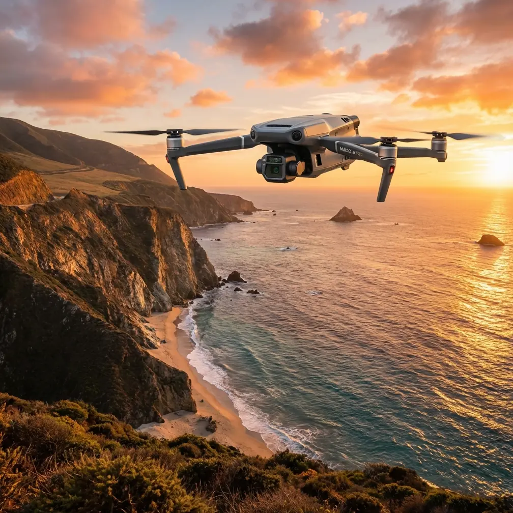
Mavic 3T Field Report: What Actually Matters When Crop Monitoring Turns Cold, Wet, and Unpredictable
META: A specialist field report on using the DJI Mavic 3T for agricultural monitoring in extreme temperatures, with practical insights on thermal signatures, weather shifts, mapping accuracy, and operational reliability.
I spend a lot of time around pilots who want a simple answer to a difficult question: can the Mavic 3T hold up when field conditions stop cooperating?
That question usually comes from growers, agronomists, and operations teams working in weather that refuses to stay stable. A field can begin the morning with frozen ground, low contrast in visible imagery, and a calm wind profile. An hour later, the sun breaks through, surface moisture starts moving, thermal behavior changes, and the aircraft is suddenly working in a very different environment than the one it launched into. Those are the moments that separate a drone that merely flies from one that can still produce usable information.
This report focuses on the Mavic 3T in exactly that kind of scenario: monitoring agricultural land in extreme temperatures, with weather shifting mid-flight. Not as a brochure exercise. As a practical evaluation of what the aircraft does well, where operators need discipline, and why certain features matter more in the field than they do on a spec sheet.
The mission profile that exposes weak points
Cold-weather field monitoring sounds straightforward until you define the real objective. Most teams are not just trying to collect pretty images. They need to identify irrigation irregularities, plant stress patterns, drainage issues, equipment-related compaction, and edge-zone anomalies before those conditions widen into operational losses.
In those jobs, the Mavic 3T earns attention because it combines a thermal camera, a visual sensor suite, and a platform compact enough to deploy quickly when the weather window is narrow. That matters. In agricultural monitoring, the best aircraft is often the one that gets airborne before conditions change again.
On one recent winter-style field assessment, the launch happened under a brittle, cold morning layer. Ground temperatures were uneven. Low-lying sections held moisture from the previous night, while raised beds and compacted tractor lanes were shedding thermal energy differently. At takeoff, those contrasts were distinct enough to show clear thermal separation. Mid-flight, wind picked up from the west, cloud cover broke, and reflected solar loading began to interfere with the initial thermal read on exposed sections. That shift is where many operators misread what the aircraft is telling them.
The Mavic 3T did what a useful field platform should do: it kept transmitting cleanly, held a stable route, and gave enough sensor consistency to compare changing zones in context rather than in isolation. The aircraft itself was not the weak link. Interpretation was.
Why thermal signature matters more in agriculture than many teams realize
The phrase “thermal signature” gets thrown around casually, but in crop monitoring it has a precise operational meaning. You are not simply looking for hot spots and cold spots. You are reading heat behavior as a proxy for biological and environmental processes.
With the Mavic 3T, thermal data becomes useful when the operator understands timing. Early morning can reveal retained moisture, sub-surface drainage pathways, and stressed areas that cool or warm differently than surrounding vegetation. But once sun angle changes and wind increases, those same patterns can flatten, shift, or become noisy. The drone does not eliminate that challenge. It gives you a better chance of catching meaningful data before the window closes.
That is one reason the Mavic 3T fits fast-response agricultural work better than many larger, slower-to-deploy systems. A platform that takes too long to set up can miss the best thermal interval entirely. If your target is field stress detection during extreme temperatures, readiness is not a convenience feature. It is part of data quality.
The thermal sensor on the Mavic 3T is especially useful when paired with visible imagery during a single mission. If a row section appears cooler than expected, that can suggest moisture retention, denser canopy behavior, shadow influence, or a mechanical irrigation issue. Thermal alone raises the question. The visual feed helps narrow the answer. That paired workflow saves time during post-flight review and reduces the temptation to over-interpret isolated heat patterns.
The weather changed mid-flight. Here is what that exposed
The most revealing part of the mission came when the weather turned.
About halfway through the route, the field moved from stable overcast into mixed light. Wind speed increased enough to affect surface behavior and visual texture. The thermal image did not fail, but its meaning changed. Cold pockets near drainage channels became less visually dramatic as solar exposure rose. Meanwhile, a few compacted access strips started showing stronger contrast because they warmed differently than adjacent planted zones.
This is where the Mavic 3T’s stable transmission and flight control characteristics become more valuable than raw camera discussion alone. DJI’s O3 transmission system helps keep the pilot connected to the aircraft feed when conditions are changing and the aircraft is working farther out over large acreage. In practical terms, that means fewer interruptions while validating whether a thermal anomaly is persistent, angle-related, or simply the result of rapidly changing ambient conditions.
For agricultural users, that matters because field decisions are often made in compressed windows. If the live feed becomes unreliable during a weather shift, the operator either aborts too early or continues with lower confidence. Neither outcome is efficient. A stable link supports better judgment.
Security also matters more than many assume in farm operations, especially when flights involve proprietary trial plots, irrigation layouts, or sensitive land-use data. AES-256 transmission security is not just an enterprise checklist item. It is a relevant protection layer when imagery and thermal records could expose operational strategies, field conditions, or infrastructure layouts that a grower would not want casually intercepted.
Mapping is possible, but photogrammetry needs discipline
A common mistake is assuming the Mavic 3T is only a thermal inspection tool. It is more useful than that, but only if operators stay realistic about workflow.
For field mapping, photogrammetry can still play a valuable role, especially when teams need repeatable visual records of crop blocks, access roads, drainage patterns, or storm-related change over time. The aircraft can support structured image capture, but anyone expecting precision outputs without ground control is setting themselves up for drift in the results.
If you are mapping for measurement or comparing multi-date surveys, GCPs should be part of the plan. Ground control points anchor the dataset and give the orthomosaic or model a level of positional reliability that flight-only data usually cannot guarantee on its own. In agriculture, that difference becomes operationally significant when a manager wants to verify whether a wet area expanded by a few meters, whether wheel-track damage followed a repeated route, or whether a treatment zone aligns with field boundaries.
The Mavic 3T is particularly effective when you separate mission intent before takeoff. One flight can be biased toward thermal interpretation. Another can be designed around cleaner visual overlap for photogrammetry. Trying to squeeze every objective into one hurried sortie often creates mediocre results in both datasets.
Battery strategy becomes a field productivity issue
On paper, battery management looks procedural. In real field work, it shapes what the aircraft can actually accomplish before conditions move on.
When temperatures are extreme, battery behavior deserves more attention than many teams give it. Cold air can reduce efficiency and change how conservatively a pilot should manage mission legs. In large agricultural areas, that becomes a planning issue, not just a technical one. If the thermal window is narrow and your return timing is too cautious, you may leave critical sections unflown. If it is too aggressive, you bring unnecessary risk into a mission that may already be dealing with shifting wind and reduced thermal clarity.
That is where hot-swap batteries become operationally meaningful. The ability to cycle power quickly and relaunch without dragging out downtime can preserve continuity across a field inspection day. In a monitoring program, that means less delay between sectors, more consistent environmental comparison, and a better chance of revisiting an anomaly while conditions are still comparable.
For growers managing large parcels, this directly affects how drone data integrates into the day’s decisions. A system that can pause briefly, swap, and continue is far more useful than one that turns every battery change into a workflow reset.
Can the Mavic 3T support BVLOS-style thinking?
Strictly speaking, BVLOS operations depend on the regulatory framework, waivers, location, and operator approval environment. That part is not a hardware feature. But it is still worth discussing how the Mavic 3T fits the broader conversation.
Agricultural users often think in terms of distance, acreage, and distributed assets rather than compact job sites. The Mavic 3T’s communication reliability, portability, and sensor combination make it a credible aircraft for organizations building toward more advanced operational structures. Even when missions are flown within visual line of sight, teams often design procedures that anticipate future BVLOS expansion: standardized route planning, repeatable launch points, secure data handling, and mission logs that can stand up to scrutiny.
In that context, the aircraft works well as a bridge platform. It supports serious data gathering without forcing the complexity of a much larger airframe. For farm operators and service teams, that makes it easier to build repeatable practice around mission discipline now, while leaving room for more advanced operating concepts later.
What the Mavic 3T did well in the field
The strongest impression from this type of mission is not that the Mavic 3T is indestructible or universal. It is that it remains useful when conditions are no longer tidy.
That distinction matters. A lot of drones perform well in clean weather and short demonstrations. Agricultural monitoring in extreme temperatures is messier. Moisture shifts. Wind alters thermal readability. Light changes within a single route. Surface conditions create false positives. A drone that stays controllable, transmits consistently, and lets the pilot cross-check thermal observations against visible imagery keeps the operation productive when interpretation becomes difficult.
That is the Mavic 3T’s real value in field monitoring. It reduces the gap between deployment speed and actionable insight.
If I were advising a grower or field operations manager, I would not position it as a replacement for every mapping aircraft or every agronomic method. I would position it as a highly practical response tool for targeted assessment, thermal verification, infrastructure checks, and short-notice reconnaissance when conditions are unstable and decisions cannot wait.
It also rewards trained operators more than casual users. The aircraft can capture meaningful thermal evidence, but only if the pilot understands environmental timing, angle effects, and the difference between actual field stress and temporary thermal noise. That is not a limitation of the drone. It is the reality of professional thermal work.
Where operators should be careful
The Mavic 3T is strong in mixed inspection roles, but there are avoidable errors that show up repeatedly in agricultural use.
First, do not treat every thermal contrast as agronomic truth. In cold weather, soil composition, standing moisture, crop residue, and even surface orientation can create patterns that look biologically important but are mostly environmental artifacts.
Second, do not skip repeatability. If you want comparisons that hold up, fly similar routes at similar altitudes and similar times when possible. Extreme-temperature work is already variable enough.
Third, use visible imagery to challenge your first interpretation, not confirm it. A thermal anomaly that lines up with a tire path, drainage edge, or exposed soil patch may tell a different story once you examine the optical image carefully.
And finally, if your goal includes measurable mapping outputs, build around GCP-supported photogrammetry rather than assuming a quick flight will be sufficient. The aircraft is capable, but workflows still matter.
Final assessment
For monitoring fields in extreme temperatures, the Mavic 3T makes the most sense when the operator needs three things at once: quick deployment, thermal awareness, and dependable situational control after weather conditions start changing.
That combination is more valuable than it sounds. Many agricultural decisions happen in unstable windows. By the time a team notices irrigation inconsistency, drainage pooling, frost impact, or uneven crop response, the field picture may already be shifting. An aircraft that can get airborne fast, maintain a clean O3 link, protect data with AES-256, and keep producing interpretable thermal and visual information through a mid-flight weather change has real operational credibility.
If your team is evaluating how it fits into field monitoring workflows, I suggest discussing mission design before hardware assumptions. The best results come from pairing the Mavic 3T with clear objectives, battery discipline, thermal timing awareness, and mapping practices that respect the role of GCPs. If you want to compare notes on that process, you can message a field specialist here.
Ready for your own Mavic 3T? Contact our team for expert consultation.