Mavic 3T Monitoring Tips for Mountain Fields
Mavic 3T Monitoring Tips for Mountain Fields: A Practical Case Study from the Slope
META: A field-tested case study on using the DJI Mavic 3T for mountain agriculture monitoring, with practical advice on thermal scanning, O3 transmission, battery planning, terrain workflow, and data reliability.
Mountain agriculture exposes every weakness in an aerial workflow.
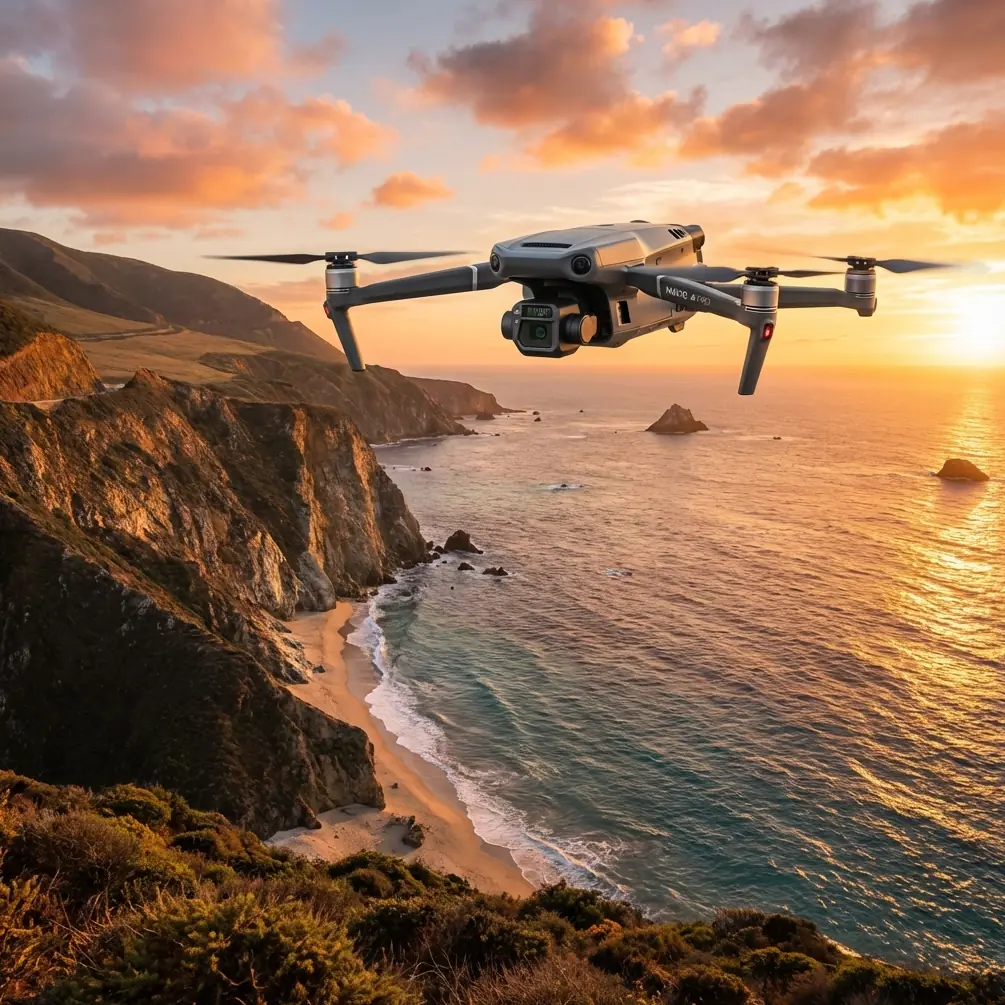
Flatland routines break fast once you start dealing with ridgelines, fractured plots, wind funnels, uneven canopy temperature, and long walking distances between observation points. The Mavic 3T is often discussed as a compact thermal platform, but that description misses the real reason it works well in steep field-monitoring jobs: it compresses multiple kinds of situational awareness into one aircraft that can be carried, launched, and repositioned quickly when the terrain is doing its best to slow everything down.
I recently revisited a mountain-field monitoring workflow through the lens of the Mavic 3T, thinking about how a specialist like Dr. Lisa Wang would structure a repeatable inspection routine for growers and land managers working across elevated terraces. Rather than talking about the aircraft in broad marketing terms, this case study focuses on a specific problem: how to monitor crop condition across sloped fields where line of sight, thermal variation, and access constraints all affect decision-making.
The field problem: steep ground changes what “normal” monitoring means
In mountain farming, “one field” is rarely one field in the operational sense. It may be a chain of narrow terraces, separated by tree bands, irrigation channels, footpaths, and abrupt elevation jumps. A visible-light drone flight can give a decent visual snapshot, but the real challenge is identifying stress before it becomes obvious from standard RGB imagery alone.
That is where thermal signature matters.
The Mavic 3T’s appeal in this setting is not just that it carries a thermal sensor. It is that the thermal view can be used alongside visual observation to sort signal from noise on terrain where temperature patterns are distorted by slope angle, shadow timing, rock outcrops, irrigation inconsistency, and wind exposure. In practice, that means a grower is no longer relying only on what looks discolored from above. They can begin to assess where water distribution may be uneven, where plant vigor is diverging by terrace section, or where a drainage edge is behaving differently from the rest of the block.
The mountain environment makes that dual-perspective workflow more valuable than it would be on a uniform plain.
The case study setup
The operating area in this scenario was a set of mountain plots arranged in staggered bands along a south-facing slope. The mission objective was simple on paper: monitor field condition after a week of shifting weather and identify zones that required ground follow-up. The operational reality was less simple. Access roads were narrow, walking the full site would have taken hours, and direct observation from a single hilltop would have hidden parts of the lower terraces.
The Mavic 3T was used because it could cover three essential tasks in one deployment:
- Quick visual review of the full hillside
- Thermal screening for abnormal heat patterns
- Georeferenced image collection for later comparison and mapping support
This matters because mountain field work rarely rewards specialized gear that needs a large setup footprint. A compact system that can move with the team is often more useful than a larger platform with marginally better endurance on paper.
Why O3 transmission matters more in the mountains than most people expect
One technical detail that becomes operationally significant on steep terrain is O3 transmission.
A lot of people treat transmission standards as a brochure item. In mountain agriculture, they directly affect whether the aircraft remains a trustworthy observation tool once it drops behind contour breaks or moves laterally along a slope. Terrain creates partial masking. Trees and ridge shoulders complicate the signal path. A stable transmission link is not just about pilot comfort; it supports better flight path control and more confident image review while repositioning across difficult topography.
With the Mavic 3T, O3 transmission helps maintain usable situational awareness when the aircraft is working across irregular terrain rather than out over open, unobstructed ground. That does not turn mountain flying into a casual task, and it certainly does not erase local operational limits or visual-flight requirements. But it does reduce one common source of disruption in agricultural monitoring: losing clean video confidence just when the aircraft reaches the section of the site you most need to examine.
For teams building a mountain workflow, this has a second benefit. It allows more deliberate stand-off positioning. Instead of hiking to every terrace edge, the operator can often work from safer and more efficient launch points while still getting meaningful coverage.
A thermal anomaly that was not a crop problem
One of the more telling moments in this case was a wildlife encounter.
During an early morning pass over the upper terraces, the thermal feed showed a compact warm signature moving along the edge of a brushy drainage strip beside a cultivated plot. At first glance, it looked like an isolated heat anomaly near an irrigation transition zone. A closer visual check from the zoom view clarified the situation: it was a small deer moving across the boundary vegetation before slipping downslope and out of the cultivated area.
That may sound like a minor anecdote, but it highlights why sensor interpretation matters. In mountain fields, not every thermal irregularity is plant stress, exposed pipework, machinery residue, or moisture imbalance. Animals, sun-warmed stones, and thermal lag from mixed ground materials can all create misleading signals. The Mavic 3T’s value is not simply that it detects heat. It helps the operator verify what that heat represents before a ground crew wastes time checking the wrong location.
For farms bordering natural habitat, that distinction is practical. It avoids false positives and supports a less disruptive monitoring approach.
Building a repeatable slope-monitoring workflow
The strongest Mavic 3T results in mountain agriculture usually come from process discipline, not from flying longer or faster. Dr. Lisa Wang’s style of field work would likely prioritize repeatability over improvisation, and that is exactly the right instinct here.
A useful sequence looks like this:
1. Start with a broad visual reconnaissance pass
Use the first flight to understand current terrain conditions, wind behavior over the slope, access obstacles, and visible crop variation. On mountain sites, the pilot should not rush into thermal interpretation before understanding shadow lines and terrain breaks.
2. Follow with targeted thermal review
Once the overall pattern is clear, identify terraces or edge zones with suspicious temperature contrast. Thermal signature is especially useful where irrigation distribution may vary by elevation or where sections of a field receive unequal sunlight due to topography.
3. Mark candidate zones for ground truthing
Not every thermal anomaly needs immediate intervention. Some need soil moisture checks, plant inspection, or irrigation line review. The drone’s job is to narrow the search area intelligently.
4. Capture consistent imagery for later comparison
This is where photogrammetry enters the conversation, even though the Mavic 3T is often framed mainly as an inspection tool. On mountain farms, historical comparison can be more valuable than a single dramatic flight. If the team captures repeatable visual datasets from similar altitudes and flight paths, they can build comparative records of terrace condition over time.
Photogrammetry and GCPs: why they still matter in a thermal-heavy workflow
Mountain operators sometimes assume that if thermal is the main point, mapping discipline can be relaxed. That is a mistake.
Photogrammetry gives structure to what would otherwise be a series of loosely interpreted aerial observations. Even if the immediate mission is not a full survey deliverable, repeatable visual data supports better comparisons across irrigation cycles, weather events, and plant development stages. In sloped fields, image geometry can be tricky. Elevation changes distort overlap planning and can introduce inconsistencies if flight height is not managed carefully relative to the terrain.
GCPs, or ground control points, are useful here because they help anchor the dataset when accurate location consistency matters. In mountain agricultural blocks, especially where terraces create repeated visual patterns, small positional errors can muddy comparison. A handful of well-placed GCPs can improve confidence in how observations line up from one monitoring session to the next.
That is the operational significance: better alignment means better decisions. If a stressed band appears to shift between flights, the team needs to know whether that reflects actual field change or just mapping inconsistency.
Battery planning is not optional on slopes
The Mavic 3T benefits from a field workflow that treats batteries as part of mission design rather than an afterthought. In mountain operations, travel time between launch areas can exceed flight time. If the site is segmented by ridges or narrow access paths, battery management directly affects whether the team can maintain a clean schedule and inspect all critical plots before lighting conditions change.
This is where hot-swap batteries become tactically useful in the civilian sense of the word: they keep the inspection moving. You land, swap, verify the next objective, and relaunch without turning a compact drone workflow into a long reset cycle. On a mountain slope, that can be the difference between completing all priority terraces in the cooler morning window or trying to interpret thermal data after the sun has complicated the surface temperature picture.
Thermal work is highly sensitive to timing. A disciplined battery plan preserves the best part of the day for actionable reads.
Data handling in the real world: why AES-256 deserves attention
Another detail often treated as abstract is AES-256.
For field-monitoring teams, secure data handling matters when flights produce sensitive geospatial records tied to farm operations, infrastructure routes, water management patterns, or crop health trends. Mountain farms are often worked by cooperatives, family operators, consultants, and agronomy contractors all at once. That creates data-sharing friction. If the drone platform supports strong data protection practices, it becomes easier to integrate into professional reporting workflows without treating every mission as an informal exercise.
The operational significance is straightforward: trust. People are more willing to use aerial data consistently when they know the system supports secure handling of images and flight records.
What about BVLOS?
BVLOS is one of those terms people like to mention because it signals advanced operations, but in mountain agriculture it needs to be discussed carefully and responsibly. Beyond visual line of sight operations depend on local regulation, approvals, site-specific risk controls, crew structure, and communication procedures. It is not simply a feature you “turn on” because the terrain is large.
Still, the reason BVLOS comes up around mountain field monitoring is understandable. Sloped farms often extend farther laterally than they look from the access road, and ridge geometry can make ground movement slow. The practical lesson for Mavic 3T users is not to assume BVLOS solves that problem. The lesson is to build efficient legal workflows first: smart launch positioning, segmented missions, consistent observation points, and stable transmission planning.
Teams that master those basics usually extract far more value than teams chasing distance for its own sake.
The real strength of the Mavic 3T in mountain fields
After enough field use, the Mavic 3T stops feeling like “a drone with thermal” and starts feeling like a compact decision-support tool.
That is the real story here.
In a mountain-field context, its usefulness comes from combining mobility, reliable viewing options, practical transmission performance, and enough data structure to support repeat inspections. The drone helps answer three questions quickly:
- Where should we look on the ground?
- What is changing across terraces?
- Which anomalies are real, and which are just terrain or timing artifacts?
When a team can answer those questions in one morning, they reduce labor waste and improve intervention speed.
If you are planning a mountain-field monitoring routine and want to compare workflows, sensor settings, or mapping methods with someone who understands this category, you can message a specialist here.
Final field advice from this case
If I had to reduce this mountain case study to a few hard-earned lessons, they would be these.
Do not treat thermal imagery as self-explanatory. Verify anomalies with visual context.
Do not ignore mapping discipline just because the mission feels like inspection rather than survey. Photogrammetry and GCP-backed consistency can turn isolated flights into a usable record.
Do not underestimate transmission performance on broken terrain. O3 is not decorative in the mountains.
Do not plan your battery cycle casually. Hot-swap efficiency protects the narrow time window when thermal readings are most useful.
And do not forget that mountain fields are shared environments. The deer crossing the terrace edge was a useful reminder that the landscape is alive, dynamic, and not always behaving according to your inspection checklist.
That is exactly why the Mavic 3T works here. It gives the operator enough perspective to interpret the slope on its own terms rather than forcing a flatland workflow onto a layered, irregular site.
Ready for your own Mavic 3T? Contact our team for expert consultation.