Monitoring Windy Fields With the Mavic 3T
Monitoring Windy Fields With the Mavic 3T: A Practical Case Study From the Edge of Signal and Weather
META: A field-tested case study on using the DJI Mavic 3T for windy agricultural monitoring, covering thermal signature analysis, antenna adjustment in electromagnetic interference, O3 transmission, AES-256 security, and workflow tips for reliable results.
When people talk about agricultural drone work, they often focus on camera specs or flight time in isolation. Out in a windy field, those specs only matter if the aircraft can hold a stable working position, keep a clean link, and give the operator data that still makes sense once the gusts start pushing dust, crop movement, and signal noise into the workflow.
That is where the Mavic 3T becomes interesting.
This is not a platform that earns attention just because it carries a thermal sensor. Its real value shows up when a job gets messy: variable wind across open ground, patchy electromagnetic interference near irrigation pumps or metal structures, and a need to gather both visual and thermal evidence without losing confidence in what the data actually means. For growers, agronomists, and field managers trying to monitor crop stress, drainage problems, or equipment heat anomalies, that combination matters more than a headline spec sheet.
What follows is a real-world style case study based on how the Mavic 3T fits a windy field-monitoring scenario.
The operating problem: wind, moving crops, and noisy signal conditions
A broad agricultural block rarely gives a drone ideal conditions. Wind is usually stronger than it feels from the ground because the field offers little shelter. The crop canopy moves constantly. On top of that, EMI can creep in from pump stations, overhead utility infrastructure, weather stations, metal-roofed sheds, and even temporary generator setups.
Those details are not minor. They shape whether a mission becomes useful evidence or a collection of shaky images and thermal snapshots that are hard to trust.
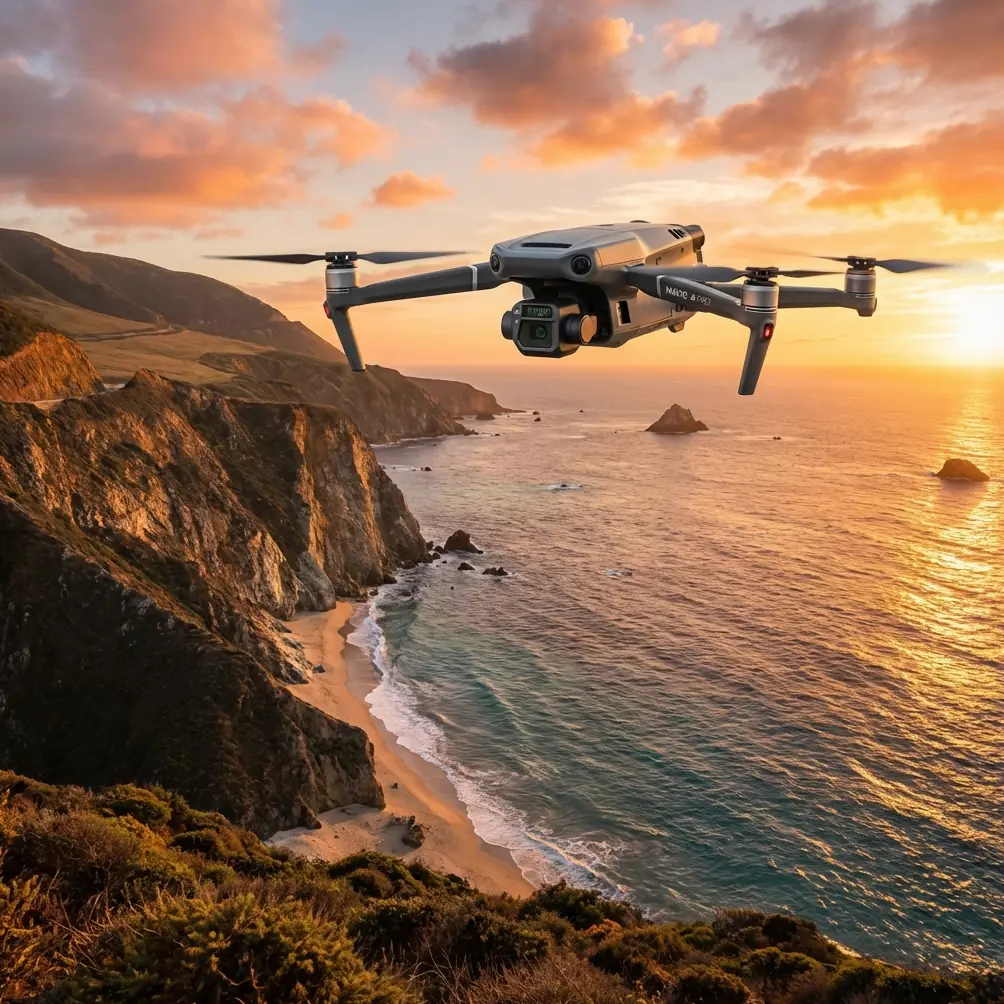
The Mavic 3T is well suited to this kind of work because it combines a thermal camera, a wide camera, and transmission reliability that is strong enough for large-area monitoring when the pilot manages the link correctly. DJI’s O3 transmission system gives the operator a robust live feed, but “robust” does not mean “ignore antenna discipline.” In field conditions with interference, antenna adjustment can make the difference between a clean survey pass and a hesitant, broken workflow.
That point is easy to underestimate until you see it happen.
The scenario: a windy afternoon over mixed-condition crops
Picture a 200-acre agricultural block after a week of uneven irrigation and strong crosswinds. The farm manager wants answers, not pretty imagery. Which sections are retaining moisture poorly? Is a pump motor running hotter than expected? Are there localized areas of crop stress that visual inspection from the ground is missing?
A conventional RGB-only sortie can reveal lodging, stand inconsistencies, and obvious waterlogging. But wind complicates visual interpretation because moving leaves can hide subtle color variation, and low-angle light can exaggerate or flatten problems depending on the time of day.
The Mavic 3T adds another layer through thermal signature analysis. That matters because temperature differences across a field can expose irrigation irregularities, drainage issues, stressed plants, and overheated support equipment. In windy conditions, though, thermal work requires a more disciplined approach than many new operators realize. Wind can cool surfaces unevenly and reduce contrast in some areas while exaggerating transient effects in others.
So the operator’s job is not simply to launch and scan. It is to separate useful thermal patterns from weather noise.
Why the Mavic 3T fits this job
The Mavic 3T sits in a useful middle ground. It is portable enough to deploy quickly between weather windows, but it is capable enough to support serious field decisions. For agriculture, that matters because issues often need confirmation the same day. You do not always have the luxury of scheduling a larger aircraft, crew, and transport plan just to check a suspected irrigation fault or inspect a section of crop after a windy night.
Its thermal payload is the obvious attraction. Less obvious, but just as important, is the ability to cross-reference thermal findings with the visible image during the same operation. If a hotspot appears along a line of infrastructure, the operator can quickly determine whether that pattern corresponds to exposed piping, a motor housing, dry soil, compacted ground, or stressed vegetation. That speeds up the path from image to decision.
The platform also supports secure workflows through AES-256 encryption. For many readers, that may sound like an IT checkbox rather than a field feature. In practice, it matters for commercial operators handling sensitive farm maps, infrastructure imagery, or client inspection records. Agricultural operations increasingly treat crop and asset data as confidential business information. A secure transmission and data environment helps protect that work, especially when flights are conducted for third-party clients or across multiple managed properties.
The moment things went wrong: EMI near the pump line
In this case study, the mission started cleanly. The operator launched from the field edge, climbed to a safe working altitude, and began a broad scan over the western irrigation block. Wind was consistent but manageable. The aircraft held position well enough to support deliberate thermal observation rather than rushed passes.
Then the live feed began to degrade near a pump installation surrounded by metal fencing and electrical equipment.
This is where less experienced pilots often make a poor decision. They assume the aircraft is the problem, continue pushing into the same line, and accept a degraded connection as unavoidable. A better approach is to treat the transmission path as part of the mission geometry.
With O3 transmission, maintaining a strong link depends heavily on controller orientation and antenna alignment. In open fields, this is usually straightforward. Near EMI sources, it becomes dynamic. The pilot in this scenario paused the forward progression, shifted body position to restore a cleaner line of sight, and adjusted the controller antennas to better face the aircraft’s operating zone rather than the previous leg of flight. That small correction stabilized the feed enough to continue thermal inspection around the pump corridor.
Operationally, this matters for two reasons.
First, stable video is not just a convenience in thermal work. Thermal anomalies are often subtle. If the feed stutters while you are trying to compare temperature variation across a narrow irrigation path or inspect a motor housing, confidence drops immediately.
Second, antenna adjustment can reduce the temptation to reposition the aircraft unnecessarily. In gusty conditions, every needless correction adds workload and drains battery time that should be reserved for actual data collection.
If you want a field workflow discussion tailored to your own site conditions, including link management around agricultural infrastructure, this is the kind of scenario worth discussing directly: message a Mavic 3T specialist on WhatsApp.
Reading thermal signatures in wind without fooling yourself
The thermal sensor is powerful, but interpretation is where professionals separate themselves from casual users.
In windy fields, a hotspot does not always mean a failing component, and a cool patch does not always mean healthy vegetation. Airflow changes surface temperature. Crop movement changes what the sensor sees. Shadows and recent cloud cover can shift apparent temperature relationships across the same block.
The practical method with the Mavic 3T is to use thermal imagery as a prioritization layer, not a final verdict. When a thermal signature suggests a problem, the operator should immediately validate it against the visible feed and, if necessary, run a second pass from a slightly different angle or altitude. In our field example, one thermal anomaly first looked like a stressed strip of crop along a drainage edge. Cross-checking with the visual feed showed it was actually exposed soil where wind had thinned canopy cover. That distinction matters. One finding might trigger irrigation adjustment. The other might suggest reseeding or a soil-structure review.
On the infrastructure side, thermal contrast around pumps, electric boxes, and moving parts can be even more actionable. A component running unusually warm compared with adjacent equipment can justify a maintenance inspection before a failure interrupts irrigation during a critical growth period.
The mapping question: when photogrammetry helps, and when it doesn’t
The Mavic 3T can contribute to mapping tasks, but windy agricultural monitoring is not always a pure photogrammetry mission. That distinction matters. If the field manager needs repeatable measurements, orthomosaics, or terrain-linked analysis, photogrammetry discipline becomes necessary. That means controlled overlap, stable flight paths, and ideally GCPs when higher positional confidence is required.
GCPs, or ground control points, improve geospatial reliability. In a windy field context, they become especially useful if the output will be compared over time or merged with other farm data. A thermal observation on its own may identify a suspicious area, but tying that finding accurately to repeatable map coordinates strengthens decision-making. The agronomy team can return to the same exact zone, compare conditions after intervention, or incorporate the result into a broader field management system.
Still, there is a practical boundary. If strong wind is causing excessive crop movement, a photogrammetry run may produce less dependable outputs than a targeted inspection mission. A professional operator should know when to stop treating the flight as a mapping job and instead use the Mavic 3T as a rapid diagnostic tool. Not every agricultural question needs a perfect model. Some need a reliable answer before the next irrigation cycle.
Battery planning in real field conditions
Wind changes battery strategy. It is one of the first planning adjustments experienced operators make.
A calm-day flight plan can become unrealistic when the aircraft spends more energy holding track against gusts or returning upwind. This is where hot-swap batteries change the workflow, even though the term is sometimes used loosely in the field. The real advantage is not that you can keep flying endlessly; it is that a prepared battery rotation lets the operator maintain momentum, keep observations consistent, and relaunch quickly while environmental conditions remain comparable.
That continuity matters in agriculture. If you identify a thermal irregularity on one pass, swap batteries efficiently, and relaunch without a long delay, you can verify whether the pattern persists under roughly similar conditions. Leave too much time between sorties and wind shift, sun angle, and surface heating can complicate interpretation.
What about BVLOS?
BVLOS comes up often whenever people discuss large agricultural properties. The temptation is obvious. Fields are expansive, and the aircraft’s transmission capability encourages operators to think bigger.
But BVLOS is not just a technical question. It is a regulatory and operational one. For most commercial users, the Mavic 3T’s real value in field monitoring comes from disciplined, lawful operations within the rules that apply to the site and jurisdiction. In windy conditions especially, visual situational awareness remains a practical advantage, not a limitation. It helps the pilot judge gust behavior, observe bird activity, assess dust, and react quickly to changing field conditions around infrastructure.
The smartest field teams use the platform to maximize legal, repeatable efficiency rather than trying to stretch every mission to its outer theoretical envelope.
The real takeaway from this kind of mission
The Mavic 3T is not merely a compact drone with thermal capability. In a windy agricultural environment, it becomes a decision tool that works best when the operator respects signal management, weather effects, and the limits of raw imagery.
Two details stand out operationally.
First, O3 transmission is genuinely valuable in broad, open farmland, but only when paired with correct antenna adjustment around electromagnetic interference. That turns a spec into a usable field advantage.
Second, thermal signatures can reveal crop and equipment issues quickly, but only if they are cross-checked against the visible image and interpreted with wind effects in mind. That turns a dramatic-looking screen into evidence a farm manager can actually trust.
For readers considering the Mavic 3T for monitoring fields in windy conditions, that is the heart of the story. The aircraft is capable. The data can be highly useful. But the outcome depends on operator discipline more than brochure-level promises.
That is what makes the platform worth serious attention in agriculture. It does not replace judgment. It rewards it.
Ready for your own Mavic 3T? Contact our team for expert consultation.