Mavic 3T in Low-Light Field Monitoring: A Specialist Case
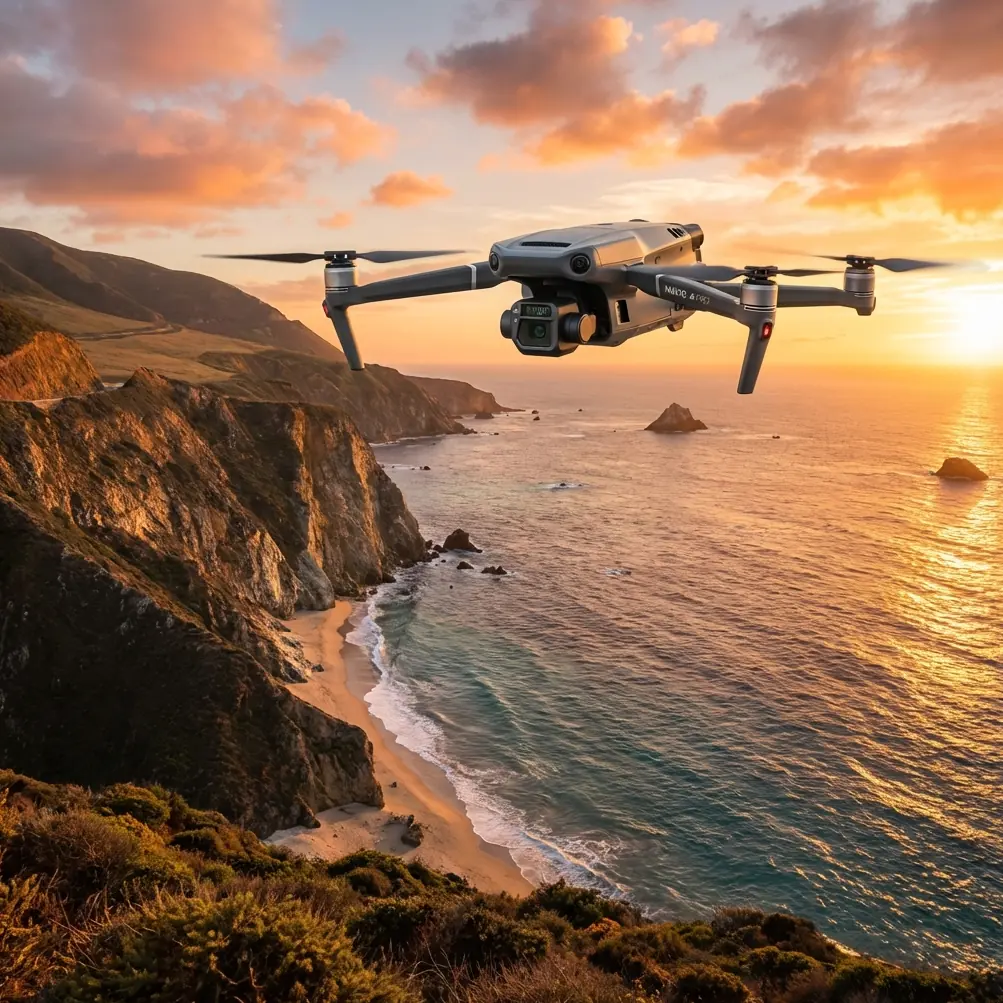
Mavic 3T in Low-Light Field Monitoring: A Specialist Case Study from the Edge of Dawn
META: A field-based case study on using the DJI Mavic 3T for low-light agricultural monitoring, thermal detection, mission planning, and safer data capture before sunrise.
By Dr. Lisa Wang, Specialist
Low-light crop monitoring is where a drone either proves its value or exposes its limits. Midday flights can make almost any platform look capable. The hard work starts before sunrise, when irrigation lines are cool, stressed plants separate from healthy ones by subtle thermal contrast, and the ground still holds the memory of the night.
That is where the Mavic 3T becomes interesting.
This is not a generic overview of the aircraft. It is a field case built around a specific operating problem: surveying mixed farmland in low light without losing spatial accuracy, missing heat anomalies, or wasting the short thermal window that matters most. In this type of work, details such as sensor pairing, transmission reliability, and battery workflow are not spec-sheet trivia. They directly shape what you can detect, how fast you can act, and whether the data is useful after the flight.
The assignment: pre-dawn field monitoring
The farm in question had three priorities. First, identify irrigation irregularities before the sun reduced thermal contrast. Second, check boundary zones where wild animals had been moving through planted areas. Third, capture enough visual context to support later mapping and maintenance decisions.
The timing was deliberate. We launched before first light because thermal signatures are usually cleaner then. Once the sun starts heating soil, leaves, equipment, and track surfaces unevenly, interpretation becomes harder. A warm pipe leak and a sunlit patch of exposed ground can begin to look similar if you wait too long.
The Mavic 3T fits this window because it combines a thermal camera with a visual system in a compact airframe that can be deployed quickly. In field operations, speed to launch matters. If a crew spends too long assembling equipment, calibrating multiple payloads, and organizing support gear, the most valuable part of the morning is gone.
Why the Mavic 3T matters in this scenario
The practical advantage of the Mavic 3T is not that it simply “has thermal.” It is that thermal and visible data can be gathered during the same mission with enough alignment to support decision-making in the field.
For a farm manager, a heat anomaly by itself is only half the answer. You also need to know what physical feature is producing it. Is it a blocked emitter line, a pump housing retaining heat, compacted ground, animal presence, or a section of crop canopy under stress? The visible sensor helps resolve that question immediately.
That dual-read approach is where the aircraft earns its keep in low light.
The drone’s transmission link also matters more than many teams expect. DJI’s O3 transmission system supports stable image delivery at range, which is operationally significant in agriculture because field edges, shelter belts, drainage lines, and access tracks can break up sightlines and make piloting in dim conditions less forgiving. A cleaner downlink means fewer moments of hesitation when the pilot needs to hold position, confirm a hotspot, or reframe an area without unnecessary repositioning.
Security is not usually the first topic growers raise, but it should not be ignored. When farms are documenting field conditions, infrastructure routes, and operational patterns, data handling has value. AES-256 encryption support is a relevant feature here because it reduces risk when sensitive imagery and flight data are transmitted and stored within a professional workflow. For operators working with agribusiness clients, cooperatives, or contracted survey programs, that is a real trust factor, not a marketing footnote.
What we were looking for in the dark
Our route covered irrigation corridors, planted rows near a hedgerow, and a low-lying zone that had a history of uneven moisture retention. Thermal imaging before dawn is particularly useful in these areas because temperature differences often reveal process failures before visual symptoms become obvious.
A leaking irrigation junction may create a cooler patch in surrounding soil. A blocked section can leave plants thermally stressed compared with neighboring rows. Vehicle tracks that altered compaction can also influence moisture distribution enough to register as a pattern. None of these issues announces itself clearly from the ground at 5:10 a.m. From above, the field starts telling the truth.
The Mavic 3T let us move from broad scan to targeted inspection quickly. Wide sweeps established pattern anomalies. Then we tightened the view to inspect discrete points. That workflow is essential because low-light missions are short by nature. You are not trying to admire the scene; you are racing the sunrise.
The wildlife encounter that changed the route
About twelve minutes into the mission, the thermal feed picked up a moving hotspot at the edge of a drainage strip near young plants. At first glance it looked like a compact warm mass crossing from the hedgerow toward the field. We slowed the aircraft, held altitude, and verified with the visual feed as the ambient light improved slightly.
It was a deer, not large, likely moving back toward cover after feeding.
This was more than an interesting sighting. It changed how we flew the next leg. Low-light field monitoring is not only about crop condition. It is also about conducting the mission without creating unnecessary disturbance. The thermal signature allowed early recognition before the aircraft got close enough to alter the animal’s movement abruptly. We widened the standoff distance, adjusted the track line, and continued the inspection with minimal disruption.
That is one of the quiet strengths of thermal sensing in agricultural environments. It improves awareness of what is in the field before the visible camera can reliably do so. In practice, that supports safer and more considerate operations around livestock, wildlife, and workers moving near access roads at dawn.
Thermal signatures that actually led to action
Two findings from that morning justified the flight immediately.
The first was an elongated cool zone tracing along one irrigation branch. On visible imagery, nothing looked dramatic. On thermal, the temperature pattern was too consistent to dismiss. Ground inspection later confirmed a distribution problem in the line affecting part of the block. Because it was found early, the team corrected the issue before stress became visually obvious across a larger section.
The second finding appeared as a cluster of warmer patches near the field margin. These were not crop anomalies at all. The visual camera showed exposed stones and disturbed soil where animal movement had broken surface cover. This is exactly why thermal data needs context. Heat contrast alone can mislead if the operator treats every bright spot as a plant-health issue. The Mavic 3T’s multi-sensor workflow reduced false assumptions on the spot.
Mapping relevance: when photogrammetry enters the conversation
Some operators treat thermal flights and mapping flights as separate worlds. In reality, farm management often benefits when they inform each other.
The pre-dawn thermal mission identified problem locations. Later, once light conditions improved, those same locations could be revisited for higher-detail visual capture and photogrammetry. If the client wants measurable change over time, repeatable geospatial context matters. That is where GCPs, or ground control points, become useful. They anchor mapping outputs to known positions, improving confidence when comparing drainage fixes, recurring wet spots, wheel-track damage, or edge encroachment across multiple surveys.
The Mavic 3T is not just a “find the hotspot” tool. Used properly, it can become the first stage in a broader evidence chain: detect early, verify visually, map precisely, then direct maintenance crews to the right place with far less guesswork.
That workflow is especially valuable in larger holdings where a crew cannot walk every row every morning. Thermal identifies where to look. Photogrammetry and GCP-backed mapping help explain what changed and where intervention should be documented.
Battery workflow and the real constraint in the field
People often ask about sensors first. Experienced crews ask about continuity.
Low-light work is unforgiving because the best contrast may last less than an hour. If battery handling is clumsy, your data quality suffers. That is why hot-swap batteries come up in professional planning discussions even when the exact airframe procedure varies by operating setup. The concept matters operationally: keep aircraft turnaround tight, keep mission pauses short, and avoid losing the environmental conditions you were there to capture in the first place.
With the Mavic 3T, disciplined battery rotation and preplanned mission segments make a noticeable difference. Instead of one long, inefficient sortie, divide the property into blocks, prioritize known risk zones, and land with enough reserve to relaunch quickly. The aim is not simply longer airtime. It is preserving consistency across the period when thermal contrast is strongest.
Transmission, confidence, and low-light piloting discipline
Low-light operations expose weak piloting habits. They also expose weak links in communications. A crisp live feed through O3 transmission helps the pilot maintain situational confidence when tree lines, irrigation structures, and uneven terrain complicate orientation. That confidence reduces drift, overcorrection, and unnecessary altitude changes that can degrade image consistency.
This is also where mission planning discipline matters more than pilot instinct. If a farm team is exploring repeat inspections over broad tracts, conversations around BVLOS tend to appear quickly. The commercial appeal is obvious: more area, fewer repositionings, less downtime. But field monitoring only benefits from expanded operational range when the regulatory framework, observer procedures, risk controls, and data objectives all support it. Otherwise, operators gain distance and lose reliability.
The Mavic 3T can support serious enterprise workflows, but good outcomes still depend on professional planning. Sensor capability does not compensate for poor route design, weak altitude selection, or inconsistent overlap when a mapping deliverable is expected.
What the farm learned from one dawn mission
By the time the sun had climbed enough to flatten the thermal picture, we already had what we needed:
- one irrigation fault pattern worth immediate inspection
- one wildlife movement corridor to avoid during future dawn sorties
- one field-edge zone requiring follow-up visual mapping
- one stronger case for recurring pre-dawn monitoring as part of routine crop management
That combination is where the Mavic 3T stands out. It is portable enough to deploy without ceremony, yet capable enough to produce information that changes field decisions the same morning.
For growers and agronomy teams, the value is not abstract. Better timing on irrigation fixes can reduce stress spread. Earlier recognition of animal activity can shape route planning and crop protection measures without disruptive chasing or guesswork. Better location data can make maintenance crews faster because they are walking to a known point, not searching a whole block.
The expert takeaway
The Mavic 3T is at its best in low-light agricultural work when it is treated as an operational tool, not a novelty sensor. Its thermal capability is most useful before sunrise, when temperature separation still carries meaning. Its visual system matters because interpretation without context creates expensive mistakes. O3 transmission improves confidence during dim, edge-of-field flying. AES-256 support matters when imagery and operational data need to be handled professionally. And if the mission is expected to feed later mapping outputs, the smartest teams connect thermal findings with photogrammetry and GCP-based accuracy instead of keeping those workflows separate.
The deer at the drainage strip was a reminder that dawn monitoring is never just about crops. Fields are living systems. Equipment, water, soil, plants, and animals all leave signatures. The Mavic 3T gives you a chance to read them before daylight starts erasing the clues.
If you are building a low-light monitoring workflow around the Mavic 3T and need a field-practical discussion rather than a brochure, start the conversation here: message a specialist directly.
Ready for your own Mavic 3T? Contact our team for expert consultation.