Mavic 3T in Remote Field Monitoring: A Practical Field
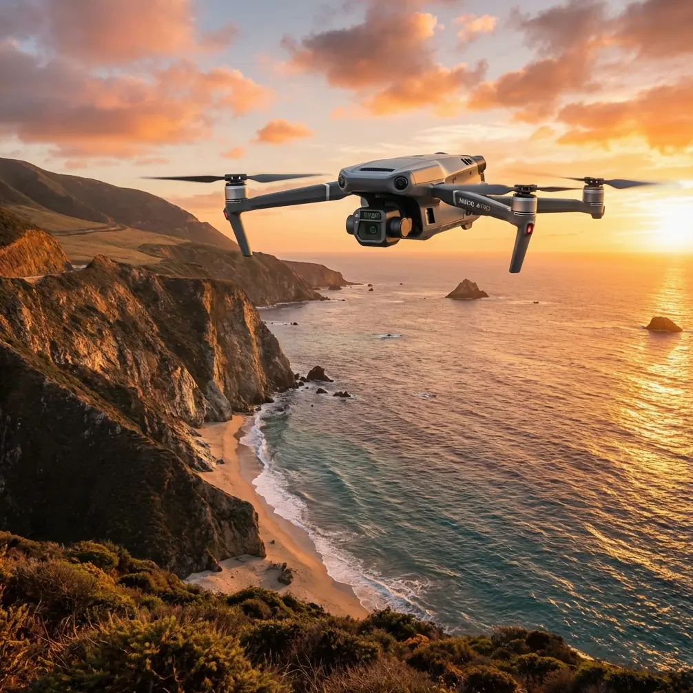
Mavic 3T in Remote Field Monitoring: A Practical Field Report on Altitude, Wind Exposure, and Thermal Reliability
META: Expert field report on using the Mavic 3T for remote field monitoring, with practical guidance on flight altitude, thermal signature capture, wind exposure, transmission stability, and mission planning.
I’ve spent enough time around field operations to know that the drone rarely fails on paper. Trouble shows up in the margins: wind gusts at the edge of a valley, weak signal over a tree break, thermal images that looked decisive in the air but become ambiguous back at the desk, and batteries that turn a one-sortie plan into a sequence problem. For teams using the Mavic 3T to monitor remote fields, those margins matter more than spec-sheet summaries.
This report focuses on one operational question that comes up constantly: what is the right flight altitude for field monitoring when you need usable thermal data, reliable coverage, and repeatable results in remote areas?
The answer is not a single number. It’s a working range shaped by what the aircraft sees, what the environment does to it, and how quickly conditions change once the drone leaves the launch point.
Why altitude is the first real decision
With the Mavic 3T, altitude determines three things at once.
First, it sets your thermal interpretation quality. Too high, and small heat anomalies flatten into vague patches. Too low, and you gain detail but lose area coverage, which can break mission efficiency on large properties. Second, altitude affects image geometry for visible-light mapping and photogrammetry, especially if you are trying to align repeated field surveys with GCP-backed outputs. Third, altitude changes how the aircraft is exposed to wind structure.
That last point gets less attention than it should. One of the reference engineering texts behind this article discusses how parked civil aircraft control surfaces can be damaged by irregular, high-frequency gust loading, and it cites a possible maximum ground gust intensity of 65 knots, or 33.4 m/s. The Mavic 3T is obviously not a parked manned aircraft with exposed control surfaces in the same sense, but the design lesson carries over cleanly: gusts are not steady loads. They are irregular, fast-changing energy inputs, and equipment lasts longer when those loads are anticipated rather than treated as background noise.
For remote field monitoring, that means altitude should never be chosen only by coverage math. It should also be chosen by how unstable the air mass becomes over crops, irrigation channels, tree lines, and embankments.
My practical altitude rule for remote fields
For most remote field monitoring with the Mavic 3T, I recommend starting with a two-layer workflow rather than trying to force one altitude to do everything.
- High reconnaissance pass: roughly 70 to 100 meters AGL
- Low diagnostic pass: roughly 30 to 60 meters AGL over flagged areas
The higher pass gives you situational awareness and efficient thermal screening over broad acreage. It is often the best place to detect irrigation inconsistency, heat retention differences in soil zones, stressed vegetation patterns, fence-line issues, and access path conditions. The lower pass is where you verify whether the anomaly is meaningful or just a thermal artifact created by angle, timing, or mixed surfaces.
If I had to name one “optimal” altitude insight for the reader monitoring remote fields, it would be this: begin near 80 meters AGL for the first thermal sweep unless the anomalies you care about are physically small. That altitude usually gives a solid balance between area efficiency and thermal signature separation without exposing the mission to unnecessary low-altitude turbulence around vegetation or structures.
Then descend with intent. Don’t cruise low from the start unless you already know what you’re chasing.
What the aircraft design references tell us, indirectly, about drone field work
At first glance, the provided references look unrelated to a compact enterprise drone. One deals with interior aircraft noise control and material properties. The other covers gust protection in civil aircraft control systems. Yet both point to operating truths that matter in the field.
The first reference notes that aircraft acoustic insulation performance can be expressed as the mass required per square meter for each decibel of sound insulation, with a target example mentioning 14 dB of isolation performance. Operationally, the lesson is straightforward: better isolation is never free. Performance usually costs weight, and weight drives handling, efficiency, endurance, and system design.
For Mavic 3T operators, the comparable trap is payload and accessory thinking. Even when the aircraft itself is fixed-configured, teams often load the mission with extra demands: longer route expectations, repeat passes, denser overlap for photogrammetry, more hover time for thermal confirmation, and transmission redundancy habits that keep the aircraft airborne longer than necessary. Every extra requirement acts like “virtual weight.” The aircraft may lift it operationally, but you pay in battery cycle count, turnaround pressure, and weather exposure.
That same reference also lists material properties such as aluminum alloy density around 2.8 g/cm³ and compares it with lighter and lower-stiffness alternatives. Why does that matter to a field drone operator? Because structural stiffness, mass, and damping are always in tension. A platform intended to stay portable cannot simply brute-force stability by getting heavier. The Mavic 3T earns its usefulness by balancing transportability with enough structural control to deliver usable visible and thermal data in the real world. The operator’s role is to respect that design balance. Don’t fly it like a heavy inspection multirotor. Use mission planning to make the aircraft look more stable than the weather really is.
The second reference is even more directly useful. It describes a gust-protection damping concept with two damping regions: a high-damping outer region for large movement or high-speed disturbance, and a low-damping middle region so normal control remains responsive. That is smart engineering because it separates abnormal energy absorption from normal operation.
Field crews can apply the same logic to mission planning. Build your operating method in two modes:
- a disturbance-tolerant mode for transit, perimeter checks, and broad screening in uncertain air;
- a precision mode for lower-speed, lower-altitude thermal confirmation and image capture.
If you try to fly every minute of the mission in precision mode, you expose the aircraft to more risk and often get worse data. If you stay only in broad screening mode, you miss the detail that justifies the flight in the first place.
Thermal signature capture: what altitude changes in practice
Thermal imaging over fields can be deceptive because plant stress, wetness, exposed soil, plastic sheeting, rocks, standing water, and compacted tracks all emit differently. On a broad pass at 80 meters AGL, what you’re really seeking is thermal contrast structure, not diagnosis. You want to know where the field behaves differently.
That difference may show up as:
- warmer strips indicating irrigation inconsistency
- cool patches from standing moisture
- edge heating along compacted access roads
- livestock or wildlife heat presence affecting a crop zone
- equipment left in remote paddocks
- drainage paths that retain or shed heat differently
Once you identify those zones, the lower pass lets the Mavic 3T separate blended signatures into interpretable shapes. This is where many operators make the wrong call and descend too aggressively. In remote fields, especially near hedges and shelterbelts, lower altitude often means more disturbed air, not less. A moderate low pass at 40 to 50 meters can be more productive than trying to skim at 20 to 25 meters unless the target is extremely small.
If the mission combines thermal review with photogrammetry, keep your visible-light mapping run separate from your thermal confirmation run when possible. Thermal tells you where to look. Photogrammetry tells you how the site is structured. Those are related tasks, but not identical ones.
O3 transmission in remote terrain: range is not the same as certainty
Remote field work is where transmission marketing gets misunderstood. The useful question is not whether the link can reach far. It is whether the link stays clean enough for confident decision-making while you maintain legal and safe operating margins.
The Mavic 3T’s O3 transmission system is a serious asset in rural operations because it helps preserve image awareness over long open corridors. But signal confidence still depends on terrain, vegetation walls, and aircraft orientation relative to the controller. A shallow rise between pilot and aircraft can matter more than the raw distance number.
My field preference is simple: launch from the highest sensible point with the clearest line over the first half of the route. If the property is large and segmented, treat signal geometry as part of the route design. Don’t push the far edge first. Fly the sectors that are easiest to recover from if conditions change.
For organizations handling sensitive crop, land, or infrastructure data, AES-256 matters too. Not because it changes image quality, but because remote field monitoring often includes commercially sensitive information: irrigation layouts, yield patterns, water access, damage zones, and asset locations. Transmission security is one of those features that only gets noticed when it was missing.
Wind, gusts, and why remote fields punish lazy launch decisions
The gust-protection reference makes a crucial point: damage risk comes from random, high-frequency impacts, not just sustained loading. In drone terms, that translates into launch and hover behavior.
I see many crews power up at the field edge, rise into a hover, fiddle with settings, discuss the route, then begin. That is exactly backward in gusty open terrain. The aircraft is most exposed when it is stationary in disturbed low-altitude air while the team is still deciding what to do.
My recommendation:
- Build the mission before takeoff.
- Check wind at launch height and at a higher reference layer if local conditions allow.
- Lift with purpose.
- Transition quickly into the planned working altitude.
- Avoid extended low hover near tree lines, sheds, or irrigation rigs.
This matters for data quality as much as aircraft care. Gust-driven micro-corrections can blur visible data, distort overlap consistency, and create thermal framing differences that make change detection harder when you compare surveys across time.
Battery strategy for remote monitoring
The Mavic 3T becomes much more useful in remote fields when crews treat batteries as a mission architecture question, not a consumable detail. Hot-swap batteries reduce dead time between sorties, which sounds obvious until you realize what that means in practice: less waiting, less thermal drift across the survey window, and more consistent dataset timing.
That consistency is critical. If your first block is flown under one thermal condition and the second block is delayed through a significant surface-heating shift, interpretation becomes harder. Fast battery turnover helps preserve comparability.
For large or segmented field inspections, I prefer dividing sorties by decision purpose:
- sortie one: broad thermal sweep
- sortie two: low-altitude verification
- sortie three: visible-light follow-up or photogrammetry over selected areas
That workflow gives each battery a clear job and reduces the temptation to overrun one flight trying to answer every question in one pass.
GCPs, photogrammetry, and when precision is worth the setup time
If your field monitoring output needs to support repeatable agronomic comparison or asset documentation, adding GCPs can tighten your photogrammetry workflow. Not every rural mission needs them. A quick thermal reconnaissance usually does not. But when you are tracking drainage changes, erosion progression, access road deterioration, or repeat vegetation block performance, GCP-supported outputs improve confidence across time.
The trick is to deploy that precision selectively. On a remote property, the setup burden can exceed the value unless the survey area is constrained and the output will actually be used for measurement rather than visual review. The Mavic 3T can bridge both worlds well, but only if the operator knows whether the flight is meant to find problems or prove them.
A note on BVLOS thinking
Many field operators are tempted to plan as if BVLOS capability is just an administrative step away, because remote acreage creates a strong urge to stretch every launch position. That instinct is understandable. It’s also where discipline matters.
Even when the property is open and the aircraft link looks excellent, route design should be based on authorized operations, recovery margins, and terrain awareness. The right lesson from enterprise drone capability is not “go farther.” It is “extract more value per legal, controlled flight.”
The field-tested operating pattern I trust most
If I were deploying the Mavic 3T tomorrow on a remote agricultural property, this is the pattern I’d use:
- launch from a point with the best elevation and line of sight
- first pass at about 80 meters AGL
- watch for thermal outliers, surface discontinuities, wetness patterns, and access issues
- mark zones rather than interpreting everything in the moment
- return and hot-swap
- second pass at 40 to 50 meters AGL over flagged sectors
- collect visible confirmation where thermal ambiguity exists
- only add photogrammetry where the anomaly requires measurement or repeat comparison
That sequence respects both the aircraft and the environment. It also mirrors the engineering logic from the references: absorb disturbance efficiently, preserve normal control authority, and understand that every performance gain has a structural or operational tradeoff somewhere else.
If your team is refining this workflow and wants to compare route ideas for a real property layout, you can send a field plan here and get a practical second opinion.
The Mavic 3T is at its best in remote field monitoring when it is used as a decision system, not just a flying camera. Altitude is the hinge point. Choose it well, and thermal signatures become clearer, sorties become more efficient, and the aircraft spends less time fighting the environment and more time revealing what the field is actually doing.
Ready for your own Mavic 3T? Contact our team for expert consultation.