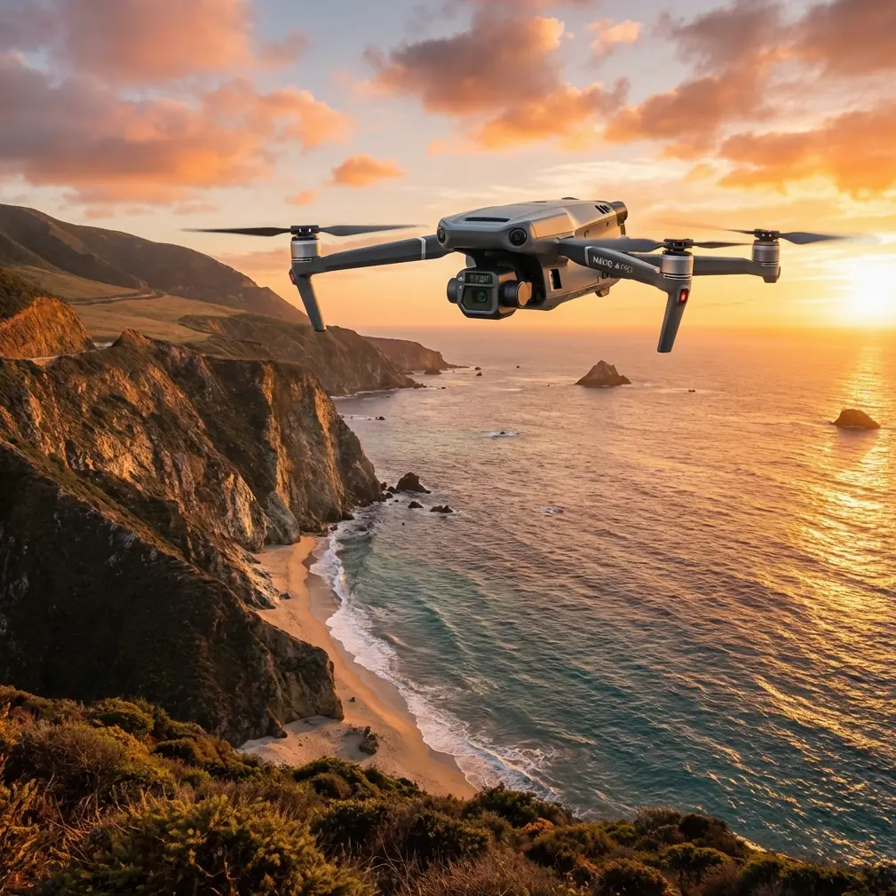
Monitoring Remote Forests With the Mavic 3T
Monitoring Remote Forests With the Mavic 3T: A Field Tutorial Built Around Rhythm, Thermal Clarity, and Mid-Flight Change
META: Learn how to use the Mavic 3T for remote forest monitoring with practical guidance on thermal signature reading, O3 transmission, AES-256 security, photogrammetry planning, and adapting when weather shifts mid-flight.
Remote forest monitoring looks simple on paper. Launch, scan canopy, collect thermal data, return home. In the field, it rarely behaves so neatly.
Tree lines break signal paths. Light changes faster than many operators expect. Moisture moves in. Wind rises above the canopy while the clearing below still feels calm. And if your goal is not just pretty footage but actionable information—heat stress, drainage issues, canopy gaps, storm damage, disease patterns—you need a method that goes beyond “fly around and see what shows up.”
For Mavic 3T operators, especially those working in remote woodland, one of the most useful ways to improve data quality is to borrow a concept from photography: visual rhythm. A recent Chinese photography piece explained rhythm and tempo not as sound, but as something created by lines, shapes, and light-shadow. It used curved stairs and rows of tea fields as examples of how repeating elements make an image feel organized and alive. That idea matters in forest work more than many pilots realize.
Because forests are full of repetition. Trunk spacing. Road edges. planting rows. drainage cuts. ridge contours. shadow bands at different sun angles. If you can learn to see those repeating structures while you fly, the Mavic 3T becomes much more than a thermal spotting tool. It becomes a platform for pattern detection.
This tutorial is built around that principle.
Why rhythm matters in forest monitoring
When you review Mavic 3T data from a remote forest block, the most valuable findings often appear as disruptions in repetition.
A healthy plantation stand may present near-regular crown spacing. A stressed section breaks that cadence. A drainage corridor should carry a predictable cool signature in the morning; if one segment runs warm, something changed. A service track should read as a continuous line. If its edge becomes jagged or interrupted after rainfall, erosion may be beginning.
The photography article’s core point was that rhythm can be created at the moment of shooting, not fixed later in post. That translates directly to drone operations. If your flight path, camera angle, and overlap are poor, no amount of later processing will restore the missing relationships between lines, shadows, and heat patterns.
With remote forestry, “shoot it right first” is not an artistic luxury. It is operational discipline.
Start with a dual mission plan, not a single flight idea
The Mavic 3T is often deployed for thermal work first, visual work second. That is understandable, but incomplete. In forest monitoring, thermal signature without structural context can lead to false assumptions.
Instead, build two layers into every mission:
- Thermal scan layer for anomaly detection
- Visual mapping layer for interpretation and confirmation
If the site allows it, use a broad thermal pass early, when temperature contrast is still helpful. Then follow with a more deliberate visual or photogrammetry-oriented pass designed to capture canopy structure, road geometry, water channels, and storm impact zones.
This is where photogrammetry and GCP discipline come in. Even when your primary goal is not a survey-grade map, a few well-placed ground control points can make later comparisons more reliable. In remote forests, that matters over time. You are not just documenting what is there today. You are building a record that lets you compare one flight to the next.
Without that consistency, subtle canopy retreat or recurring thermal anomalies may be dismissed as “just different flight conditions.”
Read the forest as repeated geometry
The photography reference described repeated elements such as tea rows and curved stair movement as a source of visual rhythm. In forest operations, use that same lens.
Look for:
- Parallel access tracks
- Repeating plantation spacing
- Regular breaks in canopy height
- Linear creeks and drainage swales
- Edge transitions between species blocks
- Firebreaks and utility corridors
- Shadow bands cast by ridges or taller emergent trees
The point is not to make the image look elegant. The point is to give your eye a baseline. Once the baseline is visible, anomalies become easier to trust.
A warm patch in isolation may be noise. A warm patch that interrupts a repeating cool drainage line is a clue.
A missing tree crown in a mixed stand may be ordinary. Five canopy interruptions aligned with a service route may indicate access-related stress, waterlogging, or pest spread.
The Mavic 3T is especially useful here because it lets you correlate visible linework with thermal irregularity in one mission cycle.
Camera discipline beats random coverage
A lot of forest data becomes less useful because pilots fly reactively. They chase points of interest instead of establishing structure first.
Use this sequence instead:
1. Establish the dominant lines
Before the first serious data run, take a short reconnaissance lap. Identify the lines that organize the site: road spines, ridgelines, drainage directions, cut boundaries, planting rows.
2. Match your flight direction to those lines
If the dominant pattern runs north-south, do not automatically fly east-west just because the software suggested it. A route aligned with the site’s own rhythm often produces cleaner interpretation, especially for edge damage and thermal breaks.
3. Use angle deliberately
A straight nadir capture is useful for mapping, but oblique passes can reveal the “tempo” of the forest much better—shadow depth, crown layering, slope transition, and structural breaks. Again, that echoes the source article’s focus on lines and light-shadow at capture time rather than after the fact.
4. Leave margin for re-checks
Do not burn all battery time on a single perfect grid. In remote forest monitoring, something usually deserves a second pass.
When weather changed mid-flight
On one remote forest mission, conditions shifted halfway through what was meant to be a routine canopy and drainage assessment. The first part of the flight was clear enough for stable visual interpretation. Then cloud thickened, the ridge line started producing uneven gusts, and contrast across parts of the canopy changed fast.
That is where the Mavic 3T’s practical strengths become more than a spec-sheet exercise.
The first advantage was maintaining control confidence through O3 transmission. In forested terrain, especially where terrain and tree mass can complicate signal behavior, a robust link is not just convenient. It reduces hesitation. The operator can continue flying methodically instead of rushing decisions because the connection feels fragile.
The second advantage was secure handling of collected data through AES-256. In commercial forestry, environmental consulting, and infrastructure-adjacent land monitoring, image sets may include sensitive site details—roads, boundaries, work areas, utility access paths. Strong encryption is not abstract IT language here. It supports responsible handling of site intelligence, particularly when teams share material across contractors and regional offices.
The third advantage was operational continuity from hot-swap batteries. In changing weather, the most expensive mistake is often not a hard failure but a broken data story. If your first battery captures pre-cloud conditions and the second flight captures post-change conditions with too much delay or too much setup friction, comparability drops. Fast battery turnover helps preserve the timeline of the event you are documenting.
That day, the weather shift ended up being useful. The contrast between earlier and later passes exposed areas where moisture retention altered thermal behavior near a drainage crossing and service road edge. Had the mission been flown as casual footage, that pattern would probably have been missed.
Thermal signature is only valuable when tied to site logic
Forest operators new to thermal often over-trust bright spots. Heat alone is not diagnosis.
Use thermal signature in context:
- Canopy stress may appear as warmer patches, but compare against species type, slope aspect, and time of day.
- Water movement can produce cooler lines, unless recent weather flips the pattern.
- Exposed soil can read warmer than vegetation and create false concern.
- Road edges and compacted areas often hold or shed heat differently from the stand around them.
This is another reason the rhythm concept is so practical. Patterns matter more than isolated pixels. The photography source emphasized repeated visual forms as the basis of rhythm. In forest thermal work, repeated thermal behavior is just as important. You are learning the site’s normal cadence so the abnormal section stands out.
Build repeatability into remote operations
Monitoring forests in remote areas is not a one-off exercise. The value compounds when flights are comparable.
A useful routine includes:
- Same launch area when possible
- Similar time window for thermal comparison
- Consistent altitude for key legs
- Standardized overlap for photogrammetry runs
- Reused GCP positions where site access allows
- Notes on cloud cover, wind, and moisture conditions
This sounds basic, but it reflects a deeper aviation principle found in one of the technical references: standardization matters. The flight-control systems document stressed standardized numerical handling and map-based positional awareness, including deviation indication and structured display logic. While that document comes from crewed aircraft systems, the takeaway fits drone fieldwork perfectly. In remote monitoring, standardized workflows reduce interpretation error. If every mission is planned and logged differently, your ability to compare outcomes degrades fast.
The same document also referenced a horizontal offset capability with a minimum increment of 0.5 nautical mile and a maximum of 99 nautical miles in the context of route management. For Mavic 3T operators, the literal values are less relevant than the operational mindset: route geometry should be intentional, measurable, and adjustable. In forest work, offsetting a pass line to inspect a drainage feature or wind-exposed edge should be a planned action, not improvised drift.
Practical photogrammetry with the Mavic 3T in forests
Photogrammetry in wooded areas is always more demanding than open-ground mapping. Dense canopy limits ground visibility. Shadows compress detail. Wind moves texture between frames.
Still, it remains useful for:
- trail and road condition monitoring
- harvest block boundary checks
- erosion observation
- storm damage documentation
- site access planning
- comparing canopy edge retreat over time
A few field habits help:
Use GCPs where they can actually be seen
Do not waste time placing points under canopy openings that disappear from the air. Put them at clearings, intersections, road shoulders, or exposed hardscape.
Separate mapping logic from spotting logic
The pass that is best for anomaly spotting is not always the pass that is best for model generation. Treat them as related missions, not identical ones.
Watch shadow timing
The source photography article made light-shadow central to the idea of image rhythm. In photogrammetry, those same shadows can either reveal landform or corrupt consistency. Long shadows can be excellent for visual interpretation but troublesome for clean reconstruction if they move during the mission window.
BVLOS planning deserves realism
Remote forest operations often raise the question of BVLOS. The temptation is to treat beyond visual line of sight as the obvious answer for large sites. Sometimes it is. But forest terrain punishes sloppy assumptions.
Even where BVLOS frameworks or waivers are relevant, mission design still has to account for:
- terrain masking
- weather build-up behind ridges
- emergency landing options
- communications reliability
- observer positioning where required
- retrieval planning if conditions deteriorate
This is where strong transmission and disciplined route architecture matter more than ambition. A technically capable airframe does not remove the need for conservative judgment.
A field mindset that produces better forest data
If you want better outcomes with the Mavic 3T in remote forest monitoring, stop thinking like a casual image collector and start thinking like a pattern analyst.
Before takeoff, ask:
- What repetition defines this site?
- What break in that repetition would matter operationally?
- What light angle helps reveal that break?
- What thermal behavior should be normal here today?
- How will I confirm an anomaly with a second sensor or second pass?
That shift sounds small. It is not. It changes the entire mission from broad observation to evidence gathering.
If you are building a workflow for remote forest programs and want to compare planning approaches, payload choices, or data handling steps, you can message our field team directly on WhatsApp for Mavic 3T workflow questions.
The real advantage of the Mavic 3T in forests
The Mavic 3T works well in remote forest monitoring not because it turns every operator into a survey specialist, but because it supports disciplined observation across changing conditions.
Its value shows up when weather shifts halfway through the job and you still preserve a coherent dataset. It shows up when O3 transmission keeps the aircraft responsive in difficult terrain. It shows up when AES-256 supports secure project handling. It shows up when hot-swap batteries let you keep the timeline intact. And it shows up when you stop flying random pictures and start composing information.
The photography source that inspired this article framed rhythm through five seven-character poetic lines. That is a beautiful way to teach seeing. In the forest, the practical version is simpler: repeated lines, repeating crowns, repeating shadows, repeating temperatures. Learn the rhythm first. Then the exceptions tell you where to work.
That is where the Mavic 3T becomes genuinely useful.
Ready for your own Mavic 3T? Contact our team for expert consultation.