Mavic 3T Monitoring Guide for Mountain Forest Work
Mavic 3T Monitoring Guide for Mountain Forest Work: What Actually Matters in the Field
META: Practical Mavic 3T best practices for mountain forest monitoring, including thermal workflow, O3 transmission tuning, electromagnetic interference handling, photogrammetry planning, GCP use, AES-256 security, and battery strategy.
Mountain forest monitoring looks easy on a map. In practice, it is a chain of compromises: broken sightlines, unstable weather, wet canopies, radio reflections from rock faces, and the constant pressure to get clean data before the light shifts.
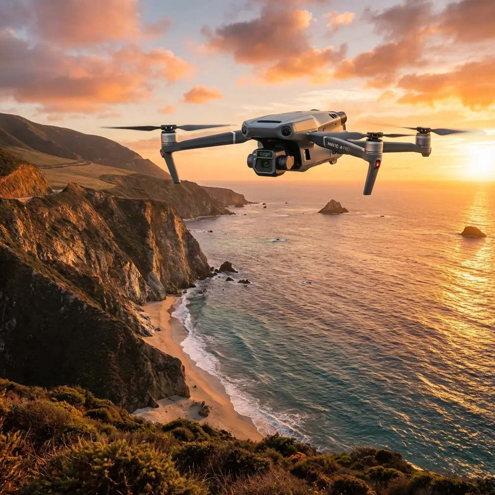
The Mavic 3T is often discussed as a compact thermal drone, but that description is too thin for real fieldwork. In mountain environments, its value comes from how several systems work together under stress: thermal sensing for anomaly detection, visual imaging for context, stable transmission when terrain starts fighting your signal, and a workflow that lets you move from scan to verification without losing time.
This guide is built around that reality. Not a spec-sheet recap. A field tutorial for teams using the Mavic 3T to monitor forests in steep terrain.
Start with the mission, not the aircraft
Forest monitoring in mountains usually falls into one of four job types:
- early detection of heat anomalies in dry vegetation
- post-storm assessment of landslides, washouts, and damaged access routes
- canopy health review across hard-to-reach slopes
- repeated documentation of known problem zones for compliance or land management
The Mavic 3T can support each of these, but not with the same flight profile.
If you are searching for thermal signatures in a wide valley, your priority is coverage and contrast. If you are documenting slope damage for comparison over time, photogrammetry discipline matters more than raw speed. If you are checking a suspected hotspot under dense edge cover, transmission reliability and camera handoff become more important than anything written in marketing copy.
That is why mountain work rewards operators who think like systems engineers.
Why mountain interference behaves differently
Most pilots understand interference in a city. Fewer understand it in a mountain forest.
In urban settings, EMI often comes from dense infrastructure. In mountain regions, the problem is less obvious. Ridge lines can partially block and then reflect signal paths. Wet vegetation can attenuate transmission. Narrow valleys create strange signal geometry where the aircraft appears close on the map but the radio link behaves as if it is much farther away. Add a metal-roofed ranger station, power lines near a trailhead, or a comms repeater on a ridge, and your control link becomes inconsistent at exactly the wrong time.
This is where the Mavic 3T’s O3 transmission system earns its place. In open terrain, it provides enough resilience for confident route execution. In broken terrain, though, resilience still depends on pilot handling.
The biggest mistake I see is treating antennas as a static setup. They are not. When you encounter electromagnetic interference or terrain-driven signal instability, antenna adjustment should be active, deliberate, and continuous.
A practical antenna method for mountain forests
Keep the controller antennas oriented so their broadside faces the aircraft’s likely position, not the antenna tips aimed directly at it. When the aircraft transitions behind a shoulder of terrain, do not wait for the signal warning to become severe. Step laterally if possible, raise your own body position, and re-angle the controller before the link degrades further.
Small changes matter. In one mountain mission, moving just a few meters away from a rock wall can clean up multipath issues enough to stabilize video and telemetry. Operators who have only flown in flat farmland often underestimate this.
If your route repeatedly loses quality at the same waypoint, the fix may not be more altitude alone. It may be a launch point relocation that creates a cleaner radio corridor for the whole mission.
That is the first lesson: in mountains, signal quality is part route design, part antenna discipline, part terrain reading.
Thermal signatures are useful only if you understand the background
The phrase “thermal signature” sounds precise. In forests, it rarely is at first glance.
A warm object on a ridgeline at sunrise may be exactly what you need to investigate. It may also be sun loading on exposed rock, a recently heated roof panel, or a gap in canopy density. The Mavic 3T helps because it lets you move quickly from thermal detection to visual confirmation, but the real skill lies in reading thermal context.
Mountain forests change thermal behavior hour by hour:
- shaded gullies stay cool long after open slopes warm up
- exposed boulders hold heat differently than surrounding soil
- deadfall and brush piles may present unusual patterns in dry conditions
- watercourses can distort local contrast by cooling adjacent ground
For this reason, I recommend flying thermal search passes during periods when the expected anomaly has the best temperature separation from its surroundings. In many mountain environments, that means avoiding the lazy middle of the day unless the task specifically benefits from broad surface heating.
The Mavic 3T becomes much more reliable when you stop asking, “Do I see heat?” and start asking, “Does this heat behave like the thing I am looking for?”
That framing cuts down false positives and saves battery cycles.
The odd but useful lesson from legacy aircraft manuals
The reference material behind this article is not about drones at all. One source describes aircraft hydraulic hose construction for operation at 20.7 MPa across a temperature range of -55°C to 125°C, including layered reinforcement and performance under pressure. Another lists landing gear and tire reference data from older aircraft platforms.
At first that seems irrelevant to a Mavic 3T. It is not.
These references point to a mindset that matters in mountain UAV work: field reliability is always a materials-and-environment problem before it becomes a mission success problem.
A hose designed for aviation fluid service is built in layers because one material alone cannot carry pressure, flex, temperature tolerance, and chemical resistance. The same systems thinking applies to your Mavic 3T deployment in the mountains. No single feature solves the mission. Thermal payload, transmission discipline, battery planning, weather judgment, and image control each carry part of the load.
The second source, with its landing gear and tire sizing data across aircraft types, reinforces another operational truth: aircraft are always shaped by the surface environment they must tolerate. In drone terms, that means your launch and recovery site in a mountain forest is not an afterthought. Uneven gravel, wet timber decks, loose dust, and sloped clearings affect every takeoff and landing decision. A compact aircraft like the Mavic 3T gives you flexibility, but only if you treat the ground zone with the same seriousness as the airspace.
Those old aviation details matter because they remind us that durable operations come from respecting interfaces: airframe to environment, mission to materials, pilot to terrain.
Photogrammetry in forests: when it works and when it wastes your time
A lot of teams try to use photogrammetry everywhere because they want a map output from every flight. In dense mountain forests, that can become expensive in time and battery without delivering reliable surface reconstruction.
Use photogrammetry when the mission target is visible enough to justify it:
- landslide edges
- road washouts
- exposed slope failures
- logging boundaries
- infrastructure corridors cutting through canopy
- burn scars after a vegetation event
If the canopy is too dense to reveal the surface you care about, photogrammetry will not magically recover terrain detail. In those cases, use the Mavic 3T for thermal reconnaissance, visual documentation, and change detection at the canopy or corridor level instead.
When you do need mapping-grade repeatability, place GCPs where they are actually visible from the air. This sounds obvious, but in mountain terrain teams often put GCPs near convenient trail edges where shadows, foliage, or slope angle reduce visibility. A smaller number of well-placed GCPs beats a larger number of compromised ones.
Keep GCP placement tied to the feature of interest, not just the easiest hiking route.
Battery strategy is a terrain decision
People talk about hot-swap batteries as if they are just a convenience feature. In mountain forest operations, they are a tempo tool.
You may have a short weather window, a narrow opening in valley wind conditions, or a thermal period that lasts less than an hour before contrast drops. If your team can land, replace power, and relaunch with minimal delay, you preserve the environmental consistency of the dataset.
That matters more than many operators realize.
A stitched set of images or repeated thermal passes collected under stable conditions is far easier to interpret later. Break the mission into long gaps, and your comparison quality falls apart due to changing sun angle, cloud cover, and surface temperature.
For repeated monitoring jobs, I recommend planning batteries by objective rather than by percentage alone:
- one battery block for wide-area scan
- one for anomaly verification
- one for close documentation or reruns of weak data
That structure reduces the common mistake of spending most of your available energy on the first broad pass and leaving too little margin for the flights that actually answer the mission question.
Secure handling matters more than most field teams admit
Forest monitoring can involve private land boundaries, utility corridors, conservation areas, or sensitive commercial assets. Even when the mission itself is routine, the data may not be.
AES-256 support matters because it strengthens the security posture around transmission and data handling, especially when teams are operating from temporary field sites or sharing outputs across multiple stakeholders. Security in this setting is not about drama. It is about preserving trust, maintaining clean custody of imagery, and avoiding unnecessary exposure of location data tied to infrastructure or environmental incidents.
If you are running recurring mountain surveys for a client or land manager, build a simple data protocol:
- define who receives raw files
- define who receives processed outputs
- label thermal and visual datasets consistently
- archive by slope, sector, and date rather than by vague flight names
That discipline pays off later when a stakeholder asks for historical comparison after six months of seasonal change.
BVLOS thinking without bad habits
Many teams discuss BVLOS because mountain monitoring naturally tempts longer corridors and hidden terrain. Whether your operation is authorized for that framework or not, you should adopt BVLOS-level planning habits even for standard missions.
That means:
- designing routes with known terrain obstacles in mind
- identifying communication weak points before launch
- creating abort logic for each segment
- marking alternate recovery zones
- pre-assigning observer roles if the terrain justifies them
The point is not to chase range. The point is to remove improvisation from a hard environment.
The Mavic 3T performs best in mountains when you stop flying it like a camera and start operating it like a managed sensor platform.
A sample mountain forest workflow with the Mavic 3T
Here is the workflow I use for a typical monitoring task on a steep forested site.
1. Choose the launch point for radio geometry
Do not pick the closest trail pullout by habit. Pick the point with the cleanest likely transmission corridor into the target area. This often means giving up a little hiking convenience for much better O3 stability.
2. Run a short high-confidence visual pass
Before the main thermal mission, do a brief orientation leg to confirm wind layering, signal behavior, and obstacle profile along the route.
3. Scan for thermal signatures when contrast supports the mission
Do not just launch because the crew is ready. Launch when the terrain is likely to reveal useful separation between target and background.
4. Verify anomalies immediately
Switch from broad search logic to targeted inspection logic. Thermal alone is rarely enough for reporting.
5. Capture visual context for every meaningful find
A useful anomaly without context creates work later. A useful anomaly paired with clear visual orientation becomes actionable.
6. If mapping is required, separate it from thermal search
Do not try to force one flight to do every job well. Mapping patterns and anomaly hunting often want different altitudes, speeds, and image priorities.
7. Manage batteries around decision points
Land before your battery becomes a constraint on judgment.
8. Reposition if signal quality degrades repeatedly
This is where antenna adjustment and operator movement matter. If you want a second opinion on setup logic for your site, you can share field details through this WhatsApp channel for mission planning.
What separates good operators from busy operators
Busy operators fly more. Good operators bring back cleaner answers.
With the Mavic 3T in mountain forest monitoring, the winning habits are not flashy:
- reading terrain before reading telemetry
- treating interference as a predictable condition, not bad luck
- understanding thermal background, not just thermal brightness
- using GCPs only when they genuinely improve deliverables
- protecting mission tempo with disciplined battery swaps
- securing data as part of normal operations
The old reference material on aviation hoses and landing gear may feel far removed from a foldable thermal drone, yet the lesson is direct. Aircraft work succeeds when environment, materials, and mission logic are treated as one problem. A mountain forest will expose any weakness in that chain.
The Mavic 3T is capable. That part is easy. The harder part, and the part that decides outcomes, is whether the operator can turn capability into repeatable field evidence under imperfect conditions.
Ready for your own Mavic 3T? Contact our team for expert consultation.