Mavic 3T in Extreme Temperatures: A Field Report
Mavic 3T in Extreme Temperatures: A Field Report for Wildlife Monitoring Teams
META: Expert field report on using the DJI Mavic 3T for wildlife monitoring in extreme temperatures, with practical insight on thermal detection, O3 transmission, battery management, and mission reliability.
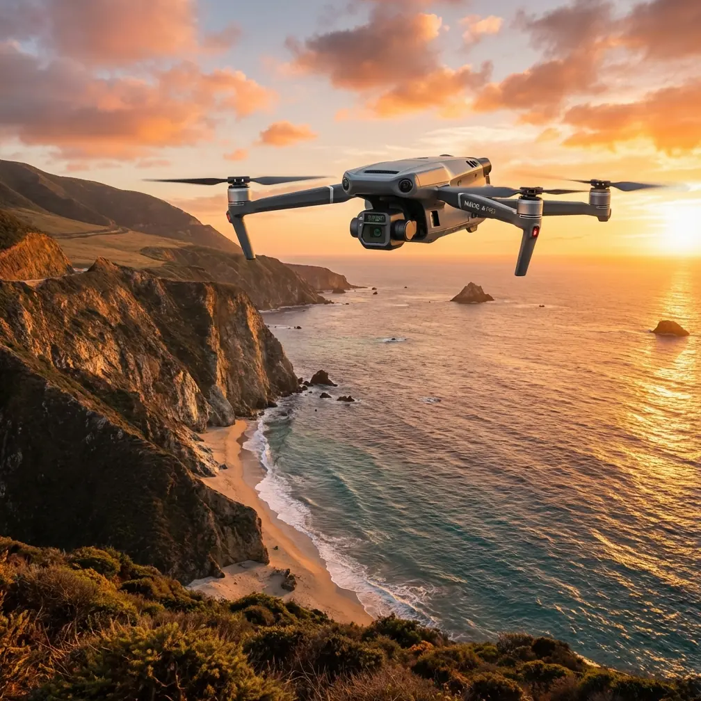
I’m Dr. Lisa Wang, and when teams ask me which compact thermal drone I trust for wildlife work in punishing temperatures, the DJI Mavic 3T keeps coming up for a simple reason: it solves more field problems than most aircraft in its class create.
That distinction matters when the assignment is not a tidy daytime survey over forgiving terrain. Wildlife monitoring in extreme heat or deep cold is where weak platforms reveal themselves fast. Batteries sag. Links drop. Thermal images wash out at the wrong moment. Pilots lose precious minutes handling avoidable friction while the target animal has already moved out of frame.
The Mavic 3T is not a miracle machine. It is, however, unusually well-balanced for this kind of work. It combines a thermal payload, a wide camera, a tele camera, long-range O3 transmission, enterprise-grade security with AES-256, and a battery workflow that minimizes downtime in the field. On paper that sounds expected for a modern enterprise drone. In practice, the way those pieces work together is what makes it especially effective for wildlife monitoring when temperatures push both aircraft and crew to their limit.
Why Extreme Temperatures Change Everything
Anyone who has monitored wildlife in severe conditions knows temperature is not just background context. It changes the mission.
In extreme cold, battery chemistry becomes less forgiving. Flight planning gets tighter. Launch procedures matter more. Animals may cluster in wind-sheltered terrain or move during narrow windows of thermal contrast. In extreme heat, thermal clutter increases, ground surfaces radiate aggressively, and distinguishing an animal from sun-soaked rock becomes more demanding. The drone is no longer just a camera platform. It becomes a timing tool, a sensor management tool, and a reliability test.
That is why I tend to judge the Mavic 3T less by marketing categories and more by operational sequence. How quickly can a field team deploy? How consistently can they identify a target? Can they maintain visual and sensor confidence at range? Can they recover useful data without exhausting batteries or personnel?
This is where the aircraft starts to separate itself from many compact competitors.
Thermal Signature Detection That Works in Real Terrain
The Mavic 3T’s strongest argument in wildlife work is not simply that it has a thermal sensor. Plenty of platforms do. The real advantage is how the thermal feed integrates into a compact, quickly deployable airframe that also gives operators a wide visual perspective and a telephoto option for confirmation.
That combination matters because thermal signature alone rarely tells the whole story. A warm shape in brush could be a deer bedded down, a smaller predator moving through cover, livestock outside the study area, or even residual heat retained by terrain features. The Mavic 3T lets crews move from detection to verification without changing platforms or sacrificing mobility.
For teams working dawn patrols in snowfields or late-evening surveys over arid ground, this shortens the decision cycle. You find a hotspot, cross-check its form, behavior, and surroundings, then document it with the visual payload. In operational terms, that means fewer false positives and less wasted flight time.
Compared with many heavier thermal systems, the Mavic 3T also has a major field advantage: it gets airborne fast. That sounds mundane until you are standing in sub-freezing wind trying to catch the narrow interval when an animal’s body heat clearly separates from the environment. The best thermal drone is not always the one with the most intimidating spec sheet. Often it is the one that is actually in the air, on station, and collecting interpretable data before conditions shift.
O3 Transmission Changes How Confidently You Can Work
The Mavic 3T’s O3 transmission system is one of the least glamorous but most consequential features for wildlife monitoring. A thermal mission is not just about seeing a target. It is about maintaining enough link confidence to make decisions without creeping closer than necessary.
That is particularly important around sensitive species. If your aircraft requires repeated repositioning because the signal margin is poor, you may increase disturbance, lose observation continuity, or compromise data consistency across repeated missions. O3 helps reduce that friction. You get a more stable video and control experience at practical operating distance, which translates into smoother route execution and less unnecessary maneuvering.
In open habitats, that means better continuity during perimeter sweeps and transect work. In broken terrain, it can be the difference between a mission that stays structured and one that devolves into signal babysitting.
This is also one of the areas where the Mavic 3T often excels over compact rivals that look competitive on a feature checklist but feel less composed in the field. A drone can have acceptable thermal capability and still underperform if the live feed becomes the weak point. In wildlife monitoring, delayed interpretation is often equivalent to missed observation.
Battery Workflow Is Not a Side Issue
The phrase “hot-swap batteries” gets thrown around casually, but for wildlife teams working in extreme temperatures, battery handling is central to mission quality.
You are not only managing endurance. You are managing thermal conditioning, sortie pacing, hand exposure in cold weather, and turnaround efficiency when a moving target requires repeated launches. The Mavic 3T supports a practical enterprise workflow that reduces downtime between flights. That has real consequences in the field.
If a herd shifts into a ravine just as one pack is nearing reserve, a slow, clumsy battery process may cost you the follow-up pass. If your winter survey window is narrow because daylight is short and air temperature is hammering usable battery performance, every minute on the ground matters. The Mavic 3T’s enterprise ecosystem is built with that rhythm in mind, which is one reason many professional crews find it easier to sustain disciplined sortie cycles with this aircraft than with prosumer-style alternatives.
And that is where it often beats competitors that advertise portability but still feel compromised once you factor in repeated operational resets. A compact thermal drone is only truly efficient if its power workflow supports the mission tempo rather than interrupting it.
Security Matters More Than Some Wildlife Teams Assume
Wildlife monitoring is not always politically neutral or operationally simple. Sensitive nesting sites, anti-poaching patrol patterns, migration corridors, and protected-species locations can all be information that should not circulate loosely.
The Mavic 3T’s AES-256 security support deserves more attention in this context. It is easy to think of encryption as a feature for industrial inspection or public safety only. That is too narrow a view. If your operation involves protected habitat, restricted research zones, or collaboration with state agencies, secure handling of flight and image data becomes part of professional practice.
Operational significance is straightforward: better data protection reduces the risk of exposing location-sensitive information that could undermine conservation goals. It also makes the platform easier to justify for organizations that need clear internal controls around mission data.
That is not a headline feature. It is a trust feature. And in professional wildlife work, trust is often what determines whether a drone program scales beyond pilot projects.
Thermal Detection Is Powerful, but Pair It With Structured Mapping
Here is where many teams underuse the Mavic 3T. They treat it as a search tool only, when it can support a much more disciplined monitoring framework.
For wildlife projects that need repeatable habitat documentation, photogrammetry still has a role even when the thermal payload gets most of the attention. The visual cameras can help teams map terrain changes, track water-source conditions, and build mission baselines that improve interpretation of later thermal surveys. If you combine that with carefully placed GCPs, you can tighten spatial consistency between flights and compare seasonal changes with more confidence.
This matters in extreme environments because temperature stress often changes animal behavior indirectly by changing the landscape first. Water access shifts. Snow cover redistributes. Vegetation stress alters shelter and forage patterns. A team that uses the Mavic 3T both for thermal detection and for structured visual documentation ends up with stronger evidence, not just better sightings.
That dual use is another point in the aircraft’s favor against some purpose-built thermal systems that are excellent spotters but less versatile for ongoing ecological documentation.
What the Mavic 3T Looks Like in a Real Cold-Weather Workflow
A typical cold-weather mission with this platform should begin before takeoff, not at it.
Batteries need to be managed deliberately so they are not exposed longer than necessary. Flight plans should prioritize areas where animals are likely to create distinct thermal separation from the landscape. The first pass should usually be broad and efficient, using thermal to identify candidate targets without overflying them aggressively. Once a hotspot appears, visual confirmation becomes critical. The tele camera can be especially useful here because it allows you to inspect behavior and form with less intrusion.
Then comes the part many crews skip: contextual capture. Document surrounding terrain, likely movement corridors, and any environmental conditions affecting interpretation. If the mission contributes to repeat surveys, anchor the area with consistent reference points and, where appropriate, GCP-supported visual mapping.
The Mavic 3T is effective because it supports that whole chain without making the operator juggle a large, slow, complicated aircraft. It is not merely capable of collecting thermal imagery. It is good at helping a team finish a mission with usable evidence.
Where It Stands Against Competitors
The Mavic 3T does not dominate every metric against every thermal UAV. Larger systems can carry more specialized sensors. Some aircraft offer advantages for very long endurance or niche payload flexibility. But that is not the comparison most wildlife teams should care about.
The real contest is between compact thermal drones that can actually be deployed repeatedly by field staff in difficult weather. In that category, the Mavic 3T stands out because it avoids a common tradeoff: many rivals are either portable but operationally shallow, or capable but cumbersome. This model sits in the middle with unusual competence.
Its edge comes from the package rather than a single bragging-rights feature:
- thermal plus visual confirmation in one aircraft
- stable O3 transmission for cleaner decision-making at distance
- AES-256 support for sensitive mission data
- efficient battery turnover for repeated sorties
- enterprise workflow maturity rather than hobby-grade improvisation
That mix is especially valuable for wildlife professionals who may need to survey, verify, document, and revisit the same area under harsh conditions with small crews.
A Note on BVLOS Reality
Some teams looking at broad habitat monitoring immediately think about BVLOS operations. The Mavic 3T can absolutely be part of that conversation, but only inside the regulatory and procedural framework that applies to your jurisdiction. In practical terms, its transmission reliability and enterprise feature set make it a more credible candidate for scaled operations than consumer-class aircraft. That said, no platform feature removes the need for proper authorization, risk assessment, and operating discipline.
The significance here is not that the drone magically turns every wildlife mission into a BVLOS program. It is that it gives organizations a platform that can grow into more sophisticated operational structures without forcing an early fleet replacement.
Final Assessment From the Field
If your work centers on monitoring wildlife in extreme temperatures, the Mavic 3T earns attention not because it is fashionable, but because it is composed. That is a better compliment.
It handles the practical realities that break lesser systems: inconsistent thermal interpretation, fragile transmission confidence, slow battery turnover, and weak security posture. It also adapts well to a smarter workflow where thermal detection is only one layer of a broader monitoring method that can include photogrammetry, GCP-based repeatability, and carefully controlled observation.
For teams that need a compact UAV capable of serious field performance, this aircraft remains one of the strongest options available. Not the loudest. Not the most exaggerated. Just one of the most operationally convincing.
If your program is evaluating how to deploy the Mavic 3T for extreme-weather conservation or research work, you can message a UAV specialist here to discuss mission design, sensor workflow, and deployment strategy.
Ready for your own Mavic 3T? Contact our team for expert consultation.