Mavic 3T in Dusty Wildlife Monitoring: A Field Case Study
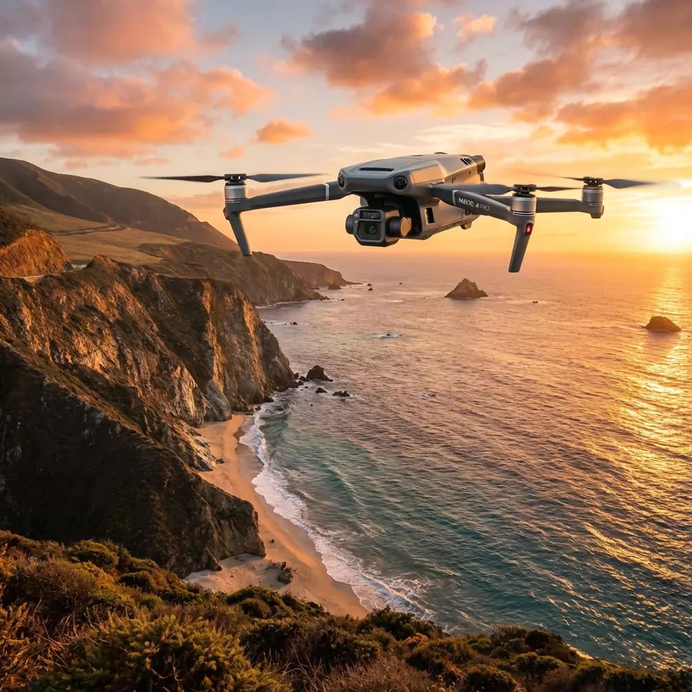
Mavic 3T in Dusty Wildlife Monitoring: A Field Case Study From the Edge of Visibility
META: A practical expert case study on using the DJI Mavic 3T for dusty wildlife monitoring, covering thermal detection, O3 transmission, AES-256 security, battery workflow, and field-ready mission strategy.
A few years ago, I was asked to support a wildlife monitoring team working across dry scrubland at the end of a punishing summer. Their problem was not lack of effort. It was visibility.
By mid-morning, dust would hang in the air like a veil. Vehicle patrols pushed animals deeper into cover. Fixed observation posts gave only partial coverage. Standard RGB drone flights looked sharp on paper, but in practice they kept running into the same wall: heat shimmer, low contrast, and animals blending into the landscape long before the team could build a reliable count.
That is the context in which the Mavic 3T makes sense.
Not as a fashionable upgrade. Not as a generic “thermal drone” label. As a tool that solves a very specific field problem: finding and tracking wildlife in harsh, dusty conditions without turning the mission itself into the main disturbance.
Why dust changes the mission
Dust affects more than image quality. It changes the entire logic of a wildlife operation.
In clean air, an observer can often work from visual detail. Coat patterns, antler shape, body posture, trail direction. In dusty conditions, those cues collapse fast. The background flattens. Shadows become misleading. Distance estimates get sloppy. A herd near a dry riverbed can disappear visually even when it is still well within the flight area.
That is why thermal signature matters so much in this type of work.
With the Mavic 3T, the job shifts from “spot the animal by appearance” to “detect the heat contrast first, then verify.” That sounds simple, but operationally it is a major improvement. When visibility is compromised by airborne dust, thermal is often the first reliable indicator that something living is present at all. Instead of scanning endlessly for shape and color, the pilot and observer can identify a hotspot, assess movement, and then use the visual payload to classify what they are seeing.
For wildlife monitoring, that sequence is efficient and less intrusive. Less time searching. Less time loitering. Fewer unnecessary low passes.
The field lesson that changed our workflow
On one survey block, we had repeated trouble monitoring movement between a watering point and a patch of sparse cover to the north. Ground teams knew animals were using the corridor, but visual counts were inconsistent. Some mornings suggested a strong presence. Others appeared almost empty. The issue was not migration. It was detection failure.
The breakthrough came when we stopped treating the mission as a simple daylight mapping flight and started treating it as a thermal-led observation task.
The Mavic 3T allowed us to launch early, while the ground still held some overnight cooling and animal heat signatures separated more clearly from the terrain. In those windows, the aircraft could pick up movement patterns that were nearly invisible once the sun pushed dust and thermal clutter into the scene. The difference was immediate. Routes that looked empty in RGB began to show intermittent crossings. Resting positions near scrub lines became visible. We were no longer guessing where the animals might be; we were building repeatable evidence.
That is where this aircraft earns its place in wildlife work. It compresses the gap between probable activity and confirmed activity.
O3 transmission matters more than most teams expect
One of the details that rarely gets enough attention in wildlife monitoring is link stability. People talk about sensor quality, and rightly so, but the live feed is what turns a drone from a camera into an operational tool.
The Mavic 3T’s O3 transmission system matters in dusty field conditions because wildlife monitoring is often done at the edge of practical observation distance. You may be working from a standoff position to avoid disturbing animals. You may be behind uneven terrain or sparse tree lines. You may also be dealing with environmental haze that makes the visual scene harder to interpret in real time.
A stable transmission link is not just a convenience. It reduces hesitation in the field.
When the pilot can trust the feed, the aircraft can be positioned more deliberately. The observer can call out movement without second-guessing signal breakup. Search lanes become cleaner. Reacquiring a thermal target after a turn or altitude change becomes faster. On sensitive wildlife operations, that translates into shorter exposure over the target area and fewer corrective maneuvers.
If you have ever tried to confirm animal position through a choppy feed while the scene itself is already obscured by dust, you know how quickly a mission turns from disciplined to reactive. O3 helps prevent that slide.
Thermal detection is only useful if you interpret it correctly
The Mavic 3T is not magic. Thermal signature can mislead inexperienced teams, especially in dry environments.
Warm rocks, sun-loaded soil, recently used tracks, livestock outside the survey brief, and even equipment left in the field can all create false positives. The aircraft solves the detection problem, but the operator still has to solve the interpretation problem.
In our case, we built a simple decision rule. First detect the hotspot thermally. Then confirm movement or body structure. Then cross-check with the visual sensor when conditions allow. That reduced overcounting and kept the reporting defensible.
This matters because wildlife monitoring is often used to support management decisions, conservation planning, and sometimes conflict mitigation near agricultural boundaries. A drone that finds more targets is helpful. A drone workflow that produces reliable evidence is what actually changes outcomes.
The Mavic 3T supports that evidence chain well because it gives teams two ways to verify what they are seeing. In dusty conditions, that dual confirmation is often the difference between a useful count and an argument about artifacts.
Battery workflow decides whether the day stays productive
Dusty wildlife operations usually involve travel time, setup time, pauses for animal behavior, and bursts of intensive flying when movement picks up. That makes battery logistics more important than many first-time teams expect.
This is where hot-swap batteries, even if managed as a field practice rather than just a feature phrase, become operationally significant. The value is continuity. If your team can land, change power quickly, and relaunch on a known pattern without rebuilding the entire mission rhythm, you preserve the most important asset in the field: timing.
Wildlife does not move on your schedule. A herd can emerge for a short crossing window, then vanish into cover for hours. A predator can appear briefly near a carcass site and never present the same opportunity again that day. Efficient battery change procedures keep the aircraft available during those narrow intervals.
With the Mavic 3T, that means planning staging points, dust control around takeoff and landing, battery rotation discipline, and a clear handoff between pilot and observer. The aircraft may be compact, but the mission should not be casual.
In one deployment, we started using a landing mat and a strict battery sequence because dust contamination during quick turnarounds was causing avoidable friction in the workflow. The improvement was not glamorous. It was just smart fieldcraft. But it increased usable sortie time and cut down on rushed relaunches.
Security has a place in conservation work
Another detail worth calling out is AES-256.
Some readers associate encrypted transmission with industrial inspection or public safety, but it also has clear value in wildlife monitoring. Sensitive location data can be a real concern. Nesting sites, migration corridors, watering points, or concentrations of vulnerable species should not be casually exposed through weak operational practices.
AES-256 matters because it strengthens the security posture around live feeds and mission data handling. For teams working in anti-poaching support, protected reserves, or private conservation areas, that is not theoretical. Operational discretion matters.
The Mavic 3T therefore fits an increasingly common requirement in modern conservation: collect precise aerial intelligence without creating unnecessary risk around the information itself.
That is one of the reasons I now advise teams to think beyond “Can this drone see the animals?” and ask the harder question: “Can this system support the full chain of observation, recording, transfer, and review responsibly?”
Where photogrammetry fits, and where it does not
The Mavic 3T is often discussed primarily for thermal work, but there is a useful secondary role here.
Photogrammetry can support wildlife monitoring when the task includes habitat change assessment, route analysis, erosion tracking, or comparing vegetation density around water sources. If a team needs to understand not just where animals were seen, but why movement patterns are shifting, a site model can add context. Dusty landscapes are dynamic landscapes. Tracks wash out. Informal trails split. Seasonal water edges move.
That said, teams should be careful not to force a mapping workflow onto every wildlife task. In active monitoring, detection and observation usually come first. Photogrammetry is most valuable when paired with a clear habitat or terrain question. If you are building spatial products for repeat comparison, GCP placement can improve consistency, particularly where management decisions depend on accurate alignment across survey dates.
The key is role separation. Use the Mavic 3T to detect and monitor. Use structured mapping only when the objective genuinely calls for terrain analysis or repeatable site documentation.
A practical note on BVLOS thinking
In many wildlife areas, the temptation is obvious: expand the search area, push farther, cover more ground. That is where BVLOS enters the conversation.
From a pure mission-design standpoint, BVLOS concepts are attractive for conservation work because animal movement corridors can be long, access can be poor, and ground disturbance should be minimized. But the practical reality is regulatory, procedural, and risk-based. Teams need legal authority, robust procedures, and communication discipline before treating expanded-range operations as routine.
The Mavic 3T gives operators tools that support structured field missions, but responsible use matters more than raw reach. For most teams, the smarter near-term gain comes from improving launch timing, observer coordination, thermal interpretation, and battery turnover before trying to scale outward.
That is not a conservative answer. It is the answer that usually produces better data.
What made the biggest difference in the end
The biggest improvement was not one isolated specification. It was the way the Mavic 3T allowed the mission to be redesigned around conditions that used to beat us.
Dust no longer meant the survey was compromised before it began. We could fly earlier, detect heat before visual detail emerged, maintain a solid live link through O3 transmission, and protect sensitive operational data with AES-256. Those are not abstract features. In the field, they become fewer missed sightings, less disturbance, and a more defensible record of what was actually observed.
For teams monitoring wildlife in dry, dusty environments, that combination is what matters.
It turns a frustrating search problem into a structured observation workflow.
It also changes the attitude of the crew. When people stop fighting visibility and start working with reliable cues, they make better decisions. They fly cleaner patterns. They spend less time chasing uncertainty. They come back with information that can actually be used.
If your operation is wrestling with that same challenge, it may help to compare field workflows before comparing spec sheets. That conversation is usually more revealing than marketing language. If you want to talk through a real monitoring scenario, you can message the field team here and frame it around terrain, dust load, target species, and reporting needs.
That is how I now evaluate the Mavic 3T for wildlife work. Not by asking whether it can fly over a dusty landscape, but whether it can make that landscape readable again.
Ready for your own Mavic 3T? Contact our team for expert consultation.