Mavic 3T for Remote Coastline Scouting: A Practical Expert
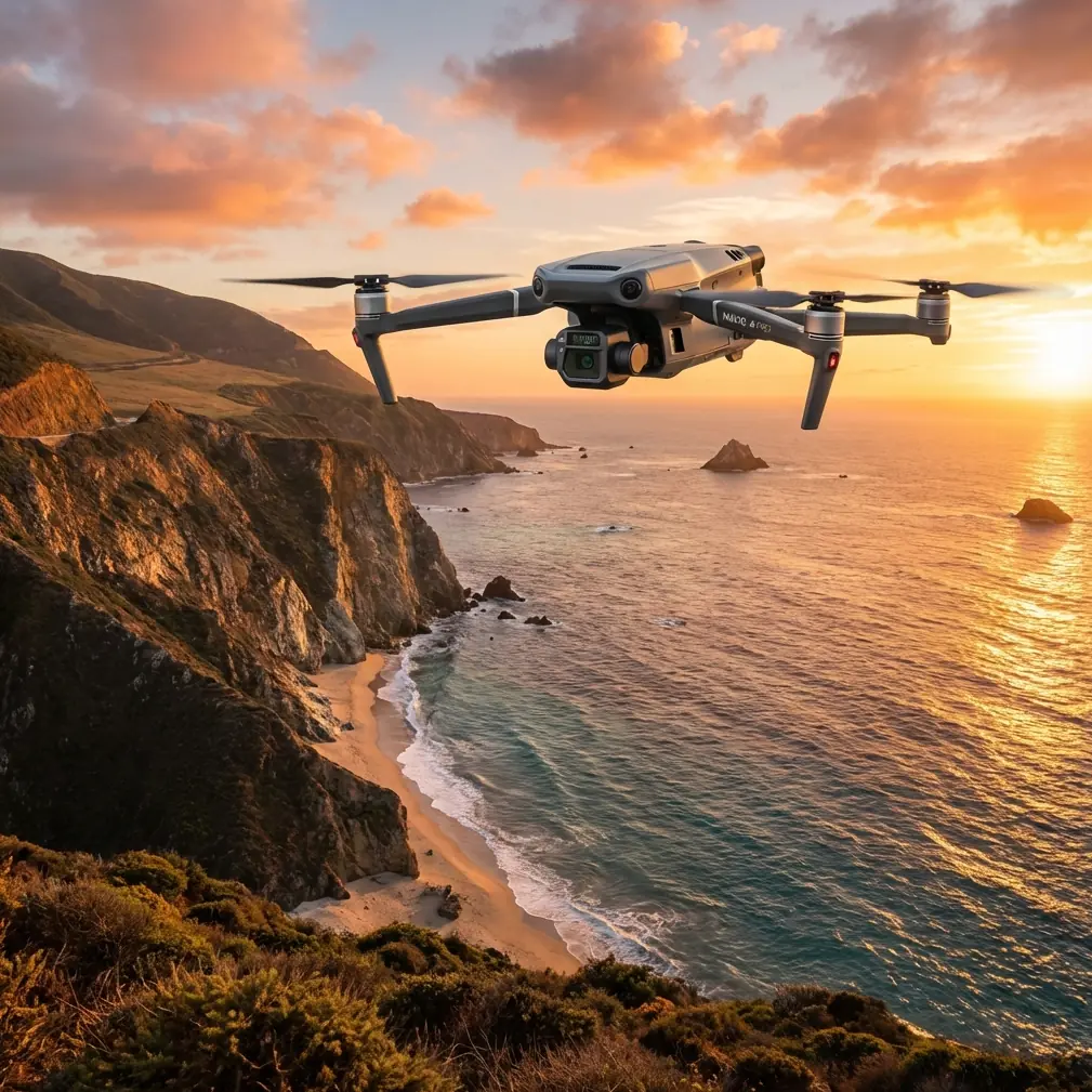
Mavic 3T for Remote Coastline Scouting: A Practical Expert Guide
META: Learn how the Mavic 3T fits remote coastline scouting with thermal workflows, control-system logic, airworthiness discipline, and field-ready operating methods.
Remote coastline scouting sounds simple until you actually do it.
Salt haze softens contrast. Access roads disappear. Tidal windows compress your working time. Wind shifts around cliffs and harbors. And if your job is to document erosion, inspect shoreline assets, check aquaculture zones, or screen for heat anomalies around equipment and structures, the drone has to do more than fly far. It has to fly predictably, gather evidence cleanly, and support a workflow you can defend afterward.
That is where the Mavic 3T earns its place.
I’m not approaching this from the usual feature-sheet angle. For coastal work, the more useful question is this: why does a compact thermal platform become trustworthy in remote operations? The answer is not just the thermal sensor, or O3 transmission, or the convenience of hot-swap batteries. It is the way the aircraft fits into a disciplined mission chain: pilot input, aircraft response, sensor capture, testable operating limits, and repeatable documentation.
That chain matters more on a remote shoreline than almost anywhere else.
Why the Mavic 3T suits coastline scouting better than many larger platforms
There is a persistent assumption in industrial drone teams that bigger aircraft are automatically better for harsh terrain. In some categories, yes. But remote coastline scouting often rewards a different balance.
The Mavic 3T can be deployed quickly from uneven staging points, moved between overlooks without a large crew, and used for mixed-task sorties where visual context and thermal signature both matter. That last point is where it tends to outperform many competing compact drones: it is not trapped in a single-purpose workflow. One aircraft can document a failing sea wall in daylight, scan thermal irregularities on roofed shoreline facilities, and record reference imagery for later photogrammetry planning.
For remote sites, flexibility is not a bonus. It reduces mission risk.
A larger system may offer endurance or payload expansion, but it also adds transport burden, launch complexity, and more friction around short weather windows. On coastlines, those windows close fast.
The hidden engineering reason predictable control matters over water and rock
A lot of operators talk about transmission range first. I would put controllability ahead of it.
One of the most relevant technical ideas from flight-control design is the command loop. In aircraft control theory, the command loop defines the relationship between pilot input and aircraft motion. The source material here is very specific: command gradient is described as a basic parameter of control-law design, linking pilot force or displacement to aircraft response. It also notes that the response model is commonly shaped as a first-order inertial element, with a time constant typically around 0.2 to 0.25 seconds, to smooth abrupt control inputs and suppress high-frequency disturbance.
That sounds abstract until you fly near a broken coastline in crosswind.
What you want in that environment is not twitchy immediacy. You want an aircraft that turns pilot intent into stable motion without overreacting to small stick corrections. When you are orbiting a lighthouse foundation, tracing the edge of an eroded bluff, or moving laterally to maintain sightlines around a rock outcrop, smooth command shaping is operationally significant. It helps the aircraft remain composed when the pilot is working under visual compression and gust load.
This is one reason the Mavic 3T feels more “finished” in serious fieldwork than many lower-tier thermal drones. The aircraft’s practical value comes from stable behavior, not just sensor stacking. For coastline scouting, stable behavior directly improves image overlap, thermal interpretation, and pilot confidence.
Thermal use on the coast: what actually works
Thermal on shorelines is often misunderstood.
People imagine it as a universal detection layer. It is not. Thermal is strongest when you already know what kind of contrast you are trying to reveal. On coastal missions, the Mavic 3T’s thermal capability is most useful in a few recurring situations:
- checking for unusual heat around remote utility housings, pumps, or shoreline electrical infrastructure
- identifying moisture-related thermal inconsistency in built coastal assets
- separating disturbed ground or manmade objects from cooler background during low-light windows
- screening inaccessible rooflines or revetment-adjacent structures where standard visual cues are weak
The phrase to keep in mind is thermal signature, not just thermal image.
A thermal signature only becomes meaningful when tied to timing, surface type, weather, and viewing angle. Wet rock, sand, concrete, marine growth, metal roofing, and standing water all release and retain heat differently. The Mavic 3T gives you a practical way to compare those conditions in one sortie, but interpretation still depends on method.
My recommendation is straightforward: use thermal passes early or late in the daily temperature cycle, then immediately follow with visual context capture. That sequence turns anomalies into usable evidence rather than isolated heat patches on a screen.
Height control matters more than pilots realize
Another useful detail from the reference material comes from automatic flight control design. It describes altitude deviation feedback using sensors such as a barometric altimeter, radio altimeter, or atmospheric data sensor to measure deviation from a preset height and adjust pitch so the aircraft maintains the desired altitude. It also describes attitude-angle feedback, where gyroscopic measurement of pitch, roll, or yaw is fed into the control system to maintain aircraft attitude.
For remote coastline scouting, these are not textbook footnotes. They explain why some flights produce clean datasets while others produce inconsistent ones.
If you are doing shoreline documentation for later photogrammetry, small altitude fluctuations degrade consistency in ground sampling distance and overlap. If you are scanning a seawall line or coastal road edge, roll corrections from gusts can also alter your camera geometry enough to complicate stitching and interpretation. A drone with robust attitude and altitude control gives you a more reliable capture platform when terrain and airflow are constantly changing.
That is especially relevant if you are planning orthomosaic work with GCP support. Ground control points can sharpen geospatial confidence, but they cannot rescue poor image geometry caused by sloppy flight behavior. The Mavic 3T is not a dedicated large-format survey aircraft, yet for many coastal asset teams it is good enough to serve as a reconnaissance mapper before a heavier photogrammetry platform is mobilized.
In practice, that means you can use it in two tiers:
- rapid thermal and visual scouting
- preliminary photogrammetry-grade capture to decide whether a full survey is justified
That dual role is where it often pulls ahead of single-sensor competitors.
Airworthiness thinking is not just for manufacturers
One of the strongest reference points in the source material comes from civil aircraft certification procedure. It outlines how an applicant proposes a certification basis, how a certification plan defines the applicable standards, verification methods, document numbers, and expected completion dates, and how reviewers inspect not only the product but also the test installation, equipment, and personnel qualifications. It even references formal documentation such as AAC-033 (11/88) and AAC-039 (11/88) during examination and approval steps.
Why bring up civil aircraft certification when talking about a Mavic 3T on a shoreline?
Because professional drone work improves dramatically when operators borrow that mindset.
Remote coastal missions are where casual planning breaks down. A serious Mavic 3T team should build its own mini version of a conformity plan before departure:
- mission objective
- required sensor outputs
- battery rotation plan
- communication method
- transmission risk areas
- altitude and standoff constraints
- environmental limits
- data verification checklist
- crew qualifications and role split
That is not bureaucracy. It is how you avoid returning from a difficult site with incomplete evidence.
The source material also stresses that the applicant must explain why the design contains no unsafe factors and show that design features have been sufficiently inspected and tested. For field operators, the parallel is obvious: do not rely on assumptions about your aircraft, batteries, tablets, antennas, payload settings, or team habits. Validate the whole operating package before you bet a tide-sensitive mission on it.
A practical coastline workflow for the Mavic 3T
Here is the workflow I use for remote shoreline scouting when the goal is actionable documentation rather than casual observation.
1. Build the route around line-of-sight breaks, not just distance
Cliffs, ridgelines, service sheds, and harbor structures interrupt control and video links in ways open-field pilots often underestimate. O3 transmission is a real advantage here because it helps maintain a more resilient feed in complex terrain, but no transmission system turns obstructed geography into open sky. Segment the route into observation pockets rather than one long out-and-back.
If your operation is moving toward BVLOS frameworks, planning discipline becomes even more important. Stay inside your approved civilian operating structure and make sure communications, observers, and procedures match the authorization environment.
2. Fly thermal first when contrast is favorable
Capture the thermal signature before the sun flattens it. On manmade shoreline assets, even a short delay can erase the contrast you came to inspect.
3. Follow with visual passes for context
Every thermal anomaly needs visual explanation. Roof seam, wet patch, exposed conduit, trapped debris, surface spall, vehicle trace, drainage path—without context, the thermal image has limited value.
4. Add mapping lines if the site may need escalation
If the mission could lead to engineering review, collect overlap while you are there. Even if the Mavic 3T is not your final mapping platform, a usable preliminary dataset can save a return trip.
5. Confirm metadata before leaving the site
Do not pack up until you verify key frames, thermal captures, timestamps, and position records. Remote coastlines are expensive to revisit.
Security and data handling in remote infrastructure work
Many coastal missions involve sensitive commercial sites: ports, energy transfer points, fishery infrastructure, utility enclosures, storage zones. In those environments, secure handling is part of operational credibility.
That is where AES-256 enters the conversation. Not as a buzzword, but as part of a broader discipline around protected transmission and data stewardship. Security features matter most when paired with boring habits: controlled device access, defined file naming, synchronized time settings, and clean handoff procedures once the aircraft lands.
On a remote mission, technical capability without data discipline creates downstream risk.
Batteries, weather windows, and the real meaning of efficiency
People often underestimate how much time is lost on shoreline deployments between flights rather than during them.
This is why hot-swap batteries matter in practice. They shorten the dead interval between sorties, which is often the difference between finishing the thermal pass in stable light and missing it. On remote coastlines, where launch points may require hiking, scrambling over riprap, or vehicle repositioning, every interruption amplifies fatigue and increases the chance of skipped checks.
The Mavic 3T is strongest when the team treats turnaround speed as a mission-quality factor, not a convenience.
Where the Mavic 3T clearly excels against competitors
Against many compact rivals, the Mavic 3T stands out because it combines deployability, thermal utility, stable flight behavior, and operational maturity in one package. Some alternatives are easier on the budget but weaker in transmission robustness or thermal integration. Others are capable imagers but less efficient as fast-response field tools.
For remote coastline scouting, the winner is rarely the drone with the longest brochure. It is the one that lets a small team capture defensible data in unstable conditions and leave the site with confidence.
That is exactly the niche the Mavic 3T serves well.
Final field advice from a coastline perspective
If you are using the Mavic 3T for remote coastal work, think like both a pilot and a reviewer.
Pilot thinking helps you read wind, terrain, access, and timing. Reviewer thinking forces you to ask whether your mission plan, verification steps, crew roles, and outputs would stand up to scrutiny after the fact. That blend is what turns a capable drone into a dependable operational system.
The engineering references behind this discussion are revealing for that reason. One explains how a well-shaped command loop and feedback structure produce stable aircraft response. The other shows how disciplined review, test planning, and qualification logic support safe, credible flight operations. Together, they point to the real lesson: good drone work is not only about sensors. It is about control and proof.
And for remote coastlines, proof is everything.
If you want to compare your shoreline workflow, thermal inspection method, or mapping setup with an experienced team, you can message us directly on WhatsApp for field-use questions.
Ready for your own Mavic 3T? Contact our team for expert consultation.