Mavic 3T Field Report: Scouting Dusty Fields When Every
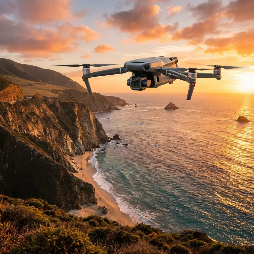
Mavic 3T Field Report: Scouting Dusty Fields When Every Sensor Decision Counts
META: Expert field report on using the DJI Mavic 3T for dusty field scouting, with thermal insight, O3 transmission reliability, battery workflow, and what current industry trends signal for commercial operators.
Dust changes everything.
It softens contrast, hides surface texture, and turns a straightforward scouting job into a test of sensor discipline. That is exactly where the Mavic 3T starts to separate itself from aircraft built for cleaner, simpler environments. In dusty field conditions, you are not just flying to “see” land. You are trying to extract usable information despite glare, haze, heat shimmer, and the constant chance that a visual-only pass misses what matters.
I have been thinking about that reality in the context of the latest industry signals coming out of Zhuhai. This year’s Zhuhai Airshow drew markedly more overseas exhibitors than past editions, and the show floor was packed with first-time debuts across new technologies and new equipment. That matters even for a practical platform like the Mavic 3T. When a major aviation event becomes busier, more international, and more centered on first appearances, it usually tells us something specific: operators are no longer satisfied with drone hardware that merely flies well. They want integrated sensing, cleaner workflows, and aircraft that hold their value in real operating environments.
For field scouting crews, that trend lands squarely on the Mavic 3T.
The aircraft’s appeal is not that it does one glamorous thing. It is that it reduces uncertainty. In dusty farmland, open industrial lots, and rough perimeter roads, uncertainty is expensive. It burns daylight, drains batteries, delays follow-up teams, and creates bad decisions from incomplete observations. A field report should start there, because that is the standard professionals actually use: not how the aircraft looks on paper, but whether it helps you trust your data before you leave the site.
Why dusty fields expose weak workflows
On a clear day with low wind, many drones appear capable. Dust is where weak systems show themselves.
A dusty scouting mission usually combines several problems at once. Fine particulate reduces visible detail near the surface. Vehicle movement or dry wind can stir fresh plumes mid-flight. Solar loading changes thermal behavior across the ground through the day. And if you are covering broad acreage, the pilot may spend more time managing link quality, battery rhythm, and waypoint confidence than actually interpreting what the camera sees.
The Mavic 3T answers that with a multi-sensor approach that makes more sense in the field than in a brochure. Thermal signature analysis is not a novelty here. It becomes the second opinion that the visible camera cannot provide when dust obscures edges or masks subtle differences in crop stress, ground compaction, or equipment heat. In a scouting run, that means you can cross-check what looks like a uniform area in RGB against a thermal layer that tells a different story.
That difference is operationally significant. If one section of field appears visually similar to the surrounding area but carries a hotter thermal pattern, you have a reason to inspect irrigation performance, machinery tracks, or subsurface variation before the issue spreads or the team leaves. In practical terms, the drone is not just collecting imagery. It is filtering where your attention should go.
A wildlife moment that proved the value of thermal
One recent dusty field operation brought that home in a way no spec sheet ever could.
We were working a dry agricultural block with low vegetation, loose soil, and enough suspended dust to flatten the scene whenever the wind picked up. Midway through the mission, a hare broke from the edge of the field and moved across a warmer patch near a vehicle track. In the visual feed, it appeared briefly and then blended into the color and texture noise almost immediately. In the thermal view, it remained distinct long enough to adjust the flight path and maintain a safe, non-intrusive buffer.
That is not a dramatic story. It is a useful one.
The significance was not the animal itself. It was what the sensors allowed us to do: recognize movement early, avoid crowding the wildlife, and keep the operation calm and controlled without guessing. In dusty terrain, where visual detail can collapse without warning, thermal gives you a cleaner read on live obstacles and changing conditions. For civilian field teams, that is the kind of capability that improves safety and preserves mission continuity at the same time.
O3 transmission matters more than people admit
Most pilots talk about image quality first. In the field, I often care just as much about staying connected.
Dusty environments are usually broad environments. The job may involve linear passes, oblique checks on access routes, and repeated repositioning over acreage that stretches farther than the initial setup point suggests. This is where O3 transmission becomes more than a marketing acronym. A stable, high-quality link lets the operator make better decisions on the first pass rather than burning time on repeat runs because the feed was unreliable or too degraded to interpret in real time.
Operationally, that changes how the crew works. If the transmission holds up cleanly while the drone is crossing a dusty corridor or turning near a reflective surface, the pilot can keep confidence in the framing, and the observer can flag anomalies without waiting for post-flight review. You are compressing the gap between collection and decision.
That compression is valuable for agriculture and land management. It is just as useful for industrial yards, solar sites near dry terrain, and training grounds where environmental conditions are less forgiving than office demos suggest. A field drone that preserves decision quality during the mission can save an entire afternoon of unnecessary follow-up.
Thermal plus photogrammetry is where the Mavic 3T gets practical
There is a habit in the market to separate thermal work from mapping work as if they belong to different missions. In reality, some of the best scouting outcomes happen when you combine them intelligently.
Photogrammetry gives spatial context. Thermal signature gives diagnostic context. Add solid GCP discipline, and suddenly your field report moves beyond “something looks off over there” to a more credible, repeatable dataset that teams can compare over time.
This is one of the more underappreciated strengths in a platform like the Mavic 3T for scouting work. You can use the aircraft as an early-stage intelligence tool rather than a single-purpose camera. A thermal anomaly by itself is useful. A thermal anomaly anchored to accurate map products and verified against GCP-backed geometry is actionable. That is when agronomists, site supervisors, and asset managers stop arguing about whether they are seeing the same problem.
Dusty field environments particularly benefit from that layered approach because visibility is often inconsistent across the mission. A section flown in slightly calmer air may produce stronger visual detail than the next section flown ten minutes later. Thermal can stabilize interpretation, while photogrammetry keeps the whole survey coherent.
Battery rhythm decides whether the mission feels professional
People tend to treat batteries as a logistics footnote. On real field days, battery handling often determines whether the job remains disciplined.
In dusty locations, crews usually work from vehicles, improvised tables, or the tailgate. The cleaner and faster the swap process, the less chance of contaminating gear, mismanaging state of charge, or letting the timeline drift. Hot-swap batteries are not just about speed. They support continuity. When the aircraft returns, the team can rotate power quickly, maintain observation momentum, and keep the area model consistent while environmental conditions are still comparable.
That continuity has a hidden advantage in dusty field scouting: thermal consistency. If you can relaunch efficiently, you reduce the spread between sequential captures and preserve a more useful comparison across the site. When surface temperatures are shifting with sun angle and wind, every unnecessary delay degrades interpretive value.
This is one reason professional operators gravitate toward workflows that feel almost boring in their reliability. Dusty field work punishes improvisation. The Mavic 3T fits better when used as part of a battery-and-data routine that is repeatable, clean, and fast.
Security and confidence are now part of the buying conversation
The rise in overseas participation at Zhuhai is not just a headline about crowd size. It points to a more competitive and more scrutinized drone ecosystem. When exhibitor numbers from abroad grow sharply and first-time launches dominate attention, buyers become more demanding about trust, not only capability.
That is where details like AES-256 matter. For many commercial operators, secure transmission and protected data handling are no longer niche concerns. They are procurement questions. Whether the mission is crop scouting, utility inspection, or contractor documentation, teams increasingly need confidence that operational data is not casually exposed during collection or transfer.
This trend will only intensify. A busier, more internationally watched showcase tends to accelerate comparison between platforms, and comparison pushes standards upward. Operators looking at the Mavic 3T today are not just asking whether it flies well. They are asking whether it fits modern expectations for sensing, security, and workflow integrity.
If you are assessing that fit for your own environment, a quick field-oriented discussion usually surfaces more than a generic product page ever will, and this direct WhatsApp line can be useful: https://wa.me/85255379740
The real meaning of all those “firsts” at Zhuhai
The most interesting takeaway from Zhuhai was not a single debut. It was the density of first-time reveals.
When a major exhibition becomes known for repeated first appearances, the signal to working operators is clear: platform cycles are accelerating, and expectations around mission-specific features are rising with them. For Mavic 3T users, that does not mean chasing every new release. It means understanding why this category is moving toward integrated sensing, stronger links, tighter security, and cleaner field workflows.
In that sense, the Mavic 3T sits in a very current lane of the market. It reflects the same pressure visible on the exhibition floor: do more on one sortie, reduce ambiguity, and convert sensor data into field decisions without dragging the operation into complexity.
For dusty field scouting, that alignment is unusually relevant. You do not need a drone that looks advanced at a trade show. You need one that handles environmental friction. Dust, heat, wildlife movement, and wide-area coverage all create friction. A useful aircraft lowers it.
What I would watch before committing the Mavic 3T to a field program
The Mavic 3T is strong, but it performs best when the operating concept is clear.
If your field program depends on repeatable scouting over dry terrain, I would focus on four questions:
First, are you using thermal as a decision layer or just as an extra view? If it is the former, the aircraft becomes more valuable immediately.
Second, do you have a photogrammetry plan that includes GCP placement where accuracy matters? That determines whether your findings remain anecdotal or become trackable over time.
Third, is your battery routine built for continuity? Hot-swap efficiency has more influence on mission quality than most teams expect.
Fourth, are you planning around communication confidence, especially if your sites are large enough to raise BVLOS planning questions in the future under applicable local rules and approved workflows? Even if you are operating strictly within current visual line-of-sight requirements, a platform with strong O3 transmission supports better discipline today and smoother scaling tomorrow.
These are not abstract considerations. They shape the difference between owning a capable aircraft and running a capable drone program.
Final assessment from the field
What stands out to me most about the Mavic 3T in dusty scouting work is not any single feature. It is the way the aircraft reduces blind spots.
Thermal helps when the visible scene becomes unreliable. O3 transmission helps when distance and terrain complexity start stressing pilot confidence. AES-256 speaks to a more mature commercial expectation around data handling. Hot-swap workflow protects the tempo of the mission. Photogrammetry paired with GCPs turns observations into something teams can revisit and defend.
And the broader industry context matters. A major event like Zhuhai attracting significantly more overseas exhibitors, while showcasing wave after wave of first-time launches, tells us that operational users now sit in a more competitive, faster-moving market. That raises the bar. The Mavic 3T remains relevant not because it is fashionable, but because it answers real field conditions with a practical sensor package and disciplined workflow potential.
In dusty fields, that is what earns trust. Not hype. Not novelty. Clean decisions from imperfect conditions.
Ready for your own Mavic 3T? Contact our team for expert consultation.