Scouting Urban Fields with the Mavic 3T: A Case Study
Scouting Urban Fields with the Mavic 3T: A Case Study in Thermal Clarity, Control Limits, and Better Data
META: A field-tested case study on using the DJI Mavic 3T for urban field scouting, with practical insight on thermal signature reading, flight control, accessory choices, and why environmental constraints matter.
I’m Dr. Lisa Wang, and when people ask whether the Mavic 3T is “enough” for urban field scouting, my answer is usually the same: the aircraft is rarely the weak link. The limiting factors are almost always interpretation, environment, and setup discipline.
That became obvious during a recent scouting exercise over fragmented urban-edge fields bordered by roads, glass structures, low-rise rooftops, and heat-soaked concrete. This was not a wide-open agricultural block where a pilot can simply grid the site, collect imagery, and go home with clean orthomosaics. The challenge here was mixed surfaces, compressed airspace, unstable thermal backgrounds, and the need to identify field conditions without overflying carelessly or wasting battery cycles.
The Mavic 3T handled the assignment well, but not because it is magic. It worked because its sensing stack, transmission stability, and thermal workflow aligned with the realities of the job.
Why urban field scouting is different
Scouting a field in an urban setting sounds simple until you actually do it. The moment a crop area sits beside reflective façades, paved service lanes, drainage structures, parked vehicles, and warm rooftop equipment, thermal interpretation becomes less forgiving. The operator is no longer reading crop condition in isolation. They are reading crop condition inside a noisy heat environment.
That matters because a thermal signature is only useful if the pilot understands what is influencing it. An irrigated strip near a concrete boundary may present a very different temperature pattern from the same crop variety in an open rural block. Not all thermal contrast is agronomic. Some of it is environmental contamination.
This is where the Mavic 3T becomes valuable for civilian field scouting. It allows the operator to compare visible context and thermal behavior in one flight workflow, instead of forcing a split between separate aircraft or disconnected payload sessions. In a tight urban window, that integration saves time and often prevents misreads.
What shaped our flight plan
Before the first takeoff, we built the mission around two realities that pilots often ignore.
First, airframe control is never independent from aerodynamic load. One of the reference engineering documents highlights a principle from aircraft structural behavior: control effectiveness can decrease as aerodynamic forces rise, and in extreme conditions the intended control response can begin to reverse. The text describes how aerodynamic force from a control surface scales with dynamic pressure, while the opposing structural twist effect grows even faster, effectively with the square of that pressure. In plain language, speed and load can make an aircraft less obedient.
Now, the Mavic 3T is not a swept-wing transport aircraft, and nobody should force a one-to-one comparison. But the operational lesson still carries over. In urban scouting, aggressive inputs near obstacles, gust corridors between buildings, or fast repositioning passes can degrade precision. The smartest Mavic 3T pilots don’t just ask, “Can I reach that corner quickly?” They ask, “Will higher speed and turbulence reduce the quality of the data or my margin of control?”
Second, environment-driven heat effects need calibration thinking. Another reference source, focused on anti-icing and windshield thermal management, gives a useful engineering perspective: on aircraft windshields, interior heat loss can be only about 5% of exterior heat loss under a typical cruise case at 2134 m altitude. That number is from a very different aircraft system, but the broader significance is relevant here: external thermal conditions dominate surface heat behavior far more than people intuitively expect.
For Mavic 3T field scouting, that means outside conditions deserve more respect than office-plior assumptions. Surface heating from sun angle, wind exposure, building shadows, and residual urban warmth can overwhelm subtler crop signals if the operator does not account for them. In our mission, we scheduled two short windows rather than one long flight block: an early pass for moisture and stress contrast, then a later pass to confirm whether suspect hot spots were persistent or simply surface warming artifacts.
That decision made the dataset more trustworthy.
The site and the mission objective
The property was a patchwork of managed green plots used for urban agriculture trials, bordered by utility fencing and service access lanes. The client wanted three things:
- A rapid condition overview across all plots
- Identification of irregular thermal zones that could indicate drainage, compaction, or irrigation inconsistency
- Enough geospatial structure to support follow-up ground checks with GCP-backed map products
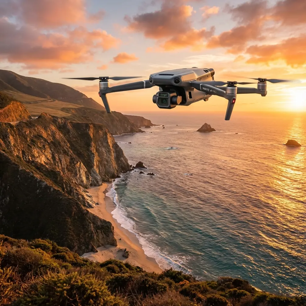
This is exactly the kind of assignment where the Mavic 3T fits well. It is small enough to deploy quickly in constrained takeoff areas, but capable enough to generate useful thermal and visual intelligence in the same sortie.
Why the Mavic 3T fit this job
The aircraft’s real strength in this scenario wasn’t any one spec in isolation. It was the way multiple capabilities reduced operational friction.
The thermal camera helped isolate anomalous heat patterns at plot edges and drainage transitions. The visual camera provided context when thermal readings alone were ambiguous. O3 transmission mattered because the site included visual clutter, RF noise sources, and partial obstructions at the perimeter. Stable link quality is not just a convenience in urban work; it affects confidence in framing, route discipline, and safe return decisions.
Security also mattered. This was not a secretive site, but it was inside a sensitive urban development zone where image handling standards were strict. AES-256 support is one of those features that many operators gloss over until a client asks how data transmission is protected. Having a straightforward answer builds trust.
And then there is battery workflow. For short-interval scouting, hot-swap batteries are not a luxury. They preserve momentum. In this case, we needed to compare conditions across closely timed flights while maintaining similar environmental assumptions. Quick turnaround let us keep the temporal gap tight rather than letting the site heat profile drift too far between sorties.
The accessory that improved results
The single best enhancement on this job was a third-party RTK workflow kit paired with portable GCP targets.
Not because the Mavic 3T suddenly became a dedicated survey platform. It didn’t. But when the goal is to revisit precise irregularities found in thermal imagery, spatial confidence matters. We used clearly visible ground targets to tighten alignment between visible imagery, thermal observations, and later boots-on-ground inspection.
That changed the quality of the handoff. Instead of saying, “There’s a warm patch near the east side,” we could say, “The anomaly appears along the northeastern edge of Plot C, aligned with the drainage break and visible in both thermal contrast and surface texture.” That level of specificity speeds client action.
A lot of operators underestimate this point. Photogrammetry is not only about making a beautiful map. In field scouting, it is about reducing ambiguity so that thermal findings can be checked efficiently. If a grower or site manager has to search an area manually, the value of the aerial data drops.
What the data actually showed
The first pass revealed three categories of thermal behavior.
One set of warm areas tracked exactly where we expected urban influence: along paved access edges and near a wall that reflected late-morning heat. Those zones looked dramatic in thermal view but had weak agronomic significance once compared with visible context.
A second set showed narrow linear warm signatures running diagonally through two plots. These turned out to correspond with shallow drainage inconsistency. The thermal pattern was subtle enough that without the Mavic 3T’s thermal layer, a visual-only pass would likely have missed it.
The third category was the most useful: one plot presented patchy temperature variation not tied to hardscape boundaries. The visible image showed slight canopy irregularity, and the thermal signature persisted in the second flight window. That persistence mattered. It suggested a real field condition rather than a transient heating effect.
This is where many scouting missions either succeed or fail. The aircraft can show you contrast, but it cannot think for you. Repeatability, comparison, and geospatial discipline are what turn images into decisions.
Control discipline in dense surroundings
Let’s come back to the structural-control reference, because it offers a surprisingly practical lesson for multirotor operators. The source explains that as aerodynamic loading increases, control effectiveness can be reduced by deformation-related effects, and eventually the response can even invert at a critical condition. Again, this is classical fixed-wing aeroelasticity, not a direct description of the Mavic 3T.
Still, the operational takeaway is excellent: do not assume more speed produces better control authority in a demanding environment.
In our urban field mission, the best thermal passes happened during slower, more deliberate legs with minimized yaw corrections. Fast repositioning introduced unnecessary blur risk, framing inconsistency, and avoidable workload. When flying between buildings or over boundary edges, maintaining smooth control inputs gave cleaner thermal comparisons than trying to “cover more ground” at higher speed.
That matters if you are trying to produce defensible scouting results. A rushed mission often looks efficient from the outside. It usually isn’t.
Thermal interpretation needs environmental humility
The anti-icing reference may seem far removed from small-drone operations, but one number from it captures a truth many pilots overlook: in one aircraft windshield case, internal heat loss was only around 5% of the external heat loss. The engineering context is different, yet the message is universal. Outside conditions dominate surface thermal behavior.
For Mavic 3T users scouting urban fields, that means you should treat thermal images as environment-dependent evidence, not stand-alone truth. Surface angle, reflective surroundings, wind washing, recent cloud transitions, and substrate moisture all shape what you see. The thermal camera is powerful precisely because it is sensitive. That sensitivity is an advantage only when the operator is equally disciplined.
Our second flight confirmed that approach. Several apparent hot spots vanished once shadow geometry changed. The persistent anomalies remained. Those were the ones worth flagging for on-site inspection.
Practical tips that came out of the case
A few habits made this mission cleaner:
- Fly one visual-context pass before relying on thermal interpretation.
- Use GCPs when follow-up action depends on precise location.
- Keep some flight legs slower than you think necessary.
- Compare at least two thermal windows if urban surface heating is a factor.
- Treat hardscape-adjacent heat with skepticism until verified.
- Use battery swaps to preserve timing consistency, not just total airtime.
If you are integrating the Mavic 3T into a repeatable scouting program, those details matter more than chasing headline specs.
Where the Mavic 3T stood out
The aircraft proved especially useful in the handoff between reconnaissance and action. We were not just collecting imagery. We were narrowing uncertainty.
The combination of thermal signature analysis, visual verification, secure transmission, and efficient battery turnover gave the client something operationally useful: a short list of probable field issues ranked by confidence. That is what commercial drone work should do. Not flood a stakeholder with screenshots. Reduce the number of things they need to inspect on foot.
For teams planning similar urban field work, I’d also recommend discussing workflow design before the first mission rather than after the first confusing heat map. If you want help thinking through payload setup, thermal checks, or GCP-backed scouting routines, you can message our flight planning desk here.
The larger lesson
The Mavic 3T is often discussed as if capability begins and ends with the sensor block. That misses the point.
On this job, success came from respecting control limits in a cluttered environment, understanding that thermal behavior is strongly shaped by the outside world, and adding a modest third-party positioning workflow to make findings easier to verify. Those are not glamorous details. They are the difference between interesting imagery and dependable field intelligence.
Urban field scouting asks more from the operator than open farmland does. There are more surfaces, more heat contamination sources, tighter flight geometry, and less room for sloppy interpretation. The Mavic 3T is well suited to that reality when used with method rather than haste.
That, ultimately, is why it remains such a practical aircraft for this kind of civilian work. Not because it does everything, but because it lets a disciplined operator connect thermal anomalies, visible evidence, and actionable location data in one compact platform.
Ready for your own Mavic 3T? Contact our team for expert consultation.