Scouting Mountain Forests With the Mavic 3T
Scouting Mountain Forests With the Mavic 3T: Practical Flight Altitudes, Thermal Strategy, and Terrain-Aware Workflow
META: A field-focused Mavic 3T tutorial for mountain forest scouting, covering optimal flight altitude, thermal signature interpretation, O3 transmission limits, AES-256 security, battery planning, and photogrammetry workflow.
Mountain forest scouting looks simple on paper: launch, climb, scan canopy, identify heat sources or terrain changes, come home. In practice, it is one of the more demanding jobs you can give a compact enterprise drone.
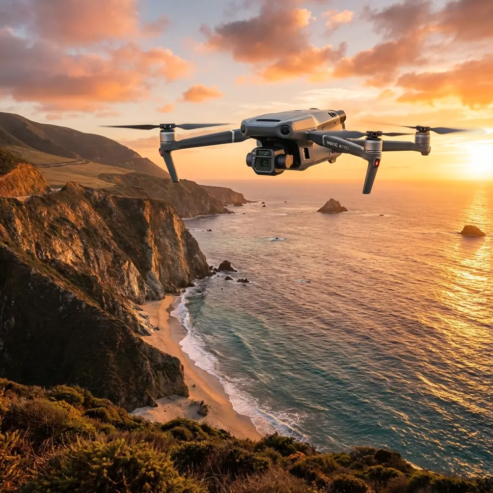
The DJI Mavic 3T is well suited to this work because it combines three things that rarely show up together in a small airframe: a thermal sensor, a wide visual camera, and a compact platform you can move quickly between trailheads, ridgelines, and access roads. For teams working in forestry, environmental assessment, utility corridor checks, and mountain land management, that combination matters. You are often operating in shifting weather, uneven terrain, partial GNSS masking under canopy edges, and places where every extra kilogram of equipment becomes a penalty.
This tutorial is built around a specific scenario: scouting forests in mountainous terrain with the Mavic 3T. The main question is not just whether the aircraft can do it. It can. The real question is how to fly it at the right altitude and with the right workflow so the data is useful once you leave the field.
Why mountain forests are harder than flat woodland
A forest on level ground usually allows a more consistent flight profile. In the mountains, the canopy and the terrain are both moving targets. You may be only 60 meters above the trees on one pass and 140 meters above them a few seconds later if you hold a constant altitude relative to launch point. That difference is not a minor detail. It directly affects:
- thermal detectability
- image resolution
- overlap for mapping
- obstacle risk
- radio link stability
This is where many pilots waste battery and gather weak data. They fly one comfortable altitude from takeoff and assume it will translate across a slope. It rarely does.
With the Mavic 3T, the better approach is to think in terms of height above canopy or target surface, not just height above takeoff point.
The altitude sweet spot for forest scouting
For mountain forest reconnaissance, a practical starting band is 70 to 120 meters above the canopy, adjusted to the task.
That number is useful because it balances three competing needs.
1. Thermal detection needs closeness more than many operators expect
Thermal imaging is not magic. A warm object hidden by branches will not suddenly become obvious because you climbed higher for a wider view. As altitude increases, each pixel covers more ground, and small heat anomalies become less distinct. In forests, that matters because you are not usually looking at a clean target against open terrain. You are trying to separate a thermal signature from trunks, branches, sun-warmed rock, and uneven canopy heating.
For general scouting, I suggest:
- 70 to 90 meters above canopy when the goal is to identify localized heat sources, stressed vegetation zones, wildlife exclusion checks, smoldering ground areas after controlled land work, or human activity indicators on trails and clearings
- 90 to 120 meters above canopy when the priority is broad-area coverage, route planning, or a first pass to decide where to descend for closer inspection
Once you climb much beyond that, your search width improves, but your confidence in subtle thermal interpretation often drops. In mountain forests, a wide scan with uncertain interpretation can be less valuable than a tighter scan with stronger thermal contrast.
2. Visual mapping needs enough height for overlap and terrain safety
The Mavic 3T is not only a thermal platform. In this environment, the visible camera is often what lets you convert a suspicion into evidence. You may see a thermal hotspot, but then use RGB imagery to determine whether it is exposed rock, a vehicle, a structure roof, or a canopy gap receiving direct solar load.
If you intend to support photogrammetry, your altitude needs to produce stable overlap and manageable perspective distortion. In broken terrain, too low can be just as problematic as too high. Flying at roughly 90 to 110 meters above local canopy often gives a stronger balance for broad orthomosaic work than hugging the trees, provided you are using terrain-aware planning.
Ground control points, or GCPs, become especially valuable in mountain environments. Without them, elevation shifts and uneven geometry can degrade final outputs, particularly along slopes and ridges. The Mavic 3T can gather useful mapping imagery, but if the deliverable matters beyond a quick-look map, GCP placement is what turns acceptable into defensible.
3. Mountain airspace punishes poor clearance management
Climbing too low over a ridge-backed forest is not efficient flying. Turbulence, abrupt terrain rise, and protruding emergent trees all compress your safety margin. If you are traversing across a mountainside, the key is maintaining a meaningful buffer above the highest local canopy, not the average canopy.
A pilot who says “I flew at 100 meters” has told me very little. A pilot who says “I maintained 85 meters above the crown line on the south-facing slope and increased to 110 near the saddle for clearance and link quality” is operating with useful precision.
Thermal signature reading in forests: what the Mavic 3T does well
The Mavic 3T is at its best in mountain forests when thermal is used as a decision layer, not the only layer.
A few field realities matter here:
- Sunlit rocks on exposed slopes often hold heat and can mimic meaningful targets.
- Forest edges and logging breaks create mixed heating patterns that look dramatic from the air but are operationally ordinary.
- Streams, wet ground, and shaded gullies create temperature troughs that can help orient your thermal reading.
- Early morning and late afternoon usually produce cleaner separation than midday, especially when you are trying to isolate subtle signatures beneath or beside canopy.
This is why the aircraft’s combined sensor package matters so much. Thermal tells you where to look. The visible image tells you what you are likely seeing. In mountain work, that pairing saves time and reduces false positives.
If your scouting mission involves locating stressed vegetation, erosion-exposed ground, trail activity, or heat-retaining debris after forestry operations, a two-pass method works well:
- First pass at 100 to 120 meters above canopy for area familiarization
- Second pass at 70 to 90 meters above canopy over specific anomalies for confirmation
That approach uses battery efficiently and avoids descending everywhere based on ambiguous first impressions.
O3 transmission in the mountains: range is not the same as reliability
Pilots often cite transmission performance as if it were a static specification. In mountain forests, radio link quality is a terrain problem first and a drone problem second.
The Mavic 3T uses O3 transmission, and that gives the aircraft a strong communications backbone for fieldwork. But ridgelines, dense stands, and your own launch position can degrade the link long before the system itself becomes the limiting factor.
Operationally, here is what matters:
- Launch from a spot with clean sky exposure when possible.
- Avoid putting the drone behind rock faces, deep folds, or dense tree-covered shoulders relative to your position.
- Do not interpret a strong link on ascent as proof of a strong link across the whole slope.
- Plan lateral routes that preserve line quality rather than simply the shortest path.
Mountain scouting also pushes teams toward discussions about BVLOS operations. Whether or not your regulatory framework allows that kind of mission profile, the planning logic remains useful even for visual line of sight work: segment the route, define terrain pinch points, and identify where link degradation is likely before takeoff.
Data security matters more than many field teams admit
Mountain forest surveys are often tied to sensitive commercial or environmental work: land-use assessments, utility path studies, ecological restoration projects, private estate forestry, and infrastructure corridor analysis.
That is why onboard and transmission security should not be treated as a box-ticking feature. The Mavic 3T supports AES-256, which is significant for teams handling proprietary site imagery, environmental compliance documentation, or asset records that should not circulate casually.
In practical terms, this matters when you are flying over managed timber blocks, private mountain access roads, or industrial-adjacent forest land. The drone is not just a camera in the sky. It is a data collection endpoint. Security standards affect procurement decisions, client trust, and whether the aircraft is suitable for professional deployment at all.
Battery rhythm in cold elevations and long slope runs
The Mavic 3T platform is efficient, but mountain work drains energy in ways new operators often underestimate.
You spend battery on:
- climbing from low launch points
- fighting gusts near ridges
- repeated repositioning to reacquire targets
- conservative routeing around terrain masks
- temperature-related performance reduction at altitude or in cold morning air
This is where disciplined battery handling becomes part of mission design. Teams often talk about hot-swap batteries as a general workflow convenience, but in mountain forest scouting, the operational value is specific: it shortens the downtime between localized search segments.
That matters because thermal conditions can change quickly. If you are working a slope during the best contrast window, losing too much time between flights can alter the scene enough to reduce comparability. Fast turnaround preserves both productivity and data consistency.
A simple rule I use: if the slope is complex and the mission objective is detection rather than general overview, divide the area into smaller blocks than you think you need. Finish each block with battery margin. Mountain terrain punishes optimism.
A practical Mavic 3T workflow for forest scouting
Here is a field-tested sequence that suits the Mavic 3T well.
1. Start with terrain study before arrival
Review contours, canopy density, access points, likely wind exposure, and areas with mixed sun and shadow. In mountain forests, desktop planning is not optional.
2. Choose launch point for link quality, not convenience alone
The nearest roadside pull-off is not always the best spot. A slightly higher, cleaner position may improve O3 transmission and reduce time spent climbing into useful geometry.
3. Fly the first pass high enough to understand the slope
Use around 100 to 120 meters above canopy for initial orientation. Look for thermal anomalies, breaks in canopy pattern, exposed ground, drainage lines, and route hazards.
4. Descend for confirmation
For suspect zones, move to 70 to 90 meters above canopy. This is often the most productive band for interpreting thermal signature detail without sacrificing too much area coverage.
5. Capture RGB support imagery
Do not rely on thermal alone if the mission outcome needs explanation later. Pair every meaningful thermal observation with visible imagery.
6. If mapping is required, plan for photogrammetry properly
Mountain photogrammetry needs deliberate overlap and, where accuracy matters, GCPs. The Mavic 3T can support useful terrain documentation, but the workflow must respect slope geometry rather than treat the site like flat farmland.
7. Rotate batteries around the thermal window
Keep flights tight and purposeful. If your team needs a quick field planning discussion or accessory advice before deployment, this Mavic 3T field contact is a straightforward option.
Mistakes I see repeatedly
Three errors show up again and again in mountain forest operations.
Flying too high for thermal confidence.
Operators chase coverage and lose interpretability.
Using one fixed altitude across changing terrain.
That creates inconsistent data and unnecessary risk.
Ignoring visible imagery because thermal feels more advanced.
Thermal without context often creates more questions than answers.
The Mavic 3T rewards pilots who work methodically. Its compact size makes it easy to underestimate, but that would be a mistake. Used well, it is a serious field instrument for mountain forestry scouting, especially when speed, portability, and multi-sensor confirmation all matter on the same mission.
The best altitude is the one tied to the actual objective
If I had to reduce this entire tutorial to one operational principle, it would be this: do not ask for the best altitude in absolute terms; ask for the best altitude above canopy for the task at that moment.
For most mountain forest scouting with the Mavic 3T, that means beginning around 100 to 120 meters above canopy for broad reconnaissance, then tightening to 70 to 90 meters above canopy for thermal confirmation and detail work.
That small shift in thinking changes everything. It improves your thermal reads. It sharpens your visual evidence. It makes your photogrammetry more consistent. It protects link stability by forcing you to think about terrain shape. And it helps you use battery like a professional rather than like a tourist with a thermal camera.
Dr. Lisa Wang would put it plainly: the Mavic 3T is not difficult to fly in the mountains, but it is easy to fly superficially. The pilots who get the most from it are the ones who let terrain dictate method, not ego.
Ready for your own Mavic 3T? Contact our team for expert consultation.