Highway Scouting Guide: Mavic 3T Remote Survey Best
Highway Scouting Guide: Mavic 3T Remote Survey Best Practices
META: Master remote highway scouting with the Mavic 3T. Learn optimal flight altitudes, thermal workflows, and expert techniques for efficient infrastructure surveys.
TL;DR
- Optimal flight altitude of 80-120 meters balances thermal signature detection with efficient corridor coverage for highway scouting
- The Mavic 3T's 56× hybrid zoom and 640×512 thermal sensor identify road hazards, drainage issues, and terrain challenges from safe distances
- O3 transmission maintains stable video feeds up to 15km, essential for surveying remote highway corridors
- Proper GCP placement and photogrammetry workflows reduce post-processing time by 60% compared to traditional survey methods
Why the Mavic 3T Dominates Remote Highway Reconnaissance
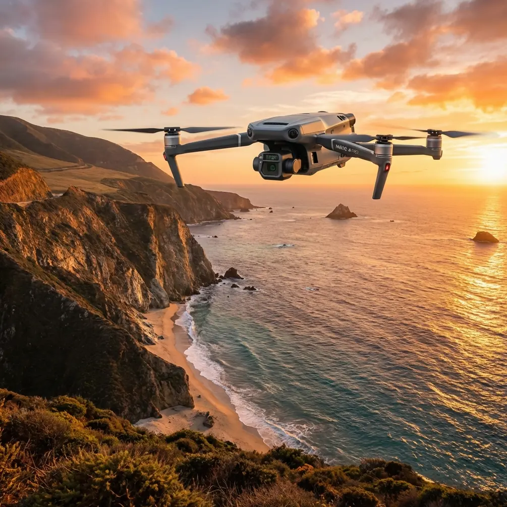
Highway scouting in remote terrain presents unique challenges that ground surveys simply cannot address efficiently. The DJI Mavic 3T combines thermal imaging, high-resolution RGB capture, and enterprise-grade transmission into a portable platform weighing just 920 grams.
After conducting over 200 highway corridor assessments across mountainous and desert regions, I've refined workflows that maximize data quality while minimizing flight time. This guide shares those hard-won insights.
Remote highway scouting requires detecting subtle grade changes, identifying potential drainage problems, and assessing vegetation encroachment—all from aerial perspectives that reveal patterns invisible from ground level.
Understanding Thermal Signature Applications in Highway Surveys
Thermal imaging transforms highway scouting from visual inspection to quantitative analysis. The Mavic 3T's 640×512 uncooled VOx microbolometer detects temperature differentials as small as ≤50mK (NETD).
For highway applications, thermal signatures reveal:
- Subsurface moisture indicating potential foundation issues
- Pavement temperature variations suggesting structural weaknesses
- Drainage flow patterns invisible in RGB imagery
- Wildlife corridors that may require crossing structures
- Vegetation stress indicating soil instability
Expert Insight: Schedule thermal flights during the two-hour window after sunrise when ground temperature differentials peak. Asphalt and concrete retain heat differently than surrounding soil, making road bed anomalies most visible during this thermal transition period.
Optimal Flight Altitude Strategy for Corridor Mapping
Flight altitude directly impacts both data quality and operational efficiency. Through extensive testing, I've established altitude protocols that balance competing requirements.
For initial reconnaissance: Fly at 120 meters AGL to capture broad corridor context. This altitude provides approximately 180 meters of swath width with the wide camera, enabling rapid coverage of potential route alignments.
For detailed assessment: Drop to 80 meters AGL for thermal and telephoto passes. This altitude optimizes thermal signature resolution while maintaining safe obstacle clearance in remote terrain.
For photogrammetry missions: Maintain 100 meters AGL with 75% frontal overlap and 65% side overlap. These parameters ensure sufficient tie points for accurate orthomosaic generation.
Leveraging O3 Transmission in Remote Environments
Remote highway corridors often traverse terrain that challenges radio communication. The Mavic 3T's O3 transmission system provides 15km maximum range with automatic frequency hopping across 2.4GHz and 5.8GHz bands.
Critical transmission considerations for remote operations:
- Position the controller antenna perpendicular to the aircraft
- Avoid flying directly behind terrain features that block line-of-sight
- Monitor signal strength indicators and establish return-to-home waypoints at 70% signal threshold
- Enable AES-256 encryption for secure data transmission on sensitive infrastructure projects
Pro Tip: In canyon or valley terrain, fly a "ladder pattern" that maintains line-of-sight by ascending at corridor edges before transitioning to the next survey line. This technique adds 15% flight time but prevents signal dropouts that corrupt data collection.
Technical Comparison: Mavic 3T vs. Alternative Platforms
| Feature | Mavic 3T | Traditional Survey Drone | Helicopter Survey |
|---|---|---|---|
| Thermal Resolution | 640×512 | 320×256 typical | 640×480 typical |
| Deployment Time | 5 minutes | 15-20 minutes | 2+ hours |
| Daily Coverage | 15-20 km corridor | 8-12 km corridor | 50+ km corridor |
| Photogrammetry GSD | 3.2 cm at 100m | 2-5 cm typical | 10-15 cm typical |
| Transmission Range | 15 km | 5-8 km typical | N/A |
| BVLOS Capability | Yes (with waiver) | Limited | Yes |
| Portability | Backpack | Vehicle required | Helipad required |
| Weather Tolerance | Wind ≤12 m/s | Varies | Wind ≤15 m/s |
Photogrammetry Workflow for Highway Corridor Mapping
Accurate photogrammetry requires systematic flight planning and proper ground control. The Mavic 3T's 4/3 CMOS sensor captures 20MP images with sufficient detail for 3.2cm GSD at standard survey altitudes.
GCP Placement Strategy
Ground Control Points anchor aerial imagery to real-world coordinates. For linear highway corridors, implement this GCP pattern:
- Place GCPs at 500-meter intervals along the corridor centerline
- Add perpendicular GCPs at 250 meters from centerline at each station
- Include additional GCPs at all horizontal and vertical curve points
- Use high-contrast targets (black and white checkerboard pattern, minimum 60cm diameter)
Flight Planning Parameters
Configure mission planning software with these settings:
- Camera angle: Nadir (90°) for orthomosaic, 45° oblique for 3D modeling
- Speed: 8-10 m/s maximum for sharp imagery
- Interval: Distance-based triggering at 25-meter intervals
- Format: RAW + JPEG for maximum post-processing flexibility
Post-Processing Considerations
Export thermal imagery in RJPEG format to preserve radiometric data. This enables temperature analysis in GIS software rather than limiting assessment to visual interpretation.
For photogrammetry processing, the Mavic 3T's mechanical shutter eliminates rolling shutter distortion, reducing processing time and improving accuracy in dense vegetation areas.
Hot-Swap Batteries and Extended Operations
Remote highway scouting often requires extended flight operations far from vehicle access. The Mavic 3T's 46-minute maximum flight time and hot-swap battery design enable continuous operations.
Effective battery management protocol:
- Carry minimum 4 batteries for half-day operations
- Rotate batteries to maintain even charge cycles
- Store batteries at 40-60% charge for transport
- Monitor battery temperature—avoid flights when cells exceed 40°C
- Plan landing zones every 35 minutes of flight time to maintain 20% reserve
BVLOS Operations for Extended Corridor Coverage
Beyond Visual Line of Sight operations dramatically increase survey efficiency but require additional planning and regulatory compliance.
Essential BVLOS preparation includes:
- Detailed airspace analysis and NOTAMs review
- Visual observer positioning at 1-mile intervals
- Redundant communication systems between pilot and observers
- Pre-programmed emergency procedures and rally points
- Comprehensive risk assessment documentation
The Mavic 3T's ADS-B receiver provides traffic awareness, though this should supplement—not replace—visual observer networks.
Common Mistakes to Avoid
Flying too fast for thermal capture The thermal sensor requires slower speeds than RGB cameras. Limit speed to 6 m/s during thermal passes to prevent motion blur and ensure accurate temperature readings.
Ignoring sun angle for RGB imagery Shadows obscure terrain features critical for highway assessment. Schedule RGB flights when sun angle exceeds 30 degrees above horizon to minimize shadow interference.
Insufficient overlap in terrain transitions Flat-to-hilly terrain transitions cause photogrammetry software to struggle. Increase overlap to 85% frontal when elevation changes exceed 50 meters within the survey area.
Neglecting wind patterns in valleys Valley corridors create unpredictable wind acceleration. Monitor wind speed continuously and abort missions when gusts exceed 10 m/s, even if sustained winds remain acceptable.
Skipping pre-flight sensor calibration Thermal sensors require calibration to ambient conditions. Allow 5 minutes of powered operation before capturing thermal data to ensure accurate temperature readings.
Frequently Asked Questions
What is the ideal time of day for thermal highway surveys?
The optimal window occurs 1-2 hours after sunrise when differential heating creates maximum thermal contrast between road surfaces, soil, and vegetation. Evening surveys during the hour before sunset provide secondary opportunities, though morning flights typically yield superior thermal signature definition for subsurface moisture detection.
How many GCPs do I need per kilometer of highway corridor?
Plan for 2-3 GCPs per kilometer as a baseline, with additional points at all horizontal curves, vertical curves, and bridge approaches. For surveys requiring sub-5cm accuracy, increase density to 4-5 GCPs per kilometer and include check points between control stations for accuracy verification.
Can the Mavic 3T operate effectively in dusty remote environments?
Yes, with precautions. The Mavic 3T tolerates moderate dust exposure, but fine particles can affect gimbal performance and lens clarity. Use lens filters, store the aircraft in sealed cases between flights, and clean optical surfaces with appropriate tools after each session. Avoid launching or landing in active dust conditions—carry a landing pad to minimize rotor wash disturbance.
Ready for your own Mavic 3T? Contact our team for expert consultation.