Mavic 3T for High-Altitude Highway Scouting
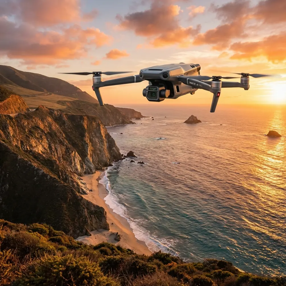
Mavic 3T for High-Altitude Highway Scouting: What Actually Matters When Conditions Turn Mid-Flight
META: Expert analysis of using the Mavic 3T for high-altitude highway scouting, with practical insight on reliability, thermal workflows, weather shifts, transmission stability, and maintenance thinking inspired by aerospace design principles.
High-altitude highway scouting sounds straightforward until the mountain decides otherwise.
You launch with a clean plan: verify road edges, inspect drainage behavior, scan cut slopes for fresh movement, document guardrail damage, and capture thermal anomalies around tunnels, pavement patches, or exposed infrastructure. Then the weather pivots. Wind angles shift as it spills across the ridge. Temperatures fall. Light flattens. Moisture moves in. What looked like a routine Mavic 3T sortie becomes a test of how well the aircraft, payload, and operator workflow hold together under pressure.
That is where the Mavic 3T earns its place—not because it is merely compact or widely recognized, but because in high-altitude road work, reliability is not a slogan. It is a chain. One weak link can ruin the mission.
As Dr. Lisa Wang would frame it, highway scouting at elevation is less about a single headline feature and more about system behavior. Thermal signature quality, visual capture, transmission resilience, battery handling, and post-flight traceability all have to work in sequence. If one stage degrades, the rest of the workflow can still look “successful” on paper while quietly producing bad operational decisions.
The real problem in high-altitude highway scouting
Most teams underestimate two things.
First, mountain roads are long, segmented, and operationally messy. A single survey block can include embankments, culverts, retaining walls, exposed rock faces, overpasses, and temporary repair zones. You are not just flying over a road. You are reading a moving corridor with layered failure modes.
Second, the environment amplifies small weaknesses. A mild transmission interruption at low elevation might be recoverable with little consequence. At altitude, where ridgelines, variable wind, and sudden cloud shifts can alter line-of-sight conditions, the same interruption can compromise data continuity at the exact point you needed a clean thermal pass.
This is why the Mavic 3T is especially useful when the mission is framed correctly. It is not only there to “see more.” It is there to help maintain decision quality when the environment is actively trying to degrade it.
Why a highway mission should be planned like a reliability system
One of the more useful lessons from classic aircraft design literature has nothing to do with brand loyalty or marketing language. It is the idea that sequential systems deserve sequential risk analysis.
Aerospace engineers use fault-tree analysis because some systems work in a tightly ordered chain: one action depends on the previous one. In the reference material, this is described as a sequence in which each link connects to the next, and even a single-point failure can become critical. That logic translates surprisingly well to Mavic 3T road scouting.
Think about a typical high-altitude highway mission:
- Safe launch site selection
- GNSS lock and environmental check
- Stable O3 transmission link
- Visual and thermal data capture
- Corridor tracking and image overlap
- Return planning under changing wind
- Data verification before leaving the site
If step 3 becomes unstable, step 4 may still occur partially, but step 5 can lose consistency. If battery management is rushed because weather is moving in, step 6 becomes harder. If the operator leaves before validating image continuity, step 7 fails silently. The mission may look complete until someone tries to build a photogrammetry model or compare thermal frames later.
The reference text also points out something many field teams learn the hard way: non-fatal small events can combine into a serious outcome. In highway scouting terms, that may mean no single issue causes a crash or a lost mission, but several minor degradations together create unusable data. A momentary transmission dip, slightly reduced overlap, one rushed turn at a slope face, and uneven thermal timing after a cloud bank moves through—now your reporting confidence collapses.
That is why the Mavic 3T should be deployed with an aviation-style mindset. Not paranoia. Structure.
What the Mavic 3T does well in this scenario
The Mavic 3T makes sense for high-altitude highway work because it supports a mixed evidence model. You are rarely relying on one sensor alone.
Visual capture supports road geometry, surface condition logging, and photogrammetry where overlap and control are adequate. Thermal imaging adds another layer, useful for identifying thermal signature differences that may indicate moisture intrusion, drainage issues, heat-retaining patchwork, or equipment stress around roadside assets. Neither view is enough by itself in changing weather. Together, they are much more defensible.
O3 transmission matters more than many teams admit. In a mountain corridor, keeping the command-and-video link stable is not just about pilot comfort. It affects how confidently you can maintain consistent framing over retaining structures, switchbacks, and slope transitions. The Mavic 3T’s transmission architecture helps reduce the number of moments where the operator is forced into reactive flying instead of measured inspection work.
AES-256 also belongs in the conversation, especially for civil infrastructure clients. Highway scouting often generates location-sensitive imagery: maintenance staging areas, access routes, construction phasing, and condition documentation. If that data is being shared across project stakeholders, encrypted handling is not a luxury detail. It is part of professional project governance.
A mid-flight weather shift: where the aircraft and the workflow get tested
On one high-altitude road corridor mission, the first leg went exactly as expected. Cold morning air, stable visibility, and clean thermal contrast along a repaired drainage section. The plan was to capture a visual corridor pass, then tighten in on several slope faces with the thermal payload to compare runoff patterns along a cut.
Halfway through the second segment, the mountain changed its mind.
Cloud cover rolled over the ridge faster than the forecast suggested. Surface contrast softened. Crosswind increased at the shoulder of the slope. The road itself was still visible, but the light became less helpful for edge definition, and the colder gusts started affecting how long we wanted to remain exposed on station.
This is where the Mavic 3T’s value became practical rather than theoretical.
The thermal payload still gave us enough contrast to continue evaluating selected target areas, even as visible-light conditions lost some clarity. O3 transmission remained stable enough to hold disciplined passes rather than retreating into a purely defensive flight pattern. Battery handling became the real operational pivot: instead of chasing the full original route, we cut the mission into a shorter, evidence-prioritized sequence and prepared for a fast turnaround using hot-swap batteries.
That decision matters. In mountain work, the smartest flight is often the one that abandons its original ambition early enough to preserve data quality. A rushed final leg in deteriorating weather usually creates rework. The Mavic 3T helps because it can support this kind of modular mission logic. You do not need to force a heroic sortie. You need to secure the highest-value corridor segments while conditions still support defensible interpretation.
Thermal signature is only useful if timing and context are controlled
A lot of content around thermal drones treats heat maps as self-explanatory. They are not.
Highway surfaces, drainage lines, retaining walls, tunnel portals, culverts, and adjacent rock masses all respond differently to sunlight, cloud cover, and moisture. A thermal signature seen at 9:10 a.m. under stable conditions may look very different twenty minutes later after cloud cover changes. At high altitude, these transitions can happen quickly.
That is why operational discipline matters more than excitement over the thermal camera itself. If you are documenting suspected water ingress or uneven surface behavior, maintain a repeatable sequence. Capture visual context immediately around thermal targets. Log weather change points. Keep the angle of observation as consistent as terrain allows. If the conditions shift sharply, record that in the mission notes rather than pretending all frames belong to the same analytical baseline.
The same discipline applies if you are feeding imagery into photogrammetry workflows. The Mavic 3T can contribute valuable mapping context, but corridor mapping in mountain terrain benefits from careful overlap planning and, where precision matters, GCP support. High-altitude highways are notorious for visual monotony in some sections and abrupt elevation complexity in others. Without control points and capture discipline, a model can appear smooth while masking the very distortions that affect engineering interpretation.
Maintenance thinking matters more than operators expect
The second reference document, though written for aircraft structural design, offers a lesson that drone teams should not ignore: environmental exposure and cyclic stress work together in ways that are easy to underestimate.
The source explains that corrosion fatigue does not require a narrow special condition to become relevant; under corrosive media and alternating stress, damage can accumulate. It also notes a dangerous embrittlement risk window around roughly -100°C to +150°C, with sensitivity near room temperature, and recommends post-plating hydrogen relief baking in the 95–150°C range for certain parts. Another explicit threshold appears in the text: steel parts above 1240 MPa tensile strength should not receive some plating methods because of embrittlement risk.
Why mention this in a Mavic 3T highway article? Because high-altitude road work exposes drone systems and support hardware to exactly the kind of combined stress logic engineers should respect: temperature swings, moisture, repeated transport vibration, and cyclic loading from frequent deployment. Even if field users are not re-engineering components, the principle is operationally significant.
If your team uses custom mounts, vehicle-based charging arrangements, external brackets, or site-made transport fixtures, material choice and corrosion control are not side issues. A bracket that survives dry lowland work can degrade far faster in cold, wet mountain duty. A minor fastener problem can become the drone-world equivalent of the “non-fatal events combining into a serious outcome” described in the reliability reference.
So treat the Mavic 3T as part of a broader field system:
- Inspect mounts, hinges, connectors, and cases for corrosion and micro-damage.
- Track repeated cold-weather deployment cycles.
- Avoid casual modifications with poorly understood metals or coatings.
- Verify battery contact cleanliness after wet or dusty operations.
- Build maintenance logs around exposure patterns, not just flight hours.
That mindset is more aviation than gadget culture, and it pays off.
BVLOS discussions need restraint and discipline
Many infrastructure teams ask whether highway scouting with the Mavic 3T can scale toward BVLOS-style corridor operations. The short answer is that the platform fits into that conversation better than many smaller ad hoc tools, but only if the regulatory environment, risk controls, communication procedures, and mission design are all mature.
The practical point is simpler: even when operating within conventional visual constraints, you should plan like corridor complexity will punish sloppy assumptions. Stable transmission, modular route segmentation, weather-triggered abort points, and verified data checkpoints give you much of the benefit people often imagine they need BVLOS to achieve.
The smarter solution: build a corridor method, not just a flight plan
For high-altitude highways, the best Mavic 3T results usually come from a repeatable problem-solution method:
Problem: Mountain corridors produce fragmented, weather-sensitive inspection conditions.
Solution: Break the road into priority segments and capture each segment as a complete evidence package.
For each segment:
- Capture an establishing visual pass
- Record thermal targets with contextual framing
- Maintain disciplined overlap if photogrammetry is required
- Log weather changes during acquisition
- Confirm transmission quality and any interruptions
- Review critical files before relocating
This approach reduces the chance that one bad segment contaminates the whole mission.
If your team is still refining that workflow, it helps to compare notes with operators who work these environments routinely. A practical place to start is this field coordination channel for mountain corridor drone projects, especially if your use case involves mixed thermal and mapping requirements.
What separates good Mavic 3T operations from average ones
Not the spec sheet.
The difference is whether the operator understands that highway scouting at altitude is a reliability exercise disguised as a drone mission. The Mavic 3T is strong because it supports layered observation, stable transmission, secure data handling, and flexible field execution. But the real gains come when those strengths are used inside a structured workflow.
The aerospace references behind this discussion point to two enduring truths.
First, sequential systems fail in sequences. A single-point weakness matters, and a cluster of small faults can become more dangerous than one obvious failure. For Mavic 3T operations, that means planning every corridor mission as a chain of dependencies rather than a casual point-and-shoot flight.
Second, environmental exposure changes material behavior over time. Corrosion, fatigue, and embrittlement are not abstract engineering topics. They are reminders that field reliability is earned through maintenance decisions long before takeoff.
That is the right way to think about the Mavic 3T in high-altitude highway scouting. Not as a miracle tool. As a disciplined aerial instrument that performs best when the crew respects how mountain conditions, sensor timing, transmission integrity, and maintenance practice all interact.
When the weather turns mid-flight, that difference becomes obvious.
Ready for your own Mavic 3T? Contact our team for expert consultation.