Mavic 3T for Low-Light Highway Scouting: A Practical Field
Mavic 3T for Low-Light Highway Scouting: A Practical Field Method That Holds Up When Conditions Shift
META: Expert tutorial on using the Mavic 3T for low-light highway scouting, with field workflow, thermal interpretation, weather adjustments, transmission reliability, and data capture best practices.
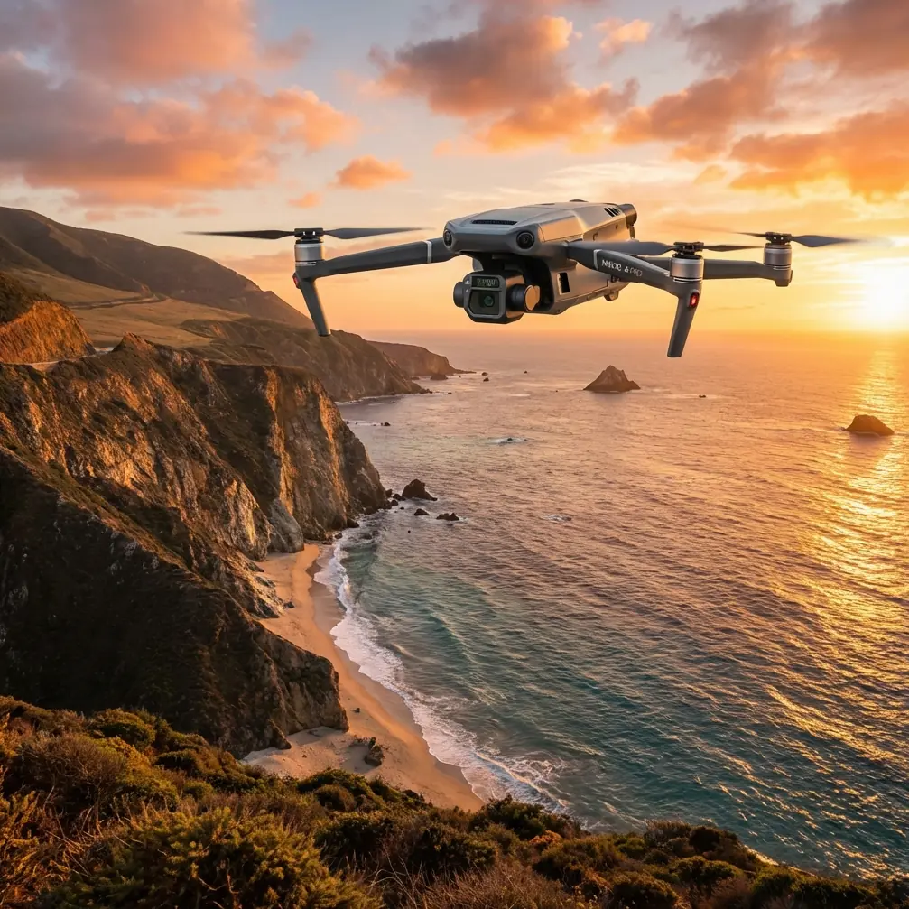
Highway scouting before sunrise sounds straightforward until the road surface starts radiating uneven heat, traffic throws moving signatures into your frame, and a weather front rolls through halfway into the mission. That is exactly where the Mavic 3T earns its place. Not because it can simply fly at night-adjacent hours, but because it gives the operator enough sensing, transmission stability, and workflow flexibility to make decisions while conditions are changing.
I approach the Mavic 3T as a field tool, not a spec sheet. For low-light highway work, the real question is not whether the aircraft can detect something warm. It is whether you can separate meaningful thermal signature from false contrast, maintain positional discipline across long linear corridors, and bring back footage or imagery that can stand up to review later.
This guide is built around that reality.
Why low-light highway scouting is harder than it looks
Highways create a messy visual and thermal environment. Asphalt stores heat. Concrete barriers cool at a different rate. Culverts, bridge joints, embankments, parked maintenance vehicles, and recent tire paths all produce temperature variation. In darkness or near-darkness, the thermal camera can reveal details your visible sensor cannot, but it can also tempt inexperienced operators into overreading the scene.
The Mavic 3T helps because it lets you layer viewpoints instead of trusting a single image source. Thermal gives you detection. The visual camera gives context. Zoom helps confirm whether a hotspot is a drainage issue, a vehicle component, a person-sized heat source in a safe civilian context such as roadside worker detection, or simply a patch of road that retained more warmth after sunset.
That is the difference between collecting images and actually scouting.
The planning mindset: think like an integrated digital model
One of the more useful ideas from traditional aircraft design is the move toward electronic product definition, or EPD. In aircraft development, EPD replaced fragmented drawings with a full digital model that captured exact shape, position, movement, tolerances, and production instructions in one coordinated environment. That mattered because design, manufacturing, maintainability, and interference checks could happen in parallel instead of being discovered too late.
That same mindset improves Mavic 3T highway missions.
Before launch, do not treat route planning, battery strategy, sensor settings, and reporting format as separate tasks. Build one digital mission definition. Your map corridor, waypoint logic, expected thermal targets, handoff points, weather thresholds, and output requirements should all be connected from the start.
Why this matters operationally:
- It reduces rework in the field.
- It keeps visual, thermal, and location data aligned.
- It makes repeat flights comparable over time.
- It helps other stakeholders review the mission without guessing what the pilot intended.
Aircraft designers use digital preassembly to place components in the correct position inside one model before metal is ever cut. A Mavic 3T operator should do something similar with flight lines, scan sectors, target classes, and reporting layers before props ever spin. On a long road corridor, that discipline saves time and avoids missed segments.
Build the route around decision points, not around battery percentages alone
Many operators break a highway mission into equal flight lengths. That is convenient, but not always smart. The better approach is to divide the route around operational decision points:
- interchanges
- bridges
- drainage structures
- lay-bys and maintenance pull-offs
- known complaint areas
- segments with uneven terrain or tree cover
- sections prone to fog pooling
The Mavic 3T is especially useful when those segments need quick thermal screening first, followed by selective closer inspection. In practical terms, you are creating a corridor scan with escalation rules. If a section presents an unexpected thermal pattern, you pause the broader sweep and confirm with another sensor view instead of continuing blindly.
This is where a stable link matters. O3 transmission gives the pilot the confidence to work at useful stand-off distances while maintaining real-time image awareness. On long linear assets like roads, that operational confidence is not a luxury. It affects whether you can hold your inspection geometry and whether your observer and pilot can make the same call at the same time.
If your work includes sensitive infrastructure footage, AES-256 matters too. It is easy to treat encryption as an IT checkbox, but on commercial transport corridors it becomes part of professional data handling. Clients increasingly care about who can access route footage, especially when the mission documents repair conditions, contractor activity, or restricted maintenance zones.
A field-tested low-light workflow for the Mavic 3T
Here is the method I use when the goal is reliable scouting rather than cinematic flying.
1. Launch during the thermal transition window
The best low-light results often come when ambient conditions are still shifting. Pre-dawn and post-sunset both work, but they behave differently. Pre-dawn can flatten certain surface contrasts after a long cooling period. Early evening tends to exaggerate retained heat in pavement and structures.
On a recent road-edge scouting flight, we launched just after sunset under stable air. Twenty minutes later, a light breeze arrived and a thin band of cloud reduced surface contrast in sections that had been showing clear thermal separation. The Mavic 3T handled the shift well, but the useful adjustment was not in the aircraft. It was in the workflow: we stopped treating the route as one homogeneous pass and began comparing shaded, elevated, and sheltered sections separately.
That is a key lesson. Weather does not need to become severe to change your thermal read.
2. Start wide, then narrow
Begin with a broader altitude and a disciplined corridor pattern to identify anomalies. Resist the urge to dive toward the first bright object. You need context first.
Look for:
- repeated hot or cool patterns
- discontinuities at joints or repairs
- unusual roadside signatures
- heat retention differences around drainage and shoulder edges
- standing water effects after recent moisture events
Once an anomaly appears, switch to a tighter pattern and validate with the visible camera or zoom. Thermal alone can be persuasive and wrong.
3. Mark, classify, and move
Do not solve every anomaly in the air. For highway scouting, the job is usually to detect, classify, and prioritize.
A practical classification model:
- benign thermal variation
- likely infrastructure feature
- maintenance follow-up required
- immediate review recommended
The Mavic 3T is strong when used this way because it supports quick transitions between detection and confirmation. You can move efficiently without turning each finding into a mini investigation.
What fixed-wing aerodynamic research teaches us about stable observation
At first glance, research on swept leading edges and vortex lift sounds far removed from a compact multirotor like the Mavic 3T. It is not directly transferable in a design sense, but it does offer a useful operational lesson about stability and margins.
One of the cited aerodynamic references notes that when leading-edge sweep is below 35 degrees, vortex lift is basically absent. Once sweep exceeds 50 degrees, vortex lift begins to appear across a wider angle-of-attack range, and stronger vortex formation does not really arrive until beyond 55 degrees. It also points out that for stable vortices in related configurations, a sweep range around 70 to 75 degrees is often preferred, while too much sweep can introduce asymmetry and rocking.
Why should a Mavic 3T operator care?
Because the principle is broader than the airframe. Stability does not happen by accident. It comes from staying inside the geometry where the system behaves predictably. For highway scouting, your “sweep angle” equivalent is your flight path, yaw behavior, sensor angle, and stand-off distance. Push those inconsistently and the imagery starts to rock in a different way: not physically, but analytically. Targets become hard to compare from pass to pass. Hotspots shift from center frame to edge frame. Reviewers lose confidence.
The practical takeaway is simple: standardize your observation geometry. Use repeatable offsets, repeatable camera angles, and repeatable pass directions where possible. That is how you get data that can be compared across days, not just viewed once.
Mid-flight weather changes: what actually works
When conditions change during a low-light mission, the operator has three jobs:
- preserve safety,
- preserve interpretability,
- preserve comparability.
On the Mavic 3T, that means making measured adjustments rather than dramatic ones.
If wind picks up
Lower your expectations for exact hover-based comparison over exposed medians and bridge edges. Use smoother passes and avoid abrupt yaw inputs. Thermal interpretation suffers when you start chasing framing.
If cloud cover moves in
Expect the visible feed to lose texture first. Thermal may remain useful, but contrast can soften in previously reliable areas. Re-check a known reference spot before assuming the whole corridor changed.
If light mist or humidity rises
You may still complete portions of the mission, but be stricter about confirmation. A faint signature in those conditions should not be treated as equivalent to a clean early-pass detection.
If you need to continue the route
This is where hot-swap batteries matter in the broader operational ecosystem, even if your exact field kit and platform mix vary. On corridor work, continuity is everything. A battery change should be procedural, not disruptive. You want the next lift to resume the same mission logic, not restart the thinking process.
Thermal signature interpretation on highways
The Mavic 3T’s thermal camera is only as good as the operator’s restraint. A few habits help.
Compare like with like
Do not compare a bridge deck to a shaded embankment and assume the warmer target is abnormal. Compare similar materials under similar exposure.
Watch edges
Cracks, patches, drains, and expansion joints often present stronger edge contrast than broad surface areas. That can be useful, but it can also exaggerate routine features.
Use motion carefully
Moving vehicles create obvious heat, but residual heat trails and temporarily warmed surfaces can linger in ways that confuse quick reads. If traffic is present, do not assess a spot immediately after a vehicle passes over it unless you intend to revisit it.
Build a thermal baseline
On repeat highway work, the real value is trend detection. One flight tells you what looked different that day. Several flights tell you what changed.
Mapping, photogrammetry, and when not to force them
Readers often ask whether the Mavic 3T should be used for full photogrammetry on a low-light highway mission. Sometimes yes, often no.
If the task is corridor awareness, targeted thermal anomaly detection, and follow-up documentation, a full mapping workflow may be unnecessary. If the task includes surface change monitoring, earthwork comparison, or drainage grading review, then photogrammetry becomes more relevant.
When you do move into mapping logic, good GCP discipline still matters. Ground control points are not glamorous, but they are how you turn a useful image set into defensible spatial data. Low-light operations can complicate visual identification of GCPs, so plan for placement and visibility before the flight, not after the files are downloaded.
The Mavic 3T is not just a detector. In the right workflow, it becomes the front end of a documented asset review chain.
BVLOS talk needs discipline
BVLOS gets mentioned constantly in corridor operations for obvious reasons. Long roads encourage operators to think beyond direct proximity. But the real professional move is not to stretch the concept casually. It is to build the mission around the applicable operational framework, communication plan, observer structure, and airspace conditions that govern your work.
For most teams, the lesson is this: fly the method you can support consistently. The Mavic 3T rewards disciplined operations far more than ambitious improvisation.
A reporting structure clients can actually use
After the mission, do not hand over a folder full of mixed screenshots and video clips. Deliver findings in a format that mirrors your route logic:
- segment ID
- time captured
- thermal observation
- visible confirmation status
- location reference
- recommended follow-up
This is another place where the EPD idea has real value. In aircraft development, one digital definition reduced downstream confusion. In Mavic 3T highway scouting, one structured mission record does the same. It helps engineering teams, maintenance coordinators, and project managers work from the same picture.
If your team wants a practical workflow review for low-light corridor missions, you can message James directly here.
The real strength of the Mavic 3T in this role
The Mavic 3T is not special because it replaces field judgment. It is special because it rewards good field judgment with faster confirmation and cleaner documentation.
For low-light highway scouting, that means:
- seeing meaningful thermal signature before daylight fills the scene
- keeping enough visual context to avoid false calls
- holding a reliable link through long, linear observation patterns
- protecting sensitive route data with AES-256
- adapting when weather shifts without losing the thread of the mission
The best missions with this aircraft do not feel dramatic. They feel controlled. You launch with a digital plan, maintain consistent geometry, interpret thermal cues conservatively, and adjust when the environment changes. Then you land with findings that someone else can actually use.
That is what separates a flight from an operation.
Ready for your own Mavic 3T? Contact our team for expert consultation.