Urban Venue Scouting: Mavic 3T Professional Guide
Urban Venue Scouting: Mavic 3T Professional Guide
META: Master urban venue scouting with the DJI Mavic 3T. Expert thermal imaging techniques, antenna positioning tips, and workflow strategies for professionals.
TL;DR
- Thermal signature detection identifies HVAC systems, electrical hazards, and crowd capacity indicators during pre-event venue assessments
- Optimal antenna positioning at 45-degree angles maximizes O3 transmission range in urban canyon environments
- Photogrammetry workflows with GCP integration deliver survey-grade accuracy for venue mapping
- Hot-swap batteries enable continuous 90+ minute scouting sessions without returning to base
Why Urban Venue Scouting Demands Specialized Tools
Urban venue scouting presents unique challenges that consumer drones simply cannot address. Between RF interference from cellular towers, GPS multipath errors from reflective buildings, and complex airspace restrictions, professionals need equipment engineered for hostile electromagnetic environments.
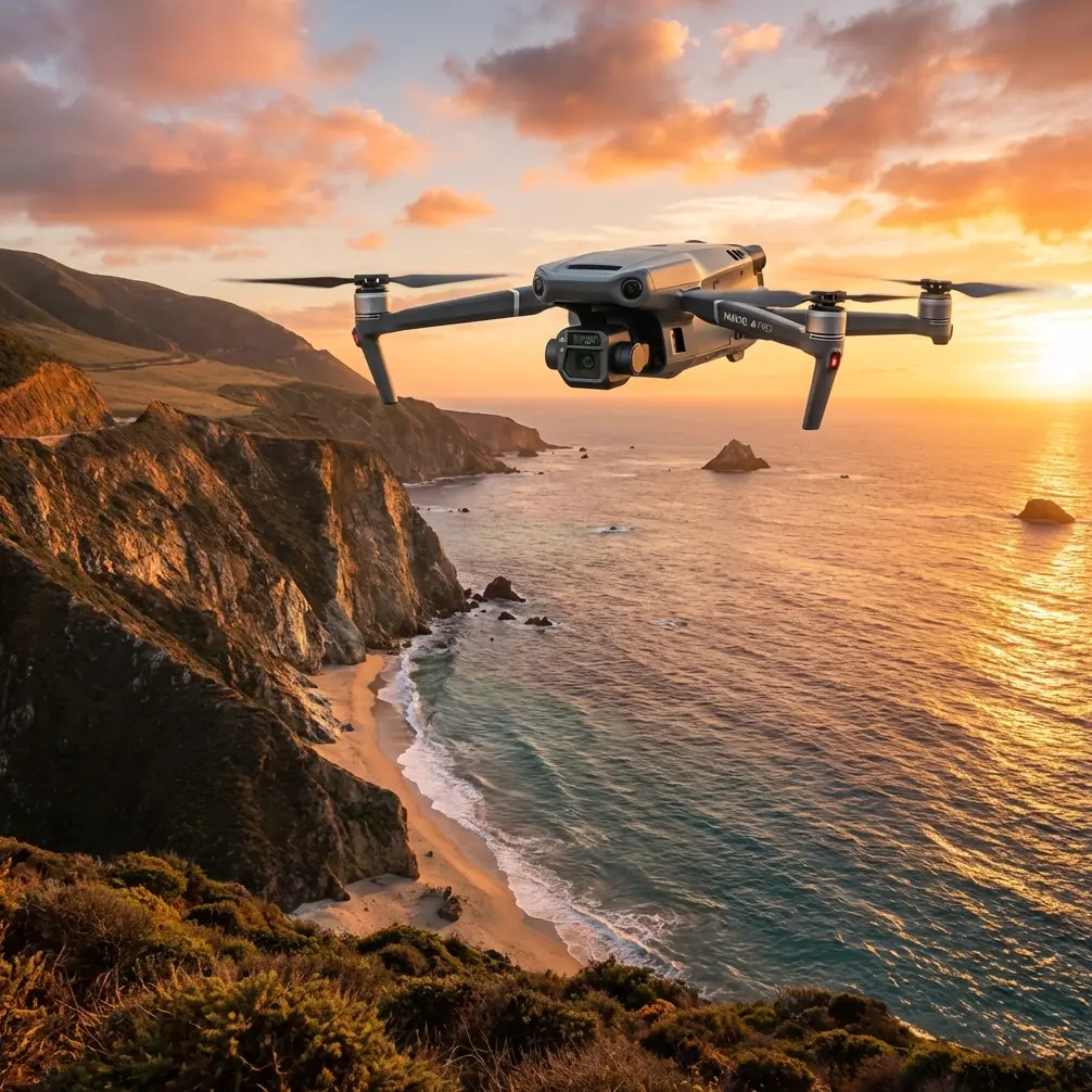
The Mavic 3T combines a 48MP wide camera, 12MP zoom lens, and 640×512 thermal sensor in a compact airframe weighing just 920 grams. This triple-sensor configuration captures visual documentation, detailed inspections, and thermal signature analysis in a single flight—eliminating multiple passes that drain batteries and extend project timelines.
For venue scouts evaluating concert halls, sports complexes, or outdoor festival grounds, this capability translates directly into faster site assessments and more comprehensive deliverables.
Antenna Positioning for Maximum Urban Range
O3 transmission technology delivers impressive specifications on paper, but urban environments ruthlessly expose poor antenna technique. Here's how to maintain solid links in challenging conditions.
The 45-Degree Rule
Position your controller antennas at 45-degree angles relative to the aircraft's expected flight path. This orientation ensures at least one antenna maintains optimal polarization regardless of the drone's heading.
Vertical antenna positioning—common among beginners—creates signal nulls when the aircraft banks or changes direction. In urban canyons where multipath interference already degrades signal quality, these nulls cause video dropouts and control latency spikes.
Building Penetration Strategies
When scouting venues surrounded by structures, position yourself to maintain line-of-sight with the aircraft whenever possible. The Mavic 3T's O3 system operates on 2.4GHz and 5.8GHz bands simultaneously, automatically selecting the cleaner frequency.
Pro Tip: Scout your own operating position before launching. Identify a location that provides clear sightlines to your intended flight area while keeping you away from large metal structures that create RF shadows. Rooftop parking garages often provide excellent elevated positions with minimal interference.
For venues requiring BVLOS operations, coordinate with visual observers positioned strategically around the site. AES-256 encryption ensures your command links remain secure even in crowded RF environments.
Thermal Signature Analysis for Venue Assessment
The 640×512 uncooled VOx sensor captures thermal data that reveals infrastructure conditions invisible to standard cameras.
HVAC System Evaluation
Thermal imaging identifies:
- Active cooling zones indicating climate control coverage
- Heat leaks around doors, windows, and loading docks
- Equipment hot spots suggesting maintenance issues
- Electrical panel thermal anomalies requiring inspection
During pre-event scouting, this data helps production teams plan equipment placement, identify power distribution challenges, and anticipate climate control requirements for specific venue areas.
Crowd Capacity Indicators
Thermal signatures from previous events—captured in residual heat patterns on seating surfaces—reveal actual usage patterns versus theoretical capacity. This intelligence informs realistic crowd flow modeling and emergency egress planning.
Optimal Thermal Capture Settings
Configure the thermal sensor for venue work:
- Palette: Ironbow for presentations, White Hot for analysis
- Gain Mode: High gain for subtle temperature differentials
- Isotherm: Enable to highlight specific temperature ranges
- FFC: Set to auto for consistent calibration during extended flights
Expert Insight: Schedule thermal flights during early morning hours when ambient temperatures are lowest. The temperature differential between active systems and passive structures reaches maximum contrast, making HVAC analysis significantly more accurate. Evening flights after venue closure also work well for identifying equipment left running.
Photogrammetry Workflows for Survey-Grade Mapping
Venue documentation often requires deliverables that integrate with CAD systems, event planning software, and architectural drawings. The Mavic 3T's photogrammetry capabilities meet these professional requirements.
Ground Control Point Integration
For survey-grade accuracy, establish GCP networks before flight operations:
- Place minimum 5 GCPs distributed across the survey area
- Position points at varying elevations when terrain allows
- Use high-contrast targets visible in both RGB and thermal imagery
- Record coordinates with RTK GPS receivers for centimeter accuracy
The Mavic 3T's 1/2-inch CMOS sensor captures sufficient detail for GCP identification at standard mapping altitudes, while the mechanical shutter eliminates rolling shutter distortion that compromises photogrammetric accuracy.
Mission Planning Parameters
| Parameter | Venue Mapping | Detailed Inspection | Thermal Survey |
|---|---|---|---|
| Altitude AGL | 80-100m | 30-50m | 60-80m |
| Front Overlap | 75% | 80% | 70% |
| Side Overlap | 65% | 75% | 60% |
| Gimbal Angle | -90° | -45° to -70° | -90° |
| Speed | 8-10 m/s | 5-6 m/s | 6-8 m/s |
Processing Considerations
Export imagery in DNG format for maximum post-processing flexibility. The Mavic 3T's 12-bit color depth preserves shadow and highlight detail that compressed formats discard—critical when processing imagery captured in challenging urban lighting conditions.
Hot-Swap Battery Strategy for Extended Operations
Urban venue scouting rarely fits within a single 45-minute flight window. Implementing hot-swap procedures maximizes operational efficiency.
Battery Rotation Protocol
Maintain minimum 3 batteries per scouting session:
- Battery 1: Active flight
- Battery 2: Charging in vehicle
- Battery 3: Staged and ready
Land for battery swaps at 25% remaining capacity—not the 20% warning threshold. This buffer accounts for unexpected wind conditions or extended return flights that urban obstacles sometimes require.
Charging Infrastructure
Vehicle-based charging using 100W USB-C PD chargers restores batteries from 25% to 90% in approximately 50 minutes. Dual-charger setups enable continuous operations without returning to base.
Position your vehicle charging station with consideration for summer heat. Battery temperatures above 40°C trigger charging delays that disrupt operational tempo.
Common Mistakes to Avoid
Neglecting compass calibration in urban environments. Steel structures and underground utilities create magnetic anomalies that corrupt compass readings. Calibrate at your launch point, not in parking structures or near vehicles.
Flying thermal missions during peak solar heating. Midday sun heats all surfaces uniformly, reducing thermal contrast and obscuring the signatures you're trying to capture. Schedule thermal work for early morning or post-sunset windows.
Ignoring airspace authorization timelines. LAANC provides instant authorization for many urban areas, but venue locations near airports or restricted zones require 90-day advance coordination. Begin airspace planning immediately upon project confirmation.
Underestimating RF interference. Urban venues host dense cellular infrastructure, broadcast equipment, and wireless systems that degrade drone links. Conduct RF site surveys before committing to flight plans, and identify backup operating positions.
Skipping redundant data capture. Storage is cheap; repeat flights are expensive. Capture 200% more imagery than you think necessary. Urban lighting changes rapidly, and having options during post-processing prevents costly return visits.
Frequently Asked Questions
What flight altitude works best for urban venue thermal scanning?
Maintain 60-80 meters AGL for optimal thermal resolution while preserving sufficient coverage efficiency. Lower altitudes improve thermal detail but require significantly more flight time to cover equivalent areas. The Mavic 3T's 640×512 sensor resolves 7.5cm thermal pixels at 60 meters—sufficient for HVAC analysis and electrical inspection.
How do I maintain GPS lock in urban canyon environments?
Enable GPS + Galileo + BeiDou constellation tracking in flight settings. Position your launch point away from tall buildings on at least two sides. The Mavic 3T acquires minimum 12 satellites before allowing takeoff, but urban multipath can degrade position accuracy even with strong signal counts. Consider RTK modules for survey-grade positioning requirements.
Can the Mavic 3T operate legally over private venue property?
Property access agreements do not automatically grant airspace authorization. Coordinate with venue management for ground access, then obtain separate airspace authorization through LAANC or manual FAA coordination. Urban venues frequently fall within controlled airspace requiring specific altitude restrictions and flight windows.
Elevate Your Venue Scouting Operations
The Mavic 3T transforms urban venue scouting from a multi-day, multi-tool operation into streamlined single-platform workflows. Thermal analysis, photogrammetric mapping, and detailed visual documentation converge in an airframe that navigates complex urban environments with professional-grade reliability.
Mastering antenna positioning, thermal capture timing, and battery management separates efficient professionals from operators burning daylight on preventable problems.
Ready for your own Mavic 3T? Contact our team for expert consultation.