How to Scout Windy Venues with the Mavic 3T Without Guesswor
How to Scout Windy Venues with the Mavic 3T Without Guesswork
META: A practical expert tutorial on using the DJI Mavic 3T to scout venues in windy conditions, with thermal imaging, O3 transmission, secure data handling, and field workflow tips.
Wind changes everything when you are scouting a venue from the air.
A site that looks simple on paper can become a bad candidate for event staging, roof access, temporary structures, utility placement, or thermal inspection once gusts start moving across open ground or around buildings. Trees funnel air. Grandstands create turbulence. Waterfront venues behave differently from inland lots. If you are flying to make operational decisions, not just collect pretty footage, the drone has to give you stable information under pressure.
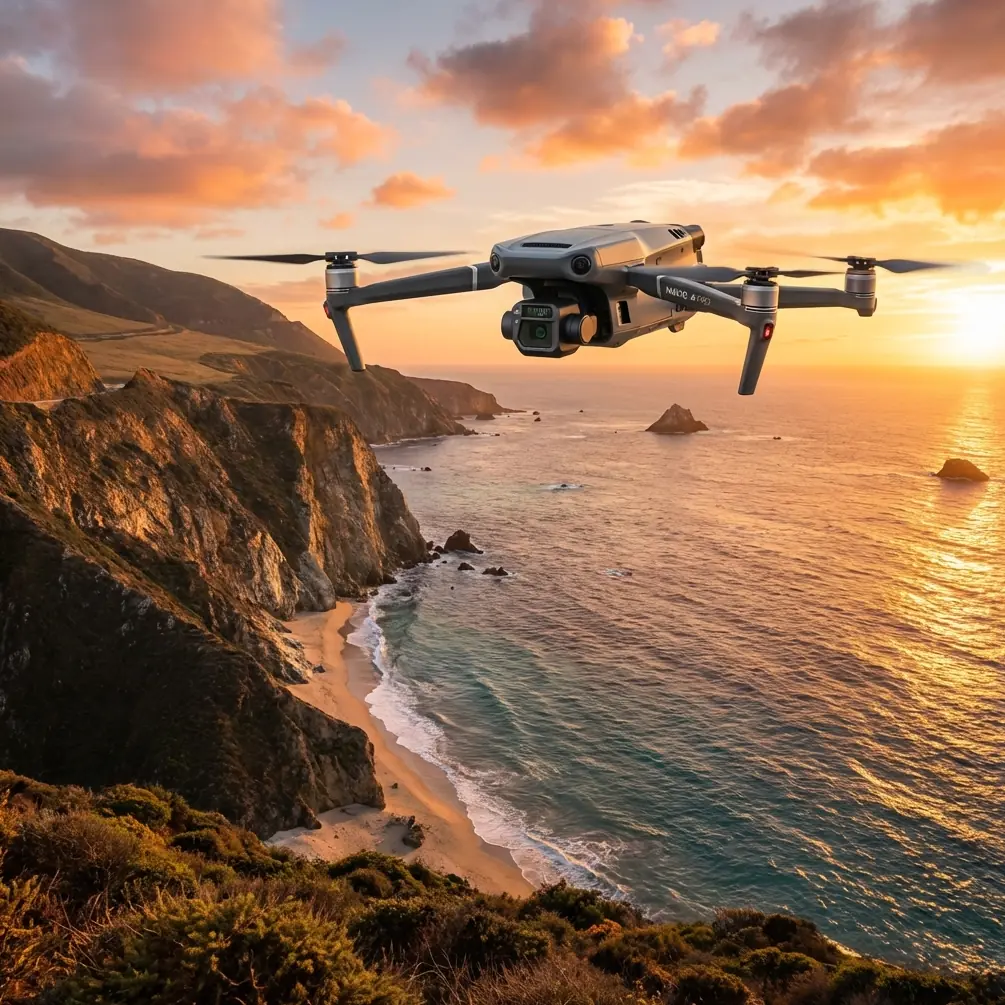
That is where the Mavic 3T earns its place.
This is not a generic “drone for inspections” conversation. For venue scouting in windy conditions, the value of the Mavic 3T comes from how several systems work together: its thermal payload, visual imaging, O3 transmission link, compact field deployment, and security features such as AES-256 encryption. Used properly, those features help you answer the questions that matter on a difficult site: Where are the wind-exposed zones? Which rooftop areas are actually usable? Are temporary structures likely to sit in thermal stress pockets? Can you maintain a reliable link while moving around obstacles? And can your team gather all of that quickly enough to act on it?
Here is how I would approach the job.
Start with the real objective, not the flight
Most venue scouting flights fail before takeoff because the operator thinks the mission is “go fly and look around.”
That is too vague.
For a windy venue assessment, your objective is usually one of these:
- identify wind-sensitive placement zones for temporary infrastructure
- assess safe access routes to roofs or elevated platforms
- inspect heat buildup or thermal irregularities on structures exposed to sun and crosswind
- create a fast situational map for a planning team
- verify whether the site supports repeatable drone operations for future survey or photogrammetry work
The Mavic 3T is strong in this role because it does more than provide visible imagery. Its thermal signature analysis gives another layer of site intelligence. On a windy day, thermal differences can reveal how air is moving around surfaces, where heat is retained, and where materials may be responding unevenly. That is useful when you are reviewing roofing, HVAC zones, stage power placement, or utility enclosures at a venue that will later support crowds, equipment, or sensitive operations.
Competitor aircraft in this class may offer compact airframes or strong cameras, but the Mavic 3T stands out by combining enterprise-ready thermal capability with a highly portable platform. For venue scouts working against time, that matters. You do not always get a second weather window.
Why wind scouting is different from routine site capture
A calm-day mapping routine does not translate well to gusty venue work.
In wind, you are not just worried about airframe stability. You are worried about whether the data still means what you think it means. A thermal image taken during inconsistent airflow can be misleading if you do not understand the environment. A visual pass over a roof edge may look acceptable until you realize the wind is curling upward and creating turbulence exactly where a maintenance team planned access. Even simple line-of-sight judgment can be distorted by changing aircraft attitude and shifting shadows.
The Mavic 3T helps reduce those errors because it can collect both visual and thermal information in one field session. That paired view lets you cross-check what you see. If an area looks exposed in RGB and also shows unusual thermal behavior, that is a stronger operational signal than either dataset alone.
This dual-perspective workflow is one of the most practical reasons professionals choose the 3T over more basic camera drones.
Pre-flight: build a wind-specific checklist
Before launching, I recommend a checklist tailored to venue scouting rather than a generic safety form.
1. Define wind corridors
Study the venue shape. Open parking lots, stadium gaps, rooftops, loading bays, shoreline edges, and tree lines all change airflow. Mark the likely turbulence zones before you fly.
2. Separate “must capture” from “nice to capture”
In wind, battery time and positional margin become more valuable. Your first flight should answer the essential planning questions only.
3. Choose your observation points
Do not stand in the most convenient spot. Stand where the O3 transmission system will have the best chance of maintaining a clean link while you inspect the sides of structures that matter. The Mavic 3T’s O3 transmission is one of its most useful operational strengths here. In venue work, signal integrity is not just about range; it is about staying connected around cluttered environments with rooflines, trusses, lighting rigs, and partial obstructions.
4. Plan battery rotation realistically
If you are doing multiple short flights in unstable wind, hot-swap batteries becomes a workflow concept even if the aircraft itself is not literally keeping power while swapping like a larger platform. The point is field continuity: have charged packs staged, logging standardized, and relaunch intervals short. Wind scouting often works best as a series of tight missions rather than one long, wandering sortie.
5. Decide whether you need GCP-backed mapping later
The Mavic 3T can support venue documentation, but if your final deliverable requires high-confidence photogrammetry, think ahead. A windy recon flight may tell you whether a later survey should use GCP placement, when to schedule it, and which areas need additional overlap or lower-altitude passes.
In the air: a field method that actually works
When scouting a windy venue, I prefer a three-pass method.
Pass 1: High situational orbit
Start with a conservative altitude that gives broad context without pushing the aircraft into unnecessary exposure. The goal is to see how the venue sits in relation to surrounding wind influences: adjacent buildings, open water, elevated terrain, tree masses, or industrial structures.
On this first pass, watch for three things:
- where the aircraft attitude changes noticeably
- where video framing becomes harder to hold
- where thermal contrast behaves unexpectedly across surfaces
That third point is easy to underestimate. A thermal signature does not only tell you “this is hot” or “this is cool.” It can reveal uneven heating on roofs, mechanical areas, utility boxes, façade sections, or temporary service zones. In a venue context, that may help you identify stress points, insulation inconsistencies, or equipment clusters that deserve closer inspection before crews arrive.
Pass 2: Edge and access analysis
Now bring the Mavic 3T lower and focus on operational edges:
- roof parapets
- service entrances
- cable routes
- HVAC clusters
- lighting or staging support areas
- temporary installation zones
This is where a compact aircraft has a real advantage over bulkier enterprise platforms. You can reposition quickly, work around awkward geometry, and inspect from angles that are often impractical with larger systems. For venue scouting, speed is not vanity. It is how you capture useful data before the weather shifts.
Use the zoom and thermal views together to decide whether apparent risk is visual only or actually tied to heat stress, equipment load, or poor airflow. If a rooftop equipment bank appears normal in visible view but runs hotter than surrounding units, wind may not be cooling that area effectively. That can affect where support crews stage, where temporary covers are installed, or whether certain paths remain acceptable during a live event build.
Pass 3: Repeat the problem areas
Do not trust the first look at a windy site.
Re-fly the sections that showed the biggest aircraft corrections or the most ambiguous thermal patterns. Wind is dynamic. A second pass often reveals whether you observed a persistent site condition or just a brief atmospheric change.
This is also the point where a stable transmission link becomes mission-critical. O3 transmission gives the operator more confidence when assessing marginal areas near structures, and that can separate a professional recon from a half-finished one. If your image feed hesitates right when you are evaluating a roof edge or access route, your notes become guesses. The Mavic 3T reduces that problem better than many consumer-leaning alternatives because it was built for field decisions, not casual capture.
Thermal isn’t a novelty feature here
A lot of pilots still treat thermal as a specialist add-on. For windy venue scouting, that misses the point.
The thermal camera on the Mavic 3T can help you identify:
- HVAC imbalance zones on roofs
- overheated equipment enclosures
- moisture-related anomalies that alter thermal behavior
- sun-loaded surfaces that may affect temporary infrastructure placement
- hidden heat retention in staging, service, or utility areas
Why does that matter in wind?
Because wind and heat interact. A venue can be mechanically exposed, thermally uneven, or both. A visually sheltered area may still trap heat. An area with strong cross-flow may cool one surface while leaving another stressed. If your job is to advise planners, builders, maintenance teams, or surveyors, the Mavic 3T gives you a more complete picture than a standard optical drone.
Data security matters more than people think
Venue scouting often involves sensitive layouts, access routes, infrastructure details, and operational planning. Even when the use case is fully civilian, those files may still need controlled handling.
That is where AES-256 enters the conversation in a practical way. Secure data handling is not just a box-tick for larger organizations. If you are surveying event spaces, commercial campuses, utility-adjacent sites, or critical building infrastructure, encryption helps protect imagery and operational records as they move through your workflow.
For consultants or internal teams working under client confidentiality, this can be a deciding factor. It is one reason the Mavic 3T fits professional deployment better than consumer-oriented aircraft that prioritize content creation over secure operations.
What about photogrammetry and mapping?
The Mavic 3T is not always the first aircraft people think of for pure mapping, but that does not make it irrelevant to photogrammetry.
For windy venue scouting, its role is often upstream. It helps you decide whether a site is suitable for a later full mapping mission and where that mission will need support. If your final objective includes measured outputs, orthomosaics, or site planning models, use the 3T to identify where GCPs should be placed, which surfaces will create poor reconstruction in wind, and which corridors need additional overlap.
This saves time later. It also reduces the common mistake of attempting a full photogrammetry job in conditions that will produce weak data.
And if your operation is looking ahead to larger-scale workflows, including advanced corridor or longer-distance observation programs, the venue recon may also expose whether future BVLOS planning is even realistic under local conditions and regulations. For most teams, that decision should come after a clean on-site reconnaissance, not before.
A practical competitor comparison
Where does the Mavic 3T beat competing options for this specific mission?
Not in every category. Not universally.
But for windy venue scouting, it often wins on the balance of portability, thermal usefulness, enterprise workflow, and transmission reliability. Some alternatives offer larger payload flexibility but at the cost of setup time and maneuverability. Others are easier on the budget but lack serious thermal integration or secure operational features. Some camera drones produce excellent visuals yet fall short when the mission shifts from “capture” to “evaluate.”
The Mavic 3T sits in a productive middle ground. It is quick enough for fast deployment, serious enough for professional decision-making, and versatile enough to support inspection, planning, and follow-up documentation without changing aircraft.
That balance is why it excels.
A sample workflow for venue teams
If I were briefing a crew scouting a windy venue with the Mavic 3T, I would use this sequence:
- Walk the site and identify airflow channels and access constraints.
- Launch for a broad visual and thermal overview.
- Mark roof edges, service corridors, and utility clusters.
- Revisit high-risk or high-heat areas from a second angle.
- Log notes tied to exact image captures, not memory.
- Rotate batteries quickly and relaunch for any unresolved zones.
- Export findings into a planning package for operations, facilities, or event build teams.
If you need help structuring that field workflow, this direct WhatsApp line is useful for technical coordination: https://wa.me/85255379740
Common mistakes to avoid
A few errors show up again and again on this kind of mission.
Treating wind as only a flight issue
It is also a data issue. If wind changes the meaning of what you are observing, your report can be wrong even if the aircraft flies safely.
Ignoring thermal until the end
Thermal should not be a secondary check. On many venues, it is the feature that explains what the visual camera cannot.
Flying one long mission
Shorter, deliberate flights usually produce better results in gusty conditions.
Forgetting transmission planning
A strong aircraft is wasted if your control position creates unnecessary signal problems. O3 is a major advantage, but it still works best when the operator thinks ahead.
Overpromising mapping outputs
Use the Mavic 3T to assess whether later photogrammetry will succeed. If precision deliverables matter, plan for GCP use and proper conditions.
Final thought
The Mavic 3T is at its best when the site is complicated enough that a normal camera drone would leave too many unanswered questions. Windy venue scouting is exactly that kind of job.
Its strength is not one headline feature. It is the way thermal imaging, O3 transmission, compact deployment, and secure data handling come together in the field. That combination helps professionals move from vague impressions to defensible decisions. On a windy site, that difference is everything.
Ready for your own Mavic 3T? Contact our team for expert consultation.