Mavic 3T: Mountain Vineyard Scouting Excellence
Mavic 3T: Mountain Vineyard Scouting Excellence
META: Discover how the Mavic 3T transforms mountain vineyard scouting with thermal imaging and precision mapping. Expert guide for viticulture professionals.
TL;DR
- Thermal signature detection identifies irrigation issues and vine stress across steep terrain in minutes, not hours
- 56× hybrid zoom enables detailed canopy inspection without disturbing delicate growing conditions
- O3 transmission maintains reliable control through mountainous terrain with 15km range capability
- Integration with third-party RTK base stations achieves centimeter-level accuracy for photogrammetry workflows
The Mountain Vineyard Challenge
Steep slopes, variable microclimates, and limited access roads make traditional vineyard scouting in mountainous regions a logistical nightmare. Walking rows on 30-degree inclines exhausts crews and limits daily coverage to perhaps 2-3 hectares. Meanwhile, vine health issues spread undetected.
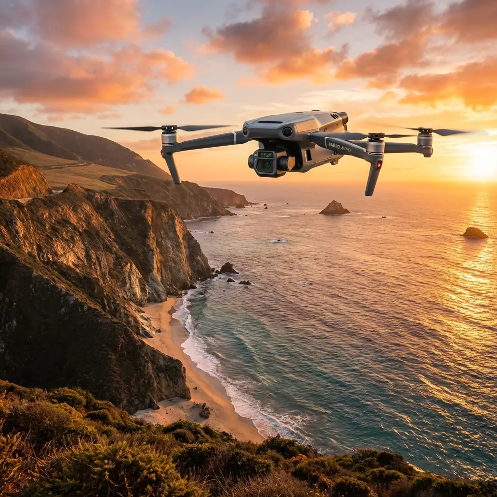
The DJI Mavic 3T addresses these challenges with an enterprise-grade thermal and visual imaging system packed into a 920g airframe. This guide breaks down exactly how this platform performs in demanding mountain viticulture applications, including a workflow enhancement using the Emlid Reach RS2+ base station that transformed our GCP accuracy.
Core Capabilities for Vineyard Operations
Thermal Imaging That Reveals Hidden Problems
The Mavic 3T's 640×512 thermal sensor operates in the 8-14μm spectral range, capturing temperature differentials as subtle as ≤50mK NETD. For vineyard managers, this translates to early detection of:
- Water stress patterns before visible wilting occurs
- Disease hotspots showing abnormal thermal signatures
- Irrigation system failures through soil temperature mapping
- Frost damage assessment during critical spring periods
- Drainage issues on terraced mountainside plots
During pre-dawn flights over a Willamette Valley hillside vineyard, thermal signature analysis revealed a blocked drip line affecting 47 vines—damage that would have gone unnoticed for weeks using ground-based inspection.
Expert Insight: Schedule thermal flights during the 2 hours before sunrise for irrigation analysis. Soil and canopy temperatures reach equilibrium overnight, making moisture variations dramatically more visible than midday scans.
Visual Inspection at Unprecedented Detail
The 56× max hybrid zoom (combining 4/3 CMOS wide camera with telephoto) enables operators to inspect individual grape clusters from 120m AGL. This matters enormously in mountain vineyards where:
- Terrain prevents close approach in many areas
- Rotor wash at low altitude damages delicate fruit
- Wildlife disturbance must be minimized
- Time efficiency demands high-altitude survey patterns
The wide camera captures 20MP stills at 84° FOV, ideal for orthomosaic generation. Meanwhile, the telephoto lens delivers 12MP images at 15° FOV for targeted inspection of problem areas identified during broader surveys.
Reliable Control in Challenging Terrain
Mountain topography creates RF nightmares. Ridgelines block signals. Valleys create multipath interference. The Mavic 3T's O3 transmission system addresses these challenges with:
- 15km maximum transmission range
- 1080p/60fps live feed at extended distances
- Triple-channel redundancy for signal stability
- Automatic frequency hopping across 2.4GHz and 5.8GHz bands
Flying a 340-hectare estate with 600m elevation change, we maintained solid video feed even when the aircraft operated behind a ridge—something that caused complete signal loss with previous-generation equipment.
Photogrammetry Workflow for Precision Viticulture
Flight Planning Considerations
Mountain vineyard mapping requires careful mission design. Standard grid patterns fail when terrain rises 200m across the survey area. The Mavic 3T supports terrain-following modes, but optimal results come from:
- Constant GSD flights maintaining consistent ground sampling distance
- Cross-hatch patterns at 70/80% overlap for steep slopes
- Oblique capture angles for accurate 3D reconstruction of vine rows
- Multiple battery missions using hot-swap batteries to minimize downtime
A typical 50-hectare hillside block requires 3-4 flights at 100m AGL to achieve 2.5cm/pixel resolution suitable for plant counting and vigor analysis.
GCP Integration for Survey-Grade Accuracy
Here's where third-party equipment dramatically enhanced our Mavic 3T workflow. The Emlid Reach RS2+ base station, positioned on a known survey monument, broadcasts RTK corrections that our ground control points receive.
This setup achieves:
- Horizontal accuracy: ±8mm
- Vertical accuracy: ±15mm
- Processing confidence: Dramatically improved bundle adjustment
Without proper GCP distribution, even the best photogrammetry software produces maps with meter-scale errors—useless for precision agriculture applications like variable-rate fertilization or automated harvester guidance.
Pro Tip: Place GCPs at elevation extremes in mountain vineyards. A common mistake is clustering control points in accessible flat areas, leaving steep sections poorly constrained in the adjustment.
Technical Specifications Comparison
| Feature | Mavic 3T | Mavic 3E | Phantom 4 RTK |
|---|---|---|---|
| Thermal Sensor | 640×512 | None | None |
| Wide Camera | 4/3 CMOS 20MP | 4/3 CMOS 20MP | 1" CMOS 20MP |
| Zoom Capability | 56× Hybrid | 56× Hybrid | None |
| Max Flight Time | 45 min | 45 min | 30 min |
| Transmission | O3 15km | O3 15km | OcuSync 2.0 8km |
| Weight | 920g | 915g | 1391g |
| IP Rating | IP54 | IP54 | None |
| RTK Module | Optional | Optional | Built-in |
| AES-256 Encryption | Yes | Yes | Yes |
| BVLOS Capable | Yes* | Yes* | Yes* |
*Regulatory approval required for BVLOS operations
The Mavic 3T's combination of thermal imaging and extended flight time makes it uniquely suited for agricultural applications where both capabilities matter. The IP54 rating also permits operations in light rain—common in mountain vineyard regions during spring assessment periods.
Data Security for Commercial Operations
Vineyard mapping data represents significant intellectual property. Crop health information, yield predictions, and precise block boundaries have real commercial value. The Mavic 3T implements AES-256 encryption for:
- Local data storage on aircraft
- Transmission between aircraft and controller
- Cloud sync operations (when enabled)
Enterprise users can enable Local Data Mode, completely disconnecting from internet services while retaining full functionality. This satisfies IT security requirements for operations on sensitive agricultural properties.
Common Mistakes to Avoid
Flying during midday thermal crossover Solar heating creates confusing thermal signatures between 11am-2pm. Soil, vegetation, and structures all reach similar temperatures, eliminating the contrast that reveals problems.
Insufficient overlap on steep terrain Standard 75/75% overlap works on flat ground. Mountain vineyards need 80/85% or higher to ensure adequate tie points where terrain drops away from the sensor.
Ignoring wind patterns in valleys Mountain terrain creates predictable but powerful wind acceleration through gaps and over ridges. A calm launch site means nothing when the aircraft climbs into 40km/h winds at ridge height.
Skipping pre-flight compass calibration Magnetic anomalies from iron-rich soils common in volcanic vineyard regions cause erratic flight behavior. Calibrate at each new launch location, not just each new property.
Processing thermal and RGB separately Modern photogrammetry software aligns thermal data to RGB orthomosaics, enabling direct comparison. Processing separately creates registration errors that complicate analysis.
Frequently Asked Questions
Can the Mavic 3T replace ground-based vine scouting entirely?
The Mavic 3T dramatically reduces ground scouting requirements but doesn't eliminate them entirely. Aerial thermal and visual data identifies where problems exist with remarkable accuracy. However, confirming what specific pest, disease, or deficiency causes an anomaly still requires physical inspection and often laboratory analysis. Think of drone scouting as a triage system—it tells crews exactly where to focus limited ground-inspection time rather than walking entire blocks hoping to spot issues.
What flight altitude provides the best balance of coverage and detail for vineyard mapping?
For most mountain vineyard applications, 80-100m AGL with terrain following delivers optimal results. This altitude achieves approximately 2-2.5cm/pixel GSD with the wide camera—sufficient resolution for individual vine identification and health assessment. Lower altitudes increase detail but extend flight time dramatically and create stitching challenges on steep slopes. Higher altitudes sacrifice the resolution needed for precision agriculture analytics.
How does weather affect thermal imaging effectiveness for vineyard assessment?
Cloud cover actually improves thermal imaging by eliminating solar reflection artifacts that confuse interpretation. Light overcast conditions between dawn and 9am often produce the clearest thermal differentiation. Rain within the previous 24 hours complicates soil moisture analysis but enhances plant stress detection as healthy vines recover transpiration faster than stressed specimens. Wind above 20km/h creates thermal noise from leaf movement, degrading image quality regardless of other conditions.
Maximizing Your Investment
The Mavic 3T represents a significant capability upgrade for vineyard operations struggling with mountain terrain challenges. Its combination of thermal imaging, extended zoom, and robust transmission creates a scouting platform that genuinely transforms what's possible for precision viticulture.
Success requires more than just purchasing hardware. Developing flight planning expertise, understanding thermal interpretation, and integrating aerial data into existing farm management systems all demand investment. The payoff—early problem detection, reduced labor costs, and data-driven decision making—justifies that investment for operations serious about precision agriculture.
Ready for your own Mavic 3T? Contact our team for expert consultation.